Category:Earth Observations
Updated Q3, 2015
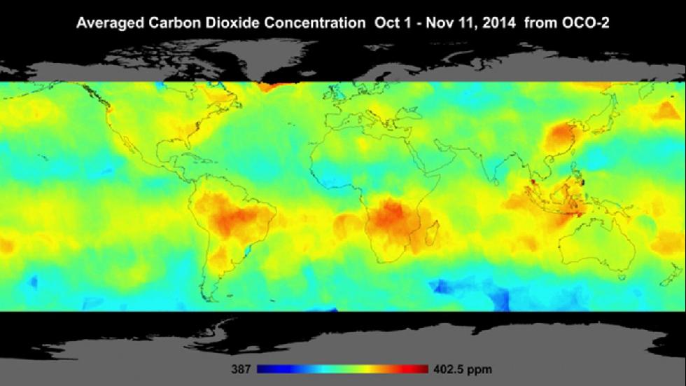
OCO-2 CO2 Observations-Data
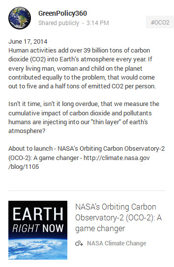
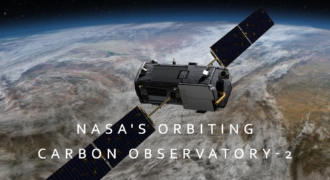
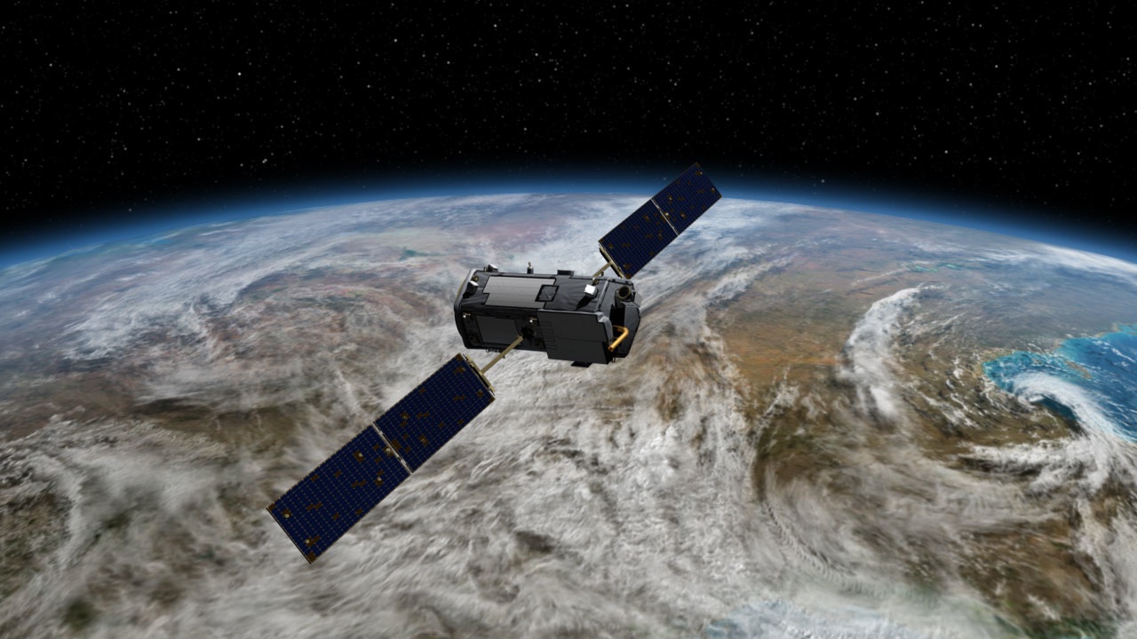
The history-making emissions-monitoring, climate change satellite begins making its earth atmospheric science available via JPL-NASA.... Sept 2015
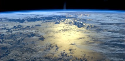
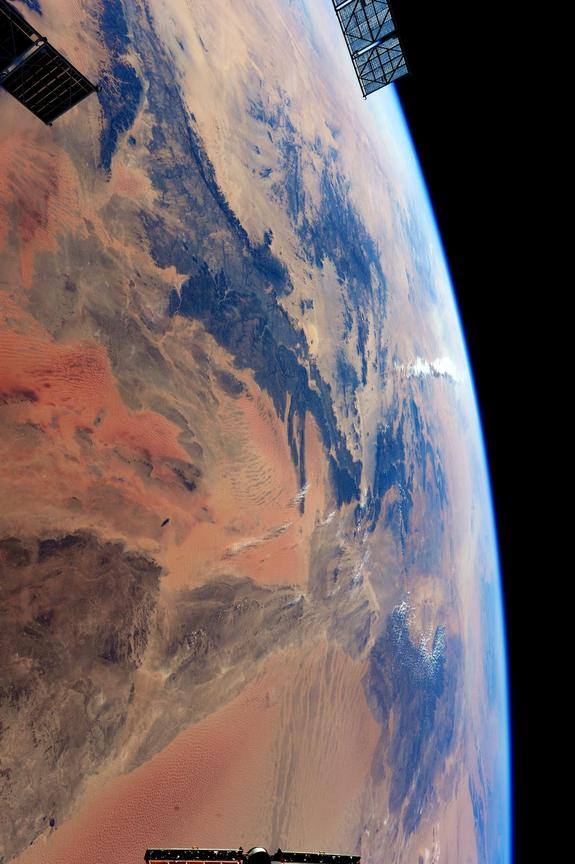
Look more closely at our 'thin blue layer' ... http://oco.jpl.nasa.gov/science/OCO2DataCenter/
○ ○ ○ ○ ○ ○ ○ ○ ○ ○ ○ ○ ○ ○ ○ ○ ○ ○ ○ ○ ○
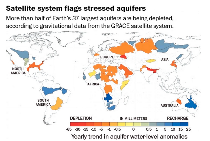
Shifting from earth's atmosphere studied from space (in this first-generation of earth-satellite observation), we now look at earth's water sources as studied from space...
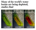
One of the issues rarely confronted when considering high intensive agriculture is the use of water in unsustainable irrigation. The draw down and depletion of aquifers is a rising cost and only recently, with the advent of earth observation and monitoring systems, are technologies becoming available to measure the extent of groundwater basins and recharging capabilities. The new satellite measurements of aquifers/ground water globally, as are now being reported with NASA GRACE satellites, comprise both a warning and a capability of needed sustainable environmental security. Water saving and water security are essential to a sustainable agriculture policy and larger goals of environmental security
http://www.greenpolicy360.net/w/Aquifers
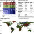
"Time to depletion" -- "Significant segments of Earth's population are consuming groundwater quickly without knowing when it might run out..."
"Available physical and chemical measurements are simply insufficient," said UCI professor and principal investigator Jay Famiglietti, who is also the senior water scientist at NASA's Jet Propulsion Laboratory in Pasadena, California. "Given how quickly we are consuming the world's groundwater reserves, we need a coordinated global effort to determine how much is left."
The studies are the first to comprehensively characterize global groundwater losses with data from space, using readings generated by NASA's twin GRACE satellites.
···················································································································
Earth Observation Science Initiatives Grow in Importance
Groundwater Basins in Distress
The GRACE mission reports home -- http://touch.latimes.com/#section/-1/article/p2p-83799955/ -- http://www.nzherald.co.nz/world/news/article.cfm?c_id=2&objectid=11466534
http://mashable.com/2015/06/16/groundwater-aquifers-depleted/ -- http://www.washingtonpost.com/blogs/wonkblog/wp/2015/06/16/new-nasa-studies-show-how-the-world-is-running-out-of-water/
○
Environmental Security: Earth Science Programs Cut
http://www.greenpolicy360.net/w/File:Presidents_budget_see_earth_science.jpg
http://www.greenpolicy360.net/w/File:House_budget_see_earth_science.jpg
Re: funding cuts to NASA's critical Earth science and space technology programs
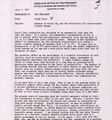
On May 1, 2015, White House Office of Science and Technology Policy Director Dr. John P. Holdren issued the following statement on proposed funding cuts to NASA's critical Earth science and space technology programs:
"If enacted, the NASA authorization bill headed to the House floor later this month would do serious damage to the Nation’s space program, as well as to Earth-observation and Earth-science programs essential for predicting, preparing for, and minimizing the damage from disasters both natural and human-induced.
The House bill would also gut the NASA “mission to planet Earth”—the satellite observations and related research that provide key measurements and insights relevant to forecasting and tracking hurricanes, fighting wildfires, observing the state of the world’s farms and forests, mapping the extent of droughts, measuring the stocks of groundwater, and monitoring the likelihood of landslides. The draconian cuts in the House bill would also delay advances in our ability to research and prepare for volcanic eruptions, earthquakes, and tsunamis and blind us to changes in the Earth’s oceans and ice sheets that can be discerned only from space."
New Definitions of National Security
○ ○ ○ ○ ○ ○ ○ ○ ○ ○ ○ ○ ○ ○ ○ ○ ○ ○ ○ ○
http://www.greenpolicy360.net/w/Earth_Right_Now
https://twitter.com/hashtag/EarthRightNow?src=hash
http://science.nasa.gov/earth-science/
http://www.nasa.gov/topics/earth/index.html
○ ○ ○ ○ ○ ○ ○ ○ ○ ○ ○ ○ ○ ○ ○ ○
December 2014
Historic Orbiting Carbon Observatory Satellite Sends Back Most Detailed CO2 View Ever / Dec 18, 2014
Initial OCO-2 data available in March for scientists and public to download and explore
Phys.org - Discovery - Weather - Nature
Sample Data -- OCO-2 Data Portal
○ ○ ○ ○
○ ○ ○ ○
November
Counting carbon over Southern California - OCO-2 at work
October
September
August
August 13th/Climate Central news report of first data
July 2 2014
- Watching the Planet Breathe
NASA Launches New Carbon-Sensing Mission to Monitor Earth’s 'Breathing'
"Climate change is the challenge of our generation," says NASA Administrator Charles Bolden
- Follow the OCO-2 Mission
Follow the tweets of the OCO-2 bird
Follow the NASA climate blog
http://climate.nasa.gov/blog/1105/ -- http://climate.nasa.gov/blog/
"Game changing" science Unraveling mysteries
○ ○ ○ ○ ○ ○ ○ ○ ○ ○ ○ ○ ○ ○ ○ ○
- Climate Change, Global Warming
Observing Global Warming with #OCO-2
Historic launch #PlanetCitizen mission to study #EarthsAtmosphere
"First Light!" [1] [2] OCO-2 announces 'We have data!'
OCO-2 tweets - https://twitter.com/IamOCO2
What monitoring a potential existential crisis looks like...spectra from #OCO-2 #Earth360
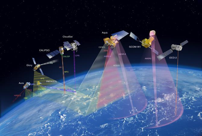
Earth observing satellites, Orbiting Carbon Observatory the "Afternoon Constellation", the "A-Train" joined by #OCO-2 newly launched and historic in its mission to study global warming
"Watching the Earth Breathe from Space" [3] [4] [5] [6]
About the Earth Observatory Mission
○ ○ ○ ○ ○ ○ ○ ○ ○ ○ ○ ○ ○ ○ ○ ○
With the launch of OCO-2, a "game changer", the data of #Earth360 will grow in unprecedented ways
#Earthdata enables informed decisions and policy
"You can manage only what you can measure"
○ ○ ○ ○ ○ ○ ○ ○ ○ ○ ○ ○ ○ ○ ○ ○
Eyes on the Earth [7] [8] [9] [10]
○ ○ ○ ○ ○ ○ ○ ○ ○ ○ ○ ○ ○ ○ ○ ○ ○ ○ ○
Global Earth Science Data Links
eGY -- electronic Geophysical Year / http://www.egy.org/ -- An Earth and Space Science Information Commons Initiative: International Co-operation for Open Access to Data
GEO -- Group on Earth Observations / http://www.earthobservations.org/index.php -- Established in 2005, GEO is a voluntary partnership of governments and organizations that envisions “a future wherein decisions and actions for the benefit of humankind are informed by coordinated, comprehensive and sustained Earth observations and information.”
CEOS -- Committee On Earth Observation Satellites / http://ceos.org/ -- 2015 - CEOS was established in September, 1984 in response to a recommendation from a Panel of Experts on Remote Sensing from Space and set up under the aegis of the G7 Economic Summit of Industrial Nations Working Group on Growth, Technology, and Employment.
This Panel recognized the multidisciplinary nature of space-based Earth observations and the value of coordinating international Earth observation efforts to benefit society. Accordingly, the original function of CEOS was to coordinate and harmonize Earth observations to make it easier for the user community to access and use data. CEOS initially focused on interoperability, common data formats, the inter-calibration of instruments, and common validation and inter-comparison of products. However, over time, the circumstances surrounding the collection and use of space-based Earth observations have changed.
- The number of Earth-observing satellites has vastly increased.
- Onboard instruments are more complex and are capable of collecting new types of data in ever-growing volumes.
- The user community has expanded and become more diverse as different data types become available and new applications for Earth observations are developed.
Users have become more organized, forming several international bodies that coordinate and levy Earth observation requirements.
CEOS WGISS -- Committee On Earth Observation Satellites / http://ceos.org/ourwork/workinggroups/wgiss/ -- Working Group on Information Systems and Services - WGISS stimulates, coordinates, monitors, and promotes collaboration on the development of the systems and services that manage and supply satellite Earth observation (EO) data and information.
CEOS IDN -- Committee On Earth Observation Satellites / http://idn.ceos.org/ -- International Directory Network (IDN) / http://idn.ceos.org/portals/Home.do?Portal=idn_ceos&MetadataType=0 -- The CEOS International Directory Network (IDN) is a Gateway to the world of Earth Science data and services. The CEOS IDN is an international effort developed to assist researchers in locating information on available datasets and services. The directory is sponsored as a service to the Earth science community.
GCMD -- Global Change Master Directory / http://gcmd.nasa.gov/
DIF -- DIF Writer's Guide / http://gcmd.gsfc.nasa.gov/add/difguide/index.html -- Directory Interchange Forma... The DIF does not compete with other metadata standards. It is simply the "container" for the metadata elements that are maintained in the IDN database, where validation for mandatory fields, keywords, personnel, etc. takes place. The DIF is used to create directory entries which describe a group of data. A DIF consists of a collection of fields which detail specific information about the data. Eight fields are required in the DIF; the others expand upon and clarify the information. Some of the fields are text fields, others require the use of controlled keywords...Directory Interchange Format (DIF) Writer's Guide, 2015. Global Change Master Directory. National Aeronautics and Space Administration. http://gcmd.nasa.gov/add/difguide/ - http://gcmd.nasa.gov/ -- Global Change Master Directory
GGOS -- GGOS at the GFZ Potsdam / http://www.ggos.org/ -- GGOS is the Observing System of the International Association of Geodesy (IAG). GGOS works with the IAG components to provide the geodetic infrastructure necessary for monitoring the Earth system and for global change research. It provides observations of the three fundamental geodetic observables and their variations, that is, the Earth's shape, the Earth's gravity field and the Earth's rotational motion. GGOS integrates different geodetic techniques, different models, different approaches in order to ensure a long-term, precise monitoring of the geodetic observables in agreement with the Integrated Global Observing Strategy (IGOS)
IVOA -- International Virtual Observatory Alliance (IVOA) / http://www.ivoa.net/ -- The Virtual Observatory (VO) is the vision that astronomical datasets and other resources should work as a seamless whole. Many projects and data centres worldwide are working towards this goal. The International Virtual Observatory Alliance (IVOA) is an organisation that debates and agrees the technical standards that are needed to make the VO possible.
DLR -- Deutsches Zentrum für Luft- und Raumfahrt / http://www.dlr.de/dlr/en/desktopdefault.aspx/tabid-10002/
JPL -- Jet Propulsion Laboratory - California Institute of Technology / http://www.jpl.nasa.gov/
PO.DAAC -- Physical Oceanography Distributed Active Archive Center PO.DAAC / http://podaac.jpl.nasa.gov/
INDIGO -- Inter-service Data Integration for Geodetic Operations / http://indigo.nasa.gov/
UTCSR -- University of Texas at Austin - Center for Space Research / http://www.csr.utexas.edu/ - GRACE mission status / http://www.csr.utexas.edu/grace/operations/mission_status/ - http://podaac.jpl.nasa.gov/grace/ - http://isdc.gfz-potsdam.de/index.php?module=pagesetter&func=viewpub&tid=1&pid=35
DGFI -- Deutsches Geodätisches Forschungsinstitut / http://www.dgfi.tum.de/en/
IAG -- IAG Services - International Association of Geodesy / http://www.iag-aig.org/index.php?tpl=text&id_c=1&id_t=102
ICGEM -- International Centre for Global Earth Models / http://icgem.gfz-potsdam.de/ICGEM/ICGEM.html
PV 2007 -- PV 2007: Proceedings and Results / http://pv2007.dlr.de/main/results_en.htm
Paper: The ISDC concept for long-term sustainability of geoscience data and information / http://pv2007.dlr.de/Papers/Ritschel_ISDC.pdf
IUGG 2007 -- Proceedings of IUGG XXIV General Assembly / UNION SYMPOSIA Proceedings - Earth: Our Changing Planet / http://www.iugg2007perugia.it/webbook/download.htm
VOiG -- Virtual Observatories in Geosciences (VOIG) Conference 2007 / http://www.egy.org/VOiG/Home.html
○ ○ ○ ○ ○ ○ ○ ○ ○ ○ ○ ○ ○ ○ ○ ○ ○ ○ ○ ○ ○ ○ ○ ○ ○ ○ ○ ○ ○ ○ ○ ○
Earth Observation from Space: GreenPolicy Links - 2014
NASA's Earth Science Enterprise (ESE) -- Originally called "Mission to Planet Earth (MTPE)"
![]()
October 2014 http://bit.ly/VitalSignsPulseofthePlanet / Video To fully appreciate the detail of the models, click on the gear symbol and set to 720p resolution and choose full screen video
ESE is dedicated to "understanding the total Earth system and the effects of natural and human-induced changes on the global environment." [11]
Mission to Planet Earth's successor, NASA’s Earth Observing System (EOS), provides long-term global observations of the land surface, biosphere, solid Earth, atmosphere, and oceans.
Earth Observing System Data and Information System - Maps
Suomi NPP - Next-generation Earth-observing satellite system NPP Images Gallery
Next generation NASA-NOAA #EarthMonitoring satellite to launch in 2017
"The ultimate beneficiaries are the present and future generations of the people on Earth..."
The goal of the Earth Observing project is "improved understanding of the Earth as an integrated system."
ESE's Mission: "To improve life here" and "to understand and protect our home planet."
#EarthScience, #GeoScience, #Earth360, #GP360, #EarthPOV
Eyes on the Earth-Earth Right Now, Earth Observing System Project, Earth Data, Earth Observatory, [12], Grace, Grace-JPL, Grace-UTexas
Visible Earth, Global Maps, Visible Earth_2, Visible Earth_3, Visible Earth_4, Earth Mission List
ICESat-2 [13] - [14] Video of ICESat's laser in operation ICESat-2 science at work...
○ ○ ○ ○ ○ ○ ○ ○ ○ ○ ○ ○ ○ ○ ○ ○ ○ ○ ○ ○ ○ ○ ○ ○ ○ ○ ○ ○ ○ ○ ○ ○ ○ ○ ○ ○
○ ○ ○ ○ ○ ○ ○ ○ ○ ○ ○ ○ ○ ○ ○ ○ ○ ○ ○ ○ ○ ○ ○ ○ ○ ○ ○
European space program - earth system monitoring
European Space Agency "Living Planet Programme" managed by Earth Observation Programmes - [15]
- GOCE – Gravity Field and Steady-State Ocean Circulation Explorer - launched on March 17, 2009 - [16]
- SMOS – Soil Moisture and Ocean Salinity satellite - studying ocean salinity and soil moisture; launched in 2 November 2009 - [17]
- CryoSat is designed to map the Earth's ice cover. CryoSat-2 was launched 8 April 2010 - [18] - Euro Cryo Satellite/Earth Imaging
- Swarm – Three satellites mapping the Earth's magnetism (also see the US GRACE mission). The SWARM constellation was launched successfully on 22 November 2013 - [19]
- Aeolus – Atmospheric Dynamics Mission will use an innovative laser to measure winds. Due for launch in 2015 - [20]
- EarthCARE – Earth Clouds Aerosols and Radiation Explorer will examine the formation and effects of clouds. Due for launch in 2016 - [21]
- BIOMASS is designed to calculate the amount of carbon stored in the world's forests, and to monitor for any changes over the course of its five-year mission. Due to launch in 2020 - [22]
○ ○ ○ ○ ○ ○ ○ ○ ○ ○ ○ ○ ○ ○ ○ ○ ○ ○ ○
Earth Science from Above
from National Geographic News
PUBLISHED OCTOBER 22, 2014
Scientists have uncovered a cache of satellite images of Earth from the 1960s that had been forgotten in storage for nearly 50 years and that push back the first satellite images of our planet a full 17 years.
The trove includes the first publicly available satellite photos of Europe, the earliest aerial views of Antarctica's ice, and a record of Central Asia's Aral Sea before it dried up. There's also a rare photo of the most powerful storm to hit North America in modern times.
The images, when compared with recent satellite photos, show how humankind has changed the planet, from deforestation to changes in sea ice.
(Related: "Maps From Space Show World's Disappearing Forests.")
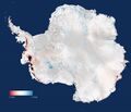
Among the images from 1964 were views of Antarctica that showed a greater extent of sea ice than ever measured since. That is, until recent weeks, when the 1964 record was broken just as it was discovered to be a record at all. Unlike Arctic sea ice, which has been in decline due to global warming, the extent of Antarctic ice has varied, making the historical data all the more important for scientists trying to understand what drives changes there.
(Related: "Shrinking Arctic Ice Prompts Drastic Change in National Geographic Atlas.")
Earth scientists David Gallaher and Garrett Campbell liberated the data from a National Climatic Data Center archive in North Carolina, uncovering 25 boxes of magnetic tapes and photographic film from three Nimbus weather satellites launched in the 1960s and 1970s.
Gallaher had heard about the data at a conference and called the National Climatic Data Center to request access to some pictures of Greenland. "We have no way of figuring out what's Greenland," came the reply.
That's because the data had never been sorted or digitized. So Gallaher and Campbell took on the painstaking process of digitizing hundreds of thousands of photos and making them publicly available....
○
Shrinking Arctic Ice Prompts Drastic Change in National Geographic Atlas
Warming oceans have caused a drastic reduction in sea ice
○
Subcategories
This category has the following 16 subcategories, out of 16 total.
A
C
D
E
F
G
N
P
S
W
Pages in category "Earth Observations"
The following 176 pages are in this category, out of 176 total.
3
A
C
- C40 Cities Climate Leadership Group
- Carbon Brief
- Citizen Science
- Clearcutting
- Climate Change - Global Warming Keyword-Terms
- Climate Change Denier Talking Points -- and Rebuttals
- Climate Change Summit Paris
- Climate Conference - Paris 2015
- Climate Desk
- Climate Law Blog @Columbia Law School
- Climate migration
- Climate News
- Climate News Events Archive ... 1970 to Today
- Climate Plans Enforcement - Resources
- Climate Problems, Climate Solutions
- Copernicus EU
- Creatively Green
D
E
- Each of us can make a positive difference
- Earth
- Earth and Space, Politics
- Earth Day
- Earth Day 2020
- Earth Day Memories on the 50th Anniversary
- Earth Day Summit - April 22 2021
- Earth from NASA
- Earth Imaging-New Space
- Earth Observation Portal
- Earth Right Now
- Earth Science
- Earth Science Eco-Fields
- Earth Science Research from Space
- Earth Science Vital Signs
- EarthPOV
- Earthrise
- EarthTime
- Earthviews
- Earthviews from Astronauts
- Eco-nomics
- Ecolivia
- Environmental agreements
- Environmental full-cost accounting
- Environmental Rules Rolled Back
- Environmental Security Organizations
- EOS eco Operating System
- ESA Living Planet Announcement - May 2022
- Ethics and Climate Change
- European Union Green Deal - Fit for 55
- Extinction
- ExxonMobil and US House Science Committee v US Attorneys General and Environmental Groups
F
G
- Generation Green
- Geoengineering
- George E. Brown Jr
- Glasgow Climate Summit - Pledges, Promises, Declarations - What's Next Up
- Global Citizen
- Global Climate Action Summit
- Global Fishing Watch
- Global Forest Watch
- Global Risks Report
- Going Green: Texas v. Pennsylvania
- Google Earth
- Google Earth Timelapse
- GP360 NewPages
- Green Bank in Maryland - and More
- Green Politics 360
- Green Politics with GreenPolicy360
- Green Quotes
- Green Stories of the Day
- Green Stories of the Day - GreenPolicy360 Archive
- GreenAction
- Greening Our Blue Planet
- GreenPolicy360 Archive Highlights 2013
- GreenPolicy360 Archive Highlights 2014
- GreenPolicy360 Archive Highlights 2015
- GreenPolicy360 Archive Highlights 2016
- GreenPolicy360 Archive Highlights 2017
- GreenPolicy360 Archive Highlights 2018
- GreenPolicy360 Archive Highlights 2019
- GreenPolicy360 Archive Highlights 2020
- GreenPolicy360 Archive Highlights 2023
- GreenPolicy360 Highlights
- Ground Truth
I
L
N
O
P
- Pale blue dot
- Paris climate change conference, Dec12, 2015 report from Rebecca Solnit
- PeoplesClimateMarch
- Permaculture Green Practices
- Permafrost
- Pictures from ISS
- Planet API
- Planet Citizen Action
- Planet Citizen Vision of Living Earth
- Planet Citizens
- Planet Citizens, Planet Scientists
- Planet Earth Perspective
- Planet Labs Doves Fly
- Planet of the Humans, a documentary film
- Planetary.org
- PlanetCitizen
S
T
U
W
Media in category "Earth Observations"
The following 200 files are in this category, out of 1,414 total.
(previous page) (next page)- 'Most beautiful from space' the Bahamas by Scott Kelly Apr 26, 2015.png 800 × 511; 767 KB
- 'Thin Blue Layer' of Earth's Atmosphere 2.jpg 800 × 486; 46 KB
- 'Thin Blue Layer' of Earth's Atmosphere l.jpg 853 × 486; 46 KB
- 'Thin Blue Layer' of Earth's Atmosphere xl.jpg 1,152 × 648; 79 KB
- -HelloEarth.png 579 × 381; 0 bytes
- 03-Scott-Kelly-NASA.jpg 800 × 500; 113 KB
- 1977 from the Office of Science and Technology Policy.jpg 661 × 711; 177 KB
- 2001 pic3.jpeg 800 × 450; 65 KB
- 2015 Hottest year a.pdf ; 316 KB
- 2015 Hottest year b.pdf ; 308 KB
- 2015 temp-report s.jpg 399 × 224; 35 KB
- 2015 temp-report.jpg 950 × 534; 119 KB
- 2020 record temperatures.png 800 × 502; 358 KB
- 3-15-2016 10-49-38 AM.png 702 × 862; 396 KB
- 3-15-2016 12-29-07 PM.png 538 × 701; 201 KB
- 3840 × 2160.jpg 3,840 × 2,160; 1.11 MB
- 5 19 14 andrew antarcticaelevationchanges-640x547.jpg 640 × 547; 59 KB
- 7-20-2020 GreenPolicy360 RT No.2.jpg 591 × 510; 125 KB
- A Brief History of the Future - 2s.jpg 448 × 309; 70 KB
- A Fierce Green Fire.jpg 208 × 314; 13 KB
- A Flash of Green by John D. MacDonald.jpg 400 × 400; 55 KB
- A Planet Citizen View.png 799 × 1,241; 1.64 MB
- A root and its mycorrhizal fungus surroundings.PNG 315 × 382; 236 KB
- A scorching year, what about the 360 warming data.jpg 600 × 706; 106 KB
- A View of the Earth and Moon from Mars.jpg 720 × 890; 3 KB
- A window view.jpg 620 × 412; 22 KB
- About Baselines and Change.png 592 × 312; 33 KB
- About website of The Invading Sea.png 800 × 343; 126 KB
- Above Earth .jpg 2,000 × 1,500; 278 KB
- Above Florida green.jpg 1,091 × 726; 171 KB
- Above.png 500 × 375; 173 KB
- Acceptance on behalf of the United States of America.png 448 × 306; 62 KB
- Act now for a livable future.png 501 × 275; 272 KB
- Acting on Climate Change.png 402 × 139; 109 KB
- Acting to make a positive difference - in St Petersburg Florida.png 600 × 723; 645 KB
- Ag production and GHG emissions.jpg 680 × 510; 33 KB
- Against the Tide - Cover - by Cornelia Dean.jpg 308 × 475; 57 KB
- Air pollution moves globally.png 620 × 412; 256 KB
- Alaska Willow - March 12 2023.png 576 × 230; 99 KB
- Alaska Willow News-March 12 2023.png 576 × 625; 235 KB
- Aldis zone blog.jpg 500 × 498; 67 KB
- Algae release -nikon-small-world-competition-2017-winners.jpg 640 × 576; 89 KB
- All Alone In the Night.png 831 × 426; 275 KB
- All species day with homo sapien in Santa Fe .jpg 640 × 369; 98 KB
- Amazon fires burn across the rainforest.jpg 800 × 504; 76 KB
- Amazon-rainforest (2).jpg 600 × 338; 68 KB
- Amazon-rainforest (3).jpg 300 × 225; 57 KB
- Amazon-rainforest.jpg 814 × 459; 142 KB
- Andrew Wheeler confirmed to head EPA.jpg 753 × 600; 85 KB
- Another year, another record.png 800 × 294; 251 KB
- Antarctica from Blue Marble wiki.jpg 768 × 768; 133 KB
- Antarctica ice shelf-glaciers 2012.png 956 × 714; 805 KB
- Antarctica Larsen B Ice Shelf.png 983 × 575; 1.13 MB
- Antarctica NASA 1024x768.jpg 1,024 × 768; 250 KB
- Antarctica-2018.jpg 768 × 1,024; 82 KB
- Anthro-transport via globaia.org.jpg 800 × 450; 444 KB
- Anthropocene bks016.png 800 × 248; 227 KB
- Anthropocene Economist.png 775 × 349; 369 KB
- Anthropocene-550x360.png 550 × 360; 335 KB
- Anthropocene-crutzen.jpg 628 × 347; 79 KB
- Anthropocene-economist cover.jpg 750 × 320; 223 KB
- Anthropocene-nature March2015.jpg 747 × 407; 103 KB
- Anthropocene-the-geology-of-humanity.jpg 628 × 347; 79 KB
- Anti science, anti open data - EPA April 2017.png 429 × 616; 198 KB
- AOC re climate task force - july 8 2020.jpg 585 × 203; 38 KB
- Apollo 8, Life Jan10,1969.png 480 × 635; 515 KB
- Apollo Earth 350x350.jpg 350 × 350; 32 KB
- Apollo.jpg 715 × 715; 102 KB
- Aquifers earthsciencefromspace Grace CA3.png 772 × 652; 559 KB
- Aquifers globalstudy 2015.png 668 × 451; 299 KB
- Aquifers June2015 past the tipping point.png 533 × 615; 195 KB
- Arctic - Antarctic - Breaking.png 639 × 600; 903 KB
- Arctic - Kolbert - 2023.png 553 × 476; 274 KB
- Arctic 30.1 C at 62.5 N.jpg 800 × 432; 80 KB
- Arctic drilling ban Dec 21, 2016.png 692 × 536; 119 KB
- Arctic heat in Russia-Siberia 2020.gif 784 × 408; 3.6 MB
- Arctic Melt - 1950-2020.png 640 × 349; 287 KB
- Arctic Sea Ice 2015.png 1,008 × 756; 542 KB
- Arctic Sea Ice Area graphic thru 2016.png 640 × 355; 382 KB
- Arctic sea ice National Geo.jpg 506 × 380; 87 KB
- Arctic sea ice watch 25 yrs of ice cover change.png 697 × 386; 314 KB
- Arctic Sea Ice.png 525 × 103; 97 KB
- Arctic Siberia Heatwave - Again - June 2021.jpg 640 × 360; 83 KB
- Arctic-March30,2019.jpg 797 × 600; 126 KB
- Arctic-Siberia-6-20-2020.jpg 478 × 644; 148 KB
- Arctic-swipa-spm.pdf ; 4.58 MB
- As Earth Warms, NASA Targets 'Other Half' of Carbon, Climate Equation.jpg 1,504 × 846; 242 KB
- AskNatureAvatar s.png 200 × 200; 14 KB
- Asteroid Watch JPL.jpg 779 × 312; 113 KB
- Astro POV - Mike Massimino - PlanetCitizen.png 800 × 466; 792 KB
- Astro Sam w new espresso machine's first cuppa java May2015.png 585 × 377; 375 KB
- Astro Samantha ISS Nov27.jpg 614 × 648; 89 KB
- Astro Samantha.png 448 × 266; 78 KB
- Astronaut Photography of Earth ISS Cupola 2014 1152x467.png 1,152 × 467; 882 KB
- Astronaut Photography of Earth ISS Cupola 2014.png 799 × 314; 325 KB
- Astronaut Samantha June 10 2015.png 620 × 624; 294 KB
- Astronaut-chris-hadfield-earth-photo.jpg 960 × 638; 105 KB
- At st peters endangered species.png 717 × 431; 242 KB
- Atmosphere layers ISS sunset 768x432.jpg 768 × 432; 52 KB
- Atmosphere Science.jpg 800 × 600; 45 KB
- Atmospheric Experiment of Humanity.jpg 519 × 574; 201 KB
- AtmosphericMoon.jpg 653 × 432; 77 KB
- AU Too Hot.png 640 × 413; 286 KB
- Audubon - Photo by Shari McCollough.jpg 795 × 559; 76 KB
- Aurora at night from the ISS 768x432.jpg 768 × 432; 192 KB
- Aurora Backyard Heden.jpg 1,000 × 884; 284 KB
- Aurora from the ISS 2016.png 844 × 434; 150 KB
- Aurora Green 2022.png 600 × 638; 330 KB
- Auroras-ISS OlegArtemyev Sept2014.jpg 768 × 432; 74 KB
- Away fly the Doves March4,2015.png 582 × 409; 167 KB
- Backbone of Night - The Milky Way by Andrew McCarthy 2023.png 796 × 1,722; 2.3 MB
- Banking - finance - climate - Mann-1.jpg 452 × 640; 162 KB
- Banking - finance - climate - Mann-2.jpg 452 × 640; 164 KB
- Barrier island hubris 6-29-2021.jpg 490 × 635; 111 KB
- Battle for Democracy.jpg 640 × 123; 24 KB
- Be a planet citizen, make a choice, act to reduce climate change.jpg 1,024 × 595; 60 KB
- Be Worried, Be Very Worried.jpg 400 × 533; 211 KB
- Ben Santer to Pruitt March 2017.png 506 × 420; 0 bytes
- Bernie Sanders, Senate 2.PNG 800 × 517; 379 KB
- Bernie Sanders, Senate Aug 3.PNG 800 × 518; 388 KB
- Biden - clean energy ambitions.JPG 640 × 334; 31 KB
- Biden announces EV policies - Aug 2021.jpg 600 × 604; 112 KB
- Biden introduces leadership team - Nov 24 2020.jpg 800 × 644; 173 KB
- Biden re Earth Day 2023.png 640 × 400; 155 KB
- Biden selects Kerry as special climate envoy.jpg 592 × 505; 87 KB
- Biden urged to act - Oct 18 2021 - The Guardian.png 663 × 600; 497 KB
- Biden's assembled an all-star climate team 4-21-2021.jpg 682 × 732; 309 KB
- Biden-January 27 2021-Environment Day 1-News headlines.jpg 800 × 673; 122 KB
- Biden-January 27 2021-Environment Day 1.jpg 800 × 500; 80 KB
- Biden-Sanders Unity Task Force on Climate.jpg 701 × 780; 139 KB
- Big Oil Rocked by News May 27 2021.jpg 639 × 600; 84 KB
- Big Wobble 2020.jpg 507 × 342; 79 KB
- Bill McKibben switches gears-Sept 2021.jpg 518 × 265; 78 KB
- Bill McKibben to next generations.JPG 700 × 700; 203 KB
- Bill Nelson on Global Temp Rise and Climate Change.png 640 × 353; 100 KB
- Bill Nye explains.jpg 543 × 508; 88 KB
- Bill Nye The Planet's on Fire.jpg 800 × 675; 106 KB
- Bioluminescent phytoplankton Maldives.jpg 842 × 526; 76 KB
- Bloomberg Carbon Clock 10-26-2021 8-47-05 AM EST.png 800 × 195; 356 KB
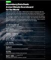
- Bloomberg Live Climate Data Dashboard.jpg 640 × 756; 156 KB
- Blue atmosphere from Astro Wheelock.jpg 800 × 532; 16 KB
- Blue earth at night... and auras.jpg 366 × 211; 13 KB
- Blue fragile edge thin blue line.jpg 1,200 × 798; 26 KB
- Blue Horizon Sept21,2015 by Astro Scott Kelly.jpg 1,023 × 681; 11 KB
- Blue Marble memories in 2022.png 768 × 969; 727 KB
- Blue Marble photo - Apollo 17.jpg 642 × 605; 129 KB
- Blue Marble photo taken by the crew of Apollo 17 (1972).jpg 642 × 605; 129 KB
- Blue Marble updated-August 2015.jpg 1,024 × 341; 109 KB
- Blue n white.jpg 1,024 × 683; 104 KB
- Blue-Green & Planet Citizens, Planet Scientists.png 549 × 844; 94 KB
- Blue-green phyto swirling 2015.png 357 × 605; 409 KB
- Bluemarble 2014-M.jpg 800 × 600; 107 KB
- Bluemarble 2014.jpg 2,400 × 1,800; 511 KB
- Brazil INDC 2015.png 592 × 366; 301 KB
- Breakpoint - Reckoning with America's Environmental Crisis.jpg 329 × 500; 49 KB
- Bridenstine talks.png 1,485 × 911; 223 KB
- Brief History of Carbon Emissions as of 2016.png 770 × 425; 342 KB
- Bucky Trimtab.jpg 348 × 336; 88 KB
- Burst of climate denial as Trump presidency ends.jpg 632 × 604; 92 KB
- C02 in atmosphere chart-3.png 570 × 800; 133 KB
- CAIT Map 1.png 800 × 415; 123 KB
- California's Central Valley Earth View June 2015.png 1,571 × 767; 0 bytes
- California's kelp forests and coastal biodiversity diminished.png 532 × 754; 307 KB
- Canary - 1.jpg 448 × 901; 144 KB
- Canary - 2.png 446 × 531; 264 KB
- Car heating and cooling.png 465 × 635; 261 KB
- Carbon Brief - Greenhouse gas levels 2021.png 640 × 436; 292 KB
- Carbon Clock March 23, 2017.png 800 × 194; 44 KB
- Carbon Footprint - BP-McKibben-Solnit-Aug2021.jpg 516 × 264; 66 KB
- Carbon Mapper - Launch - April 2021.jpg 800 × 323; 92 KB
- Carbon-footprint small or large.jpg 149 × 258; 0 bytes
- Carbon-footprint.jpg 297 × 516; 59 KB
- Cardinal directions m.png 250 × 250; 20 KB
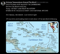
- Caribbean Sea hot - June night 2024.png 676 × 600; 386 KB
- Carl Sagan at the Emerging Issues Forum - 1990.png 360 × 460; 192 KB
- Carl Sagan at the Emerging Issues Forum.png 747 × 600; 600 KB
- Carl Sagan, 1985.PNG 480 × 566; 331 KB
- Carl Sagan, the atmosphere unifies and connects all of our world.png 360 × 390; 229 KB
- CCI-June29,2016.png 760 × 902; 201 KB
- Celebrating 50 Years of Landsat.png 600 × 610; 909 KB
- Celebrating Earth's Beauty 2015.png 1,150 × 716; 1.53 MB
- CFCs then HFCs.png 800 × 382; 169 KB
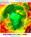
- CFSV2 world temp July 3, 2023.png 600 × 800; 513 KB
- CH4 graph - 1980-2020.JPG 640 × 446; 22 KB
- Changes in carbon dioxide per 1000 years - via Climate Central.jpg 682 × 424; 34 KB
- Charles Bolden.jpg 575 × 449; 153 KB
- ChatGPT talks of fighting climate denialism.png 707 × 747; 239 KB
- China Record Heat - August 2022.png 800 × 1,343; 812 KB
- Christina Korp Earth Day and Apollo 8.jpg 519 × 264; 80 KB
- Citizens Climate Lobby - Save Our Future Act 2021.jpg 518 × 262; 77 KB
- Citizens Climate Lobby - Tampa Bay.jpg 586 × 515; 125 KB
- Climate Action 25th conf in Madrid.jpg 680 × 510; 22 KB
- Aquifers
- Biodiversity
- Citizen Science
- Climate Change
- Earth360
- EarthPOV
- Earth Imaging
- Earth Law
- Earth Science
- Earth Science from Space
- Ecology Studies
- Environmental Full-cost Accounting
- Environmental Protection
- Environmental Security
- Environmental Security, National Security
- EOS eco Operating System
- Externalities
- Forests
- Land Ethic
- New Space
- Oceans
- Permaculture
- Planet API
- Planet Citizen
- Planet Scientist
- Planet Citizens, Planet Scientists
- Planetary Science
- Rainforest
- Sea-level Rise
- Sea-Level Rise & Mitigation
- Sustainability
- Sustainability Policies
- ThinBlueLayer
- Virtual Earth
- Virtual Planet
- Water
- Whole Earth
- Atmospheric Science
- Biogeosciences
- Cryosphere
- Geology
- Geophysics
- Geophysics and Geochemistry
- Hydrology
- Mineralogy
- Natural Resources
- Ocean Science
- Space Science and Space Physics

