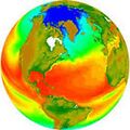
Category:Earth Science from Space


GreenPolicy360 / Strategic Demands
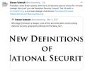
New Definitions of Security, National & Global

PlanetCitizen.org / Earth System Science / Measuring "Vital Signs"

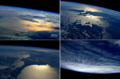
Earthviews
- Blue Marble Collection
- Earth Observations
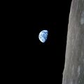
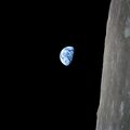
- "Pale Blue Dot"
- EarthPOV.com
- Hello Earth
- Earth360
- "Blue Marble"
- "Earthrise"
- Whole Earth
Planet Citizen
Earth Science, Monitoring Earth's 'Vital Signs' from Space
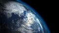
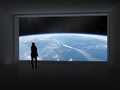
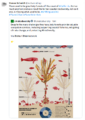
- Our planet is a lonely speck in the great enveloping cosmic dark....
- There is no hint that help will come from elsewhere to save us from ourselves.
- This distant image of our tiny world...
- underscores our responsibility to deal more kindly with one another,
- and to preserve and cherish the pale blue dot, the only home we've got."

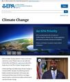
>Earth is changing on all spatial and temporal scales. The purpose of NASA’s Earth science program is to develop a scientific understanding of Earth’s system and its response to natural or human-induced changes and to improve prediction of climate, weather, and natural hazards.
>Earth science is science in the national interest. While scientific discovery from space is inherent in the Agency’s mission, NASA’s programs in Earth science also are central to three important Presidential initiatives: the Climate Change Research Initiative, Global Earth Observation, and the Oceans Action Plan. NASA pioneers new global environmental observations and research, and works with other federal agencies to improve the operational services they provide to the Nation. These services include: weather forecasting; climate prediction; natural hazard assessment, prediction, and response; and environmental management, including air quality forecasting and land use assessment.
-- NASA Strategic Plan
Environmental Security/National Security/Global Security
Visit GreenPolicy360's Associate -- StrategicDemands.com
Earth Science from Space
https://www.greenpolicy360.net/w/Earth_Science_Research_from_Space
https://www.greenpolicy360.net/w/Climate_News
https://www.greenpolicy360.net/w/Earth_and_Space,_Politics
November 2016
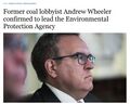
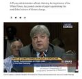
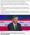
Trump to scrap Nasa climate research in crackdown on ‘politicized science’
NASA’s Earth Science division is set to be stripped of funding... Via The Guardian
GreenPolicy - #EarthScience: It is painful to acknowledge how slight the attention has been by the US media toward what is, demonstrably, one of the greatest threats rising in the US Congress.

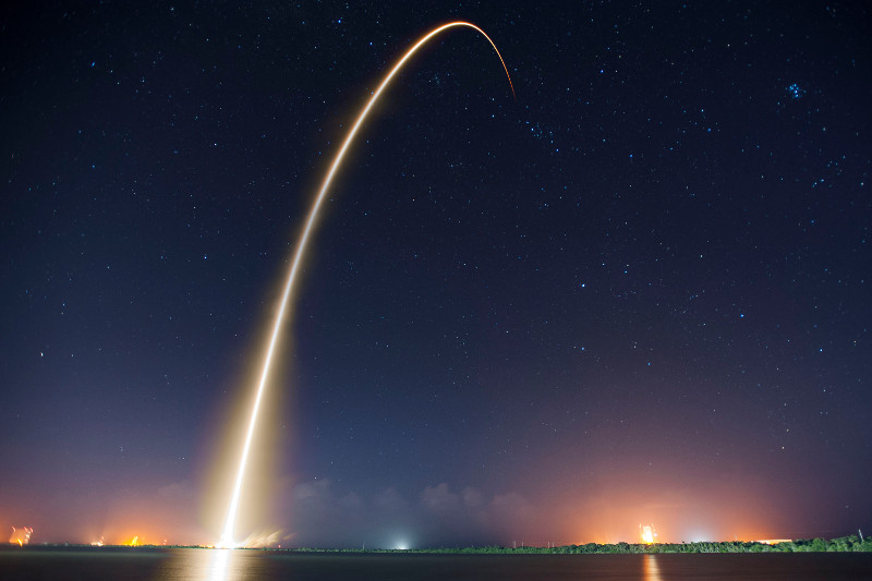
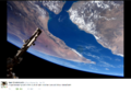
Jason-3 in Orbit / Mission to Measure & Monitor Sea-level Rise
* http://www.nasa.gov/press-release/jason-3-launches-to-monitor-global-sea-level-rise
* https://blogs.nasa.gov/Jason-3/
○ ○ ○ ○ ○ ○ ○ ○ ○ ○ ○
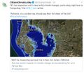
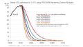
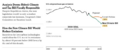
The 1,200-pound (550 kg) Jason-3 satellite is the fourth in a series of ocean-monitoring satellites, which are now taking center stage in monitoring Earth's climate. "More than 90 percent of all the heat being trapped in the Earth's system ... is actually going into the ocean," said Laury Miller, Jason-3 lead scientist with the National Oceanic and Atmospheric Administration. "This makes the ocean perhaps the biggest player in the climate change story."
Scientists can use the information to figure out ocean heights to within 0.2 inches (0.5 cm), said Josh Willis, with NASA's Jet Propulsion Laboratory in Pasadena, California. "We can really see the rise of the global oceans. This is one of the most important yardsticks we have for human-caused climate change," Willis said, adding that heat, plus runoff water from melting ice sheets, causes ocean levels to climb.
○
Eyes in the Sky: Green Groups Are Harnessing Data from Space
SkyTruth -- http://skytruth.org/about/history/
○ ○ ○ ○ ○ ○ ○ ○ ○ ○ ○ ○ ○ ○ ○

Planet Citizen/Climate Citizen News
- http://www.planetcitizen.org -- http://www.greenpolicy360.net/w/Climate_News
- http://www.greenpolicy360.net/w/Earth_and_Space,_Politics

"New Space", the Public & Private Join Together to Begin a New Era
○
#Earth360: Eyes in the Sky, Earth Science by Satellite
Space X Continues to Push Toward New Space Horizons
http://spaceflightnow.com/2015/05/15/spacex-gets-certified-to-launch-nasa-science-missions/
2015 -- NASA has formally certified SpaceX’s Falcon 9 rocket to launch all but the space agency’s most costly robotic science missions, beginning with a a U.S.-French oceanography satellite set for liftoff from California in July.
NASA’s Launch Services Program, which manages the agency’s rocket procurements for research missions, concluded the multi-year certification effort Tuesday, according to George Diller, a NASA spokesperson.
The milestone clears the Falcon 9 rocket to launch NASA’s “medium-risk” science missions, a classification which includes most of the agency’s Earth observation satellites...
-=-=-=-=-=-=-=-=-=-=-=-=-=-=-=-=-=-=-=-=-
Planet Labs Sets New Records
About Planet Labs Documentation Intro
2015 - Private Spending on Space Is Headed for a New Record - Space Race 2.0 #NewSpace
Planet Labs has raised more than $160 million and launched 73 global imaging satellites. The growth was hard to imagine three years ago, when co-founder Will Marshall built the first of the miniature satellites nicknamed “doves” in a Silicon Valley garage.
“A lot of people were very skeptical, and what we were trying to do seemed ludicrous,” said Marshall, a former engineer at NASA Ames Research Center in Mountain View, California. “But we have assets in orbit, and customers who are very interested in the data. Every time we take a picture, we can see how the world is changing.” -- Bloomberg
Planet Labs, flying Doves unprecedented, observing Planet Earth with 'rapid cadence' imaging opening possibilities never before offered
○ ○ ○ ○
2014
Building an API for the Planet: Will Marshall/PlanetLabs [1]
Mission: Democratising Access to Information About the Changing Planet
Time for Planet Labs 'Doves' to fly
Planet Labs "flock" / New Scientist [2] Flock 1
NanoRacks deployment into space [3] [4][5] [6]
○ ○ ○ ○
Earth Imaging -- Micro-satellites [7]
Nextgen #earthscience in era of #climatechange and #globalsecurity threat
“Five years from now, there might be 200 or more up there..." [10]
Geoscience Satellites -- Start-up companies
BlackBridge [11], Dauria [12], DigitalGlobe [13] [14] [15] GeoEye [16],
Firefly Space Systems [17] [18], GeoOptics [19], NanoRacks [20], [21] [22]
NovaWurks [23], OmniEarth [24] [25] [26] [27], OrbitLogic [28], PlanetiQ [29]
Planet Labs [30] Pulse [31] [32] [33], RapidEye [34], Skybox [35] [36] [37]
Teledyne [38], Tyvak Nano-Sat [39], Urthecast [40]

OpenNEX, NASA asks public to join in with space data monitoring earth [41]
○ ○ ○ ○
On the launch of Planet Labs 'Dove' nanosatellites -- applications yet-to-be developed #OpenData #PlanetCitizens
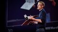
Robbie Schingler, co-founder of Planet Labs: “We are motivated to make information about the changing planet available to all people, especially the people who need it the most..."
"The imagery could be used by anyone who cares about changes in land use over time.” [42]
"Rapid cadence imagery, like Planet Labs is developing, helps us become better, more sustainable stewards of Earth." [43]
Will Marshall, co-founder of Planet Labs talks of democratization of space: videos [44] [45]
Planet Labs largest fleet of Earth-imaging satellites.
The data is expansive and of added value over time:
- - humanitarian applications, earth resource monitoring, sustainability and eco-nomics
- - extreme event and disaster relief
- - food systems, water distribution, improving agriculture
- - business intelligence (BI) metrics/performance
- - research, science
○ ○ ○ ○
June 2014 Google Buys Skybox
[46]
[47]
[48]
[49]
[Background] June 18, 2013 Inside a Startup’s Plan to Turn a Swarm of DIY Satellites Into an All-Seeing Eye [50]
June 16, 2014 - Wall Street Journal / by Christopher Mims [51]
By 2016 or so, Skybox will be able to take full images of the Earth twice a day, at a resolution that until last week was illegal to sell commercially — all with just a half-dozen satellites.
By the time its entire fleet of 24 satellites has launched in 2018, Skybox will be imaging the entire Earth at a resolution sufficient to capture, for example, real-time video of cars driving down the highway. And it will be doing it three times a day.
You might think, thanks to weather maps and the satellite view on Google Maps, that such imagery already is readily available. But because satellites were, until recently, so expensive to build and launch, that isn't the case. There are only nine satellites in orbit now that capture high resolution images for the commercial market, and their capabilities are regularly commandeered for national-security purposes by the U.S. government. That means most of the pictures of the Earth that you've seen are of poor quality and years out of date.
At Google, the business of Skybox isn't data, but knowledge. "We think we are going to fundamentally change humanity's understanding of the economic landscape on a daily basis," says Skybox co-founder Dan Berkenstock...
Skybox's images will inevitably lead to apps and services no one can envision — with unknowable disruptive potential. Skybox executives tell me they hope to offer their data to outside developers... In the short term, Google has said it would use Skybox's images to improve the search company's maps.
A patent revealed in May indicates that Google builds its superaccurate maps directly from satellite imagery, and the company has long had a deal with Skybox competitor DigitalGlobe, whose satellites cost 10 times as much as Skybox's and are 10 times heavier, leading to much higher launch costs. DigitalGlobe's stock dipped 4% on news of the Skybox deal...
○ ○ ○ ○
May 2014 Skybox and Planet Labs / re Google's purchase of Skybox, Google has a business division called “Earth Enterprise” that provides mapping data for large organizations, institutions and businesses. “Google Earth Enterprise allows you to store and process terabytes of imagery, terrain and vector data on your own server infrastructure, and publish maps securely for your users to view using Google Earth desktop or mobile apps, or through your own application using the Google Maps API..." [52]
Feb 2014 Planet Labs versus Skybox / The next step is something more like a Google for Earth: a search engine where people can find satellite photos taken in real or near-real time that answer questions like “How many ships are in the Port of Houston today?” or “How much corn is currently growing in Iowa?” [53]
_ _ _ _ _ _ _ _ _ _ _ _ _ _ _ _ _ _ _ _ _ _ _ _ _ _ _ _ _ _ _ _ _ _ _ _ _ _ _ _ _ _ _ _ _ _ _
“With all these start-ups, the things you’ll be able to do with satellite images will grow exponentially..." IEEE, May 2014
_ _ _ _ _ _ _ _ _ _ _ _ _ _ _ _ _ _ _ _ _ _ _ _ _ _ _ _ _ _ _ _ _ _ _ _ _ _ _ _ _ _ _ _ _ _ _
June 2014
- U.S. Department of Commerce lifts ban on satellite images showing features smaller than 20 inches - DigitalGlobe [54] [55] [56] [57]
- "Companies had not been allowed to make use of images where features smaller than 50cm were visible"
- Satellites Are Cleared to Take Photos at Mailbox-Level Detail per DigitalGlobe petition
- Worldview-3 satellite is set to launch in August. Digital Globe [58] [59] says it will now be able to sell images that show features as small as 31cm [60]
- Sites like Google and Bing Maps will be able to use higher-quality satellite images in near real-time [61] [62]... eventually real-time
GP360: Earth-monitoring, data-sharing, open source, is in the wings...
Citizen-networking/schools-education space-earth projects -- education looks at #earthscience from space... [63] [64]
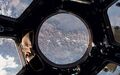
24/7 high-definition video of Earth <Urthecast-ISS> [65] Urthecast APIs
Live from the International Space Station [66] [67] [68] [69]
Earth sciences/NASA-JPL and gov contractors 'Eyes on the Earth'

Feb 2014
Until recently, since the launch of the original Landsat program in 1972, generating images of Earth from space has been the near-exclusive domain of enormous, multi-million dollar satellites sponsored by nations and major defense corporations.
- New micro-satellites, including those launched from the ISS, aim to make real-time imaging available for a fraction of the past decades price and move us from military-defense-communication operations to economic/entrepreneurial functions, 'earth systems-monitoring' and biosphere sustainability, space 'tourism' and low earth orbit travel...

Google Earth Outreach -- Satellites and Mapping as Tools for Citizen Activism
Thank you Rebecca Moore !
With Google Earth Outreach as a platform for action, Rebecca has led local and global initiatives ...
Global Forest Watch & Global Fishing Watch are two most recent successful launches.
Here's a tip of our green hat to Rebecca's 'planet citizen' work
○ ○ ○ ○ ○ ○ ○ ○ ○ ○ ○
Planet Citizen #Earth360
http://www.greenpolicy360.net/w/Planet_API#Google_Earth_Outreach
http://www.greenpolicy360.net/w/Planet_API
○ ○ ○ ○ ○ ○ ○ ○ ○ ○
○ ○ ○ ○ ○ ○ ○ ○
Earth systems-monitoring
Earth Imaging - background – 2007 - Acquiring large data sets of Earth imagery in a simple, low-cost way, represents a new market opportunity beginning to be addressed. New telescope designs enable low-cost satellites with that purpose. [70]

Jan 2014 - "Flocking" "Doves" "Nanosatellites" - http://www.scientificamerican.com/article/flock-of-nano-satellites-to-capture-high-res-views-of-whole-earth/
Google goes mapping - http://gizmodo.com/how-swarms-of-tiny-satellites-are-creating-a-real-time-1497890594
Swarms of small satellites set to deliver close to real-time imagery - http://www.nature.com/news/many-eyes-on-earth-1.14475

Dec 2013
"How Planet Labs Is Saving the Earth with 'Homemade' Satellites. It took less than six months to build twenty-eight of them"...
<more> http://www.businessinsider.com/planet-labs-fleet-of-homemade-satellites-2013-12?op=1
http://www.space.com/23739-tiny-earth-satellite-fleet-launching-december.html
Nov 2013
Flock of Mini- and Micro-sats delivered to space with international Dnepr co-venture - http://www.space.com/23738-dnepr-rocket-launches-32-satellites.html
'Minotaur 1 delivers 29 mini's/CubeSats including first-ever design/build satellite project of a US high school'
http://www.orbital.com/NewsInfo/MissionUpdates/MinotaurI_ORS-3/
○ ○ ○ ○
CubeSats - CubeSat specifications accomplish several high-level goals. Simplification of the satellite's infrastructure makes it possible to design and produce workable satellites at low cost.... Encapsulation of the launcher–payload interface takes away the prohibitive amount of managerial work... Unification among payloads and launchers enables quick exchanges of payloads and utilization of launch opportunities...
CubeSat 'nano-satellites' aim to adhere to the standards described in the CubeSat design specification -- CubeSats initiatives were conceived from educational institutions... In 2004, with their relatively small size, first-gen CubeSats could each be made and launched to Low-Earth Orbit (LEO) for an estimated $65,000–$80,000. Acc to Wikipedia, 'recent' launch prices have been $100,000-$125,000, plus approximately $10,000 to construct a CubeSat. This price tag, far lower than most satellite launches, has made CubeSat a viable option for schools and universities across the world.
- LightSail with CubeSats, Planetary Society - Launch date April 2016 [71] Video/July 2014 Explore Planets/TW
Sept 2013
Sensors and Systems - “Every year the technology improves, with better computers and storage and payloads. The technological evolution improves, price points continue to come down, and now with a small 150 to 300 kg spacecraft for $10 to $20 million you can do what you were doing with a 1,000 kg spacecraft five to 10 years ago for $500 million.” Surrey Satellite Technology-RapidEye satellite imagery “Changing the Economics of Space” ... co-ventures/joint ventures/'ride-alongs'/shared platforms/accessible data
<more> http://www.sstl.co.uk/ - note connection to SpaceX - Elon Musk - note Elon Muck opening up the Tesla platform on June 12, 2014 - http://en.wikipedia.org/wiki/Surrey_Satellite_Technology - http://www.teslamotors.com/blog/all-our-patent-are-belong-you
June 2013
Citizens in Space - http://www.citizensinspace.org/2013/06/planet-labs-to-launch-flock-1/
Opening up to understanding and interacting with our eco-operating systems
Share-able earth science data enabling earth biosphere systems monitoring/preservation policy advocacy by #globalcitizen orgs
Earth systems, monitoring over time - http://www.earthzine.org/geo-and-geoss-the-group-on-earth-observations-and-the-global-earth-observations-system-of-systems/
GEO - Group on Earth Observations - http://www.earthobservations.org/about_geo.shtml
- GEOSS - Global Earth Observation System of Systems - http://www.earthobservations.org/geoss.shtml
○
The Congressman of 'Big Science'
- George E. Brown

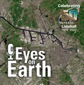
GreenPolicy Siterunner: Going back a number of years to George E. Brown, a Congressman from East LA for decades and a mentor to GreenPolicy360's siterunner, we look at one of the projects that George Brown worked to pioneer (and save from termination during cutbacks of the Ronald Reagan presidency.) The economic/ecological/scientific benefits of LANDSAT, for over fifty years now in operation, are immense. Google Earth's move to establish "Timelapse" maps is another in a profound number of extensions and uses to which the earth science of LANDSAT is being employed to benefit environmental security.
George Brown and LANDSAT, one of his many big science accomplishments, a legacy that continues on and on... many applications, many uses far beyond the original visionaries who proposed and engineered the first generation of earth science from space....
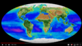
Google Earth Engine / Time Lapse
Timelapse is a global, zoomable video that lets you see how the Earth has changed over the past 32 years. It is made from 33 cloud-free annual mosaics, one for each year from 1984 to 2016, which are made interactively explorable by Carnegie Mellon University CREATE Lab's Time Machine library, a technology for creating and viewing zoomable and pannable timelapses over space and time.
Using Earth Engine, Google Earth Timelapse combines over 5 million satellite images acquired over the past three decades by 5 different satellites. The majority of the images come from Landsat, a joint USGS/NASA Earth observation program that has observed the Earth since the 1970s. For 2015 and 2016, we combined Landsat 8 imagery with imagery from Sentinel-2A, part of the European Commission and European Space Agency's Copernicus Earth observation program.
Search, pan, or zoom around to begin exploring the new Earth Engine Timelapse, or check out Google Earth's YouTube highlights. To embed the timelapse viewer on your site, use the “Share or embed” button above. You can also create a Timelapse tour that moves from one destination to another over time using the Timelapse Tour Editor.
Timelapse is an example that illustrates the power of Earth Engine’s cloud-computing model, which enables users such as scientists, researchers, and journalists to detect changes, map trends, and quantify differences on the Earth's surface using Google’s computational infrastructure and the multi-petabyte Earth Engine data catalog.
Data sources
- NASA Landsat Program, Landsat 4 (1984-1993), Landsat 5 TM (1984-2012), Landsat 7 ETM+ (1999-2013), Landsat 8 OLI (2013-2016), courtesy of the U.S. Geological Survey, Sioux Falls.
- Copernicus Sentinel Program, Sentinel 2A MSI Level 1C, European Union/ESA/Copernicus, 2015-2016.
- MOD09GA MODIS/Terra Surface Reflectance Daily L2G. NASA EOSDIS Land Processes DAAC, 2000-2016.
- MCD43A4 MODIS Terra+Aqua Nadir BRDF-Adjusted Reflectance 16-Day L3. NASA EOSDIS Land Processes DAAC, 2000-2016.
- ETOPO1 1 Arc-Minute Global Relief Model. National Geophysical Data Center, NOAA.
- Land Water Mask Derived from MODIS and SRTM L3. Version 5. NASA EOSDIS Land Processes DAAC.
- Hansen Global Forest Change v1.2 (2000-2014).
○
Subcategories
This category has the following 20 subcategories, out of 20 total.
A
C
D
E
G
N
O
P
S
T
W
Pages in category "Earth Science from Space"
The following 88 pages are in this category, out of 88 total.
C
- Carbon Brief
- Clearcutting
- Climate Change - Global Warming Keyword-Terms
- Climate Change Denier Talking Points -- and Rebuttals
- Climate Conference - Paris 2015
- Climate Desk
- Climate Law Blog @Columbia Law School
- Climate migration
- Climate News
- Climate News Events Archive ... 1970 to Today
- Climate Plans Enforcement - Resources
E
- Each of us can make a positive difference
- Earth
- Earth from NASA
- Earth Imaging-New Space
- Earth Right Now
- Earth Science Eco-Fields
- Earth Science Research from Space
- Earth Science Vital Signs
- EarthPOV
- EarthTime
- Earthviews
- Earthviews from Astronauts
- Environmental full-cost accounting
- Environmental Rules Rolled Back
- Environmental Security Organizations
- ESA Living Planet Announcement - May 2022
- Ethics and Climate Change
- European Union Green Deal - Fit for 55
- ExxonMobil and US House Science Committee v US Attorneys General and Environmental Groups
G
- GEOID
- George E. Brown Jr
- Glasgow Climate Summit - Pledges, Promises, Declarations - What's Next Up
- Global Climate Action Summit
- Global Fishing Watch
- Global Forest Watch
- Google Earth
- Google Earth Timelapse
- Green Politics 360
- Green Politics with GreenPolicy360
- Greening Our Blue Planet
- GreenPolicy360 Archive Highlights 2021
- GreenPolicy360 Archive Highlights 2022
I
L
P
S
Media in category "Earth Science from Space"
The following 200 files are in this category, out of 898 total.
(previous page) (next page) 'Thin Blue Layer' of Earth's Atmosphere 2.jpg 800 × 486; 46 KB
 'Thin Blue Layer' of Earth's Atmosphere l.jpg 853 × 486; 46 KB
 'Thin Blue Layer' of Earth's Atmosphere xl.jpg 1,152 × 648; 79 KB
 -HelloEarth.png 579 × 381; 0 bytes
 03-Scott-Kelly-NASA.jpg 800 × 500; 113 KB
 1977 from the Office of Science and Technology Policy.jpg 661 × 711; 177 KB
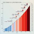
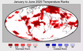 2020 record temperatures.png 800 × 502; 358 KB
 3-15-2016 10-49-38 AM.png 702 × 862; 396 KB
 3-15-2016 12-29-07 PM.png 538 × 701; 201 KB
 5 19 14 andrew antarcticaelevationchanges-640x547.jpg 640 × 547; 59 KB
 7-20-2020 GreenPolicy360 RT No.2.jpg 591 × 510; 125 KB
 @AstroSamantha HelloEarth Jan30,2015.png 998 × 699; 851 KB
 A Fierce Green Fire.jpg 208 × 314; 13 KB
 A scorching year, what about the 360 warming data.jpg 600 × 706; 106 KB
 A War on Science.png 800 × 389; 705 KB
 About Baselines and Change.png 592 × 312; 33 KB
 About Bioneers.png 581 × 800; 761 KB
 About website of The Invading Sea.png 800 × 343; 126 KB
 Above.png 500 × 375; 173 KB
 Acceptance on behalf of the United States of America.png 448 × 306; 62 KB
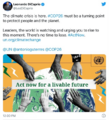
 Act now for a livable future.png 501 × 275; 272 KB
 Acting to make a positive difference - in St Petersburg Florida.png 600 × 723; 645 KB
 Actually watching the planet breathe.png 800 × 446; 649 KB
 Ag production and GHG emissions.jpg 680 × 510; 33 KB
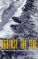 Against the Tide - Cover - by Cornelia Dean.jpg 308 × 475; 57 KB
 Air pollution moves globally.png 620 × 412; 256 KB
 Alaska Willow - March 12 2023.png 576 × 230; 99 KB
 Alaska Willow News-March 12 2023.png 576 × 625; 235 KB
 Aldis zone blog.jpg 500 × 498; 67 KB
 Amazon fires burn across the rainforest.jpg 800 × 504; 76 KB
 Andrew Wheeler confirmed to head EPA.jpg 753 × 600; 85 KB
 Another year, another record.png 800 × 294; 251 KB
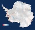
 Antarctica ice shelf-glaciers 2012.png 956 × 714; 805 KB
 Antarctica-2018.jpg 768 × 1,024; 82 KB
 Anthropocene bks016.png 800 × 248; 227 KB
 Anthropocene-crutzen.jpg 628 × 347; 79 KB
 Anthropocene-the-geology-of-humanity.jpg 628 × 347; 79 KB
 AOC re climate task force - july 8 2020.jpg 585 × 203; 38 KB
 Apollo Earth 350x350.jpg 350 × 350; 32 KB
 Apollo.jpg 715 × 715; 102 KB
 April 28, 2016.png 586 × 415; 159 KB
 Aquifers earthsciencefromspace Grace CA3.png 772 × 652; 559 KB
 Aquifers global earth observations by grace20150616-16 m.jpg 800 × 450; 117 KB
 Aquifers global earth observations by grace20150616-16.jpg 1,600 × 900; 317 KB
 Aquifers globalstudy 2015.png 668 × 451; 299 KB
 Aquifers June2015 past the tipping point.png 533 × 615; 195 KB
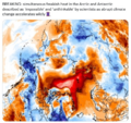 Arctic - Antarctic - Breaking.png 639 × 600; 903 KB
 Arctic - Kolbert - 2023.png 553 × 476; 274 KB
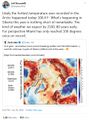
 Arctic 30.1 C at 62.5 N.jpg 800 × 432; 80 KB
 Arctic drilling ban Dec 21, 2016.png 692 × 536; 119 KB
 Arctic heat in Russia-Siberia 2020.gif 784 × 408; 3.6 MB
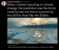
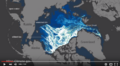
 Arctic Melt - 1950-2020.png 640 × 349; 287 KB
 Arctic Sea Ice 2015.png 1,008 × 756; 542 KB
 Arctic Sea Ice Area graphic thru 2016.png 640 × 355; 382 KB
 Arctic sea ice watch 25 yrs of ice cover change.png 697 × 386; 314 KB
 Arctic Sea Ice.png 525 × 103; 97 KB
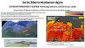 Arctic Siberia Heatwave - Again - June 2021.jpg 640 × 360; 83 KB
 Arctic-March30,2019.jpg 797 × 600; 126 KB
 Arctic-Siberia-6-20-2020.jpg 478 × 644; 148 KB
 Arctic-swipa-spm.pdf ; 4.58 MB
 AskNatureAvatar s.png 200 × 200; 14 KB
 Atmosphere Science.jpg 800 × 600; 45 KB
 Atmospheric Experiment of Humanity.jpg 519 × 574; 201 KB
 AU Too Hot.png 640 × 413; 286 KB
 Away fly the Doves March4,2015.png 582 × 409; 167 KB
 Banking - finance - climate - Mann-1.jpg 452 × 640; 162 KB
 Banking - finance - climate - Mann-2.jpg 452 × 640; 164 KB
 Barrier island hubris 6-29-2021.jpg 490 × 635; 111 KB
 Biden - clean energy ambitions.JPG 640 × 334; 31 KB
 Biden introduces leadership team - Nov 24 2020.jpg 800 × 644; 173 KB
 Biden re Earth Day 2023.png 640 × 400; 155 KB
 Biden selects Kerry as special climate envoy.jpg 592 × 505; 87 KB
 Biden urged to act - Oct 18 2021 - The Guardian.png 663 × 600; 497 KB
 Biden's assembled an all-star climate team 4-21-2021.jpg 682 × 732; 309 KB
 Biden-Sanders Unity Task Force on Climate.jpg 701 × 780; 139 KB
 Big Oil Rocked by News May 27 2021.jpg 639 × 600; 84 KB
 Bill McKibben switches gears-Sept 2021.jpg 518 × 265; 78 KB
 Bill Nelson on Global Temp Rise and Climate Change.png 640 × 353; 100 KB
 Bill Nye explains.jpg 543 × 508; 88 KB
 Bill Nye The Planet's on Fire.jpg 800 × 675; 106 KB
 Bloomberg Carbon Clock 10-26-2021 8-47-05 AM EST.png 800 × 195; 356 KB
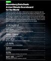 Bloomberg Live Climate Data Dashboard.jpg 640 × 756; 156 KB
 Blue Horizon Sept21,2015 by Astro Scott Kelly.jpg 1,023 × 681; 11 KB
 Blue-Green & Planet Citizens, Planet Scientists.png 549 × 844; 94 KB
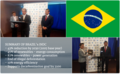 Brazil INDC 2015.png 592 × 366; 301 KB
 Breakpoint - Reckoning with America's Environmental Crisis.jpg 329 × 500; 49 KB
 Bridenstine talks.png 1,485 × 911; 223 KB
 Burst of climate denial as Trump presidency ends.jpg 632 × 604; 92 KB
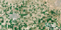 California's Central Valley Earth View June 2015.png 1,571 × 767; 0 bytes
 California's kelp forests and coastal biodiversity diminished.png 532 × 754; 307 KB
 Car heating and cooling.png 465 × 635; 261 KB
 Carbon Brief - Greenhouse gas levels 2021.png 640 × 436; 292 KB
 Carbon Clock March 23, 2017.png 800 × 194; 44 KB
 Carbon Footprint - BP-McKibben-Solnit-Aug2021.jpg 516 × 264; 66 KB
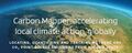 Carbon Mapper - Launch - April 2021.jpg 800 × 323; 92 KB
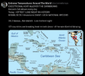 Caribbean Sea hot - June night 2024.png 676 × 600; 386 KB
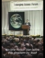 Carl Sagan at the Emerging Issues Forum - 1990.png 360 × 460; 192 KB
 Carl Sagan at the Emerging Issues Forum.png 747 × 600; 600 KB
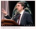
 Carl Sagan, 1985.PNG 480 × 566; 331 KB
 Carl Sagan, the atmosphere unifies and connects all of our world.png 360 × 390; 229 KB
 CCI-June29,2016.png 760 × 902; 201 KB
 Celebrating 50 Years of Landsat.png 600 × 610; 909 KB
 CFCs then HFCs.png 800 × 382; 169 KB
 CFSV2 world temp July 3, 2023.png 600 × 800; 513 KB
 CH4 graph - 1980-2020.JPG 640 × 446; 22 KB
 Changes in carbon dioxide per 1000 years - via Climate Central.jpg 682 × 424; 34 KB
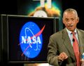 Charles Bolden.jpg 575 × 449; 153 KB
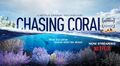 Chasing Coral.jpg 800 × 437; 65 KB
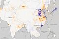 China air 2005 2014.jpg 720 × 480; 160 KB
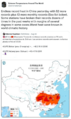 China Record Heat - August 2022.png 800 × 1,343; 812 KB
 Chloro1.jpg 432 × 216; 71 KB
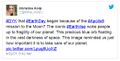 Christina Korp Earth Day and Apollo 8.jpg 519 × 264; 80 KB
 Citizens Climate Lobby - Tampa Bay.jpg 586 × 515; 125 KB
 Climate Action 25th conf in Madrid.jpg 680 × 510; 22 KB
 Climate activist - Steven Schmidt - 1978 on.png 600 × 480; 174 KB
 Climate Books - 2020.jpg 800 × 450; 69 KB
 Climate Change Agr Nov 4, 2016.png 800 × 523; 296 KB
 Climate Change Conf Nov 6-17.png 464 × 488; 107 KB
 Climate Change COP27 - Nov 11 2022 US Representatives.jpg 712 × 444; 54 KB
 Climate Change COP27 - Nov 11 Kathy Castor.jpg 712 × 710; 77 KB
 Climate change unique threat to national security.png 800 × 42; 20 KB
 Climate Change US EPA.jpg 600 × 703; 95 KB
 Climate Conferences 1979-2020.jpg 768 × 768; 121 KB
 Climate Crisis - Emily Atkin Heated No. 1.jpg 537 × 453; 61 KB
 Climate Crisis and the Global Green New Deal.jpg 293 × 418; 33 KB
 Climate debate.jpg 493 × 580; 129 KB
 Climate Desk.jpg 390 × 226; 21 KB
 Climate diplomacy is failing - June 2020.jpg 592 × 440; 71 KB
 Climate Emergency Institute - Oct 2022.png 610 × 600; 274 KB
 Climate Emergency Institute -- 2021.jpg 800 × 450; 55 KB
 Climate emergency.jpg 800 × 450; 69 KB
 Climate Headline News around the World - July 2023.jpg 600 × 704; 151 KB
 Climate Lawsuit-Our Childrens Trust-Florida.png 462 × 760; 289 KB
 Climate Legacy of Biden.jpg 600 × 687; 265 KB
 Climate Models.png 639 × 558; 123 KB
 Climate News - Oct 28 2022.jpg 626 × 600; 88 KB
 Climate News - United Nations Report - Feb 2022.png 768 × 878; 539 KB
 Climate News Dec 4 2023 in Dubai.png 800 × 1,037; 649 KB
 Climate Plan pledges as Oct6,2015.png 529 × 409; 101 KB
 Climate Plans Enforcement - Resources - GreenPolicy.png 768 × 897; 686 KB
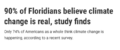 Climate poll - Florida.png 640 × 267; 36 KB
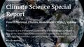 Climate Science Special Report - US - November 2017.jpg 800 × 445; 122 KB
 Climate strike - Week 171.png 739 × 600; 834 KB
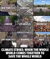 Climate Strike Around the World - Sep20,2019.jpg 700 × 830; 119 KB
 Climate Summit - Leonardo DiCaprio.png 600 × 663; 521 KB
 Climate Summit live updates - Nov 2 2021.png 751 × 600; 420 KB
 Climate Summit planned-1.jpg 800 × 301; 53 KB
 Climate Summit planned-2.jpg 800 × 187; 31 KB
 Climate Summit planned-3.jpg 800 × 278; 44 KB
 Climate Summit planned-4.jpg 800 × 241; 41 KB
 Climate usa 60 years on.jpg 800 × 480; 34 KB
 Climate365 NASA and science orgs measure and monitor.png 798 × 633; 165 KB
 ClimateNews 360.jpg 172 × 172; 9 KB
 ClimateNewsFlorida.jpg 448 × 191; 36 KB
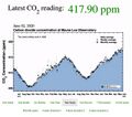 CO2 at Mauna Loa data - June 02, 2020 - 417.90 ppm.jpg 640 × 566; 66 KB
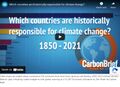 CO2 cumulative emissions 1850 - 2021 - countries.jpg 640 × 462; 211 KB
 CO2 Emissions per Capita by Country 1960-2014.png 800 × 451; 424 KB
 CO2 emissions-around-the-world.png 800 × 595; 123 KB
 CO2 global pathways via IPCC AR6 - how will we respond.jpg 800 × 450; 57 KB
 CO2 higher than in the past 5 million yrs.jpg 514 × 285; 62 KB
 CO2 photo.JPG 800 × 536; 88 KB
 Coastal Connecticut sea level rise.png 480 × 549; 396 KB
 Congressman george.e.brown.gif 235 × 305; 41 KB
 COP26 Climate Summit concludes.jpg 600 × 800; 160 KB
 COP26 concludes - 2.png 648 × 467; 177 KB
 COP26 concludes - 3.png 648 × 713; 416 KB
 COP26 concludes.png 648 × 528; 329 KB
 COP26 in GLASGOW - 31 OCT-12 NOV 2021.jpg 800 × 264; 51 KB
 COP27 'opening speech'.png 640 × 460; 160 KB
 COP28 News - Dec 13 2023.png 800 × 898; 410 KB
 CopernicusEU - Sentinel5P Atmosphere Monitoring Mission - 2.jpg 795 × 1,477; 654 KB
 CopernicusEU - Sentinel5P Atmosphere Monitoring Mission.png 583 × 465; 222 KB
 Coral bleaching - August 2023.png 488 × 430; 261 KB
 Coral bleaching - NOAA - August 2023.png 488 × 338; 201 KB
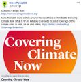 Covering Climate Now.jpg 493 × 498; 67 KB
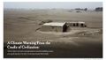 Cradle of Civilization - and climate change.jpg 640 × 360; 70 KB
 CSDA Program and Planet.jpg 800 × 379; 99 KB
 Cube Launch from the ISS via Tim Peake.png 640 × 409; 218 KB
 Cumulative CO2 Emissions by Country Since 1850.png 800 × 445; 445 KB
 Cyanobacteria Prochlorococcus worldmapping MIT.jpg 473 × 321; 60 KB
 Dated record of Earths climate - Science Report Sept 10 2020.jpg 735 × 669; 192 KB
 Day before Earth Day, April 21, 2015.png 1,275 × 752; 1.66 MB
 Day before Earth Day-m April 21, 2015.png 800 × 472; 896 KB
 Dead Sea evaporation ponds.jpeg 800 × 600; 170 KB
 Death Valley ... the heat, what its like.jpg 640 × 381; 62 KB
 Defend Our Future 6-1-2020.jpg 585 × 458; 103 KB
 Democratic Climate Plan-Introduced June 2020.jpg 528 × 561; 117 KB
 Democratic National Convention-62 climate speakers.jpg 443 × 407; 57 KB
 Democratic Party Climate Bill - Aug 2022.png 640 × 269; 70 KB
 Democratic Party pres candidates debate in Miami-June 2019.jpg 800 × 534; 124 KB
 Democratic presidential candidates on the Green New Deal.jpg 800 × 359; 57 KB
 Democratising access to information about the planet Planet Labs.jpg 804 × 452; 43 KB


.png)


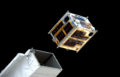
![[3]](http://www.greenpolicy360.net/mw/images/Doves_launched_from_ISS_float_against_Earth_horizon_m.jpg)
![[31]](http://www.greenpolicy360.net/mw/images/Doves_close-up-of-cubesats-leaving-nanoracks-deployer-2014-02-11_m.jpg)
- Earth360
- Democratization of Space
- Earth Imaging
- Earth Observations
- Earth Science
- Environmental Security
- Environmental Security, National Security
- ESA
- Global Security
- NanoRacks
- NASA
- National Security
- New Space
- PlanetLabs
- Planet API
- Planet Citizen
- Planet Citizens, Planet Scientists
- Planet Scientist
- Whole Earth
- Arctic
- Antarctica
- Greenland
- Forests
- Oceans
- Sea-level Rise
- Atmosphere
- Atmospheric Science
- Biogeosciences
- Climate Change
- Cryosphere
- Geophysics and Geochemistry
- Mineralogy
- Geology
- Geophysics
- Hydrology
- Natural Resources
- Ocean Science
- Planetary Science
- Space Science and Space Physics