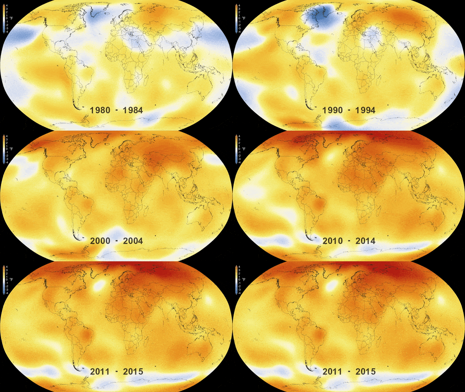
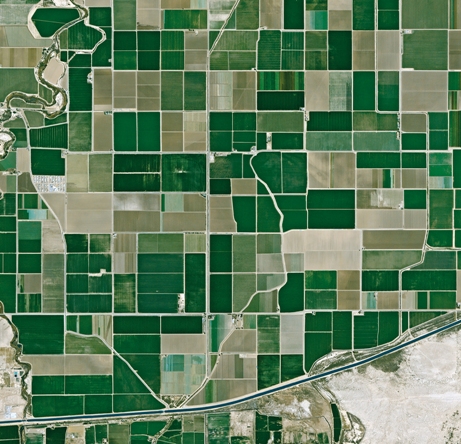
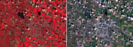
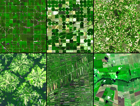
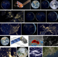
Category:Earth Science from Space
GreenPolicy360 / Strategic Demands
New Definitions of Security, National & Global
PlanetCitizen.org / Earth System Science / Measuring "Vital Signs"
Earthviews
- Blue Marble Collection
- Earth Observations
- "Pale Blue Dot"
- EarthPOV.com
- Hello Earth
- Earth360
- "Blue Marble"
- "Earthrise"
- Whole Earth
Planet Citizen
Earth Science, Monitoring Earth's 'Vital Signs' from Space
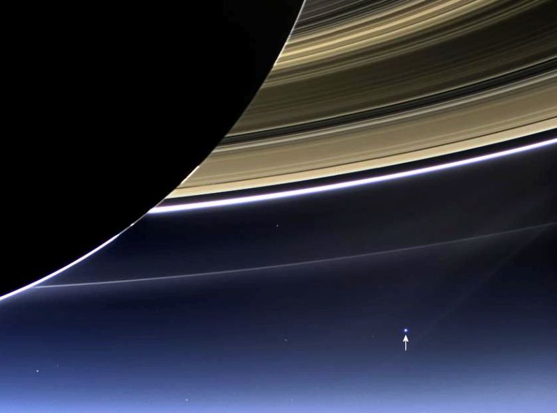
- Our planet is a lonely speck in the great enveloping cosmic dark....
- There is no hint that help will come from elsewhere to save us from ourselves.
- This distant image of our tiny world...
- underscores our responsibility to deal more kindly with one another,
- and to preserve and cherish the pale blue dot, the only home we've got."
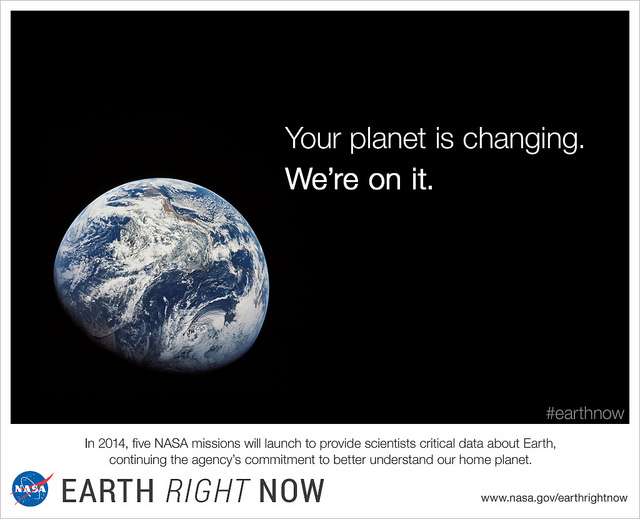
>Earth is changing on all spatial and temporal scales. The purpose of NASA’s Earth science program is to develop a scientific understanding of Earth’s system and its response to natural or human-induced changes and to improve prediction of climate, weather, and natural hazards.
>Earth science is science in the national interest. While scientific discovery from space is inherent in the Agency’s mission, NASA’s programs in Earth science also are central to three important Presidential initiatives: the Climate Change Research Initiative, Global Earth Observation, and the Oceans Action Plan. NASA pioneers new global environmental observations and research, and works with other federal agencies to improve the operational services they provide to the Nation. These services include: weather forecasting; climate prediction; natural hazard assessment, prediction, and response; and environmental management, including air quality forecasting and land use assessment.
-- NASA Strategic Plan
Environmental Security/National Security/Global Security
Visit GreenPolicy360's Associate -- StrategicDemands.com
Earth Science from Space
https://www.greenpolicy360.net/w/Earth_Science_Research_from_Space
https://www.greenpolicy360.net/w/Climate_News
https://www.greenpolicy360.net/w/Earth_and_Space,_Politics
November 2016
Trump to scrap Nasa climate research in crackdown on ‘politicized science’
NASA’s Earth Science division is set to be stripped of funding... Via The Guardian
GreenPolicy - #EarthScience: It is painful to acknowledge how slight the attention has been by the US media toward what is, demonstrably, one of the greatest threats rising in the US Congress.
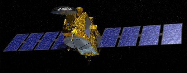
Jason-3 in Orbit / Mission to Measure & Monitor Sea-level Rise
* http://www.nasa.gov/press-release/jason-3-launches-to-monitor-global-sea-level-rise
* https://blogs.nasa.gov/Jason-3/
○ ○ ○ ○ ○ ○ ○ ○ ○ ○ ○
The 1,200-pound (550 kg) Jason-3 satellite is the fourth in a series of ocean-monitoring satellites, which are now taking center stage in monitoring Earth's climate. "More than 90 percent of all the heat being trapped in the Earth's system ... is actually going into the ocean," said Laury Miller, Jason-3 lead scientist with the National Oceanic and Atmospheric Administration. "This makes the ocean perhaps the biggest player in the climate change story."
Scientists can use the information to figure out ocean heights to within 0.2 inches (0.5 cm), said Josh Willis, with NASA's Jet Propulsion Laboratory in Pasadena, California. "We can really see the rise of the global oceans. This is one of the most important yardsticks we have for human-caused climate change," Willis said, adding that heat, plus runoff water from melting ice sheets, causes ocean levels to climb.
○
Eyes in the Sky: Green Groups Are Harnessing Data from Space
SkyTruth -- http://skytruth.org/about/history/
○ ○ ○ ○ ○ ○ ○ ○ ○ ○ ○ ○ ○ ○ ○
Planet Citizen/Climate Citizen News
- http://www.planetcitizen.org -- http://www.greenpolicy360.net/w/Climate_News
- http://www.greenpolicy360.net/w/Earth_and_Space,_Politics
"New Space", the Public & Private Join Together to Begin a New Era
○
#Earth360: Eyes in the Sky, Earth Science by Satellite
Space X Continues to Push Toward New Space Horizons
http://spaceflightnow.com/2015/05/15/spacex-gets-certified-to-launch-nasa-science-missions/
2015 -- NASA has formally certified SpaceX’s Falcon 9 rocket to launch all but the space agency’s most costly robotic science missions, beginning with a a U.S.-French oceanography satellite set for liftoff from California in July.
NASA’s Launch Services Program, which manages the agency’s rocket procurements for research missions, concluded the multi-year certification effort Tuesday, according to George Diller, a NASA spokesperson.
The milestone clears the Falcon 9 rocket to launch NASA’s “medium-risk” science missions, a classification which includes most of the agency’s Earth observation satellites...
-=-=-=-=-=-=-=-=-=-=-=-=-=-=-=-=-=-=-=-=-
Planet Labs Sets New Records
About Planet Labs Documentation Intro
2015 - Private Spending on Space Is Headed for a New Record - Space Race 2.0 #NewSpace
Planet Labs has raised more than $160 million and launched 73 global imaging satellites. The growth was hard to imagine three years ago, when co-founder Will Marshall built the first of the miniature satellites nicknamed “doves” in a Silicon Valley garage.
“A lot of people were very skeptical, and what we were trying to do seemed ludicrous,” said Marshall, a former engineer at NASA Ames Research Center in Mountain View, California. “But we have assets in orbit, and customers who are very interested in the data. Every time we take a picture, we can see how the world is changing.” -- Bloomberg
Planet Labs, flying Doves unprecedented, observing Planet Earth with 'rapid cadence' imaging opening possibilities never before offered
○ ○ ○ ○
2014
Building an API for the Planet: Will Marshall/PlanetLabs [1]
Mission: Democratising Access to Information About the Changing Planet
Time for Planet Labs 'Doves' to fly
Planet Labs "flock" / New Scientist [2] Flock 1
NanoRacks deployment into space [3] [4][5] [6]
○ ○ ○ ○
Earth Imaging -- Micro-satellites [7]
Nextgen #earthscience in era of #climatechange and #globalsecurity threat
“Five years from now, there might be 200 or more up there..." [10]
Geoscience Satellites -- Start-up companies
BlackBridge [11], Dauria [12], DigitalGlobe [13] [14] [15] GeoEye [16],
Firefly Space Systems [17] [18], GeoOptics [19], NanoRacks [20], [21] [22]
NovaWurks [23], OmniEarth [24] [25] [26] [27], OrbitLogic [28], PlanetiQ [29]
Planet Labs [30] Pulse [31] [32] [33], RapidEye [34], Skybox [35] [36] [37]
Teledyne [38], Tyvak Nano-Sat [39], Urthecast [40]
OpenNEX, NASA asks public to join in with space data monitoring earth [41]
○ ○ ○ ○
On the launch of Planet Labs 'Dove' nanosatellites -- applications yet-to-be developed #OpenData #PlanetCitizens
Robbie Schingler, co-founder of Planet Labs: “We are motivated to make information about the changing planet available to all people, especially the people who need it the most..."
"The imagery could be used by anyone who cares about changes in land use over time.” [42]
"Rapid cadence imagery, like Planet Labs is developing, helps us become better, more sustainable stewards of Earth." [43]
Will Marshall, co-founder of Planet Labs talks of democratization of space: videos [44] [45]
Planet Labs largest fleet of Earth-imaging satellites.
The data is expansive and of added value over time:
- - humanitarian applications, earth resource monitoring, sustainability and eco-nomics
- - extreme event and disaster relief
- - food systems, water distribution, improving agriculture
- - business intelligence (BI) metrics/performance
- - research, science
○ ○ ○ ○
June 2014 Google Buys Skybox
[46]
[47]
[48]
[49]
[Background] June 18, 2013 Inside a Startup’s Plan to Turn a Swarm of DIY Satellites Into an All-Seeing Eye [50]
June 16, 2014 - Wall Street Journal / by Christopher Mims [51]
By 2016 or so, Skybox will be able to take full images of the Earth twice a day, at a resolution that until last week was illegal to sell commercially — all with just a half-dozen satellites.
By the time its entire fleet of 24 satellites has launched in 2018, Skybox will be imaging the entire Earth at a resolution sufficient to capture, for example, real-time video of cars driving down the highway. And it will be doing it three times a day.
You might think, thanks to weather maps and the satellite view on Google Maps, that such imagery already is readily available. But because satellites were, until recently, so expensive to build and launch, that isn't the case. There are only nine satellites in orbit now that capture high resolution images for the commercial market, and their capabilities are regularly commandeered for national-security purposes by the U.S. government. That means most of the pictures of the Earth that you've seen are of poor quality and years out of date.
At Google, the business of Skybox isn't data, but knowledge. "We think we are going to fundamentally change humanity's understanding of the economic landscape on a daily basis," says Skybox co-founder Dan Berkenstock...
Skybox's images will inevitably lead to apps and services no one can envision — with unknowable disruptive potential. Skybox executives tell me they hope to offer their data to outside developers... In the short term, Google has said it would use Skybox's images to improve the search company's maps.
A patent revealed in May indicates that Google builds its superaccurate maps directly from satellite imagery, and the company has long had a deal with Skybox competitor DigitalGlobe, whose satellites cost 10 times as much as Skybox's and are 10 times heavier, leading to much higher launch costs. DigitalGlobe's stock dipped 4% on news of the Skybox deal...
○ ○ ○ ○
May 2014 Skybox and Planet Labs / re Google's purchase of Skybox, Google has a business division called “Earth Enterprise” that provides mapping data for large organizations, institutions and businesses. “Google Earth Enterprise allows you to store and process terabytes of imagery, terrain and vector data on your own server infrastructure, and publish maps securely for your users to view using Google Earth desktop or mobile apps, or through your own application using the Google Maps API..." [52]
Feb 2014 Planet Labs versus Skybox / The next step is something more like a Google for Earth: a search engine where people can find satellite photos taken in real or near-real time that answer questions like “How many ships are in the Port of Houston today?” or “How much corn is currently growing in Iowa?” [53]
_ _ _ _ _ _ _ _ _ _ _ _ _ _ _ _ _ _ _ _ _ _ _ _ _ _ _ _ _ _ _ _ _ _ _ _ _ _ _ _ _ _ _ _ _ _ _
“With all these start-ups, the things you’ll be able to do with satellite images will grow exponentially..." IEEE, May 2014
_ _ _ _ _ _ _ _ _ _ _ _ _ _ _ _ _ _ _ _ _ _ _ _ _ _ _ _ _ _ _ _ _ _ _ _ _ _ _ _ _ _ _ _ _ _ _
June 2014
- U.S. Department of Commerce lifts ban on satellite images showing features smaller than 20 inches - DigitalGlobe [54] [55] [56] [57]
- "Companies had not been allowed to make use of images where features smaller than 50cm were visible"
- Satellites Are Cleared to Take Photos at Mailbox-Level Detail per DigitalGlobe petition
- Worldview-3 satellite is set to launch in August. Digital Globe [58] [59] says it will now be able to sell images that show features as small as 31cm [60]
- Sites like Google and Bing Maps will be able to use higher-quality satellite images in near real-time [61] [62]... eventually real-time
GP360: Earth-monitoring, data-sharing, open source, is in the wings...
Citizen-networking/schools-education space-earth projects -- education looks at #earthscience from space... [63] [64]
24/7 high-definition video of Earth <Urthecast-ISS> [65] Urthecast APIs
Live from the International Space Station [66] [67] [68] [69]
Earth sciences/NASA-JPL and gov contractors 'Eyes on the Earth'
Feb 2014
Until recently, since the launch of the original Landsat program in 1972, generating images of Earth from space has been the near-exclusive domain of enormous, multi-million dollar satellites sponsored by nations and major defense corporations.
- New micro-satellites, including those launched from the ISS, aim to make real-time imaging available for a fraction of the past decades price and move us from military-defense-communication operations to economic/entrepreneurial functions, 'earth systems-monitoring' and biosphere sustainability, space 'tourism' and low earth orbit travel...
Google Earth Outreach -- Satellites and Mapping as Tools for Citizen Activism
Thank you Rebecca Moore !
With Google Earth Outreach as a platform for action, Rebecca has led local and global initiatives ...
Global Forest Watch & Global Fishing Watch are two most recent successful launches.
Here's a tip of our green hat to Rebecca's 'planet citizen' work
○ ○ ○ ○ ○ ○ ○ ○ ○ ○ ○
Planet Citizen #Earth360
http://www.greenpolicy360.net/w/Planet_API#Google_Earth_Outreach
http://www.greenpolicy360.net/w/Planet_API
○ ○ ○ ○ ○ ○ ○ ○ ○ ○
○ ○ ○ ○ ○ ○ ○ ○
Earth systems-monitoring
Earth Imaging - background – 2007 - Acquiring large data sets of Earth imagery in a simple, low-cost way, represents a new market opportunity beginning to be addressed. New telescope designs enable low-cost satellites with that purpose. [70]
Jan 2014 - "Flocking" "Doves" "Nanosatellites" - http://www.scientificamerican.com/article/flock-of-nano-satellites-to-capture-high-res-views-of-whole-earth/
Google goes mapping - http://gizmodo.com/how-swarms-of-tiny-satellites-are-creating-a-real-time-1497890594
Swarms of small satellites set to deliver close to real-time imagery - http://www.nature.com/news/many-eyes-on-earth-1.14475
Dec 2013
"How Planet Labs Is Saving the Earth with 'Homemade' Satellites. It took less than six months to build twenty-eight of them"...
<more> http://www.businessinsider.com/planet-labs-fleet-of-homemade-satellites-2013-12?op=1
http://www.space.com/23739-tiny-earth-satellite-fleet-launching-december.html
Nov 2013
Flock of Mini- and Micro-sats delivered to space with international Dnepr co-venture - http://www.space.com/23738-dnepr-rocket-launches-32-satellites.html
'Minotaur 1 delivers 29 mini's/CubeSats including first-ever design/build satellite project of a US high school'
http://www.orbital.com/NewsInfo/MissionUpdates/MinotaurI_ORS-3/
○ ○ ○ ○
CubeSats - CubeSat specifications accomplish several high-level goals. Simplification of the satellite's infrastructure makes it possible to design and produce workable satellites at low cost.... Encapsulation of the launcher–payload interface takes away the prohibitive amount of managerial work... Unification among payloads and launchers enables quick exchanges of payloads and utilization of launch opportunities...
CubeSat 'nano-satellites' aim to adhere to the standards described in the CubeSat design specification -- CubeSats initiatives were conceived from educational institutions... In 2004, with their relatively small size, first-gen CubeSats could each be made and launched to Low-Earth Orbit (LEO) for an estimated $65,000–$80,000. Acc to Wikipedia, 'recent' launch prices have been $100,000-$125,000, plus approximately $10,000 to construct a CubeSat. This price tag, far lower than most satellite launches, has made CubeSat a viable option for schools and universities across the world.
- LightSail with CubeSats, Planetary Society - Launch date April 2016 [71] Video/July 2014 Explore Planets/TW
Sept 2013
Sensors and Systems - “Every year the technology improves, with better computers and storage and payloads. The technological evolution improves, price points continue to come down, and now with a small 150 to 300 kg spacecraft for $10 to $20 million you can do what you were doing with a 1,000 kg spacecraft five to 10 years ago for $500 million.” Surrey Satellite Technology-RapidEye satellite imagery “Changing the Economics of Space” ... co-ventures/joint ventures/'ride-alongs'/shared platforms/accessible data
<more> http://www.sstl.co.uk/ - note connection to SpaceX - Elon Musk - note Elon Muck opening up the Tesla platform on June 12, 2014 - http://en.wikipedia.org/wiki/Surrey_Satellite_Technology - http://www.teslamotors.com/blog/all-our-patent-are-belong-you
June 2013
Citizens in Space - http://www.citizensinspace.org/2013/06/planet-labs-to-launch-flock-1/
Opening up to understanding and interacting with our eco-operating systems
Share-able earth science data enabling earth biosphere systems monitoring/preservation policy advocacy by #globalcitizen orgs
Earth systems, monitoring over time - http://www.earthzine.org/geo-and-geoss-the-group-on-earth-observations-and-the-global-earth-observations-system-of-systems/
GEO - Group on Earth Observations - http://www.earthobservations.org/about_geo.shtml
- GEOSS - Global Earth Observation System of Systems - http://www.earthobservations.org/geoss.shtml
○
The Congressman of 'Big Science'
- George E. Brown
GreenPolicy Siterunner: Going back a number of years to George E. Brown, a Congressman from East LA for decades and a mentor to GreenPolicy360's siterunner, we look at one of the projects that George Brown worked to pioneer (and save from termination during cutbacks of the Ronald Reagan presidency.) The economic/ecological/scientific benefits of LANDSAT, for over fifty years now in operation, are immense. Google Earth's move to establish "Timelapse" maps is another in a profound number of extensions and uses to which the earth science of LANDSAT is being employed to benefit environmental security.
George Brown and LANDSAT, one of his many big science accomplishments, a legacy that continues on and on... many applications, many uses far beyond the original visionaries who proposed and engineered the first generation of earth science from space....
Google Earth Engine / Time Lapse
Timelapse is a global, zoomable video that lets you see how the Earth has changed over the past 32 years. It is made from 33 cloud-free annual mosaics, one for each year from 1984 to 2016, which are made interactively explorable by Carnegie Mellon University CREATE Lab's Time Machine library, a technology for creating and viewing zoomable and pannable timelapses over space and time.
Using Earth Engine, Google Earth Timelapse combines over 5 million satellite images acquired over the past three decades by 5 different satellites. The majority of the images come from Landsat, a joint USGS/NASA Earth observation program that has observed the Earth since the 1970s. For 2015 and 2016, we combined Landsat 8 imagery with imagery from Sentinel-2A, part of the European Commission and European Space Agency's Copernicus Earth observation program.
Search, pan, or zoom around to begin exploring the new Earth Engine Timelapse, or check out Google Earth's YouTube highlights. To embed the timelapse viewer on your site, use the “Share or embed” button above. You can also create a Timelapse tour that moves from one destination to another over time using the Timelapse Tour Editor.
Timelapse is an example that illustrates the power of Earth Engine’s cloud-computing model, which enables users such as scientists, researchers, and journalists to detect changes, map trends, and quantify differences on the Earth's surface using Google’s computational infrastructure and the multi-petabyte Earth Engine data catalog.
Data sources
- NASA Landsat Program, Landsat 4 (1984-1993), Landsat 5 TM (1984-2012), Landsat 7 ETM+ (1999-2013), Landsat 8 OLI (2013-2016), courtesy of the U.S. Geological Survey, Sioux Falls.
- Copernicus Sentinel Program, Sentinel 2A MSI Level 1C, European Union/ESA/Copernicus, 2015-2016.
- MOD09GA MODIS/Terra Surface Reflectance Daily L2G. NASA EOSDIS Land Processes DAAC, 2000-2016.
- MCD43A4 MODIS Terra+Aqua Nadir BRDF-Adjusted Reflectance 16-Day L3. NASA EOSDIS Land Processes DAAC, 2000-2016.
- ETOPO1 1 Arc-Minute Global Relief Model. National Geophysical Data Center, NOAA.
- Land Water Mask Derived from MODIS and SRTM L3. Version 5. NASA EOSDIS Land Processes DAAC.
- Hansen Global Forest Change v1.2 (2000-2014).
○
Subcategories
This category has the following 20 subcategories, out of 20 total.
A
C
D
E
G
N
O
P
S
T
W
Pages in category "Earth Science from Space"
The following 88 pages are in this category, out of 88 total.
C
- Carbon Brief
- Clearcutting
- Climate Change - Global Warming Keyword-Terms
- Climate Change Denier Talking Points -- and Rebuttals
- Climate Conference - Paris 2015
- Climate Desk
- Climate Law Blog @Columbia Law School
- Climate migration
- Climate News
- Climate News Events Archive ... 1970 to Today
- Climate Plans Enforcement - Resources
E
- Each of us can make a positive difference
- Earth
- Earth from NASA
- Earth Imaging-New Space
- Earth Right Now
- Earth Science Eco-Fields
- Earth Science Research from Space
- Earth Science Vital Signs
- EarthPOV
- EarthTime
- Earthviews
- Earthviews from Astronauts
- Environmental full-cost accounting
- Environmental Rules Rolled Back
- Environmental Security Organizations
- ESA Living Planet Announcement - May 2022
- Ethics and Climate Change
- European Union Green Deal - Fit for 55
- ExxonMobil and US House Science Committee v US Attorneys General and Environmental Groups
G
- GEOID
- George E. Brown Jr
- Glasgow Climate Summit - Pledges, Promises, Declarations - What's Next Up
- Global Climate Action Summit
- Global Fishing Watch
- Global Forest Watch
- Google Earth
- Google Earth Timelapse
- Green Politics 360
- Green Politics with GreenPolicy360
- Greening Our Blue Planet
- GreenPolicy360 Archive Highlights 2021
- GreenPolicy360 Archive Highlights 2022
I
L
P
S
Media in category "Earth Science from Space"
The following 200 files are in this category, out of 879 total.
(previous page) (next page)- Not to worry 2016.png 539 × 401; 347 KB
- Nov-8-2014 2-01-50 PM EST.jpg 583 × 438; 80 KB
- Nowhere is safe - The Guardian.jpg 467 × 566; 68 KB
- NYT - Nov 1 - Day 1 headlines from Glasgow Climate Summit.png 600 × 800; 103 KB
- Ocean currents from GOCE 20141125-jpg.jpg 670 × 440; 90 KB
- Ocean Heat May 2015.png 714 × 400; 356 KB
- Oceans and Climate Change - DeCaprio July 2022.png 600 × 689; 677 KB
- Oceans hottest in 2022.png 800 × 501; 358 KB
- OCO spacecraft.jpg 1,280 × 720; 222 KB
- OCO-2 carbon dioxide Sept2014-Sept2015.gif 530 × 353; 677 KB
- OCO2 Image Dec19, from earlyNov2014 NASA.jpg 980 × 551; 55 KB
- Oco2 nasa.jpg 474 × 259; 108 KB
- Oct 21, 2021 - On Eve of International Climate Summit.jpg 733 × 466; 119 KB
- October 2016-400PPM.png 494 × 463; 160 KB
- Oh Aurora.png 800 × 540; 639 KB
- Oil gas climate change response plans - circa 2022.png 729 × 837; 335 KB
- Oil production-global 2020.JPG 640 × 478; 56 KB
- Oil profits and US gas prices.png 378 × 336; 163 KB
- On Earth, GreenPolicy360, Clearwater, Florida.jpg 600 × 646; 175 KB
- On Planet Earth.jpeg 1,147 × 1,280; 328 KB
- On the heat beat... NYT reporting-June 21 2024.png 613 × 649; 147 KB
- One Year as the Earth Rolls.jpg 800 × 1,068; 66 KB
- Oppenheimer, and the Doomsday Machine.png 703 × 830; 195 KB
- Our Biggest Experiment - by Alice Bell.jpg 333 × 499; 40 KB
- Our Fragile Moment.jpg 612 × 480; 80 KB
- Our Fragile Moment.png 301 × 448; 360 KB
- Over the Himalayas by Wakata Koichi.png 770 × 590; 695 KB
- Over the Nile and Red Sea-2018.jpg 800 × 614; 49 KB
- Over the Pacific August 2015.png 800 × 441; 685 KB
- Over the Pacific.png 800 × 441; 617 KB
- Overshoot presentation - Rees 2.png 640 × 246; 81 KB
- Overshoot presentation by Prof William Rees - 2021.jpg 640 × 432; 76 KB
- Ozone depletion CFC's human-caused disruption.png 525 × 271; 45 KB
- Ozone depletion history nasa.jpg 500 × 428; 169 KB
- Ozone depletion monitoring 'ozone hole' relative to CFC regulation.png 640 × 449; 331 KB
- Ozone-layer-un-montreal-protocol.jpg 795 × 407; 251 KB
- PACE - NASA Everything on Earth Is Connected.png 600 × 264; 70 KB
- PACE - NASA Jan 17 2024.png 600 × 662; 465 KB
- Pacific Northwest-US-Too Hot-June 2021.jpg 336 × 420; 21 KB
- Paleoclimate-at the Museum of Natural History-2.png 800 × 449; 418 KB
- Palm Springs - July 5 2024.png 800 × 585; 670 KB
- Paris Climate Summit 195 Nations Challenged INDCs.png 512 × 127; 21 KB
- PBS NOVA on climate change resiliency.jpg 497 × 679; 122 KB
- People Climate March Sept. 21st Sunday afternoon m2.jpg 498 × 353; 93 KB
- Per capita CO2 emissions - to 2020.png 640 × 442; 153 KB
- Permaculture-observation tip.jpg 480 × 540; 86 KB
- Phytoplankton - the foundation of the oceanic food chain 560x396.jpg 560 × 396; 101 KB
- Phytoplankton - the foundation of the oceanic food chain m.jpg 720 × 508; 170 KB
- Phytoplankton.jpg 600 × 600; 97 KB
- Picturing Earth from the International Space Station.jpg 800 × 470; 112 KB
- Piece of a Protoplanet.jpg 632 × 600; 69 KB
- Piers Sellers Earth & Space.jpg 800 × 544; 0 bytes
- Planet 4-15-2021 10-22-51 AM.jpg 592 × 672; 106 KB
- Planet and plan for an Earthdata platform.png 600 × 600; 280 KB
- Planet API PlanetLabs 2.png 957 × 531; 111 KB
- Planet cit s.jpg 384 × 212; 38 KB
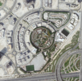
- Planet Dove satellite image over Dubai.png 800 × 791; 1.58 MB
- Planet Earth temperature taking - a recent history.png 800 × 584; 618 KB
- Planet Explorer Beta March 2017.png 579 × 340; 194 KB
- Planet Explorer beta1.png 637 × 384; 0 bytes
- Planet home page-2022.png 800 × 400; 392 KB
- Planet Lab Flock 1c CubeSats.jpg 946 × 744; 347 KB
- Planet Labs and NanoRacks launch from the ISS Feb 2014.jpg 800 × 533; 98 KB
- Planet Labs Two Doves March2015.png 768 × 432; 239 KB
- Planet Plan B - for Senator Manchin.jpg 640 × 361; 89 KB
- Planetcitizens.org.png 768 × 768; 900 KB
- PlanetLabs AZ Irrigation fields-m.jpg 684 × 513; 0 bytes
- PlanetLabs homepage2016.png 480 × 559; 411 KB
- Plankton - phytoplankton m.jpg 773 × 558; 364 KB
- Plankton swirl Jan 2015.jpg 720 × 480; 161 KB
- Polar Sea - Netflix.jpg 459 × 761; 120 KB
- Politics and Science in the House un-Science Committee.png 619 × 352; 198 KB
- PolitiFact to expand in 2024 at Poynter Times.png 604 × 190; 15 KB
- Pope meeting with oil execs - June 2019.png 640 × 360; 589 KB
- Poynter.logo.png 293 × 90; 5 KB
- Presidents budget see earth science.jpg 600 × 560; 121 KB
- Production Gap - productiongap.org.png 600 × 762; 225 KB
- Production Gap - UN report on fossil fuel production.png 600 × 664; 342 KB
- Pruitt in the news daily.png 550 × 541; 148 KB
- Race to Zero - circa January 2022.png 480 × 591; 138 KB
- RacetoZero - Dec 2020 UNFCCC.jpg 585 × 518; 95 KB
- RACHEL CARSON - 1949.jpg 600 × 600; 102 KB
- Rachel Carson courtesy of Rachel Carson Estate.jpg 640 × 776; 264 KB
- Rachel Carson ecology - ecosystem.png 800 × 388; 0 bytes
- Rachel Carson Institute.png 800 × 522; 189 KB
- Rachel carson1 NYT-Illustration by Valero Doval.png 784 × 469; 0 bytes
- Rachel Lost Woods After Silent Spring m.png 800 × 196; 101 KB
- Rainfall-earthsciencefromspace.gif 530 × 299; 2.64 MB
- Rebecca Google Outreach.jpg 276 × 183; 9 KB
- Recent Satellite Imagery of Earth - via Azavea.png 600 × 747; 488 KB
- Record shattering heat - 5 nations 2019-2023.jpeg 577 × 640; 79 KB
- Record tumble - climate change.png 727 × 333; 27 KB
- Red Line PPM.png 800 × 486; 163 KB
- Reefscape.png 582 × 567; 537 KB
- Remembering E.O. Wilson and Thomas Lovejoy.jpg 640 × 327; 56 KB
- Rep George Brown and Steve Schmidt - Oct 15, 1969 - 448x305.png 448 × 305; 272 KB
- Rep. George E Brown and a young student remembering.png 640 × 325; 109 KB
- Republican Party 2024 Climate Strategy.png 589 × 344; 44 KB
- Revkin-Brown re AGU speech-Dec2016.png 494 × 343; 68 KB
- Rising Seas, refugees, Phys.org Land Use July 2017.png 488 × 385; 190 KB
- River basins - watersheds.jpg 800 × 214; 111 KB
- Russia oil gas pipelines 2022.png 749 × 600; 163 KB
- Russia oil gas pipelines.png 687 × 600; 192 KB
- Russian satellite to monitor climate in the Arctic.jpg 638 × 281; 52 KB
- Sarah Sanders press conf-Nov 2018.png 448 × 262; 291 KB
- Satellite -comparisons.jpg 630 × 396; 72 KB
- Saudi Arabia and Middle East - Hot in May 2024.png 640 × 410; 506 KB
- Scale of energy use-2000-2016.jpg 800 × 673; 69 KB
- School strike for climate countries.png 800 × 411; 106 KB
- Science & Solutions - 2020 - Project Drawdown - NCSE Conf.jpg 800 × 351; 56 KB
- Science & Solutions - 2020 - Project Drawdown - NCSE.jpg 800 × 261; 66 KB
- Science and Climate Hearing March29,2017.png 800 × 281; 240 KB
- Science Insider Mar2015.jpg 600 × 450; 64 KB
- Science on climate change.jpg 443 × 572; 125 KB
- SCOTUS decision on water protection.png 535 × 424; 299 KB
- SCOTUS EPA decision - June 30 2022.jpg 794 × 778; 168 KB
- Sea levels surge along southern US coast.png 640 × 441; 69 KB
- Sea Wall of Miami +++.jpg 526 × 220; 48 KB
- Sea-Level Rise Twice as High as Previously Predicted.png 701 × 225; 92 KB
- Senate votes on methane - April 28, 2021.jpg 640 × 377; 77 KB
- Shell lawsuit Feb 2023.png 768 × 534; 229 KB
- Shifting Baseline Syndrome - threats to ecosystems biodiversity.png 431 × 534; 322 KB
- Shifting Baselines 2.jpg 600 × 600; 140 KB
- Short Circuiting Policy - by Leah Stokes.jpg 595 × 423; 94 KB
- Shrinking Shores Florida.png 750 × 336; 328 KB
- Slash emission now or face climate disaster.jpg 800 × 579; 94 KB
- Solar panel price - 1976-2019.png 596 × 612; 92 KB
- SolarAqua Grid 2021.jpg 640 × 331; 116 KB
- Solving our climate crisis a national townhall-dec3,2018.jpg 640 × 360; 55 KB
- South Florida Floodwaters.png 640 × 449; 251 KB
- Southeast-asia-heatwave-nasa-2022.jpg 640 × 360; 43 KB
- SouthFloridaSLR 2s-.gif 800 × 471; 349 KB
- Space stations - July 26 2022.png 544 × 462; 270 KB
- SpaceX -NASA Dragon Crew Returns.png 448 × 247; 159 KB
- Spacex Jason3 via Reuters.jpg 557 × 429; 26 KB
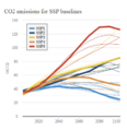
- SSP Baselines-projections 2018-2100.png 393 × 406; 42 KB
- State of the paris agreement nov2019.jpg 800 × 570; 178 KB
- Stephen-hawking-photo courtesy of pbs.jpg 800 × 533; 75 KB
- StratDem logo2a.png 242 × 70; 16 KB
- StratDem Strategic Demands.png 768 × 1,024; 626 KB
- Strike - Sept 20.jpg 754 × 754; 44 KB
- Sudan ancient formation.jpeg 800 × 600; 212 KB
- Sunflower fields m.jpg 640 × 320; 69 KB
- SunriseBmore March 1, 2021.jpg 593 × 622; 187 KB
- Suomi satellite 2014.png 512 × 506; 472 KB
- Supermoon over Washington Monument photo by J.David Ake.png 585 × 294; 164 KB
- Supreme Court decision on GHG emission cost metric - May 2022.png 640 × 442; 419 KB
- Surviving Victory.png 714 × 128; 41 KB
- Telling stories of solutions for the climate crisis.jpg 600 × 640; 121 KB
- Temperature - SST World via Climate Change Institute - 2023 chart.png 800 × 509; 144 KB
- Temperature World - chart via Climate Change Institute.jpg 800 × 509; 67 KB
- Temperatures New Normal is Not Normal.jpg 582 × 461; 56 KB
- The Carbon Dioxide Theory of Climatic Change, by Gilbert Plass, 1956.jpg 798 × 1,202; 397 KB
- The Climate Dictionary - as of 2023.png 600 × 727; 200 KB
- The New Climate War - Irish Times review 2021.jpg 792 × 2,048; 373 KB
- The Questionnaire.png 800 × 344; 147 KB
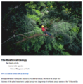
- The Rainforest Canopy, the Richest Biosphere on Earth.png 745 × 757; 730 KB
- The U.S. Role in the World ... Congressman George E Brown - 1969.jpg 448 × 334; 104 KB
- There is no plan B because....png 575 × 308; 115 KB
- There is no Planet B (vimeo-2015).png 623 × 337; 80 KB
- There is no Planet B Macron to US Congress-Apr25,2018.png 800 × 781; 1,014 KB
- ThereIsNoPlanetB.png 589 × 174; 181 KB
- They Knew.jpg 287 × 428; 31 KB
- Thin Blue 2019.jpg 1,134 × 2,015; 126 KB
- Thin Blue 2019m.jpg 800 × 1,431; 82 KB
- Thin Blue difference - approx 12 miles high.jpg 527 × 229; 37 KB
- Thin Blue difference.jpg 527 × 673; 147 KB
- Thin Blue Earth Atmosphere - @AstroSamantha.jpg 680 × 453; 14 KB
- Thin Blue Layer - Earth's Limb Horizon - Nov 2020.png 800 × 381; 506 KB
- Thomas Pesquet - Overview.png 640 × 174; 78 KB
- Threat Environment - TBay Times Series on Climate Change Impacts.png 556 × 864; 166 KB
- Thriving on Our Changing Planet.png 495 × 369; 244 KB
- Tillerson-first day at the Dept of State.png 618 × 340; 154 KB
- Tillerson-Sec of State-frontrunner news-Dec10.png 800 × 198; 180 KB
- Time for a Battle Trump v Climate Science-Dec2016.png 800 × 585; 276 KB
- Time for a Planet Update - Oct 31 2021.png 722 × 600; 852 KB
- Time for Facts and Science.jpg 144 × 604; 45 KB
- Time Nov 10 2022 COP27.jpg 600 × 600; 92 KB
- Timelapse in Google Earth -1.jpg 800 × 241; 69 KB
- Timelapse in Google Earth-2.jpg 800 × 469; 151 KB
- Timelapse in Google Earth-3.jpg 372 × 556; 52 KB
- Timelapse in Google Earth-4.jpg 525 × 244; 51 KB
- Earth360
- Democratization of Space
- Earth Imaging
- Earth Observations
- Earth Science
- Environmental Security
- Environmental Security, National Security
- ESA
- Global Security
- NanoRacks
- NASA
- National Security
- New Space
- PlanetLabs
- Planet API
- Planet Citizen
- Planet Citizens, Planet Scientists
- Planet Scientist
- Whole Earth
- Arctic
- Antarctica
- Greenland
- Forests
- Oceans
- Sea-level Rise
- Atmosphere
- Atmospheric Science
- Biogeosciences
- Climate Change
- Cryosphere
- Geophysics and Geochemistry
- Mineralogy
- Geology
- Geophysics
- Hydrology
- Natural Resources
- Ocean Science
- Planetary Science
- Space Science and Space Physics

