Category:Earth Science from Space
New Space / Earth Sciences from Space
- Earth360
- #HelloEarth
- Earth Science, Vital Signs
- Climate News
- Earth Right Now
- Micro-Satellites
- Planet Citizens, Planet Scientists
- When Doves Fly
- Planet API
Micro-Satellites, low-cost earth imaging
-=-=-=-=-=-=-=-=-=-=-=-=-=-=-=-=-=-=-=-=-=-=-=-=-=-=-=-=-=-=-=-=-=-=-=-=-=-=-=-=-
#Earth360: Eyes in the Sky, Earth Science by Satellite
Space X Continues to Push Toward New Space Horizons
http://spaceflightnow.com/2015/05/15/spacex-gets-certified-to-launch-nasa-science-missions/
May 2015 -- NASA has formally certified SpaceX’s Falcon 9 rocket to launch all but the space agency’s most costly robotic science missions, beginning with a a U.S.-French oceanography satellite set for liftoff from California in July.
NASA’s Launch Services Program, which manages the agency’s rocket procurements for research missions, concluded the multi-year certification effort Tuesday, according to George Diller, a NASA spokesperson.
The milestone clears the Falcon 9 rocket to launch NASA’s “medium-risk” science missions, a classification which includes most of the agency’s Earth observation satellites...
-=-=-=-=-=-=-=-=-=-=-=-=-=-=-=-=-=-=-=-=-
Planet Labs Sets New Records
About Planet Labs Documentation Intro
February 2015 - Private Spending on Space Is Headed for a New Record - Space Race 2.0 #NewSpace
Planet Labs has raised more than $160 million and launched 73 global imaging satellites. The growth was hard to imagine three years ago, when co-founder Will Marshall built the first of the miniature satellites nicknamed “doves” in a Silicon Valley garage.
“A lot of people were very skeptical, and what we were trying to do seemed ludicrous,” said Marshall, a former engineer at NASA Ames Research Center in Mountain View, California. “But we have assets in orbit, and customers who are very interested in the data. Every time we take a picture, we can see how the world is changing.” -- Bloomberg
Planet Labs, flying Doves unprecedented, observing Planet Earth with 'rapid cadence' imaging opening possibilities never before offered
○ ○ ○ ○
2014
Building an API for the Planet: Will Marshall/PlanetLabs [1]
Mission: Democratising Access to Information About the Changing Planet
Time for Planet Labs 'Doves' to fly
Planet Labs "flock" / New Scientist [2] Flock 1
NanoRacks deployment into space [3] [4][5] [6]
○ ○ ○ ○
Earth Imaging -- Micro-satellites [7]
Nextgen #earthscience in era of #climatechange and #globalsecurity threat
“Five years from now, there might be 200 or more up there..." [10]
Geoscience Satellites -- Start-up companies
BlackBridge [11], Dauria [12], DigitalGlobe [13] [14] [15] GeoEye [16],
Firefly Space Systems [17] [18], GeoOptics [19], NanoRacks [20], [21] [22]
NovaWurks [23], OmniEarth [24] [25] [26] [27], OrbitLogic [28], PlanetiQ [29]
Planet Labs [30] Pulse [31] [32] [33], RapidEye [34], Skybox [35] [36] [37]
Teledyne [38], Tyvak Nano-Sat [39], Urthecast [40]
OpenNEX, NASA asks public to join in with space data monitoring earth [41]
○ ○ ○ ○
On the launch of Planet Labs 'Dove' nanosatellites -- applications yet-to-be developed #OpenData #PlanetCitizens
Robbie Schingler, co-founder of Planet Labs: “We are motivated to make information about the changing planet available to all people, especially the people who need it the most..."
"The imagery could be used by anyone who cares about changes in land use over time.” [42]
"Rapid cadence imagery, like Planet Labs is developing, helps us become better, more sustainable stewards of Earth." [43]
Will Marshall, co-founder of Planet Labs talks of democratization of space: videos [44] [45]
Planet Labs largest fleet of Earth-imaging satellites.
The data is expansive and of added value over time:
- - humanitarian applications, earth resource monitoring, sustainability and eco-nomics
- - extreme event and disaster relief
- - food systems, water distribution, improving agriculture
- - business intelligence (BI) metrics/performance
- - research, science
○ ○ ○ ○
June 2014 Google Buys Skybox
[46]
[47]
[48]
[49]
[Background] June 18, 2013 Inside a Startup’s Plan to Turn a Swarm of DIY Satellites Into an All-Seeing Eye [50]
June 16, 2014 - Wall Street Journal / by Christopher Mims [51]
By 2016 or so, Skybox will be able to take full images of the Earth twice a day, at a resolution that until last week was illegal to sell commercially — all with just a half-dozen satellites.
By the time its entire fleet of 24 satellites has launched in 2018, Skybox will be imaging the entire Earth at a resolution sufficient to capture, for example, real-time video of cars driving down the highway. And it will be doing it three times a day.
You might think, thanks to weather maps and the satellite view on Google Maps, that such imagery already is readily available. But because satellites were, until recently, so expensive to build and launch, that isn't the case. There are only nine satellites in orbit now that capture high resolution images for the commercial market, and their capabilities are regularly commandeered for national-security purposes by the U.S. government. That means most of the pictures of the Earth that you've seen are of poor quality and years out of date.
At Google, the business of Skybox isn't data, but knowledge. "We think we are going to fundamentally change humanity's understanding of the economic landscape on a daily basis," says Skybox co-founder Dan Berkenstock...
Skybox's images will inevitably lead to apps and services no one can envision — with unknowable disruptive potential. Skybox executives tell me they hope to offer their data to outside developers... In the short term, Google has said it would use Skybox's images to improve the search company's maps.
A patent revealed in May indicates that Google builds its superaccurate maps directly from satellite imagery, and the company has long had a deal with Skybox competitor DigitalGlobe, whose satellites cost 10 times as much as Skybox's and are 10 times heavier, leading to much higher launch costs. DigitalGlobe's stock dipped 4% on news of the Skybox deal...
○ ○ ○ ○
May 2014 Skybox and Planet Labs / re Google's purchase of Skybox, Google has a business division called “Earth Enterprise” that provides mapping data for large organizations, institutions and businesses. “Google Earth Enterprise allows you to store and process terabytes of imagery, terrain and vector data on your own server infrastructure, and publish maps securely for your users to view using Google Earth desktop or mobile apps, or through your own application using the Google Maps API..." [52]
Feb 2014 Planet Labs versus Skybox / The next step is something more like a Google for Earth: a search engine where people can find satellite photos taken in real or near-real time that answer questions like “How many ships are in the Port of Houston today?” or “How much corn is currently growing in Iowa?” [53]
_ _ _ _ _ _ _ _ _ _ _ _ _ _ _ _ _ _ _ _ _ _ _ _ _ _ _ _ _ _ _ _ _ _ _ _ _ _ _ _ _ _ _ _ _ _ _ _ _ _ _ _ _ _ _ _ _ _ _ _ _ _ _
“With all these start-ups, the things you’ll be able to do with satellite images will grow exponentially..." IEEE, May 2014
_ _ _ _ _ _ _ _ _ _ _ _ _ _ _ _ _ _ _ _ _ _ _ _ _ _ _ _ _ _ _ _ _ _ _ _ _ _ _ _ _ _ _ _ _ _ _ _ _ _ _ _ _ _ _ _ _ _ _ _ _ _ _
June 2014
- U.S. Department of Commerce lifts ban on satellite images showing features smaller than 20 inches - DigitalGlobe [54] [55] [56] [57]
- "Companies had not been allowed to make use of images where features smaller than 50cm were visible"
- Satellites Are Cleared to Take Photos at Mailbox-Level Detail per DigitalGlobe petition
- Worldview-3 satellite is set to launch in August. Digital Globe [58] [59] says it will now be able to sell images that show features as small as 31cm [60]
- Sites like Google and Bing Maps will be able to use higher-quality satellite images in near real-time [61] [62]... eventually real-time
GP360: Earth-monitoring, data-sharing, open source, is in the wings...
Citizen-networking/schools-education space-earth projects -- education looks at #earthscience from space... [63] [64]
24/7 high-definition video of Earth <Urthecast-ISS> [65] Urthecast APIs
Live from the International Space Station [66] [67] [68] [69]
Earth sciences/NASA-JPL and gov contractors 'Eyes on the Earth'
Feb 2014
Until recently, since the launch of the original Landsat program in 1972, generating images of Earth from space has been the near-exclusive domain of enormous, multi-million dollar satellites sponsored by nations and major defense corporations.
- New micro-satellites, including those launched from the ISS, aim to make real-time imaging available for a fraction of the past decades price and move us from military-defense-communication operations to economic/entrepreneurial functions, 'earth systems-monitoring' and biosphere sustainability, space 'tourism' and low earth orbit travel...
______________________
Earth systems-monitoring - http://www.earthzine.org/geo-and-geoss-the-group-on-earth-observations-and-the-global-earth-observations-system-of-systems/
<more> http://gizmodo.com/meet-the-flockers-iss-launches-low-cost-earth-imaging-1517232660
Earth Imaging - background – 2007 - Acquiring large data sets of Earth imagery in a simple, low-cost way, represents a new market opportunity beginning to be addressed. New telescope designs enable low-cost satellites with that purpose. [70]
Jan 2014 - "Flocking" "Doves" "Nanosatellites" - http://www.scientificamerican.com/article/flock-of-nano-satellites-to-capture-high-res-views-of-whole-earth/
Google goes mapping - http://gizmodo.com/how-swarms-of-tiny-satellites-are-creating-a-real-time-1497890594
Swarms of small satellites set to deliver close to real-time imagery - http://www.nature.com/news/many-eyes-on-earth-1.14475
Dec 2013
"How Planet Labs Is Saving the Earth with 'Homemade' Satellites. It took less than six months to build twenty-eight of them"...
<more> http://www.businessinsider.com/planet-labs-fleet-of-homemade-satellites-2013-12?op=1
http://www.space.com/23739-tiny-earth-satellite-fleet-launching-december.html
Nov 2013
Flock of Mini- and Micro-sats delivered to space with international Dnepr co-venture - http://www.space.com/23738-dnepr-rocket-launches-32-satellites.html
'Minotaur 1 delivers 29 mini's/CubeSats including first-ever design/build satellite project of a US high school'
http://www.orbital.com/NewsInfo/MissionUpdates/MinotaurI_ORS-3/
○ ○ ○ ○
CubeSats - CubeSat specifications accomplish several high-level goals. Simplification of the satellite's infrastructure makes it possible to design and produce workable satellites at low cost.... Encapsulation of the launcher–payload interface takes away the prohibitive amount of managerial work... Unification among payloads and launchers enables quick exchanges of payloads and utilization of launch opportunities...
CubeSat 'nano-satellites' aim to adhere to the standards described in the CubeSat design specification -- CubeSats initiatives were conceived from educational institutions... In 2004, with their relatively small size, first-gen CubeSats could each be made and launched to Low-Earth Orbit (LEO) for an estimated $65,000–$80,000. Acc to Wikipedia, 'recent' launch prices have been $100,000-$125,000, plus approximately $10,000 to construct a CubeSat. This price tag, far lower than most satellite launches, has made CubeSat a viable option for schools and universities across the world.
- LightSail with CubeSats, Planetary Society - Launch date April 2016 [71] Video/July 2014 Explore Planets/TW
Sept 2013
Sensors and Systems - “Every year the technology improves, with better computers and storage and payloads. The technological evolution improves, price points continue to come down, and now with a small 150 to 300 kg spacecraft for $10 to $20 million you can do what you were doing with a 1,000 kg spacecraft five to 10 years ago for $500 million.” Surrey Satellite Technology-RapidEye satellite imagery “Changing the Economics of Space” ... co-ventures/joint ventures/'ride-alongs'/shared platforms/accessible data
<more> http://www.sstl.co.uk/ - note connection to SpaceX - Elon Musk - note Elon Muck opening up the Tesla platform on June 12, 2014 - http://en.wikipedia.org/wiki/Surrey_Satellite_Technology - http://www.teslamotors.com/blog/all-our-patent-are-belong-you
June 2013
Citizens in Space - http://www.citizensinspace.org/2013/06/planet-labs-to-launch-flock-1/
Opening up to understanding and interacting with our eco-operating systems
Share-able earth science data enabling earth biosphere systems monitoring/preservation policy advocacy by #globalcitizen orgs
_ _ _ _ _ _ _ _ _ _ _ _ _ _ _ _ _ _ _ _ _
Earth systems, monitoring over time - http://www.earthzine.org/geo-and-geoss-the-group-on-earth-observations-and-the-global-earth-observations-system-of-systems/
GEO - Group on Earth Observations - http://www.earthobservations.org/about_geo.shtml
- GEOSS - Global Earth Observation System of Systems - http://www.earthobservations.org/geoss.shtml
_ _ _ _ _ _ _ _ _ _ _ _ _ _ _ _ _ _ _ _ _ _ _ _ _ _ _ _ _ _ _ _ _ _ _ _ _ _ _ _ _
Subcategories
This category has the following 20 subcategories, out of 20 total.
A
C
D
E
G
N
O
P
S
T
W
Pages in category "Earth Science from Space"
The following 88 pages are in this category, out of 88 total.
C
- Carbon Brief
- Clearcutting
- Climate Change - Global Warming Keyword-Terms
- Climate Change Denier Talking Points -- and Rebuttals
- Climate Conference - Paris 2015
- Climate Desk
- Climate Law Blog @Columbia Law School
- Climate migration
- Climate News
- Climate News Events Archive ... 1970 to Today
- Climate Plans Enforcement - Resources
E
- Each of us can make a positive difference
- Earth
- Earth from NASA
- Earth Imaging-New Space
- Earth Right Now
- Earth Science Eco-Fields
- Earth Science Research from Space
- Earth Science Vital Signs
- EarthPOV
- EarthTime
- Earthviews
- Earthviews from Astronauts
- Environmental full-cost accounting
- Environmental Rules Rolled Back
- Environmental Security Organizations
- ESA Living Planet Announcement - May 2022
- Ethics and Climate Change
- European Union Green Deal - Fit for 55
- ExxonMobil and US House Science Committee v US Attorneys General and Environmental Groups
G
- GEOID
- George E. Brown Jr
- Glasgow Climate Summit - Pledges, Promises, Declarations - What's Next Up
- Global Climate Action Summit
- Global Fishing Watch
- Global Forest Watch
- Google Earth
- Google Earth Timelapse
- Green Politics 360
- Green Politics with GreenPolicy360
- Greening Our Blue Planet
- GreenPolicy360 Archive Highlights 2021
- GreenPolicy360 Archive Highlights 2022
I
L
P
S
Media in category "Earth Science from Space"
The following 200 files are in this category, out of 880 total.
(previous page) (next page)- Himawari8 3WV 0200 07 JULY2015.GIF 1,280 × 960; 616 KB
- Hindu Kush-Himalayas - 2023 Report on Dangerous Climate Impacts.png 800 × 819; 1,023 KB
- Historic climate-clean energy vote in US Congress August 12 2022.jpeg 800 × 775; 384 KB
- Historic gulf of mexico warm water.png 800 × 306; 148 KB
- Historic heat in gulf of mexico.png 800 × 810; 590 KB
- Historic photographs - Humble Oil TX - Exxon.png 591 × 596; 548 KB
- History of drought in the US Southwest.png 800 × 324; 386 KB
- Hot weather and climate change ... in Houston.png 413 × 154; 16 KB
- Hotimes.png 514 × 481; 201 KB
- Hourglass-sand-2.jpg 450 × 342; 12 KB
- House passes biggest climate investment in U.S. history.png 625 × 480; 114 KB
- How satellites monitor climate change circa 2016.png 599 × 327; 0 bytes
- How to Fact Check.png 600 × 766; 384 KB
- Huge heat anomaly in 2023 - by Gavin Schmidt.png 735 × 857; 172 KB
- Hurricane-Proofing-Home-2024-Miami-Florida.png 658 × 600; 652 KB
- Hurricanes - Typhoons via NASA data.png 764 × 924; 1,022 KB
- HyspIRI 03.29.13.jpg 383 × 787; 188 KB
- I Am Greta - the Documentary.jpg 387 × 485; 30 KB
- I Am Greta Marching.jpg 800 × 534; 80 KB
- I dont believe it.png 675 × 315; 50 KB
- I've done all I can.png 584 × 101; 19 KB
- ICESAT mission.png 640 × 271; 319 KB
- IEA - Support for Fossil Fuels - re 2021.jpg 559 × 800; 143 KB
- IEA News 1.jpg 480 × 400; 64 KB
- IEA News 2.jpg 480 × 475; 55 KB
- IEA News 3.jpg 480 × 496; 57 KB
- IEA News 4.jpg 480 × 530; 57 KB
- IEA News 5.jpg 480 × 539; 62 KB
- IFCN Code of Principles.jpg 749 × 766; 155 KB
- In nature, nothing exists alone.jpg 500 × 357; 26 KB
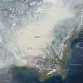
- IndonesiaFire Oct NASA Earth Observatory.jpg 400 × 403; 35 KB
- Infinite Wonder by Scott Kelly-1.jpg 800 × 235; 43 KB
- Infoamazonia-fires-Aug2019.jpg 800 × 663; 124 KB
- Infrastructure Bill and Climate Resilience - A Step Forward.png 640 × 403; 526 KB
- International Fact Checking Network - 2021 TW.jpg 600 × 755; 99 KB
- Internet Bill of Rights.png 469 × 38; 33 KB
- Invading Seas warning 2024.png 757 × 587; 669 KB
- IPCC Report - Feb 2022.jpg 448 × 291; 113 KB
- IPCC report August 9-2021 (1).jpg 745 × 380; 156 KB
- IPCC report August 9-2021 (2).jpg 745 × 428; 171 KB
- Island.jpg 760 × 506; 185 KB
- ISS interactive.jpg 1,314 × 694; 198 KB
- Iss030e031276.jpg 346 × 521; 29 KB
- Iss040e008179 earth's atmosphere .jpg 638 × 276; 19 KB
- ISS044-E-68968 Sunrise Over New Zealand Aug27,2015.JPG 760 × 506; 18 KB
- Iss049e049442-oct27,2016.jpg 700 × 470; 206 KB
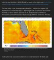
- It's hot in South Florida - July 2023.jpg 480 × 537; 92 KB
- It's Hot the Times UK Says... Act Now or else - July 2022.png 800 × 416; 568 KB
- James Hansen 2024.jpg 600 × 658; 110 KB
- James Inhofe -- and Project 2025.png 640 × 670; 566 KB
- January-May 2020 temp anomaly.jpg 680 × 380; 54 KB
- Jason3-16-2.jpg 600 × 236; 54 KB
- Jerry Brown AGU-Dec14,2016.png 476 × 344; 117 KB
- Jerry Brown re EPA - 19 June 2019.jpg 699 × 798; 126 KB
- Jerry Brown-Climate Week, NYC, Sept2018.jpg 800 × 534; 242 KB
- Jerry Brown-Global Climate Action Summit.png 800 × 453; 900 KB
- Jerry-Brown-quote.jpg 800 × 552; 69 KB
- John Kerry - Climate Envoy - 2021-09-26.png 640 × 410; 349 KB
- Journey of a Climate Pixel - May 2022.png 800 × 399; 114 KB
- July 14, 2018 - hello down there.png 524 × 467; 290 KB
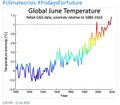
- June 2019 - NASA GISS data - hottest on record.jpg 640 × 560; 58 KB
- Kamala Harris-GND-Jan 28,2019.png 679 × 609; 243 KB
- Katharine Hayhoe - Nov 26, 2019.jpg 508 × 466; 80 KB
- Keystone to Enridge - McKibben - June 11, 2021.jpg 512 × 559; 140 KB
- Kim Cobb - Georgia Tech professor of climate science.jpeg 800 × 533; 87 KB
- LA Times - July 2023 on the world's response to the climate crisis-1a.png 800 × 1,011; 657 KB
- LA Times on the world's response to the climate crisis-2.png 800 × 651; 297 KB
- LA Times on the world's response to the climate crisis-3.png 800 × 806; 302 KB
- LA Times on the world's response to the climate crisis-4.png 800 × 896; 321 KB
- Lamar accuses March 2017.png 800 × 439; 245 KB
- Lamar re science and Trumps truth.png 627 × 607; 206 KB
- Lamar Smith Denial Offensive.png 393 × 307; 224 KB
- Lamar's science.png 584 × 537; 204 KB
- Land Remote Sensing Policy Act of 1992.jpg 563 × 480; 144 KB
- LANDSAT - NASA.jpg 622 × 415; 95 KB
- Landsat 50th anniv Sept 2016.jpg 800 × 456; 94 KB
- Landsat 9 about to launch.png 420 × 721; 355 KB
- Landsat 9 Launches - 1.jpg 600 × 693; 128 KB
- Landsat 9 Launches - 2.jpg 600 × 737; 250 KB
- Landsat at 50.png 800 × 713; 345 KB
- Landsat band imagery2.png 800 × 400; 907 KB
- Landsat data site.png 657 × 600; 499 KB
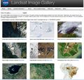
- Landsat Image Gallery.jpg 800 × 766; 187 KB
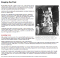
- Landsat Imaging the Past-1.png 767 × 744; 242 KB
- Landsat Imaging the Past-2.png 767 × 667; 329 KB
- Landsat Imaging the Past-3.png 767 × 560; 178 KB
- Landsat Imaging the Past-4.png 767 × 833; 496 KB
- Landsat Imaging the Past-5.png 767 × 870; 791 KB
- Landsat Imaging the Past-6.png 767 × 735; 385 KB
- Landsat launched 50 years ago today.png 528 × 779; 755 KB
- Landsat memories.png 535 × 473; 159 KB
- Landsat NASA - Feb 11 2023.png 763 × 600; 578 KB
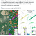
- Landsat US collection of maps 1985-2021.png 768 × 775; 1,018 KB
- Landsat, a 50 year legacy.png 528 × 575; 288 KB
- Launch into Space.jpg 800 × 717; 50 KB
- Launching soon.png 657 × 468; 225 KB
- LDCs face the climate crisis, raise the alarm - Nov 2021.png 419 × 226; 126 KB
- Leah Stokes - UCSB - Prof Climate and Energy Policy.png 640 × 476; 295 KB
- Like a speeding freight train.png 640 × 600; 492 KB
- LivingEarth2.png 800 × 503; 478 KB
- LMDCs make their case at the Glasgow climate summit.png 427 × 480; 259 KB
- Lunar Orbiter 1 First Earth Moon Image - 1966.png 656 × 805; 383 KB
- Lunar Orbiter 1 image of Planet Earth.png 800 × 551; 269 KB
- Macroscope NASA Bangladesh.jpeg 800 × 470; 122 KB
- Manchin kills the Biden climate plan.jpg 800 × 438; 71 KB
- Manchin News - Dec 20 2021.png 600 × 588; 307 KB
- Manchin News 2 - Dec 20 2021.png 600 × 600; 329 KB
- Mangroves and Coastal Wetlands tracked by Landsat.png 600 × 716; 245 KB
- Mangroves regulate flooding - EDF.png 568 × 473; 328 KB
- Map of the World wiki commons m.png 679 × 314; 18 KB
- Map of the World wiki commons s.png 339 × 157; 13 KB
- Map of the World wiki commons.png 1,357 × 628; 19 KB
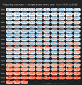
- Mapping changes in global temperature 1850-2022.png 656 × 680; 180 KB
- Mapping the Earth with Google Earth Outreach.jpg 640 × 648; 109 KB
- Mar a lagoon tba.jpg 540 × 405; 40 KB
- Mares Kelp 3.png 903 × 476; 869 KB
- Mares Kelp.png 903 × 476; 532 KB
- Mark Kelly in space.jpg 800 × 531; 83 KB
- Mascot for Glasgow intl climate conference.jpg 575 × 396; 76 KB
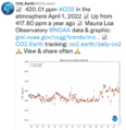
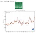
- Mauna Loa CO2 - April 2022.png 600 × 618; 203 KB
- Mauna Loa CO2 week ending May 15, 2017.png 800 × 493; 77 KB
- Mauna Loa Observatory CO2 - April 2021 - New record high.jpg 656 × 600; 55 KB
- Maya Lin Ghost Forest 5-17-2021.jpg 618 × 454; 123 KB
- McKibben 350.org logo.jpg 300 × 170; 7 KB
- McKibben re Manchin - Dec 2021.png 370 × 368; 261 KB
- McKibben reaction to Manchin blocking Biden's climate plan.png 640 × 423; 140 KB
- Memories of Big Science advocates in the US Congress.jpg 583 × 279; 87 KB
- Methane cuts pledge - COP27.png 399 × 336; 164 KB
- Methane emissions to be cut - COP26 pledges.png 640 × 464; 140 KB
- Methane Reduction proposal passes in EU Parliament - May 2023.png 620 × 600; 552 KB
- MethaneSat - 1.jpg 350 × 336; 58 KB
- MethaneSat - 2.PNG 448 × 336; 172 KB
- MethaneSat - 3.PNG 448 × 303; 248 KB
- Methods to enforce climate pledges-NDCs - Dec 2021.png 539 × 480; 333 KB
- Miami region sea level rise.gif 618 × 318; 191 KB
- Miami Reminder.jpg 411 × 292; 52 KB
- Miami sea level rise conf-May2018.jpg 800 × 600; 53 KB
- Michael E Mann - July 2022.png 766 × 1,017; 671 KB
- Michael E Mann -- act with hope not fear.jpg 720 × 1,024; 122 KB
- Michael E Mann, act with hope not fear.jpg 1,246 × 1,772; 256 KB
- Michael Mann - Susan Joy Hassol after Glasgow.jpg 460 × 1,616; 299 KB
- Michael Mann, planet citizen.png 604 × 835; 273 KB
- Mick stands in support of the global climate strike.jpg 587 × 710; 123 KB
- MLT Geospace - the Edge.jpg 800 × 600; 22 KB
- Monitoring Greenhouse Gases from Satellite Missions 2021-2030.png 801 × 386; 143 KB
- Montana climate trial News - 2023-08-14.png 789 × 768; 389 KB
- Montreal Protocol - effects study 2021.jpg 640 × 401; 76 KB
- Montreal Protocol update - Sept 2021.png 505 × 480; 291 KB
- Move along Florida-May 2018.png 448 × 454; 342 KB
- Moving to Higher Ground.png 568 × 473; 307 KB
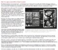
- Multispectral Scanning Systen - MSS.jpg 688 × 587; 103 KB
- Mulvaney says no lifestyle change.jpg 561 × 779; 128 KB
- Mysterious circles around the world.png 733 × 600; 655 KB
- NASA Climate Feb16,2017.png 593 × 526; 348 KB
- NASA co2-graph-061219.jpg 800 × 500; 214 KB
- NASA EARTH - NOAA January 2024.png 500 × 480; 273 KB
- NASA EPIC DSCOVR - July 6 2015.png 768 × 956; 687 KB
- NASA Gateway to Astronaut Photography of Earth.png 800 × 351; 485 KB
- NASA iss051e043291.jpg 1,041 × 693; 78 KB
- NASA Launch of Landsat 9 - Sept 27, 2021.jpg 675 × 772; 131 KB
- NASA orbiting fleet 2015 m.jpg 690 × 518; 234 KB
- NASA strong.jpg 600 × 600; 79 KB
- NASA test mission to protect earth from asteroid - Nov 2021.png 508 × 800; 424 KB
- NASA's continuing vision and mission - as of 2005.png 640 × 414; 153 KB
- NASA-aerosol-earth.png 800 × 411; 443 KB
- NASA-Debris-Kessler Syndrome.jpg 750 × 600; 76 KB
- NASA-DSCOVR and GreenPolicy360-July2016.png 577 × 575; 96 KB
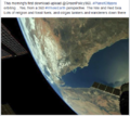
- NASAblog iss051e050137.jpg 800 × 450; 27 KB
- National Climate Pledges Must Be Enforced.png 800 × 520; 122 KB
- National Climate Task Force - first mtg Feb 11 2021.jpg 591 × 654; 144 KB
- NationalGeographic SouthPole melt West Antarctica 2016.jpg 630 × 438; 89 KB
- Navigate with Knowledge - StratDem - GreenPolicy360.jpg 800 × 534; 62 KB
- NDC Tracker - 2020.jpg 800 × 340; 50 KB
- New Climate Maps for US - 2020.jpg 800 × 169; 34 KB
- New Climate Maps for US.jpg 677 × 405; 47 KB
- New Climate Model.jpg 777 × 412; 70 KB
- New Definitions of National Security.png 447 × 198; 9 KB
- New German government announces far reaching climate plans.png 632 × 600; 446 KB
- New Mexico drought - climate change.png 538 × 480; 337 KB
- New Mexico Land Commissioner speaks up.png 497 × 405; 242 KB
- NextEra - January12 2021.jpg 530 × 127; 36 KB
- NIDIS Global Drought Conditions June 2016 Report .png 800 × 423; 214 KB
- Nile River and Mideast.jpg 750 × 929; 87 KB
- NOAA - NCEI report on US temps 2023-2024.jpg 600 × 561; 109 KB
- NOAA Climate.Gov.png 589 × 99; 7 KB
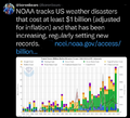
- NOAA extreme weather events charting.png 663 × 600; 288 KB
- NOAA report on heat records broken in US - 2023.jpg 600 × 480; 229 KB
- NOAA undergoes political changes - Oct 2020.jpg 800 × 719; 135 KB
- Nobel Prize 2021.jpg 551 × 473; 212 KB
- Norilsk in the Russian Arctic.jpg 615 × 600; 134 KB
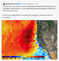
- North America West Coast hot - Aug 2023.png 484 × 501; 308 KB
- Not to worry 2016.png 539 × 401; 347 KB
- Nov-8-2014 2-01-50 PM EST.jpg 583 × 438; 80 KB
- Nowhere is safe - The Guardian.jpg 467 × 566; 68 KB
- NYT - Nov 1 - Day 1 headlines from Glasgow Climate Summit.png 600 × 800; 103 KB
- Ocean currents from GOCE 20141125-jpg.jpg 670 × 440; 90 KB
- Democratization of Space
- Earth Imaging
- Earth Observations
- Earth Science
- Environmental Security
- Environmental Security, National Security
- Global Security
- National Security
- New Space
- Planet API
- Planet Citizen
- Planet Scientist
- Atmospheric Science
- Biogeosciences
- Climate Change
- Cryosphere
- Geophysics and Geochemistry
- Mineralogy
- Geology
- Geophysics
- Hydrology
- Natural Resources
- Ocean Science
- Planetary Science
- Space Science and Space Physics
