Category:Earth Science from Space
New Space / Earth Sciences from Space
- Micro-Satellites
- When Doves Fly
- Planet API
- A "Thin Blue Layer"
- From the Vantage Point of Space
- New Definitions of National Security
Micro-Satellites, low-cost earth imaging
-=-=-=-=-=-=-=-=-=-=-=-=-=-=-=-=-=-=-=-=-=-=-=-=-=-=-=-=-=-=-=-=-=-=-=-=-=-=-=-=-
#Earth360: Eyes in the Sky, Earth Science by Satellite
Space X Continues to Push Toward New Space Horizons
-=-=-=-=-=-=-=-=-=-=-=-=-=-=-=-=-=-=-=-=-
Planet Labs Sets New Records
About Planet Labs Documentation Intro
February 2015 - Private Spending on Space Is Headed for a New Record - Space Race 2.0 #NewSpace
Planet Labs has raised more than $160 million and launched 73 global imaging satellites. The growth was hard to imagine three years ago, when co-founder Will Marshall built the first of the miniature satellites nicknamed “doves” in a Silicon Valley garage.
“A lot of people were very skeptical, and what we were trying to do seemed ludicrous,” said Marshall, a former engineer at NASA Ames Research Center in Mountain View, California. “But we have assets in orbit, and customers who are very interested in the data. Every time we take a picture, we can see how the world is changing.” -- Bloomberg
Planet Labs, flying Doves unprecedented, observing Planet Earth with 'rapid cadence' imaging opening possibilities never before offered
○ ○ ○ ○
2014
Building an API for the Planet: Will Marshall/PlanetLabs [1]
Mission: Democratising Access to Information About the Changing Planet
Time for Planet Labs 'Doves' to fly
Planet Labs "flock" / New Scientist [2] Flock 1
NanoRacks deployment into space [3] [4][5] [6]
○ ○ ○ ○
Earth Imaging -- Micro-satellites [7]
Nextgen #earthscience in era of #climatechange and #globalsecurity threat
“Five years from now, there might be 200 or more up there..." [10]
Geoscience Satellites -- Start-up companies
BlackBridge [11], Dauria [12], DigitalGlobe [13] [14] [15] GeoEye [16],
Firefly Space Systems [17] [18], GeoOptics [19], NanoRacks [20], [21] [22]
NovaWurks [23], OmniEarth [24] [25] [26] [27], OrbitLogic [28], PlanetiQ [29]
Planet Labs [30] Pulse [31] [32] [33], RapidEye [34], Skybox [35] [36] [37]
Teledyne [38], Tyvak Nano-Sat [39], Urthecast [40]
OpenNEX, NASA asks public to join in with space data monitoring earth [41]
○ ○ ○ ○
On the launch of Planet Labs 'Dove' nanosatellites -- applications yet-to-be developed #OpenData #PlanetCitizens
Robbie Schingler, co-founder of Planet Labs: “We are motivated to make information about the changing planet available to all people, especially the people who need it the most..."
"The imagery could be used by anyone who cares about changes in land use over time.” [42]
"Rapid cadence imagery, like Planet Labs is developing, helps us become better, more sustainable stewards of Earth." [43]
Will Marshall, co-founder of Planet Labs talks of democratization of space: videos [44] [45]
Planet Labs largest fleet of Earth-imaging satellites.
The data is expansive and of added value over time:
- - humanitarian applications, earth resource monitoring, sustainability and eco-nomics
- - extreme event and disaster relief
- - food systems, water distribution, improving agriculture
- - business intelligence (BI) metrics/performance
- - research, science
○ ○ ○ ○
June 2014 Google Buys Skybox
[46]
[47]
[48]
[49]
[Background] June 18, 2013 Inside a Startup’s Plan to Turn a Swarm of DIY Satellites Into an All-Seeing Eye [50]
June 16, 2014 - Wall Street Journal / by Christopher Mims [51]
By 2016 or so, Skybox will be able to take full images of the Earth twice a day, at a resolution that until last week was illegal to sell commercially — all with just a half-dozen satellites.
By the time its entire fleet of 24 satellites has launched in 2018, Skybox will be imaging the entire Earth at a resolution sufficient to capture, for example, real-time video of cars driving down the highway. And it will be doing it three times a day.
You might think, thanks to weather maps and the satellite view on Google Maps, that such imagery already is readily available. But because satellites were, until recently, so expensive to build and launch, that isn't the case. There are only nine satellites in orbit now that capture high resolution images for the commercial market, and their capabilities are regularly commandeered for national-security purposes by the U.S. government. That means most of the pictures of the Earth that you've seen are of poor quality and years out of date.
At Google, the business of Skybox isn't data, but knowledge. "We think we are going to fundamentally change humanity's understanding of the economic landscape on a daily basis," says Skybox co-founder Dan Berkenstock...
Skybox's images will inevitably lead to apps and services no one can envision — with unknowable disruptive potential. Skybox executives tell me they hope to offer their data to outside developers... In the short term, Google has said it would use Skybox's images to improve the search company's maps.
A patent revealed in May indicates that Google builds its superaccurate maps directly from satellite imagery, and the company has long had a deal with Skybox competitor DigitalGlobe, whose satellites cost 10 times as much as Skybox's and are 10 times heavier, leading to much higher launch costs. DigitalGlobe's stock dipped 4% on news of the Skybox deal...
○ ○ ○ ○
May 2014 Skybox and Planet Labs / re Google's purchase of Skybox, Google has a business division called “Earth Enterprise” that provides mapping data for large organizations, institutions and businesses. “Google Earth Enterprise allows you to store and process terabytes of imagery, terrain and vector data on your own server infrastructure, and publish maps securely for your users to view using Google Earth desktop or mobile apps, or through your own application using the Google Maps API..." [52]
Feb 2014 Planet Labs versus Skybox / The next step is something more like a Google for Earth: a search engine where people can find satellite photos taken in real or near-real time that answer questions like “How many ships are in the Port of Houston today?” or “How much corn is currently growing in Iowa?” [53]
_ _ _ _ _ _ _ _ _ _ _ _ _ _ _ _ _ _ _ _ _ _ _ _ _ _ _ _ _ _ _ _ _ _ _ _ _ _ _ _ _ _ _ _ _ _ _ _ _ _ _ _ _ _ _ _ _ _ _ _ _ _ _
“With all these start-ups, the things you’ll be able to do with satellite images will grow exponentially..." IEEE, May 2014
_ _ _ _ _ _ _ _ _ _ _ _ _ _ _ _ _ _ _ _ _ _ _ _ _ _ _ _ _ _ _ _ _ _ _ _ _ _ _ _ _ _ _ _ _ _ _ _ _ _ _ _ _ _ _ _ _ _ _ _ _ _ _
June 2014
- U.S. Department of Commerce lifts ban on satellite images showing features smaller than 20 inches - DigitalGlobe [54] [55] [56] [57]
- "Companies had not been allowed to make use of images where features smaller than 50cm were visible"
- Satellites Are Cleared to Take Photos at Mailbox-Level Detail per DigitalGlobe petition
- Worldview-3 satellite is set to launch in August. Digital Globe [58] [59] says it will now be able to sell images that show features as small as 31cm [60]
- Sites like Google and Bing Maps will be able to use higher-quality satellite images in near real-time [61] [62]... eventually real-time
GP360: Earth-monitoring, data-sharing, open source, is in the wings...
Citizen-networking/schools-education space-earth projects -- education looks at #earthscience from space... [63] [64]
24/7 high-definition video of Earth <Urthecast-ISS> [65] Urthecast APIs
Live from the International Space Station [66] [67] [68] [69]
Earth sciences/NASA-JPL and gov contractors 'Eyes on the Earth'
Feb 2014
Until recently, since the launch of the original Landsat program in 1972, generating images of Earth from space has been the near-exclusive domain of enormous, multi-million dollar satellites sponsored by nations and major defense corporations.
- New micro-satellites, including those launched from the ISS, aim to make real-time imaging available for a fraction of the past decades price and move us from military-defense-communication operations to economic/entrepreneurial functions, 'earth systems-monitoring' and biosphere sustainability, space 'tourism' and low earth orbit travel...
______________________
Earth systems-monitoring - http://www.earthzine.org/geo-and-geoss-the-group-on-earth-observations-and-the-global-earth-observations-system-of-systems/
<more> http://gizmodo.com/meet-the-flockers-iss-launches-low-cost-earth-imaging-1517232660
Earth Imaging - background – 2007 - Acquiring large data sets of Earth imagery in a simple, low-cost way, represents a new market opportunity beginning to be addressed. New telescope designs enable low-cost satellites with that purpose. [70]
Jan 2014 - "Flocking" "Doves" "Nanosatellites" - http://www.scientificamerican.com/article/flock-of-nano-satellites-to-capture-high-res-views-of-whole-earth/
Google goes mapping - http://gizmodo.com/how-swarms-of-tiny-satellites-are-creating-a-real-time-1497890594
Swarms of small satellites set to deliver close to real-time imagery - http://www.nature.com/news/many-eyes-on-earth-1.14475
Dec 2013
"How Planet Labs Is Saving the Earth with 'Homemade' Satellites. It took less than six months to build twenty-eight of them"...
<more> http://www.businessinsider.com/planet-labs-fleet-of-homemade-satellites-2013-12?op=1
http://www.space.com/23739-tiny-earth-satellite-fleet-launching-december.html
Nov 2013
Flock of Mini- and Micro-sats delivered to space with international Dnepr co-venture - http://www.space.com/23738-dnepr-rocket-launches-32-satellites.html
'Minotaur 1 delivers 29 mini's/CubeSats including first-ever design/build satellite project of a US high school'
http://www.orbital.com/NewsInfo/MissionUpdates/MinotaurI_ORS-3/
○ ○ ○ ○
CubeSats - CubeSat specifications accomplish several high-level goals. Simplification of the satellite's infrastructure makes it possible to design and produce workable satellites at low cost.... Encapsulation of the launcher–payload interface takes away the prohibitive amount of managerial work... Unification among payloads and launchers enables quick exchanges of payloads and utilization of launch opportunities...
CubeSat 'nano-satellites' aim to adhere to the standards described in the CubeSat design specification -- CubeSats initiatives were conceived from educational institutions... In 2004, with their relatively small size, first-gen CubeSats could each be made and launched to Low-Earth Orbit (LEO) for an estimated $65,000–$80,000. Acc to Wikipedia, 'recent' launch prices have been $100,000-$125,000, plus approximately $10,000 to construct a CubeSat. This price tag, far lower than most satellite launches, has made CubeSat a viable option for schools and universities across the world.
- LightSail with CubeSats, Planetary Society - Launch date April 2016 [71] Video/July 2014 Explore Planets/TW
Sept 2013
Sensors and Systems - “Every year the technology improves, with better computers and storage and payloads. The technological evolution improves, price points continue to come down, and now with a small 150 to 300 kg spacecraft for $10 to $20 million you can do what you were doing with a 1,000 kg spacecraft five to 10 years ago for $500 million.” Surrey Satellite Technology-RapidEye satellite imagery “Changing the Economics of Space” ... co-ventures/joint ventures/'ride-alongs'/shared platforms/accessible data
<more> http://www.sstl.co.uk/ - note connection to SpaceX - Elon Musk - note Elon Muck opening up the Tesla platform on June 12, 2014 - http://en.wikipedia.org/wiki/Surrey_Satellite_Technology - http://www.teslamotors.com/blog/all-our-patent-are-belong-you
June 2013
Citizens in Space - http://www.citizensinspace.org/2013/06/planet-labs-to-launch-flock-1/
Opening up to understanding and interacting with our eco-operating systems
Share-able earth science data enabling earth biosphere systems monitoring/preservation policy advocacy by #globalcitizen orgs
_ _ _ _ _ _ _ _ _ _ _ _ _ _ _ _ _ _ _ _ _
Earth systems, monitoring over time - http://www.earthzine.org/geo-and-geoss-the-group-on-earth-observations-and-the-global-earth-observations-system-of-systems/
GEO - Group on Earth Observations - http://www.earthobservations.org/about_geo.shtml
- GEOSS - Global Earth Observation System of Systems - http://www.earthobservations.org/geoss.shtml
_ _ _ _ _ _ _ _ _ _ _ _ _ _ _ _ _ _ _ _ _ _ _ _ _ _ _ _ _ _ _ _ _ _ _ _ _ _ _ _ _
Subcategories
This category has the following 20 subcategories, out of 20 total.
A
C
D
E
G
N
O
P
S
T
W
Pages in category "Earth Science from Space"
The following 88 pages are in this category, out of 88 total.
C
- Carbon Brief
- Clearcutting
- Climate Change - Global Warming Keyword-Terms
- Climate Change Denier Talking Points -- and Rebuttals
- Climate Conference - Paris 2015
- Climate Desk
- Climate Law Blog @Columbia Law School
- Climate migration
- Climate News
- Climate News Events Archive ... 1970 to Today
- Climate Plans Enforcement - Resources
E
- Each of us can make a positive difference
- Earth
- Earth from NASA
- Earth Imaging-New Space
- Earth Right Now
- Earth Science Eco-Fields
- Earth Science Research from Space
- Earth Science Vital Signs
- EarthPOV
- EarthTime
- Earthviews
- Earthviews from Astronauts
- Environmental full-cost accounting
- Environmental Rules Rolled Back
- Environmental Security Organizations
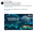
- ESA Living Planet Announcement - May 2022
- Ethics and Climate Change
- European Union Green Deal - Fit for 55
- ExxonMobil and US House Science Committee v US Attorneys General and Environmental Groups
G
- GEOID
- George E. Brown Jr
- Glasgow Climate Summit - Pledges, Promises, Declarations - What's Next Up
- Global Climate Action Summit
- Global Fishing Watch
- Global Forest Watch
- Google Earth
- Google Earth Timelapse
- Green Politics 360
- Green Politics with GreenPolicy360
- Greening Our Blue Planet
- GreenPolicy360 Archive Highlights 2021
- GreenPolicy360 Archive Highlights 2022
I
L
P
S
Media in category "Earth Science from Space"
The following 200 files are in this category, out of 879 total.
(previous page) (next page)- Diane Walder in Miami Beach.jpg 775 × 787; 147 KB
- Discover Your Planet.png 1,176 × 608; 1.11 MB
- Distant storms at dawn iss+ Reid June 2014.jpg 598 × 397; 4 KB
- Don't Look Up ....jpg 430 × 543; 172 KB
- Don't Look Up.jpg 800 × 450; 104 KB
- Donald Trump-Jair Bolsonaro-March 2019.jpg 640 × 455; 57 KB
- Dove minisat m.jpg 613 × 298; 42 KB
- Dove1 image.jpg 420 × 308; 26 KB
- Doves fly 2016.jpg 800 × 533; 89 KB
- Doves launched from ISS float against Earth horizon.jpg 4,256 × 2,832; 564 KB
- Drawdown top ten solutions - 2017.png 498 × 654; 179 KB
- Drought Monitor Map - April 2022.png 800 × 459; 238 KB
- DSCOVR EPIC - July 20 2022.png 532 × 612; 315 KB
- DSCOVR-EPIC 187 1003705 m americas dxm.png 502 × 502; 330 KB
- DSCOVR-EPIC ImagingofPlanetEarth.png 316 × 266; 19 KB
- DSCOVR-EPIC-May13,2018.png 760 × 872; 598 KB
- E&E.png 800 × 510; 474 KB
- Earth AI - Feb 2022.png 482 × 480; 192 KB
- Earth and Space, Politics.png 796 × 765; 349 KB
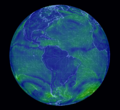
- Earth conditions dynamic map.png 673 × 673; 770 KB
- Earth Day 2021 - Climate Summit News-1.jpg 491 × 270; 127 KB
- Earth Day 50 years on.jpg 480 × 548; 107 KB
- Earth from Orbit 2014 2 released by NASA Goddard Apr20,2015.png 759 × 435; 66 KB
- Earth from the ISS.gif 480 × 270; 1.86 MB
- Earth gets hotter May2016.jpg 500 × 322; 28 KB
- Earth imaging.jpg 620 × 465; 314 KB
- Earth in Human Hands Intro.png 622 × 423; 121 KB
- Earth Information Center - 2022 Graphic NASA.png 800 × 981; 868 KB
- Earth Information Center from NASA.jpg 800 × 577; 94 KB
- Earth land ocean ice.2012 l.jpg 1,908 × 954; 231 KB
- Earth mapped.png 800 × 783; 254 KB
- Earth Observing System - fleet of satellites.png 740 × 576; 557 KB
- Earth planet changing.jpg 640 × 519; 82 KB
- Earth POV from the ISS Cupola-m.jpg 800 × 480; 71 KB
- Earth Research Findings 2015 1.png 1,088 × 686; 1.49 MB
- Earth Research Findings 2015 2.png 1,088 × 241; 512 KB
- Earth Right Now science.jpg 197 × 49; 3 KB
- Earth s.png 194 × 167; 40 KB
- Earth satellites in 3D.jpg 640 × 350; 213 KB
- Earth Science from Space-Monitoring Ice Melt.jpg 657 × 373; 60 KB
- Earth science missions in space US circa2017.jpg 800 × 448; 71 KB
- Earth Science Research from Space.png 800 × 256; 208 KB
- Earth Science Vital Signs, Pulse of the Planet Climate Essentials.png 692 × 441; 207 KB
- Earth Science Vital Signs, Pulse of the Planet EOS NASA 2014.png 758 × 776; 366 KB
- Earth Summit 1992-s.png 336 × 418; 283 KB
- Earth Summit 1992.jpg 600 × 746; 171 KB
- Earth System Observatory-1.jpg 580 × 833; 129 KB
- Earth System Observatory-2.jpg 580 × 831; 69 KB
- Earth topo observatory nasa 1024x512.jpg 1,024 × 512; 96 KB
- Earth trapping unprecedented amount of heat - NASA.jpg 468 × 373; 56 KB
- Earth Viewing from the International Space Station.jpg 496 × 307; 45 KB
- Earth-NASA.jpg 800 × 265; 39 KB
- Earth-science.png 265 × 83; 13 KB
- Earth-upper-atmosphere-NASA.jpg 800 × 781; 327 KB
- Earth1.png 818 × 776; 569 KB
- Earthatmosphere iss23 annotated nasa.jpg 657 × 329; 24 KB
- EarthDayatNASA .jpg 1,088 × 870; 745 KB
- EarthDayatNASA 2.jpg 750 × 600; 339 KB
- EarthDecadel Priorities-2018.jpg 779 × 529; 85 KB
- EarthNow our planet is changing.jpg 585 × 368; 0 bytes
- EarthRightNow Earth Science @work via 2014-2015 NASA launches m.png 490 × 293; 308 KB
- EarthRightNow Earth Science satellite fleet circa 2015 m.jpg 495 × 371; 126 KB
- EarthRightNow Five up in 11 months.jpg 1,024 × 830; 91 KB
- EarthRightNow-2.jpg 800 × 450; 115 KB
- Earthrise book cover (2008).jpg 709 × 1,070; 401 KB
- Earths-Future .jpg 351 × 198; 41 KB
- Earths-Future-cover.jpg 251 × 325; 48 KB
- EarthScience Missions via the EOS - 2022.png 800 × 219; 139 KB
- Economist.com global capital snapshot as of July 2020.jpg 800 × 477; 119 KB
- Ecostress Mission-Aug 2020.jpg 640 × 311; 85 KB
- EDF satellite - methane tracking.png 600 × 674; 388 KB
- Eiffel tower green.jpg 759 × 422; 28 KB
- Elon Musk quote - gas externality price.png 680 × 320; 199 KB
- Emissions graph - gleick tw 2018.jpg 640 × 364; 37 KB
- Energy - Electric Measuring and Monitoring.png 715 × 1,978; 862 KB
- Energy Charter Treaty.jpg 512 × 480; 74 KB
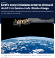
- Energy Imbalance, Climate Change - Aug 1 2021.png 640 × 672; 394 KB
- Environmental laws in US - Supreme Court votes soon.png 800 × 414; 334 KB
- Environmental Protection Agency logo.png 380 × 414; 39 KB
- EnvirSecurity.png 558 × 166; 155 KB
- EO and Fire Ants in the US - on World Wildlife Day.png 768 × 811; 663 KB
- EO Snapshot 6-29-2016 10-44-49 AM.png 839 × 768; 907 KB
- EOS EarthSats s.jpg 743 × 417; 64 KB
- EOS Terra ASTER adv spaceborne thermal emission & reflection radiometer.jpg 2,500 × 1,875; 359 KB
- EOS Terra mmm.jpg 496 × 204; 13 KB
- EOSDIS EarthData Jan2015a.png 1,594 × 844; 701 KB
- EPA website a 'ghost page' now.png 667 × 233; 45 KB
- ESA ers2-envisats-tandem s.jpg 451 × 298; 34 KB
- ESA Living Planet Symposium - Announcement.png 637 × 600; 508 KB
- ESA Living Planet Symposium - May 2022.png 700 × 600; 258 KB
- ESG Fight - Feb 2023.png 396 × 194; 88 KB
- Estates at Acqualina - Sunny Isles Miami.jpg 746 × 600; 117 KB
- Estuary in Clearwater on Tampa Bay.jpg 3,584 × 2,016; 1.5 MB
- EU agrees to cut emissions 55 percent by 2030.jpg 800 × 558; 96 KB
- EU unveils new climate change policy - July 14 2021 - 1.jpg 800 × 234; 33 KB
- EU unveils new climate change policy - July 14 2021 - 2.jpg 800 × 552; 86 KB
- EU unveils new climate change policy - July 14 2021 - 3.jpg 800 × 549; 89 KB
- EU unveils new climate change policy - July 14 2021 - 4.jpg 800 × 550; 92 KB
- EU unveils new climate change policy - July 14 2021 - 5.jpg 800 × 548; 88 KB
- EU unveils new climate change policy - July 14 2021 - 6.jpg 800 × 557; 89 KB
- EU unveils new climate change policy - July 14 2021 - 7.jpg 800 × 553; 92 KB
- EU unveils new climate change policy - July 14 2021 - 8.jpg 800 × 589; 91 KB
- Eukaryotic Cell SCU.jpg 716 × 1,024; 799 KB
- Eunice Foote Illustration climate.gov.jpg 620 × 296; 55 KB
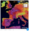
- Europe heat wave - July 19 2022 - via Copernicus satellite.png 600 × 639; 704 KB
- EVA 30 1.png 841 × 463; 507 KB
- Everest - Long lens photo from the ISS.jpg 800 × 530; 139 KB
- Everest fly over by ISS 2019.jpg 800 × 528; 72 KB
- Everest region - NASA photo.jpg 800 × 530; 189 KB
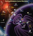
- Evolving Heliophysics System Observatory a.jpg 686 × 749; 97 KB
- Extreme temperature-world-May 2024.jpg 640 × 427; 105 KB
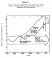
- ExxonMobil CO2 climatic response study - Graphic 1 - 1982.png 537 × 680; 150 KB
- ExxonMobil CO2 climatic response study - Graphic 2 - 1982.png 537 × 605; 112 KB
- FaceApp Florida.jpg 640 × 428; 40 KB
- Fact Checking @GreenPolicy360.jpg 580 × 800; 206 KB
- Facts about US Energy Use.jpg 697 × 600; 101 KB
- FB IMG 1528669650732.jpg 1,261 × 960; 98 KB
- Feeling the Heat 1989.png 800 × 1,095; 400 KB
- Fire Ants.png 601 × 600; 603 KB
- Floating adaptations - GCA - for sea-level rise - circa 2023.png 600 × 732; 273 KB
- Flooding in South Florida.png 640 × 742; 293 KB
- Florida 2024 Heating up and upset.jpg 460 × 581; 89 KB
- Florida and climate change denial.png 640 × 192; 46 KB
- Florida governor and legislature strike climate science - 2024.png 640 × 105; 42 KB
- Florida Keys sea surface temps for 2023 (as of July).png 480 × 585; 287 KB
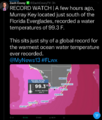
- Florida ocean water temp south of Everglades tops 99 F. degrees.png 480 × 564; 128 KB
- Florida sea surface water in the Keys area tops 100 degree F.jpg 640 × 257; 58 KB
- Fluorescent-phytoplankton-in-the-ocean1.jpg 1,500 × 900; 597 KB
- Foley on March29,2017.png 487 × 135; 0 bytes
- Forests change between 2000 and 2012.jpg 676 × 932; 71 KB
- Fox on Earth Day 2023.jpg 640 × 275; 58 KB
- Frackers dont clean up.jpg 591 × 493; 60 KB
- From 1968 to 1992 -- and the Journey continues....png 572 × 851; 320 KB
- Gavin in Glasgow - Nov 10 2021.png 728 × 600; 378 KB
- GCAS original.png 800 × 504; 94 KB
- GCAS-2.jpg 800 × 450; 136 KB
- George Brown 1969-Reflections on US Role in the World.png 700 × 372; 99 KB
- George Brown, Sci Com't.jpg 200 × 200; 7 KB
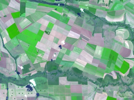
- Geosciences agriculture-farms nasa.jpg 461 × 350; 152 KB
- Geosciences Farmers-crops.jpg 460 × 277; 56 KB
- Geosciences Geo-information italy crops b.jpg 459 × 272; 57 KB
- Geosciences Geo-information italy crops.jpg 998 × 591; 312 KB
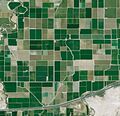
- Geosciences satellite fields b.jpg 461 × 444; 186 KB
- Geosciences water quality monitoring satellite-map africa.jpg 450 × 353; 41 KB
- GHG emissions 1970-2010.jpg 800 × 438; 50 KB
- GHG forcings 1750-2020.png 531 × 531; 94 KB
- GHG ppt concentrations 1975-2020.jpg 640 × 361; 69 KB
- Gistemp 1979-2019.png 750 × 491; 335 KB
- Glasgow-Climate Conference News-Nov 6, 2021.png 600 × 800; 290 KB
- Global Changes in temperature 1850-2020.jpg 480 × 480; 152 KB
- Global Climate Change textbook-Edition2.jpg 604 × 680; 96 KB
- Global climate conferences and GHG increases.jpg 793 × 801; 56 KB
- Global Climate Dashboard - NOAA - Climate.gov.png 630 × 480; 165 KB
- Global climate dashboard-NOAA climate.gov.jpg 521 × 221; 45 KB
- Global climate dashboard-www.climate.gov.jpg 800 × 489; 100 KB
- Global Climate Dashboard.jpg 800 × 529; 101 KB
- Global Climate Strike - RU.jpg 450 × 804; 116 KB
- Global Ecosystems Land Units Mapping.jpg 660 × 515; 98 KB
- Global Fishing Watch.jpg 1,246 × 569; 205 KB
- Global fossil fuel emissions - in a lifetime graphic.png 600 × 657; 233 KB
- Global greenhouse gas emissions - 1980 - 2020.png 640 × 480; 158 KB
- Global Precipitation Measurement US 2015.png 704 × 390; 389 KB
- Global Primary Energy Consumption - 1800-2017.jpg 800 × 583; 65 KB
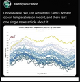
- Global sea surface temperature 1982-2024.png 800 × 823; 566 KB
- Global sea surface temperature graph as of 2024.png 800 × 455; 654 KB
- Global Stocktake, the first GST.jpg 800 × 905; 513 KB
- Global temperature change 1850-2016.gif 512 × 288; 1.38 MB
- Global temperature change 1901-2000.jpg 640 × 508; 47 KB
- Global temperature variations over past 200 years.jpg 640 × 360; 29 KB
- Global Warming Hoax, per DT.png 397 × 235; 52 KB
- Global warming June 2024.jpg 640 × 174; 46 KB
- GlobalClimateStrike-March15,2019.jpg 600 × 613; 30 KB
- GlobalFact conf - 2024.png 600 × 719; 347 KB
- GND next steps.png 567 × 660; 304 KB
- Goce2-537x322.jpg 537 × 322; 80 KB
- Good science needs good data .png 579 × 420; 223 KB
- Google Earth Hello2.png 800 × 375; 863 KB
- Green New Deal, work in progress.jpg 800 × 450; 62 KB
- Green Wave.png 613 × 405; 427 KB
- Greenhouse gas levels hit record - Reuters.jpg 600 × 696; 104 KB
- Greenland ice sheet set to raise sea level significantly.png 640 × 340; 223 KB
- GreenPolicy360 - May-10-2024.png 790 × 694; 320 KB
- Greta - the politics thats needed.jpg 639 × 203; 38 KB
- Greta anger into action.png 800 × 419; 528 KB
- Greta Looks Back.PNG 504 × 437; 368 KB
- Greta outside the Swedish Parliament, August 2018.jpg 680 × 398; 78 KB
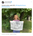
- Greta Thunberg - Week 203 Climate Strike Banner.png 209 × 127; 51 KB
- Greta Thunberg - Week 203 Climate Strike.png 554 × 601; 488 KB
- Group on Earth Observations.JPG 546 × 418; 33 KB
- Guarding Earths Water - from Space.jpg 578 × 496; 102 KB
- Gulf Stream in Critical Danger.pdf ; 181 KB
- Hansen testimony WaPo front page.jpg 480 × 210; 40 KB
- Hansen-testimony-1988.jpg 350 × 257; 42 KB
- Hawaiian fires and climate.jpg 600 × 600; 128 KB
- Democratization of Space
- Earth Imaging
- Earth Observations
- Earth Science
- Environmental Security
- Environmental Security, National Security
- Global Security
- National Security
- New Space
- Planet API
- Planet Citizen
- Planet Scientist
- Atmospheric Science
- Biogeosciences
- Climate Change
- Cryosphere
- Geophysics and Geochemistry
- Mineralogy
- Geology
- Geophysics
- Hydrology
- Natural Resources
- Ocean Science
- Planetary Science
- Space Science and Space Physics
