Category:Maps
<addthis />

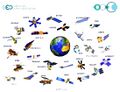
Earth Mapping
- Planet Citizens Mapping Planet Earth
- https://www.greenpolicy360.net/w/Virtual_Earth
- https://www.greenpolicy360.net/w/Planet_Citizens,_Planet_Scientists

····················································································
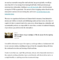
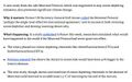
Digital maps are making quantum leaps in quality and utility ...
Type NAVD into Google
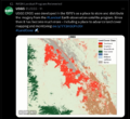
NOAA provides a baseline reference tool, 'Datums and Reference Frames', Monitor sea-level change with dynamic mapping.
A geodetic datum or reference frame is an abstract coordinate system with a reference surface (such as sea level) that serves to provide known locations to begin surveys and create maps.
NOAA and NASA Begin Sea Level Rise Project
🌎
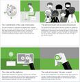
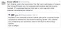
How Facebook, Apple and Microsoft are contributing to an openly licensed map of the world
Collaborating in the open to build an openly licensed map of the world: OpenStreetMap
OpenStreetMap has grown into one of the most successful collaboratively maintained open datasets in the world. Today, contributors to the maps include not just local mappers, but also a diverse mix of commercial organisations, non-governmental organisations, humanitarian organisations and also large commercial organisations.
The Microsoft Open Maps team has recently released open data on building footprints in the US. Microsoft was among the first to release satellite imagery for use by OpenStreetMap and the images are now integrated into the default editor. It also has a community of mappers directly contributing to OpenStreetMap in Australia.
Apple has an internal volunteer programme that has around 5,000 staff contributing to Missing Maps, they’ve released building data for France and Denmark, and are engaged with data improvement projects around the world.
Facebook is exploring how artificial intelligence-assisted tracing can help to improve the quality of OpenStreetMap data in Thailand.
DigitalGlobe has made its satellite imagery available under a licence that will allow it to be used by the OpenStreetMap community to improve their mapping efforts.
Telenav launched OpenStreetCam to help collect openly-licensed street imagery and has now released open data and code to explore how machine learning can enable the images to be used to improve OpenStreetMap with stop signs and turn directions.
Visit StateoftheMap
·······························
Follow some of our GreenPolicy 'cartography' favorites on Twitter
Data Viz Today - https://twitter.com/DataVizToday
David Garcia - https://twitter.com/mapmakerdavid
David M - https://twitter.com/mapbliss
Earth Lab CU-Boulder - https://twitter.com/EarthLabCU
Jim Eynard - https://twitter.com/jimeynard
Google Earth - https://twitter.com/googleearth
Katie-sky - https://twitter.com/KatieKowalsky
Joe Mascaro - https://twitter.com/joe_mascaro
Nathaniel Douglass - https://twitter.com/AlexndrTheNate
NOAA Satellites - https://twitter.com/NOAASatellites
Vanessa Schneider - https://twitter.com/vanessagene
Joshua Stevens - https://twitter.com/jscarto
USGS Landsat - https://twitter.com/USGSLandsat
·······················································
Explore Mapping / Geographic Earth Science at GreenPolicy's 'Virtual Earth


Visit Your Country and 200 Other Countries/Territories
🌎
Maps to Guide You
🌎
🌎

Available Satellite Imagery - Planet Citizen Navigation (circa 2022)
~
Google Earth
Bing Maps Aerial
Mapbox Satellite Live
HERE WeGo - Map View / Satellite
Zoom Earth
~
Maxxar
Airbus
Hexagon Geospatial
Vexcel Imaging
EagleView
Nearmap
Planet | Planet API
- https://www.planet.com/
- https://developers.planet.com/docs/data/skysat/
- https://earth.esa.int/eogateway/missions/skysat
🌎
GIS | Geographic Information System Mapping Technology - Esri
GIS connects data to a map, integrating location data (where things are) with all types of descriptive information (what things are like there). This provides a foundation for mapping and analysis that is used in science and almost every industry. GIS helps users understand patterns, relationships, and geographic context.
Hundreds of thousands of organizations in virtually every field are using GIS to make maps that communicate, perform analysis, share information, and solve complex problems around the world. This is changing the way the world works.
○
GPS: The Global Positioning System
A global public service of the U.S. government
The first GPS satellite, Navstar 1, was launched in 1978.
Watch the story of GPS origins, open-use changes to enable global applications, and ongoing funding and operations ...
More re: GPS:
○
Carto
○
Global Ecological Land Units
○
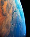
Where Are You?
Where Are You? Pictures of Us from the International Space Station
- What Are Your 'Coordinates', the Space Station Will Send You a Photo -- Pictures from ISS
🌎


🌎

○

🌎
Subcategories
This category has the following 20 subcategories, out of 20 total.
C
E
F
G
L
N
O
P
S
T
U
V
Pages in category "Maps"
The following 63 pages are in this category, out of 63 total.
C
E
G
- George E. Brown Jr
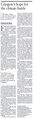
- Glasgow Climate Summit - Pledges, Promises, Declarations - What's Next Up
- Global Climate Action Summit
- Global Fishing Watch
- Going Green
- Google Earth
- Google Earth Timelapse
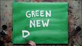
- Green New Deal
- Green Quotes
- Green Stories of the Day
- Green Stories of the Day - GreenPolicy360 Archive
- Greening Our Blue Planet
- GreenLinks
- GreenPolicy360 Archive Highlights 2013
- GreenPolicy360 Archive Highlights 2014
- GreenPolicy360 Archive Highlights 2015
- GreenPolicy360 Archive Highlights 2016
- GreenPolicy360 Archive Highlights 2017
- GreenPolicy360 Archive Highlights 2018
- GreenPolicy360 Archive Highlights 2019
- GreenPolicy360 Archive Highlights 2020
- GreenPolicy360 Archive Highlights 2023
P
S
T
Media in category "Maps"
The following 200 files are in this category, out of 577 total.
(previous page) (next page)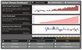 Global climate dashboard-www.climate.gov.jpg 800 × 489; 100 KB
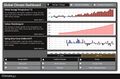 Global Climate Dashboard.jpg 800 × 529; 101 KB
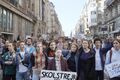
 Global Climate Strike - RU.jpg 450 × 804; 116 KB
 Global Fishing Watch 2.jpg 266 × 247; 26 KB
 Global Forest Watch top page 2014.png 800 × 416; 350 KB
 Global Forest Watch.png 631 × 409; 67 KB
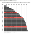 Global fossil fuel emissions - in a lifetime graphic.png 600 × 657; 233 KB
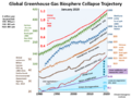 Global greenhouse gas emissions - 1980 - 2020.png 640 × 480; 158 KB
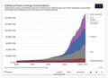 Global Primary Energy Consumption - 1800-2017.jpg 800 × 583; 65 KB
 Global sea surface temperature 1982-2024.png 800 × 823; 566 KB
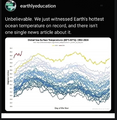
 Global sea surface temperature graph as of 2024.png 800 × 455; 654 KB
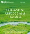 Global Stocktake, the first GST.jpg 800 × 905; 513 KB
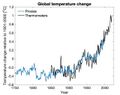
 Global temperature change 1850-2016.gif 512 × 288; 1.38 MB
 Global temperature change 1901-2000.jpg 640 × 508; 47 KB
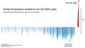 Global temperature variations over past 200 years.jpg 640 × 360; 29 KB
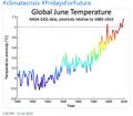
 Global warming June 2024.jpg 640 × 174; 46 KB
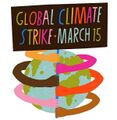 GlobalClimateStrike-March15,2019.jpg 600 × 613; 30 KB
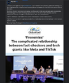 GlobalFact conf - 2024.png 600 × 719; 347 KB
 Going Green 2019.jpg 800 × 356; 15 KB
 Google Earth banner.png 800 × 222; 282 KB
 Google Earth Hello2.png 800 × 375; 863 KB
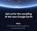 Google Earth invite-just in time for Earth Day.jpg 395 × 336; 69 KB
 Google Earth Outreach 2.jpg 640 × 441; 92 KB
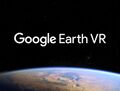
 Google Earth VR - 2016.png 800 × 395; 477 KB
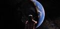
 Google Earth VR - 2017.jpg 635 × 479; 94 KB
 Google Earth VR-1.png 800 × 395; 477 KB
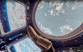
 Google Earth VR-2.jpg 800 × 395; 23 KB
 Google Maps from Space July212017-800x500.png 800 × 500; 991 KB
 GP360 tagcloud2 m.png 531 × 324; 132 KB
 Green New Deal - Strategic Demands - Oct 1, 2021.png 602 × 658; 245 KB
 Green New Deal, work in progress.jpg 800 × 450; 62 KB
 Green Wave.png 613 × 405; 427 KB
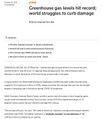 Greenhouse gas levels hit record - Reuters.jpg 600 × 696; 104 KB
 GreenPolicy360 - May- 9-2024.png 800 × 406; 119 KB
 GreenPolicy360 - May-10-2024.png 790 × 694; 320 KB
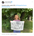
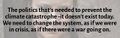 Greta - the politics thats needed.jpg 639 × 203; 38 KB
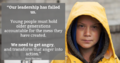 Greta anger into action.png 800 × 419; 528 KB
 Greta Looks Back.PNG 504 × 437; 368 KB
 Greta outside the Swedish Parliament, August 2018.jpg 680 × 398; 78 KB
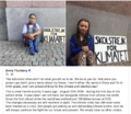
 Greta Thunberg - Week 203 Climate Strike Banner.png 209 × 127; 51 KB
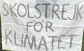
 Greta Thunberg - Week 203 Climate Strike.png 554 × 601; 488 KB
 Group on Earth Observations.JPG 546 × 418; 33 KB
 Gulf Stream in Critical Danger.pdf ; 181 KB
 Heat hitting billions.png 614 × 690; 509 KB
 Heat stress in US may double by end of century.jpg 640 × 503; 107 KB
 Heat Wave Asia - April May 2022.png 766 × 132; 25 KB
 Hindu Kush-Himalayas - 2023 Report on Dangerous Climate Impacts.png 800 × 819; 1,023 KB
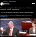
 Historic climate-clean energy vote in US Congress August 12 2022.jpeg 800 × 775; 384 KB
 Historic photographs - Humble Oil TX - Exxon.png 591 × 596; 548 KB
 History of drought in the US Southwest.png 800 × 324; 386 KB
 Hot weather and climate change ... in Houston.png 413 × 154; 16 KB
 House in Tacna Peru.jpg 800 × 548; 32 KB
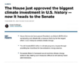 House passes biggest climate investment in U.S. history.png 625 × 480; 114 KB
 How to Fact Check.png 600 × 766; 384 KB
 Huge heat anomaly in 2023 - by Gavin Schmidt.png 735 × 857; 172 KB
 Human population map interactive.png 640 × 447; 106 KB
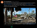
 Hurricane Helene in the Gulf of Mexico - M.jpeg 577 × 640; 119 KB
 Hurricane Helene in the Gulf of Mexico.jpeg 1,153 × 1,280; 359 KB
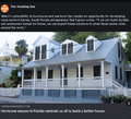 Hurricane-Proofing-Home-2024-Miami-Florida.png 658 × 600; 652 KB
 I Am Greta - the Documentary.jpg 387 × 485; 30 KB
 I Am Greta Marching.jpg 800 × 534; 80 KB
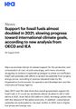 IEA - Support for Fossil Fuels - re 2021.jpg 559 × 800; 143 KB
 IEA News 1.jpg 480 × 400; 64 KB
 IEA News 2.jpg 480 × 475; 55 KB
 IEA News 3.jpg 480 × 496; 57 KB
 IEA News 4.jpg 480 × 530; 57 KB
 IEA News 5.jpg 480 × 539; 62 KB
 IFCN Code of Principles.jpg 749 × 766; 155 KB
 Infoamazonia-fires-Aug2019.jpg 800 × 663; 124 KB
 Infrastructure Bill and Climate Resilience - A Step Forward.png 640 × 403; 526 KB
 International Fact Checking Network - 2021 TW.jpg 600 × 755; 99 KB
 Internet Bill of Rights.png 469 × 38; 33 KB
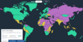 Internet Freedom - Democracy Status - FH Map 2022-23.png 800 × 407; 127 KB
 Invading Seas warning 2024.png 757 × 587; 669 KB
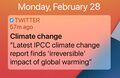 IPCC Report - Feb 2022.jpg 448 × 291; 113 KB
 IPCC report August 9-2021 (1).jpg 745 × 380; 156 KB
 IPCC report August 9-2021 (2).jpg 745 × 428; 171 KB
 It's hot in South Florida - July 2023.jpg 480 × 537; 92 KB
 It's Hot the Times UK Says... Act Now or else - July 2022.png 800 × 416; 568 KB
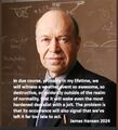 James Hansen 2024.jpg 600 × 658; 110 KB
 James Inhofe -- and Project 2025.png 640 × 670; 566 KB
 January-May 2020 temp anomaly.jpg 680 × 380; 54 KB
 Jerry Brown re EPA - 19 June 2019.jpg 699 × 798; 126 KB
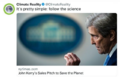 John Kerry - Climate Envoy - 2021-09-26.png 640 × 410; 349 KB
 Journey of a Climate Pixel - May 2022.png 800 × 399; 114 KB
 July 14, 2018 - hello down there.png 524 × 467; 290 KB
 June 2019 - NASA GISS data - hottest on record.jpg 640 × 560; 58 KB
 Katharine Hayhoe - Nov 26, 2019.jpg 508 × 466; 80 KB
 Keystone to Enridge - McKibben - June 11, 2021.jpg 512 × 559; 140 KB
 Kim Cobb - Georgia Tech professor of climate science.jpeg 800 × 533; 87 KB
 LA Times - July 2023 on the world's response to the climate crisis-1a.png 800 × 1,011; 657 KB
 LA Times on the world's response to the climate crisis-2.png 800 × 651; 297 KB
 LA Times on the world's response to the climate crisis-3.png 800 × 806; 302 KB
 LA Times on the world's response to the climate crisis-4.png 800 × 896; 321 KB
 Land Remote Sensing Policy Act of 1992.jpg 563 × 480; 144 KB
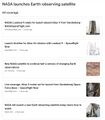
 LANDSAT - NASA.jpg 622 × 415; 95 KB
 Landsat 9 about to launch.png 420 × 721; 355 KB
 Landsat 9 Launches - 1.jpg 600 × 693; 128 KB
 Landsat 9 Launches - 2.jpg 600 × 737; 250 KB
 Landsat band imagery2.png 800 × 400; 907 KB
 Landsat data site.png 657 × 600; 499 KB
 Landsat Image Gallery.jpg 800 × 766; 187 KB
 Landsat launched 50 years ago today.png 528 × 779; 755 KB
 Landsat memories.png 535 × 473; 159 KB
 Landsat NASA - Feb 11 2023.png 763 × 600; 578 KB
 Landsat US collection of maps 1985-2021.png 768 × 775; 1,018 KB
 Landsat, a 50 year legacy.png 528 × 575; 288 KB
 Launch into Space.jpg 800 × 717; 50 KB
 LDCs face the climate crisis, raise the alarm - Nov 2021.png 419 × 226; 126 KB
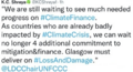
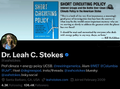 Leah Stokes - UCSB - Prof Climate and Energy Policy.png 640 × 476; 295 KB
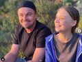 Leonardo and Greta Nov 1, 2019.jpg 587 × 438; 60 KB
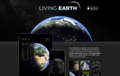 LivingEarth.png 1,311 × 825; 838 KB
 LivingEarth2.png 800 × 503; 478 KB
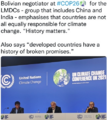 LMDCs make their case at the Glasgow climate summit.png 427 × 480; 259 KB
 Lucy, hominid from the Rift.png 336 × 407; 251 KB
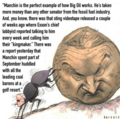
 Manchin again - July 15 2022.png 600 × 654; 523 KB
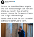
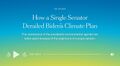 Manchin kills the Biden climate plan.jpg 800 × 438; 71 KB
 Manchin News - Dec 20 2021.png 600 × 588; 307 KB
 Manchin News 2 - Dec 20 2021.png 600 × 600; 329 KB
 Mangroves and Coastal Wetlands tracked by Landsat.png 600 × 716; 245 KB
 Map of the World wiki commons m.png 679 × 314; 18 KB
 Map of the World wiki commons s.png 339 × 157; 13 KB
 Map of the World wiki commons.png 1,357 × 628; 19 KB
 Map-Marker-Marker-free.png 256 × 256; 22 KB
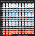 Mapping changes in global temperature 1850-2022.png 656 × 680; 180 KB
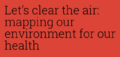 Mapping Our Air.png 640 × 306; 43 KB
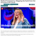 Mapping the Earth with Google Earth Outreach.jpg 640 × 648; 109 KB
 March for Science-1.png 800 × 291; 596 KB
 Market Gardening.png 800 × 334; 526 KB
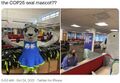 Mascot for Glasgow intl climate conference.jpg 575 × 396; 76 KB
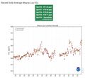 Mauna Loa Observatory CO2 - April 2021 - New record high.jpg 656 × 600; 55 KB
 McKibben 350.org logo.jpg 300 × 170; 7 KB
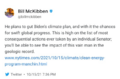
 McKibben re Manchin - Dec 2021.png 370 × 368; 261 KB
 McKibben reaction to Manchin blocking Biden's climate plan.png 640 × 423; 140 KB
 Memories of Big Science advocates in the US Congress.jpg 583 × 279; 87 KB
 Methane cuts pledge - COP27.png 399 × 336; 164 KB
 Methane emissions to be cut - COP26 pledges.png 640 × 464; 140 KB
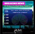 Methane Reduction proposal passes in EU Parliament - May 2023.png 620 × 600; 552 KB
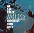 MethaneSat - 1.jpg 350 × 336; 58 KB
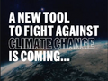 MethaneSat - 2.PNG 448 × 336; 172 KB
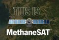 MethaneSat - 3.PNG 448 × 303; 248 KB
 Methods to enforce climate pledges-NDCs - Dec 2021.png 539 × 480; 333 KB
 Michael Mann - Susan Joy Hassol after Glasgow.jpg 460 × 1,616; 299 KB
 Mick stands in support of the global climate strike.jpg 587 × 710; 123 KB
 MLT Geospace - the Edge.jpg 800 × 600; 22 KB
 Monitoring Greenhouse Gases from Satellite Missions 2021-2030.png 801 × 386; 143 KB
 Montana climate trial News - 2023-08-14.png 789 × 768; 389 KB
 Montreal Protocol - effects study 2021.jpg 640 × 401; 76 KB
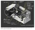 Multispectral Scanning Systen - MSS.jpg 688 × 587; 103 KB
 Mulvaney says no lifestyle change.jpg 561 × 779; 128 KB
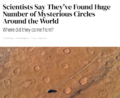 Mysterious circles around the world.png 733 × 600; 655 KB
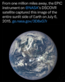 NASA EPIC DSCOVR - July 6 2015.png 768 × 956; 687 KB
 NASA Launch of Landsat 9 - Sept 27, 2021.jpg 675 × 772; 131 KB
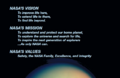 NASA's continuing vision and mission - as of 2005.png 640 × 414; 153 KB
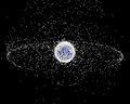 NASA-Debris-Kessler Syndrome.jpg 750 × 600; 76 KB
 National Climate Pledges Must Be Enforced.png 800 × 520; 122 KB
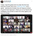 National Climate Task Force - first mtg Feb 11 2021.jpg 591 × 654; 144 KB
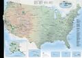 National-park-map 800x565.jpg 800 × 565; 91 KB
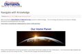 Navigate with Knowledge - StratDem - GreenPolicy360.jpg 800 × 534; 62 KB
 NDC Tracker - 2020.jpg 800 × 340; 50 KB
 Net Zero 1.png 800 × 373; 368 KB
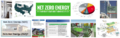 Net Zero 2.png 800 × 255; 331 KB
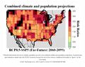
 New Climate Maps for US - 2020.jpg 800 × 169; 34 KB
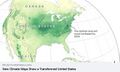 New Climate Maps for US.jpg 677 × 405; 47 KB
 New Climate Model.jpg 777 × 412; 70 KB
 New German government announces far reaching climate plans.png 632 × 600; 446 KB
 New Mexico drought - climate change.png 538 × 480; 337 KB
 NextEra - January12 2021.jpg 530 × 127; 36 KB
 Nile River and Mideast.jpg 750 × 929; 87 KB
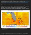
 NOAA - NCEI report on US temps 2023-2024.jpg 600 × 561; 109 KB
 NOAA Climate.Gov.png 589 × 99; 7 KB
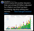 NOAA extreme weather events charting.png 663 × 600; 288 KB
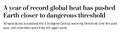
 NOAA report on heat records broken in US - 2023.jpg 600 × 480; 229 KB
 NOAA undergoes political changes - Oct 2020.jpg 800 × 719; 135 KB
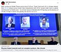 Nobel Prize 2021.jpg 551 × 473; 212 KB
 North America West Coast hot - Aug 2023.png 484 × 501; 308 KB
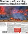 Nowhere is safe - The Guardian.jpg 467 × 566; 68 KB
 NYT - Nov 1 - Day 1 headlines from Glasgow Climate Summit.png 600 × 800; 103 KB
 Oceans and Climate Change - DeCaprio July 2022.png 600 × 689; 677 KB
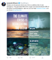
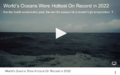 Oceans hottest in 2022.png 800 × 501; 358 KB
 Oct 21, 2021 - On Eve of International Climate Summit.jpg 733 × 466; 119 KB
 Oil gas climate change response plans - circa 2022.png 729 × 837; 335 KB
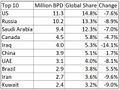 Oil production-global 2020.JPG 640 × 478; 56 KB
 Oil profits and US gas prices.png 378 × 336; 163 KB
 On the heat beat... NYT reporting-June 21 2024.png 613 × 649; 147 KB
 On the road outside of Gallup, New Mexico 2013 OLS s.jpg 404 × 302; 18 KB
 One Year as the Earth Rolls.jpg 800 × 1,068; 66 KB
 Our Biggest Experiment - by Alice Bell.jpg 333 × 499; 40 KB


.jpg)
.jpg)


