Category:Earth Imaging
Jump to navigation
Jump to search
- #EarthImaging
Earth Imaging Journal / http://eijournal.com/
http://eijournal.com/resources/optical-satellite-imagery-resources
http://eijournal.sensorsandsystems.com/magazine/toc/september-october-2014-contents
http://www.greenpolicy360.net/w/Earth_Science_Research_from_Space
○ ○ ○ ○ ○ ○ ○ ○ ○ ○ ○ ○ ○ ○ ○ ○ ○ ○ ○ ○ ○ ○ ○ ○ ○ ○ ○ ○ ○ ○ ○ ○ ○ ○ ○ ○

Subcategories
This category has the following 14 subcategories, out of 14 total.
A
C
D
E
G
N
P
S
W
Pages in category "Earth Imaging"
The following 71 pages are in this category, out of 71 total.
C
E
- Each of us can make a positive difference
- Earth and Space, Politics
- Earth at Night
- Earth Day Summit - April 22 2021
- Earth from NASA
- Earth Imaging-New Space
- Earth Right Now
- Earth Science Research from Space
- Earth Science Vital Signs
- Earthviews
- Earthviews from Astronauts
- Ecotourism
- Environmental agreements
- Environmental Protection Agency
- Environmental Security Organizations
- ESA Living Planet Announcement - May 2022
- European Union Green Deal - Fit for 55
G
L
P
S
T
Media in category "Earth Imaging"
The following 6 files are in this category, out of 657 total.
(previous page) (next page) 'Most beautiful from space' the Bahamas by Scott Kelly Apr 26, 2015.png 800 × 511; 767 KB
 'Thin Blue Layer' of Earth's Atmosphere 2.jpg 800 × 486; 46 KB
 -Earth360 Perseid ISS AstroGaran.jpg 960 × 639; 0 bytes
 1977 from the Office of Science and Technology Policy.jpg 661 × 711; 177 KB
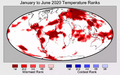 2020 record temperatures.png 800 × 502; 358 KB
 3-15-2016 12-29-07 PM.png 538 × 701; 201 KB


