Category:Earth Imaging
Jump to navigation
Jump to search
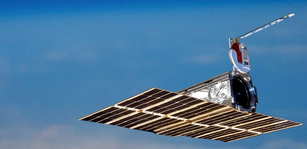
Doves Fly


Earth Science Research from Space
- ○ ○ ○ ○ ○ ○ ○ ○ ○
○
- California out in front in a Green future
- Democratization of Space
- Earth Imaging-New Space
- Micro-satellites
- New Space
- Planet Labs Doves Fly
Subcategories
This category has the following 15 subcategories, out of 15 total.
A
C
D
E
G
N
P
S
W
Pages in category "Earth Imaging"
The following 74 pages are in this category, out of 74 total.
C
E
- Each of us can make a positive difference
- Earth and Space, Politics
- Earth at Night
- Earth Day Summit - April 22 2021
- Earth from NASA
- Earth Imaging-New Space
- Earth Right Now
- Earth Science Research from Space
- Earth Science Vital Signs
- Earthviews
- Earthviews from Astronauts
- Ecotourism
- Environmental agreements
- Environmental Protection Agency
- Environmental Security Organizations
- ESA Living Planet Announcement - May 2022
- European Union Green Deal - Fit for 55
G
- George E. Brown Jr
- Glasgow Climate Summit - Pledges, Promises, Declarations - What's Next Up
- Global Climate Action Summit
- Global Fishing Watch
- Global Forest Watch
- Google Earth
- Google Earth Timelapse
- Green Education
- Green Politics 360
- Green Politics with GreenPolicy360
- Greening Our Blue Planet
- GreenLinks
L
P
S
T
Media in category "Earth Imaging"
The following 43 files are in this category, out of 680 total.
(previous page) (next page) Update - James Hansen July 2023 'We are fools'.png 595 × 800; 610 KB
 US 2020-billion-dollar-disasters-map.png 800 × 480; 259 KB
 US Annual Temperatures 1901-2020 Average Comparison.jpg 604 × 843; 242 KB
 US Biden climate agenda news re January 27, 2021.jpg 800 × 460; 81 KB
 US EPA to reverse methane rules.jpg 592 × 745; 175 KB
 US Quits Climate Accord.jpg 795 × 233; 40 KB
 US Role George E Brown 2.pdf ; 151 KB
- US Role George E Brown 3.pdf ; 157 KB
 US Senate passes 430 billion climate bill.png 468 × 396; 213 KB
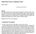 Usable climate science is adaptation science-Adam Sobel May 2021.jpg 702 × 664; 155 KB
 Venice flooding.png 530 × 516; 109 KB
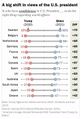 Views of the US President - June 2021.jpg 522 × 770; 88 KB
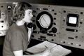 Virginia Norwood - 1948.jpg 640 × 426; 74 KB
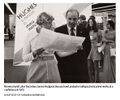 Virginia Tower Norwood and James Hodgson - 1972.jpg 589 × 489; 69 KB
 Virtual Earth cover.png 800 × 479; 833 KB
 Vital signs 1.png 853 × 507; 362 KB
 Water covers 70% of earths surface 1024x512.jpg 1,024 × 512; 223 KB
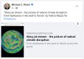 Wavy Jet Stream by Patrick Mazza.jpg 515 × 362; 64 KB
 We are all in this together-IPCC report-August 2021.jpg 513 × 768; 183 KB
 We must flatten the curve, yes ... August 2020.jpg 800 × 421; 99 KB
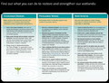 Wetlands - Wetlands Day.png 640 × 492; 333 KB
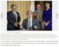 Wheeler-Mulvaney-repeal of Clean Power Plan-June19,2019.jpg 800 × 640; 145 KB
 When your house is on fire.jpg 589 × 473; 77 KB
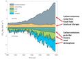 Where carbon emission come from - gleick tw 2018.jpg 640 × 460; 41 KB
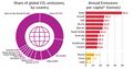 Which countries pollute the most ~2017.jpg 800 × 422; 69 KB
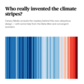 Who really invented the climate stripes - Climate Change Education.png 600 × 600; 234 KB
 Whole Earth Catalog-Internet Archive-4-23-2021.jpg 592 × 305; 48 KB
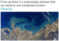 Whole Earth One Connected System Astro-Gerst 2014.png 451 × 312; 278 KB
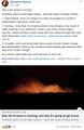 Why is the Amazon burning - Katharine Hayhoe explains.jpg 498 × 763; 149 KB
 Wildfires 2021 - August.jpg 519 × 220; 54 KB
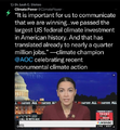 Winning on the climate legis - AOC.png 480 × 519; 249 KB
 World Map - Mercator projection v Google maps.jpg 800 × 545; 101 KB
 World Temp in 2023.jpg 448 × 198; 39 KB
 WV v EPA SCOTUS poll - June 27 2022 before court decision.png 623 × 480; 126 KB
 Your Place in Space.jpg 851 × 315; 38 KB
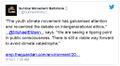 Youth Climate Movement.jpg 516 × 284; 79 KB
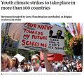 Youth Climate Strikes-March15,2019.jpg 707 × 639; 159 KB
 Zack Labe - climate viz - June 2024.png 675 × 600; 261 KB


Categories:
- Atmospheric Science
- Biogeosciences
- Climate Change
- Cryosphere
- Earth Observations
- Earth Science
- Earth Science from Space
- Geophysics and Geochemistry
- Mineralogy
- Geology
- Geophysics
- Hydrology
- NanoRacks
- Natural Resources
- New Space
- Ocean Science
- PlanetLabs
- Planetary Science
- Space Science and Space Physics
- ThinBlueLayer
- Virtual Earth