File:Global Stocktake, the first GST.jpg
Original file (800 × 905 pixels, file size: 513 KB, MIME type: image/jpeg)
Using AI to enhance satellite imagery to monitor the planet
A new method to assess different satellite designs using a powerful AI technique to more cheaply monitor our planet from space has been published in the journal Remote Sensing Letters.
An international team led by Swinburne University of Technology and Planet Labs, a leading provider of global Earth observation data, the AI-powered method reduces the cost of Earth Observation satellites while maintaining high quality of imaging.
🌎
Time for Planet Citizen Action and a "CEOS", a Committee on Earth Observation Satellites
GreenPolicy360 welcomes the arrival of a global science mission, a "Global Stocktake", a collection of earth science data to be made available to the community of nations, to planet citizen activists and scientists, educational institutions, non-profits, NGOs, young and old to become tools for legal enforcement of national climate plans & pledges.
2023
Global Stocktake, Updates, Data, and Information
2022
What is a "Global Stocktake"?
The global stocktake is a critical turning point when it comes to efforts to address climate change - it's a moment to take a long, hard look at the state of our planet and chart a better course for the future.
🌎
The Global Stocktake is a participatory, inclusive and transparent process. It consists of three main phases taking place over the course of two years: Phase 1: Information Collection and Synthesis This first phase is underway.
- https://unfccc.int/topics/global-stocktake
- https://www.wri.org/insights/explaining-global-stocktake-paris-agreement
- https://climatechampions.unfccc.int/what-is-the-global-stocktake/
GreenPolicy360's Campaign to 'Turn National Climate Promises & Pledges into Reality'
- Our Climate Plans Enforcement Initiative continues as the next Global Climate Conference approaches, November's Conference of the Parties (COP27)
- Drawing from the database of Earth Science resulting from decades of space-based missions designed to provide us with actionable 'Earth-system and Climate-related data'
- Measuring & Monitoring to better manage Earth's Living, Dynamic & Changing Systems, Local, National & Global
Methods to Enforce Climate Plan Pledges
GreenPolicy360: Climate Plans Enforcement Initiative
Pressuring Nations to Step Up, Cooperate, and Act Now
Environmental Laws, Regs, Rules... Lawsuits & Legal Actions
Glasgow (2021) & Paris (2015) Summits: Int'l Climate Plan Pledges & Promises (INDCs-NDCs)
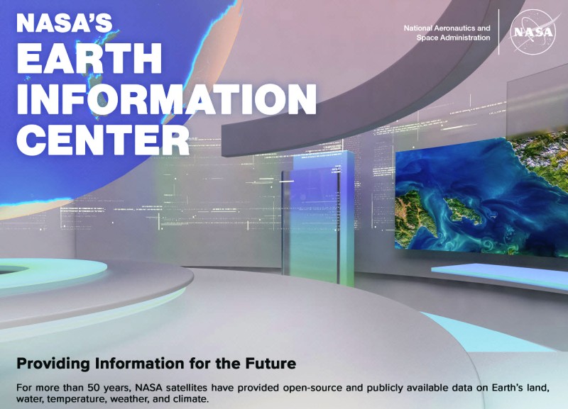
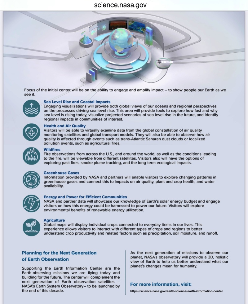
"Earth Observing System": Decades of Earth Science/Climate Science Data Accessible for Planet Citizen Action
🌎
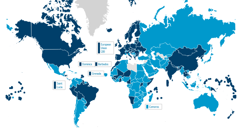
- Click on the Map for the Latest Country-by-Country News
Looking Forward to Next Year's First "Global Stocktake" (GST) Meeting in 2023
- Earth Observation Science, Earth Observation Satellites, Earth Observing Systems
CO2 & CH4 Fluxes | Above Ground Biomass | Forests | Mangroves | Agriculture | Land Cover
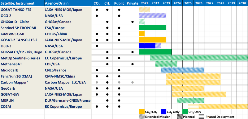
Future Prospects of Top-Down Emissions Estimates (as of 2022)
Top-down atmospheric CO2 and CH4 studies like those summarized in the graphic chart below are already providing significant insights into the largest sources and sinks of CO2 and their response to human activity and climate change. However, both the CO2 and CH4 groups caution that the pilot products should be interpreted with caution given limitations of the current atmospheric measurement and analysis systems.
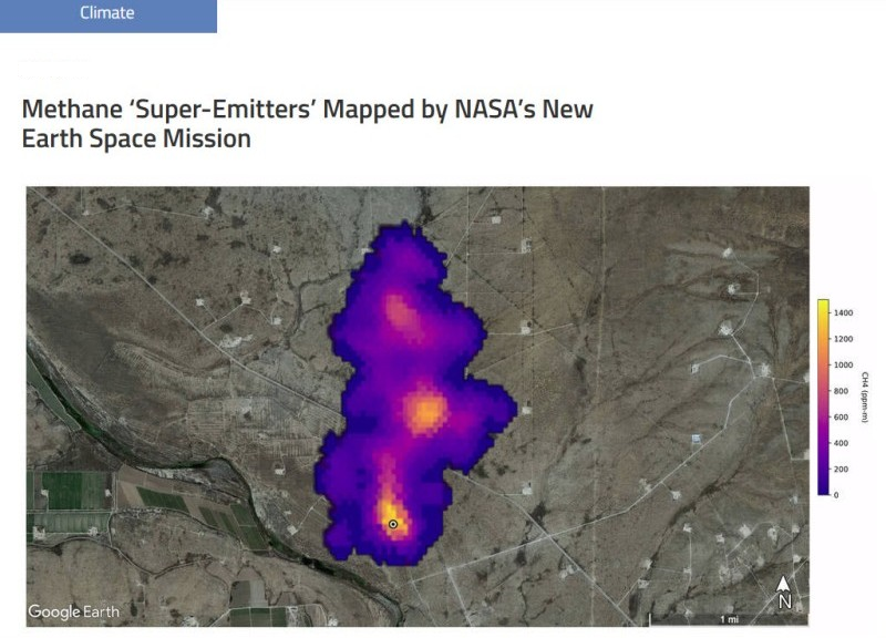
While this system does not yet completely meet the requirements for a GHG MVS system, recent advances in ground-based, airborne, and space-based measurements of CO2 and CH4, combined with progress in atmospheric inverse methods are yielding substantial improvements the precision, accuracy, resolution and coverage. Timelines for the growing fleet of space-based CO2 and CH4 sensors operated by CEOS and CGMS agencies are shown in Figure 1. Spacecraft scheduled from launch within the next five years, including Japan’s GOSAT-GW, EDF’s MethaneSat, NASA’s GeoCarb and the Copernicus CO2M satellites are expected to provide dramatic improvements in spatial coverage and resolution for both CH4 and CO2. Their observations can be combined with those of high-resolution imaging missions, such as GHGSat, Sentinel 2 and PRISMA or the planned missions such as CarbonMapper to locate intense CH4 plumes, facilitating the detection of super-emitters from oil and gas extraction, transmission, processing, and distribution facilities. Expanded ground-based and airborne systems are also expected to be deployed over this period as well, complementing the space-based systems with around-the-clock coverage, even during cloud periods and at night. The value of these data could be enhanced further if they can be harmonized to further extend the coverage and resolution and facilitate hand-off from one generation of sensors to the next.
These new measurement capabilities are driving the development of more advanced atmospheric inverse model that more fully exploit these new measurements. While the current measurement network cannot support inversions at resolutions of ~100 km, the future systems will deliver global measurements at scales as fine as 2 km by 2 km. These data could support inversions at much finer resolution, providing useful national-level constraints on emissions for much smaller countries. Other space-based measurements at resolutions as high as a few 10s of meters will drive advances in methods for modeling emission plumes from point sources such as power plants, cities, and fossil fuel extraction areas.
A key feature of these top-down atmospheric measurements in the context of a GST is their potential for transparency. Most of the ground-base, airborne and space-based data collected by public sector missions (and some private sector missions) are made freely available on publicly available archives. The methods used needed to analyze these data are complex and computationally expensive, but are currently being implemented in collaborative efforts by science teams from around the world with numerous intercomparison projects to assess the tradeoffs between different methods. If these practices are continued, it will clearly increase the value and transparency of the top-down atmospheric emissions products.
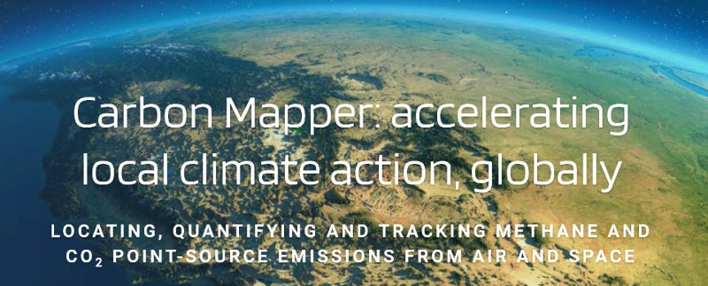
* https://www.greenpolicy360.net/w/File:Carbon_Mapper_-_Launch_-_April_2021.jpg
🌎
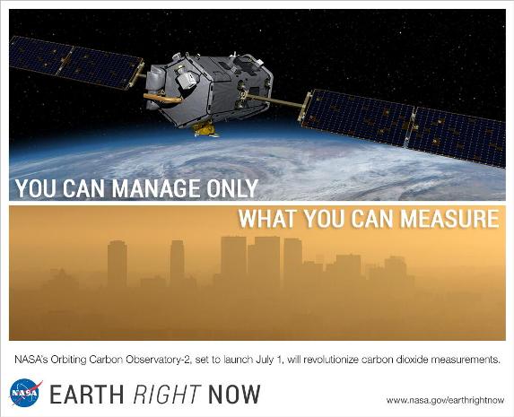
* https://www.greenpolicy360.net/w/File:NASA_has_a_new_mission..._against_Methane.png
🌎
More Links/References/Resources for Global Stocktake
🌎
GreenPolicy360: Global Stocktake: Resulting from 50+ years of Visionary Environmental Protection, Earth Science Research
GreenPolicy360 Siterunner: The International Climate Conferences, now the 27th 'Meeting of the Parties", COP27 speaks of the first UNFCCC systematic Earth Observation "Inventory". I can see back to the beginning of an Earth Observation "Inventory". I remember meeting, then years of learning, sharing and work alongside a congressman who set in motion and for decades shepherded U.S. earth science research programs. George E. Brown was a special person who brought a physics and engineering background to Congress. George saw what others didn't really understand and when he showed me the original Mission Statement of NASA, I began to understand. Here is the key phrase again -- “To understand and protect our home planet..."
Picture yourself like me, a young student in East Los Angeles meeting with a newly elected representative and talking the "big picture". George, who became my friend and over the years a colleague, garnered a reputation in the 1970s/80s/90s as the "Big Science" guy in Congress. George was low key in his approach, but truly saw and went for what I consider "generational science".
In the Science, Space & Technology committee hearing room these days, there's a big painting of George. George deserves to be watching over the earth science work of these essential missions of NASA/NOAA/USGS, Landsat and EOS and on and on.
Since George Bown's passing in 1999, the earth imaging, data collecting, measuring and monitoring work continues and I've done what I can to carry the work forward as I did with George and will continue to do for however many years I have left on our living planet.
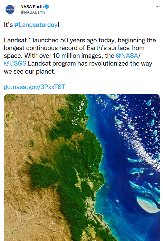
We all, as planet citizens in our own ways, have work to do ... the new international databank of earth observations, the Global Stocktake (GST) reminds me of how the data collecting, digital imaging, study and science, the baselines, trendlines, observing of changes over time started with George's 'baby', the Landsat mission and digital data collection instrumentation (thank you Virginia Tower Norwood for your Multispectral camera invention that launched digital remote imaging (and databases for analyzing earth science observations from space.) The first Congressional Climate Act, drafted by Congressman George Brown was passed in 1978, flocks of satellite missions followed, an Earth Observing System began and related science programs evolved into an EOS System that is now part of international cooperative climate efforts. This history deserves to be studied by every high school science class in the country, and the world.
The inspiration for the next generation was purposefully put on a path to do what was needed as we saw it in the 1960s and 70s, and going forward.
To create the tools and missions, the data collection, the science to study Earth's systems -- dynamic, changing, living systems -- and enable today's generation and future generations to 'measure, monitor and manage' with responsibility to preserve and protect our home planet. As the saying goes -- Earth is in our hands. Yes, as Planet Citizens, we are stewards and protectors of life on the planet.
🌎
Preparing for 2023, Next Year's First GST / Global Stocktake Meeting
- Systematic Observations of the Earth
GreenPolicy360: With Earth Science data from satellite observations over decades, we can now move on to utilizing this vital trove of information, accessing and sharing the verifiable 'forensics', the 'admissible evidence', facts and expert testimony into courts as part of actions 'National Climate Plans Enforcement'.
Climate Plans Enforcement - Resources
Systematic observations of the Earth’s atmosphere and surface from ground-based, airborne and space-based sensors can support both the Mitigation and Adaptation goals of the 2015 Global Climate Conference - Paris Agreement.
Direct measurements of atmospheric greenhouse gas (GHG) concentrations can be analysed to track GHG trends in their net emissions and removals on spatial scales spanning large urban areas, to nations, to the globe. They also support the development of top-down atmospheric inventories of GHG emissions and removals that can be used to assess the completeness and accuracy of the bottom-up methods used to compile biennial inventory reports.
High spatial resolution observations of land cover type, above-ground biomass and disturbances such as fires, severe weather and climate change can provide direct support for the development of bottom-up emissions inventories for agriculture, forestry and other land use (AFOLU).
These data also provide capacity to respond to change rather than simply observing what has happened in the past. They allow us to identify opportunities for improving resilience to the adverse impacts of climate change and fostering low GHG emissions development.
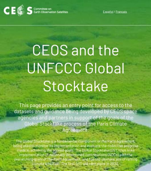
Recognising these opportunities, CEOS space agencies have embarked on a broad range of activities to support the GST. To demonstrate the utility of systematic Earth observations, a series of pilot products are being developed to support inventory development verification efforts for the 2023 GST:
• The Joint CEOS/CGMS Working Group on Climate (WGClimate) is developing spatially-resolved global atmospheric budgets of CO2 and CH4, and their changes over time.
• The CEOS Agriculture, Forestry and Other Land Use (AFOLU) Task team has embarked on an effort to identify and harmonise the best available above-ground biomass, forest, land cover, mangrove and agricultural crop products to support bottom-up inventories for the AFOLU sector.
These two efforts are being closely coordinated to develop Earth Observations products that are best suited to complement the Mitigation and Adaptation efforts being carried out by the Parties to the Paris Agreement.
The primary objective of these pilot products is to begin a conversation among the scientific community, national inventory agencies, the UNFCCC and other relevant stakeholders to establish best practices for the joint use of conventional inventories and systematic Earth observations - to produce more complete and accurate estimates of GHG emissions and removals, and to identify opportunities for improving resilience to the adverse impacts of climate change and fostering low GHG emissions development.
The resources on this page provide a single point of access to all the datasets and guidance resulting from these many activities, as a convenient reference for Parties, and for scientific and other users to access, understand and apply the data. Descriptions are provided for each dataset, along with links to the data itself, available user manuals or guidance documentation, and point of contact information is given in each case.
🌎
Planet Citizens
- Time for Planet Citizen Action
A Call to Action to Preserve & Protect Life on Earth
- It's Your Time and, as GreenPolicy360 speaks of 'Becoming Planet Citizens'
- We believe 'Each of us can make a positive difference stepping up & doing our best"
Planet Citizen Vision of Living Earth
🌎
The Earth Observing System (EOS)
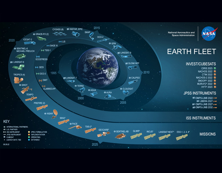
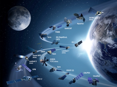
The mission of the Earth Observing System that became a core element of the ongoing NASA earth science programs was first envisioned in the 1970s. The constellation of satellites that now comprise a connected matrix of ongoing earth imaging programs (see the latest here) came about as the U.S. Congress realized in the years following NASA's establishment that Planet Earth was central to NASA's work. The initial NASA mission statement spoke of this study of Planet Earth as a key goal of NASA programs. A new science, space and technology Congressional Committee was created to envision and oversee these programs and one of the first realizations about the need for earth science came about through the LANDSAT program (see here). A historic moment brought into existence digital mapping, that is, multi-spectral imaging of earth from an orbiting satellite in space, envisioned and designed to collect and 'save' data of earth's living systems. This databank was considered to be essential by committee member George E. Brown who, as a physicist and engineer, began his three-decade + career in Congress. George eventually became known for his "big science" initiatives. What few knew back then at the beginning was how essential this data would become as climate science came into the light (in 1977 and '78 with George's work central to the drafting and passage of the first National Climate Act.)
In the 1980s, the Earth Observing System (EOS) work began in earnest.NASA's Project Science Office years later described its beginning with this statement:
>Results from early missions shed light on critical components of the Earth system while prompting further, more advanced investigations. The NASA Earth Observing System (EOS) program was conceived in the 1980s and began to take shape in the early 1990s. EOS is comprised of a series of coordinated polar-orbiting satellites designed to monitor and understand key components of the climate system and their interactions through long-term global observations. The EOS missions focus on the following climate science areas: radiation, clouds, water vapor, and precipitation; the oceans; greenhouse gases; land-surface hydrology and ecosystem processes; glaciers, sea ice, and ice sheets; ozone and stratospheric chemistry; and natural and anthropogenic aerosols.
NASA's Earth Observing System (EOS) Reference Handbook
In June 1992, the National Space Policy Council issued National Space Policy Directive and EOS became part of a global change observation system.Continuity of satellite missions gathering data over years established what is known as a longitudinal trendline of observations, the goal set forward in the late 1970s and 80s with LANDSAT, weather satellites and many others in the first generation of environmental science research with space-based remote imaging. This long vision would empower scientists and others to measure and monitor dynamic changes over time, a critical factor in enabling policies to be drafted to manage earth's systems. George Brown was a key factor in these decisions. He saw, as did your GreenPolicy360
siterunner who was following his work through the years, that data and sharing of data would build educational resources, science and new opportunities. Previous military intelligence programs from space, for example, were revisioned/rethought and ideas such as a Global Positioning System GPS with all of navigational potential on earth came into being under President Reagan in the 1980s. Later in the 1990s under Democratic administration the Next Generation Operational Control System acted toward increasing GPS positional accuracy. New mapping and navigation tools, now in most all new cars, were results of these programs that George Brown helped set in motion saw coming into existence before his passing away in 1999.
The Terra satellite, the first of 26 satellites that have orbited or continue to obit as a formal part of the EOS progam was launched on Dec. 18, 1999. Terra (originally known as EOS-1) was designed for a five-year mission life, but continued to orbit for more than another decade. George was alive as the launch of the Terra EOS program happened in December 1999. He knew that his mission, his work, was continuing on as a legacy.
We, at GreenPolicy360, tip our hat to the vision of Planet Citizen George E. Brown, a generational thinker and doer, mover and shaker...
Fifty+ Years On
Update: July 2022
🌎
Bookmark Climate Policy @GreenPolicy360
Each of us can make a positive difference ....
- Earth in Our Hands
Our Generational Challenge
Visit
GreenPolicy360's Environmental Studies Online
- GreenPolicy360's Climate Problems, Climate Solutions
Visit the Beginnings of Earth System Science Missions
- Planet Citizen George E. Brown: Whole Earth Science
- Measuring, Monitoring, Managing Earth's Dynamic/Changing Systems
- Earth Imaging, Earth Science Research from Space, Data for Today & the Future
🌎 “To understand and protect our home planet" (from the original Mission Statement of NASA]
🌎
The First 'Earth Day', a Story of Beginnings
🌎
File history
Click on a date/time to view the file as it appeared at that time.
| Date/Time | Thumbnail | Dimensions | User | Comment | |
|---|---|---|---|---|---|
| current | 15:27, 10 November 2022 |  | 800 × 905 (513 KB) | Siterunner (talk | contribs) |
You cannot overwrite this file.
File usage
- About Us
- Air Quality
- Air Pollution
- Agriculture
- Alternative Agriculture
- Antarctica
- Anthropocene
- Arctic
- Atmospheric Science
- California
- Citizen Science
- City Governments
- Clean Air
- Clean Water
- Climate Change
- Climate Migration
- Climate Policy
- Countries
- County Governments
- Democracy
- Desertification
- Digital Citizen
- Earth Imaging
- Earth Observations
- Earth360
- Earth Science
- Earth Science from Space
- Earth System Science
- Ecology Studies
- Eco-nomics
- Economic Justice
- Education
- Energy
- Environmental Full-cost Accounting
- Environmental Laws
- Environmental Protection
- Environmental Security
- Environmental Security, National Security
- ESA
- European Union
- Externalities
- Extinction
- Fisheries
- Florida
- Food
- Forests
- Fossil Fuels
- Germany
- Greenland
- Global Security
- Global Warming
- Green Best Practices
- Green Graphics
- Green Networking
- Green Politics
- Health
- INDC
- Maps
- Media
- Money in Politics
- NASA
- NOAA
- Natural Resources
- Networking
- New Definitions of National Security
- New Economy
- New Space
- Oceans
- Ocean Science
- Online Education
- Planet Citizen
- Planet Citizens
- Planet Citizens, Planet Scientists
- Pollution
- Rainforest
- Renewable Energy
- Resilience
- Russian Federation
- Sea-level Rise
- Sea-Level Rise & Mitigation
- Seventh Generation Sustainability
- Social Justice
- Soil
- Solar Energy
- Strategic Demands
- Sustainability Policies
- Threat Multiplier
- Transportation
- Ukraine
- United Nations
- US
- US Environmental Protection Agency
- Water
- Water Quality
- Water Saving
- Whole Earth
- Wind Energy
- World Bank
- World Wide Web
- Youth
