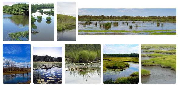
Category:Wetlands
<addthis />
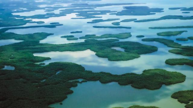
Wetlands, estuaries, coastlines and shorelines, intercoastal waterways, brackish waters, marshes and swamps, the Everglades, need we continue?
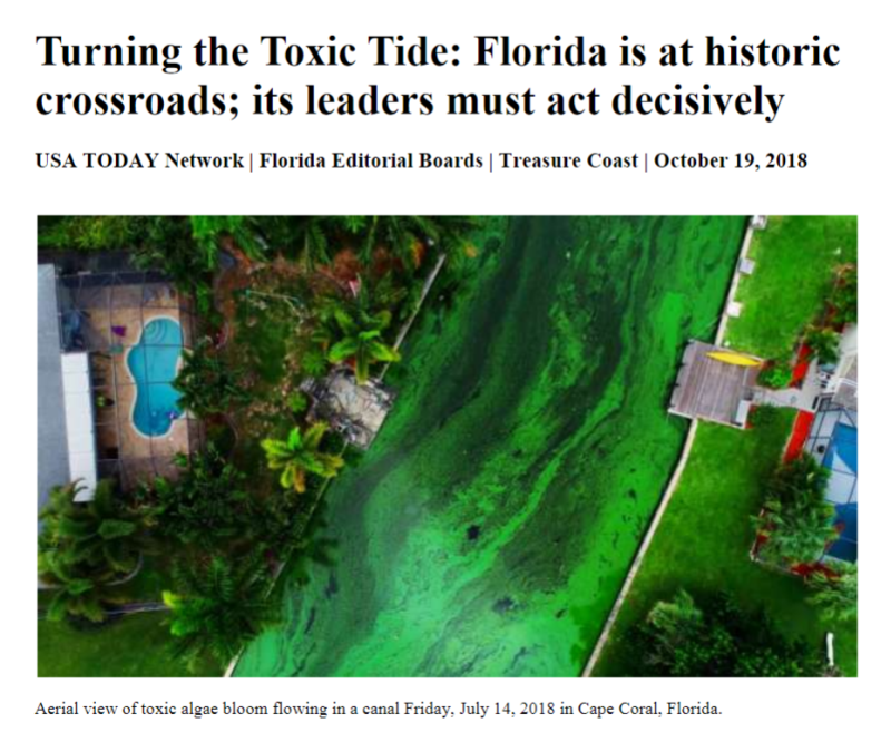
We're starting by talking of waterways in Florida, the terrestrial home of GreenPolicy360. Florida is also a state that has extensive shorelines, longest in the continental US, and its intercoastal wetlands are extensive as much of the state's topography is near sea level. Florida is also described by GreenPolicy360 as "the Frontlines of Climate Change." Florida's wetlands, although being rapidly developed and diminished, play a vital role in defending against sea-level rise, extreme weather, hurricanes, flooding, economic devastation, loss of biodiversity, wildlife, essential habitats for species, and on and on...
GreenPolicy360 continues an educational campaign with an urgent message. Now is the time for preserving and protecting natural the coastline/shoreline. Living eco-systems and -environments must become a highest priority. Florida's 'quality of life' is at great risk. Citizen action is demanded.
Please visit our Living Coastline pages for more:
"Living Coastlines, Living Shorelines"
GreenPolicy360: Join Our "Living Coastlines, Living Shorelines" Action
Managed Wetlands Can Protect Shorelines and Communities
Eco-system Designs (e.g. Mangrove biospheres) Are Natural Solutions
Eco-systems Proved Defense Against Hurricanes/Typhoons/Extreme Weather/Ocean Surges/Flooding
Eco-systems Managed with Local Support Can Work Better than Sea Walls and Constructed Barriers
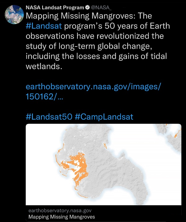
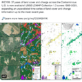
Using observational earth science remote imaging tools, eg, Landsat, to measure/monitor wetland systems
GreenPolicy360: With a special thanks to a 'father' of Landsat - Congressman George E. Brown
○
In a New Book, Annie Proulx Shows Us How to Fall in Love with Wetlands
These vital carbon sinks and havens for biodiversity, rarely encountered, are disappearing three times faster than forests
December 2022
Wetlands provide refuge for biodiversity, help protect coastlines and control flooding. They are also carbon-dense, making them crucial bulwarks against global warming. Peatlands are especially essential; though they cover only 3 percent of the Earth’s surface, peatlands “store twice as much carbon as forests.”
For all their importance to sustaining human life, few people in 21st-century America are likely to be as eager to express their affection for wetlands as Annie Proulx. “I personally find wetlands intensely interesting,” she said, in an interview via email.
🌎
Global Wetlands Outlook (2021)
Wetlands are being lost at alarming rates.
With 35% loss globally since 1970, wetlands are our most threatened ecosystem, disappearing three times faster than forests.
Land-use change is the biggest driver of degradation to inland wetlands since 1970. Agriculture, the most wide-spread form of land-use change, has damaged more than half of Wetlands of International Importance.
Climate impacts to wetlands are happening faster than anticipated. Rising sea-levels, coral bleaching and changing hydrology are all accelerating, with arctic and montane wetlands most at risk of degradation and loss.
🌎
US Supreme Court to Rule on Wetlands Definition and Protections in Clean Water Act
October 2022
Clean Water Act Turns 40 (50 in 2022)
2012 / The Clean Water Act, one of the most remarkable, far-reaching and contentious laws ever enacted by Congress -- and, as we detail in "Paving Paradise," one that set a new standard for protecting wetlands
🌎
Florida's Wetlands in Grave Danger: "Paving Paradise"
In an award-winning newspaper series, two investigative reporters from the St. Petersburg Times chronicled how federal rules meant to protect the nation's wetlands were more illusion than law. Now, that series has been expanded into a book, delving into how we got to this point, starting with land speculators making waterfront property out of sand dredged from the bottom of the ocean. Now, read how the nation's wetlands protections were formed in clashes between developers, bureaucrats, judges, activists and con artists over Florida swamps.
Published by the University Press of Florida / 2009
U.S. -- A Case Study of How One State, Florida, Represents the Failures of Environmental Protection Writ Large
This is an exhaustive, timely and devastating account of the destruction of Florida's wetlands, and the disgraceful collusion of government at all levels. It's an important book that should be read by every voter, every taxpayer, every parent, every Floridian who cares about saving what's left of this precious place.” -- Carl Hiaasen
"Craig Pittman and Matthew Waite pulled the lid off federal and state wetlands regulation in Florida and peered deep into the cauldron of 'mitigation,' 'no net loss,' 'banking,' and the rest of the regulatory stew. For anyone interested in wetlands generally, and in Florida environmental issues in particular, this is an eye-opening, must-read book."--J. B. Ruhl
Since 1990, every president has pledged to protect wetlands, and Florida possesses more than any state except Alaska. And yet, since that time Florida has lost more than 84,000 acres of wetlands that help replenish the water supply and protect against flooding.
How and why the state’s wetlands are continuing to disappear is the subject of Paving Paradise. Journalists Craig Pittman and Matthew Waite spent nearly four years investigating the political expedience, corruption, and negligence on the part of federal and state agencies that led to a failure to enforce regulations on developers. They traveled throughout the state, interviewed hundreds of people, dug through thousands of documents, and analyzed satellite imagery to identify former wetlands that were now houses, stores, and parking lots.
The result was an award-winning series, "Vanishing Wetlands," of more than twenty stories in the St. Petersburg Times, exposing the unseen environmental consequences of rampant sprawl. Expanding their work into book form in the tradition of Michael Grunwald's The Swamp, Pittman and Waite explain how wetland protection has become a taxpayer-funded program that creates the illusion of environmental protection while doing little to stem the tide of destruction.
"Vanishing Wetlands" / St. Petersburg Times
Statistics gathered by the Times investigative series, "Vanishing Wetlands," documents that legally responsible regulators, the U.S. Army Corp of Engineers rejected only one of the more than 12,000 applications to destroy Florida wetlands between 1999 and 2003..
Destruction of wetlands in Florida has a history. Developers of housing have, for decades, paved over low-lying coastal areas, marshes, bays, vulnerable-to-flooding regions. The results of extreme over development and high risk land use are now becoming
evident. Climate change is multiplying the threats and extreme weather events are increasingly delivering billions of dollars in damages. The loss of wetlands to development goes far beyond the lowlands of states like Florida. Flooding is becoming more common throughout regional watersheds.
The costs are adding up. Damages, flooding, pollution, aquifer loss, biodiversity loss, insurance crisis, the list goes on and on.
Look to the lessons and warnings of the USGS for connections between development, risks and costs:
Impervious Surfaces and Flooding
~
It began with a tip about a report from the National Academy of Sciences titled "Compensating for Wetland Losses Under the Clean Water Act." A real page turner.
Craig Pittman, who had been covering environment issues for The St. Petersburg Times for five years, was blown away by the document's indictment of the U. S. Army Corps of Engineers. He figured it was time to cover the statewide picture, not just report one loss at a time as wetlands disappeared.
When he checked the Corps' website, he discovered that more wetland destruction permits were being issued in Florida than in any other state and Florida had lost more wetlands than any other state.Thousands of acres had been bartered off to developers, never mind that yards in the new subdivisions could sprout cypress trees and float septic tanks.
A national policy of "no net loss" had been established in 1989. Clearly, the policy was in shambles. Wetlands in Florida were being converted to concrete jungle. More homes for people rather than alligators or panthers, more stores, more parking lots and more roads leading to more of the above. The Corps' mission: development enablers.
Although the Corps uses Geographic Information Systems to pinpoint wetlands, it didn't take long for Pittman to discover that the data were unreliable. His search for a GIS guru led to Matt Waite, a metro G.A. from one of the Times' bureaus assigned to computer-assisted reporting. The two teamed up to learn the technology and to begin the tussle for federal agency data.
Since the Corps' data were less than useful, Waite came up with a way to go after the story using satellite-imagery analysis. He had to take a couple of courses in remote sensing at the local university just to understand how to compute the number of acres lost. It took nearly a year to analyze where paradise had been paved.
The duo's investigative report ran May 22-23, 2005. Additional stories followed. Pittman and Waite won SEJ's top reporting awards in 2006 and 2007 for their exposé of the illusion of wetlands protection. The expanded book-length tale, 17 chapters with two appendices explaining the authors' complex methodology and a useful list of remote sensing sources, could have been called: "Tides of Destruction," "They Couldn't Say No," "A Landscape of Greed, Lies and Incompetence" or maybe "Swamped by Sprawl..."
Craig Pittman speaks at Stetson Law School
Award-winning St. Petersburg Times journalist Craig Pittman presented the Summer 2009 Biodiversity Lecture on June 22 at Stetson’s Tampa Law Center.
- https://youtu.be/gQSZotZ1AIs (Video)
🌎
GreenPolicy360: Using the earth observation capabilities that are now becoming widely available, Craig Pittman discusses how satellite imagery was used to study Florida’s wetlands. The database of satellite 'before and after' digital scanning imaging documents profound changes and losses to wetlands, with resulting losses to wildlife, biodiversity, and natural eco-systems. The damage is generational as the consequences range from more vulnerable coastline/shorelines as extreme weather events/hurricanes surge inland with new destructive force as nature's resilient-to-surge flooding barriers are removed. The role of wetlands in cleaning fresh water, throughout Florida, as wetlands recharge aquifers is being lost. Wetlands are interconnected to environmental health in immeasurable ways that science is realizing. Craig Pittman and Matthew Waite reveal the deep threat Florida, and Florida politics, faces and must deal with now before losses become irreversible. One way to protect wetlands is through what we, GreenPolicy360, call a "Living Coastline" ...
Supreme Court gets a chance on another wetlands case
○ ○ ○ ○ ○ ○ ○ ○ ○ ○ ○
Wetlands and related terms:
A wetland is a land area that is saturated with water, either permanently or seasonally, such that it takes on the characteristics of a distinct ecosystem. The primary factor that distinguishes wetlands from other land forms or water bodies is the characteristic vegetation of aquatic plants, adapted to the unique hydric soil. Wetlands play a number of roles in the environment, principally water purification, flood control, carbon sink and shoreline stability. Wetlands are also considered the most biologically diverse of all ecosystems, serving as home to a wide range of plant and animal life. Wetlands occur naturally on every continent except Antarctica, the largest including the Amazon River basin, the West Siberian Plain, and the Pantanal in South America. The water found in wetlands can be freshwater, brackish, or saltwater. The main wetland types include swamps, marshes, bogs, and fens; and sub-types include mangrove, carr, pocosin, and varzea.
The UN Millennium Ecosystem Assessment determined that environmental degradation is more prominent within wetland systems than any other ecosystem on Earth.
Estuary, Living Systems with an Integral Connection to Sustainable Environments
The word "estuary" is derived from the Latin word aestuarium meaning tidal inlet of the sea, which in itself is derived from the term aestus, meaning tide. There have been many definitions proposed to describe an estuary. The most widely accepted definition is: "a semi-enclosed coastal body of water, which has a free connection with the open sea, and within sea water is measurably diluted with freshwater derived from land drainage". However, this definition excludes a number of coastal water bodies such as coastal lagoons and brackish seas. A more comprehensive definition of an estuary is "a semi-enclosed body of water connected to the sea as far as the tidal limit or the salt intrusion limit and receiving freshwater runoff; however the freshwater inflow may not be perennial, the connection to the sea may be closed for part of the year and tidal influence may be negligible". This broad definition also includes fjords, lagoons, river mouths, and tidal creeks. An estuary is a dynamic ecosystem with a connection with the open sea through which the sea water enters with the rhythm of the tides. The sea water entering the estuary is diluted by the fresh water flowing from rivers and streams. The pattern of dilution varies between different estuaries and depends on the volume of fresh water, the tidal range, and the extent of evaporation of the water in the estuary.
Phytoplankton are key primary producers in estuaries.
Of the thirty-two largest cities in the world, twenty-two are located on estuaries. For example, New York City is located at the mouth of the Hudson River estuary.
As ecosystems, estuaries are under threat from human activities such as pollution and overfishing. They are also threatened by sewage, coastal settlement, land clearance and much more. Estuaries are affected by events far upstream, and concentrate materials such as pollutants and sediments. Land run-off and industrial, agricultural, and domestic waste enter rivers and are discharged into estuaries. Contaminants can be introduced which do not disintegrate rapidly in the marine environment, such as plastics, pesticides, furans, dioxins, phenols and heavy metals.Such toxins can accumulate in the tissues of many species of aquatic life in a process called bioaccumulation. They also accumulate in benthic environments, such as estuaries and bay muds: a geological record of human activities of the last century.
Industrial pollution, such as phenols and heavy metals, has devastated fish stocks around the world...
○ ○ ○ ○ ○ ○ ○ ○ ○ ○ ○ ○ ○ ○ ○ ○ ○ ○ ○ ○ ○ ○ ○ ○
Wetland defined by the US Environmental Protection Agency
Wetlands are part of the foundation of our nation's water resources and are vital to the health of waterways and communities that are downstream. Wetlands feed downstream waters, trap floodwaters, recharge groundwater supplies, remove pollution, and provide fish and wildlife habitat. Wetlands are also economic drivers because of their key role in fishing, hunting, agriculture and recreation.
Wetlands include swamps, marshes and bogs. Wetlands vary widely because of differences in soils, topography, climate, hydrology, water chemistry, vegetation, and other factors.
Wetlands are often found alongside waterways and in flood plains. However, some wetlands have no apparent connection to surface water like rivers, lakes or the ocean, but have critical groundwater connections.
Because many species of fish and wildlife rely on the sheltered waters of estuaries as protected spawning places, estuaries are often called the "nurseries of the sea." -- EPA
(GreenPolicy360: In other words, the loss of estuaries, and coastal waterways/wetlands/tidal inlets, brings on a cascading effect as generations of life are interrupted in their life cycles. The result is a compounded loss rippling through species... as the nursery, the incubator, the needed habitat no longer exists. And when the estuaries and coastal wetlands go away, the fisheries go away, the shorebirds and migrating birds go away, the tidal riches that feed and maintain sea life go away.
The destruction of species is a loss with immense consequences...)
EPA: Estuaries and the lands surrounding them are places of transition from land to sea and freshwater to salt water. Although influenced by the tides, they are protected from the full force of ocean waves, winds, and storms by such land forms as barrier islands or peninsulas.
Estuarine environments are among the most productive on earth, creating more organic matter each year than comparably-sized areas of forest, grassland, or agricultural land.
The tidal, sheltered waters of estuaries also support unique communities of plants and animals especially adapted for life at the margin of the sea.
Many different habitat types are found in and around estuaries, including shallow open waters, freshwater and salt marshes, swamps, sandy beaches, mud and sand flats, rocky shores, oyster reefs, mangrove forests, river deltas, tidal pools, and seagrasses.
○ ○ ○ ○ ○ ○ ○ ○ ○ ○ ○ ○ ○ ○ ○
- Marine and Coastal Zone wetlands
- Marine waters—permanent shallow waters less than six metres deep at low tide; includes sea bays, straits
- Subtidal aquatic beds; includes kelp beds, seagrasses, tropical marine meadows
- Coral reefs
- Rocky marine shores; includes rocky offshore islands, sea cliffs
- Sand, shingle or pebble beaches; includes sand bars, spits, sandy islets
- Intertidal mud, sand or salt flats
- Intertidal marshes; includes saltmarshes, salt meadows, saltings, raised salt marshes, tidal brackish and freshwater marshes
- Intertidal forested wetlands; includes mangrove swamps, nipa swamps, tidal freshwater swamp forests
- Brackish to saline lagoons and marshes with one or more relatively narrow connections with the sea
- Freshwater lagoons and marshes in the coastal zone
- Non-tidal freshwater forested wetlands
- Inland wetlands
- Permanent rivers and streams; includes waterfalls
- Seasonal and irregular rivers and streams
- Inland deltas (permanent)
- Riverine floodplains; includes river flats, flooded river basins, seasonally flooded grassland, savanna and palm savanna
- Permanent freshwater lakes (> 8 ha); includes large oxbow lakes
- Seasonal/intermittent freshwater lakes (> 8 ha), floodplain lakes
- Permanent saline/brackish lakes
- Seasonal/intermittent saline lakes
- Permanent freshwater ponds (< 8 ha), marshes and swamps on inorganic soils; with emergent vegetation waterlogged for at least most of the growing season
- Seasonal/intermittent freshwater ponds and marshes on inorganic soils; includes sloughs, potholes; seasonally flooded meadows, sedge marshes
- Permanent saline/brackish marshes
- Seasonal saline marshes
- Shrub swamps; shrub-dominated freshwater marsh, shrub carr, alder thicket on inorganic soils
- Freshwater swamp forest; seasonally flooded forest, wooded swamps; on inorganic soils
- Peatlands; forest, shrub or open bogs
- Alpine and tundra wetlands; includes alpine meadows, tundra pools, temporary waters from snow melt
- Freshwater springs, oases and rock pools
- Geothermal wetlands
- Inland, subterranean karst wetlands
- Human-made wetlands
- Water storage areas; reservoirs, barrages, hydro-electric dams, impoundments (generally > 8 ha)
- Ponds, including farm ponds, stock ponds, small tanks (generally < 8 ha)
- Aquaculture ponds; fish ponds, shrimp ponds
- Salt exploitation; salt pans, salines
- Excavations; gravel pits, borrow pits, mining pools
- Wastewater treatment; sewage farms, settling ponds, oxidation basins
- Irrigated land and irrigation channels; rice fields, canals, ditches
- Seasonally flooded arable land, farm land
The terms “coastline” and “shoreline” are often used interchangeably, but they have different meanings. The coastline of a place is defined as the boundary between the coast and the shore. In other words, a coastline is a big-picture view of the approximate line between the land and the sea. A shoreline is an ever-changing line that marks the specific place where the water and shore meet...
○
Subcategories
This category has the following 8 subcategories, out of 8 total.
A
B
C
E
W
Pages in category "Wetlands"
The following 42 pages are in this category, out of 42 total.
A
C
- Cambridge, MA Resolution on Watershed Protection
- Climate News
- Climate News Events Archive ... 1970 to Today
- Colorado State University Wetlands
- Convention on Wetlands of International Importance, especially as Waterfowl Habitat
- Copernicus EU
- Cornell University, NY Stormwater Management Wetland Demonstration Project
- Cornell University, NY Wetlands Creation
E
F
P
Media in category "Wetlands"
The following 124 files are in this category, out of 124 total.
- A root and its mycorrhizal fungus surroundings.PNG 315 × 382; 236 KB
- A scorching year, what about the 360 warming data.jpg 600 × 706; 106 KB
- AB 2480 Meadows and Forest Water Infrastructure.png 481 × 375; 248 KB
- About Baselines and Change.png 592 × 312; 33 KB
- About website of The Invading Sea.png 800 × 343; 126 KB
- Against the Tide by Cornelia Dean.jpg 600 × 800; 265 KB
- Bill Mollison 1928-2016.pdf ; 99 KB
- Bill Mollison courtesy of Permaculture magazine.jpg 460 × 300; 0 bytes
- Bill Mollison the day after his passing memories.png 1,381 × 651; 1.65 MB
- Bill Nye The Planet's on Fire.jpg 800 × 675; 106 KB
- California's kelp forests and coastal biodiversity diminished.png 532 × 754; 307 KB
- Celebrating 50 Years of Landsat.png 600 × 610; 909 KB
- Climate Legacy of Biden.jpg 600 × 687; 265 KB
- Climate News Dec 4 2023 in Dubai.png 800 × 1,037; 649 KB
- Climate Plans Enforcement - Resources - GreenPolicy.png 768 × 897; 686 KB
- Climate poll - Florida.png 640 × 267; 36 KB
- Coastal Intercoastal Wetlands.jpg 591 × 286; 55 KB
- COP28 News - Dec 13 2023.png 800 × 898; 410 KB
- Cradle of Civilization - and climate change.jpg 640 × 360; 70 KB
- Discovery Center, St Pete Pier, Living Shorelines.jpg 800 × 530; 118 KB
- Drought Monitor Map - April 2022.png 800 × 459; 238 KB
- Earths-Future .jpg 351 × 198; 41 KB
- Earths-Future-cover.jpg 251 × 325; 48 KB
- EarthScience Missions via the EOS - 2022.png 800 × 219; 139 KB
- Ebro Delta, Spain.jpg 624 × 351; 52 KB
- Environmental Protection Agency logo.png 380 × 414; 39 KB
- EO and Fire Ants in the US - on World Wildlife Day.png 768 × 811; 663 KB
- EO Snapshot 6-29-2016 10-44-49 AM.png 839 × 768; 907 KB
- ESG Fight - Feb 2023.png 396 × 194; 88 KB
- Estuary in Clearwater on Tampa Bay.jpg 3,584 × 2,016; 1.5 MB
- Eukaryotic Cell SCU.jpg 716 × 1,024; 799 KB
- Everglades restoration 2016 update.png 485 × 813; 356 KB
- Fire Ants.png 601 × 600; 603 KB
- Floating adaptations - GCA - for sea-level rise - circa 2023.png 600 × 732; 273 KB
- Flooding in South Florida.png 640 × 742; 293 KB
- Florida and climate change denial.png 640 × 192; 46 KB
- Florida rights of nature lawsuit - May 2021.jpg 527 × 806; 179 KB
- Florida via NASA 2022.png 800 × 1,020; 1.12 MB
- Florida Wildlife Corridor - 2022 illustration.png 800 × 628; 473 KB
- Florida Wildlife Corridor FLWC Water Benefits December 2022.png 768 × 886; 109 KB
- Global Climate Change textbook-Edition2.jpg 604 × 680; 96 KB
- GreenPolicy360 - May-10-2024.png 790 × 694; 320 KB
- Harvest the Rain cover .png 582 × 800; 1.06 MB
- Harvest the Rain reviews.png 800 × 879; 306 KB
- Hindu Kush-Himalayas - 2023 Report on Dangerous Climate Impacts.png 800 × 819; 1,023 KB
- Huge heat anomaly in 2023 - by Gavin Schmidt.png 735 × 857; 172 KB
- Hurricane-Proofing-Home-2024-Miami-Florida.png 658 × 600; 652 KB
- Invading Seas warning 2024.png 757 × 587; 669 KB
- James Hansen 2024.jpg 600 × 658; 110 KB
- James Inhofe -- and Project 2025.png 640 × 670; 566 KB
- Kenny Ausubel quote.jpeg 415 × 163; 46 KB
- Land Remote Sensing Policy Act of 1992.jpg 563 × 480; 144 KB
- Landsat band imagery.png 800 × 400; 907 KB
- Landsat band imagery2.png 800 × 400; 907 KB
- Landsat data site.png 657 × 600; 499 KB
- Landsat launched 50 years ago today.png 528 × 779; 755 KB
- Landsat NASA - Feb 11 2023.png 763 × 600; 578 KB
- Landsat US collection of maps 1985-2021.png 768 × 775; 1,018 KB
- Landsat, a 50 year legacy.png 528 × 575; 288 KB
- Leah Stokes - UCSB - Prof Climate and Energy Policy.png 640 × 476; 295 KB
- Living Earth.png 441 × 183; 106 KB
- Living-Shoreline.png 800 × 367; 128 KB
- LivingShorelines Graph.png 680 × 375; 73 KB
- Loss of N American Birds - 1.jpg 800 × 788; 173 KB
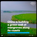
- Mangroves 'green wall' in China.png 600 × 600; 466 KB
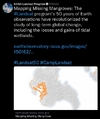
- Mangroves and Coastal Wetlands tracked by Landsat.png 600 × 716; 245 KB
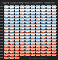
- Mapping changes in global temperature 1850-2022.png 656 × 680; 180 KB
- Mushroom life in the forest.png 640 × 458; 626 KB
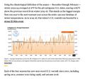
- NOAA - NCEI report on US temps 2023-2024.jpg 600 × 561; 109 KB
- NOAA extreme weather events charting.png 663 × 600; 288 KB
- NOAA report on heat records broken in US - 2023.jpg 600 × 480; 229 KB
- Oceans hottest in 2022.png 800 × 501; 358 KB
- Our Fragile Moment.jpg 612 × 480; 80 KB
- Our Fragile Moment.png 301 × 448; 360 KB
- Permaculture-observation tip.jpg 480 × 540; 86 KB
- Planet Dove satellite image over Dubai.png 800 × 791; 1.58 MB
- Planetary-Scale Threat.jpeg 640 × 593; 101 KB
- Protect the Natural World.jpg 800 × 345; 78 KB
- Rain Garden Design courtesy of www.PermaDesign.com Nate Downey.png 800 × 614; 601 KB
- Record tumble - climate change.png 727 × 333; 27 KB
- Remembering E.O. Wilson and Thomas Lovejoy.jpg 640 × 327; 56 KB
- Republican Party 2024 Climate Strategy.png 589 × 344; 44 KB
- River basins - watersheds.jpg 800 × 214; 111 KB
- Sea levels surge along southern US coast.png 640 × 441; 69 KB
- Seeds of Change, published 1994.png 628 × 763; 915 KB
- Seeds of Change.jpg 260 × 346; 27 KB
- Shell lawsuit Feb 2023.png 768 × 534; 229 KB
- Shifting Baseline Syndrome - threats to ecosystems biodiversity.png 431 × 534; 322 KB
- Shifting Baselines 2.jpg 600 × 600; 140 KB
- South Florida Floodwaters.png 640 × 449; 251 KB
- Tardi1.jpg 470 × 264; 28 KB
- Telling stories of solutions for the climate crisis.jpg 600 × 640; 121 KB
- Temperature - SST World via Climate Change Institute - 2023 chart.png 800 × 509; 144 KB
- Temperature World - chart via Climate Change Institute.jpg 800 × 509; 67 KB
- Ten thousand islands -- Marco island.jpg 640 × 360; 30 KB
- The Climate Dictionary - as of 2023.png 600 × 727; 200 KB
- The Daily Puffin.png 768 × 800; 766 KB
- The Hidden Universe - Adventures in Biodiversity.png 768 × 959; 365 KB
- Timeline-climate-change-history-485-million years.jpg 800 × 276; 42 KB
- Toby Hemenway-RIP Dec2016.png 503 × 327; 32 KB
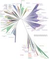
- Tree of Life nmicrobiol201648-f1 via Nature.jpg 695 × 833; 98 KB
- Tree of Life on Hand.jpg 336 × 448; 70 KB
- Trump promise to oil ceo gathering - 1.png 440 × 108; 19 KB
- Trump promise to oil ceo gathering - 2.png 480 × 495; 291 KB
- Trump promise to oil ceo gathering - 3.png 480 × 284; 270 KB
- Trump promise to oil ceo gathering - 4.png 480 × 480; 333 KB
- Update - James Hansen July 2023 'We are fools'.png 595 × 800; 610 KB
- US Election 2024 impacts our climate legacy.png 600 × 800; 719 KB
- US River basins - watersheds.jpg 800 × 477; 131 KB
- USGS Groundwater depletion map 2013.png 794 × 490; 238 KB
- Value the Wetlands - UN Biodiversity Infographic 2023.jpg 633 × 900; 110 KB
- Water Action News - March 2023.png 640 × 277; 103 KB
- WaterAction - 2023.PNG 480 × 640; 300 KB
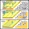
- Watershed monitoring earthscience m.png 572 × 360; 143 KB
- Wetlands - Wetlands Day.png 640 × 492; 333 KB
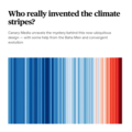
- Who really invented the climate stripes - Climate Change Education.png 600 × 600; 234 KB
- Winning on the climate legis - AOC.png 480 × 519; 249 KB
- Zack Labe - climate viz - June 2024.png 675 × 600; 261 KB
- Aquifers
- Biodiversity
- Climate Change
- Climate Policy
- Earth Imaging
- Earth Science from Space
- Ecology Studies
- Environmental Protection
- Florida
- Fisheries
- Money in Politics
- Oceans
- Planet Citizens, Planet Scientists
- Resilience
- Sea-level Rise
- Sea-Level Rise & Mitigation
- Sustainability
- Sustainability Policies
- US Environmental Protection Agency
- Water
- Wastewater Treatment
- Water Pollution
- Wildlife

