Category:Estuary
Estuaries are birthplaces of biodiversity and nurturers of successive generations of life
The Gulf of Mexico is one of the largest estuarine regions in the world, with more than two hundred estuaries (more than one quarter of all North American estuaries) occupying nearly eight million acres around its shores...
Estuaries: "Cradles of Life"
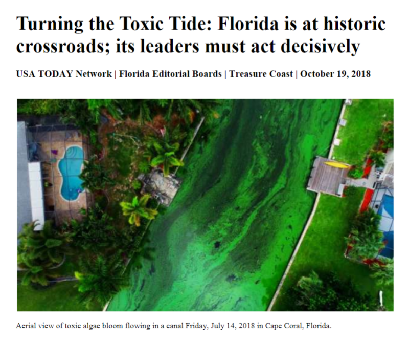
GreenPolicy360: The Florida peninsula, our home base, is a case study in understanding the immense, incalculable value of estuaries, wetlands and 'living coastlines' -- and the losses and damage being inflicted by out-of-control development and ignored environmental protections that have, for over a century, combined to devastate coastal environments and wildlife. The consequences of destruction of the natural environments are now coming into full view -- polluted waters, loss of species, 'red tide', fish kill offs, fisheries lost, mangrove coastal protections removed as more extreme, climate-induced hurricanes and extreme weather threaten, the list of damages goes on and on... our future and 'quality of life' are increasingly at risk.
Estuaries and wetlands, bays and watersheds, should be seen as "The Commons".
Together we must act more vigorously to protect our clean water, our living environments, our vital natural resources.
🌎
Estuary: Latin antecedent, Aestuarium, which means "tidal place". Central to these marine systems is a dynamic exchange between seawater and freshwater, the latter pouring in from a stream, river, or overland runoff.
The sixty-five rivers that trundle out into the Gulf collaborate in the cultivation of a nearly solid band of estuaries that runs its shores. Bearing nutrient-provisioned sediment, the flowing freshwater stirs its charge into the salty sea tide. This brackish broth stimulates spectacular vegetable and animal growth, setting a table for hungry wildlife...
Oh the water, water of life....
bays
bayous
coves
deltas
inland waterways
inlets
islands
lagoons
littoral zones
marshes
peninsulas
seas of grass
sounds (Hola Feather Sound)
tidal pools
underground springs
wetlands
the Gulf region has no shortage of all of these...
we among the world's most productive habitats.... estuaries
🌎
A Model of Green Best Practices; the Tampa Bay Estuary Program
- Protecting and Preserving Living Estuaries
Stopping those toxic/fertilizer/pollution runoffs from Lawns... Lawns
2019-2021 Tampa Bay 'State of the Bay' Report
Our local GreenPolicy360 organizing focusing on our estuary:
Tampa Bay Estuary Program (TBEP)
- 'Partnership for a Healthy Bay'
Living Coastlines, Living Shorelines
GreenPolicy360: Let's look now at the Tampa Bay estuaries, a system of waterways connected along the west central coast of Florida. The terrestrial home base of GreenPolicy360 is in Clearwater, a few meters from Bay waters and although the city's name is "clearwater", a regional struggle to clean the polluted water then protect the coastal waterways and the Bay with its estuaries has been a decades-long fight. Fortunately, due to environmental activism that has been led by forward-looking local citizens and public interest organizations like the Tampa Bay Estuary Program, a model of eco-activism.
History of the Tampa Bay Cleanup
- Progress Amid Setbacks: Water Quality Is an Ongoing Challenge
Via WUSF / August 2022
After decades of pollution suffocated Tampa Bay and killed half its seagrass and much of its marine life, unprecedented political cooperation and hundreds of science-guided projects brought the estuary back to life. Tampa Bay became a symbol for the success of the Clean Water Act of 1972, but seagrasses and fish have begun to die again.
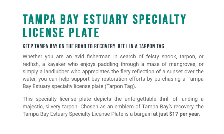
Keep Tampa Bay on the Road to Recovery
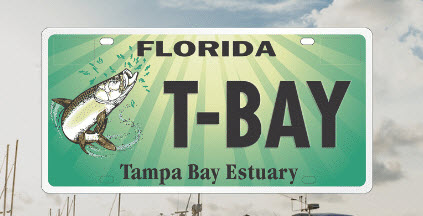
The Tarpon Tag
* https://tbep.org/get-involved/tarpon-tag/
Tampa Bay Estuary specialty Florida license plate
GreenPolicy360 siterunner:
I was told by two old fisherman as they fished estuary waters outside our office alongside Tampa Bay that "Tarpon used to grow up here".
”[Doc Ford] noticed something in the distance—something glittering, energized, rolling across the calm like a boat wake: a school of tarpon coming toward him; a dozen or more fish moving in a tight pod. Their big tails were throwing water; their chromium scales threw sunlight…. Ford stood watching, loving it.” -- Randy Wayne White, 'Sanibel Flats'
"The tarpon changed the destiny of this coast." --Randy Wayne White
"The fish is Megalops atlanticus, an archaic, cow-eyed, thick-jawed feeding machine that can reach eight feet in length and weigh 250 pounds. Tourists call it “tar-pon.” The rest of us say “tarp-in.”"
Data Visualization
Explore the Tampa Bay Estuary Program (TBEP) data visualization portal
Data for decision makers
The TBEP open science framework ensures that the region’s ongoing data collection efforts and trusted scientific research are transparent, reproducible, and discoverable. These data visualization tools summarize complex information and bridge the research-management divide, providing actionable science to support evidence-based decision making for the benefit of a healthy Tampa Bay. We monitor and report on a suite of indicators to measure progress toward meeting CCMP goals and priorities.
At the core of our open science framework is the tbeptools software package for the R programming language. This open-source package includes all necessary tools to import data, analyze results, and plot the outcomes. Visit the tbeptools data viz page for more information.
GIT HUB for Tampa Bay Estuary Program
🌎
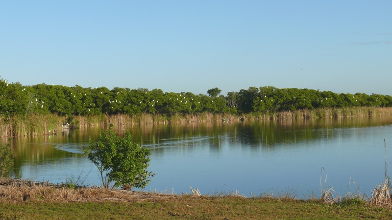
Estuary Photo, Feather Sound, Florida, 2014, by Steve Schmidt
Remember that, in the old days before the deluge of humans to southern most U.S. state, the west coast of Florida was the richest imaginable natural wonderland...
Wherever one looked, wherever one went there was a treasure of life, biodiversity we call it know, myriad interconnected species and ecosystems.
Jack E. Davis, in the Pulitzer-award winning book The Gulf chronicles this early history of Florida.
Davis explains how the wildlife was everywhere... the estuaries, the wetlands, the near-shore waters, the inlets, the intercoastal tidal ecosystems were teeming with life.
🌎
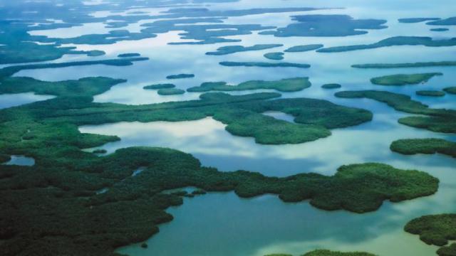
- Photo: Advertisement offering kayaking adventures through 'rich in life' intercoastal waters surrounding the tip of the Florida peninsula
🌎
🌎
Florida's Wetlands in Grave Danger: "Paving Paradise"
In an award-winning newspaper series, two investigative reporters from the St. Petersburg Times chronicled how federal rules meant to protect the nation's wetlands were more illusion than law. Now, that series has been expanded into a book, delving into how we got to this point, starting with land speculators making waterfront property out of sand dredged from the bottom of the ocean. Now, read how the nation's wetlands protections were formed in clashes between developers, bureaucrats, judges, activists and con artists over Florida swamps.
Published by the University Press of Florida / 2009
U.S. -- A Case Study of How One State, Florida, Represents the Failures of Environmental Protection
This is an exhaustive, timely and devastating account of the destruction of Florida's wetlands, and the disgraceful collusion of government at all levels. It's an important book that should be read by every voter, every taxpayer, every parent, every Floridian who cares about saving what's left of this precious place.” -- Carl Hiaasen
"Craig Pittman and Matthew Waite pulled the lid off federal and state wetlands regulation in Florida and peered deep into the cauldron of 'mitigation,' 'no net loss,' 'banking,' and the rest of the regulatory stew. For anyone interested in wetlands generally, and in Florida environmental issues in particular, this is an eye-opening, must-read book."--J. B. Ruhl
Since 1990, every president has pledged to protect wetlands, and Florida possesses more than any state except Alaska. And yet, since that time Florida has lost more than 84,000 acres of wetlands that help replenish the water supply and protect against flooding.
How and why the state’s wetlands are continuing to disappear is the subject of Paving Paradise. Journalists Craig Pittman and Matthew Waite spent nearly four years investigating the political expedience, corruption, and negligence on the part of federal and state agencies that led to a failure to enforce regulations on developers. They traveled throughout the state, interviewed hundreds of people, dug through thousands of documents, and analyzed satellite imagery to identify former wetlands that were now houses, stores, and parking lots.
The result was an award-winning series, "Vanishing Wetlands," of more than twenty stories in the St. Petersburg Times, exposing the unseen environmental consequences of rampant sprawl. Expanding their work into book form in the tradition of Michael Grunwald's The Swamp, Pittman and Waite explain how wetland protection has become a taxpayer-funded program that creates the illusion of environmental protection while doing little to stem the tide of destruction.
"Vanishing Wetlands" / St. Petersburg Times
Statistics gathered by the Times investigative series, "Vanishing Wetlands," documents that legally responsible regulators, the U.S. Army Corp of Engineers rejected only one of the more than 12,000 applications to destroy Florida wetlands between 1999 and 2003..
~
It began with a tip about a report from the National Academy of Sciences titled "Compensating for Wetland Losses Under the Clean Water Act." A real page turner.
Craig Pittman, who had been covering environment issues for The St. Petersburg Times for five years, was blown away by the document's indictment of the U. S. Army Corps of Engineers. He figured it was time to cover the statewide picture, not just report one loss at a time as wetlands disappeared.
When he checked the Corps' website, he discovered that more wetland destruction permits were being issued in Florida than in any other state and Florida had lost more wetlands than any other state.Thousands of acres had been bartered off to developers, never mind that yards in the new subdivisions could sprout cypress trees and float septic tanks.
A national policy of "no net loss" had been established in 1989. Clearly, the policy was in shambles. Wetlands in Florida were being converted to concrete jungle. More homes for people rather than alligators or panthers, more stores, more parking lots and more roads leading to more of the above. The Corps' mission: development enablers.
Although the Corps uses Geographic Information Systems to pinpoint wetlands, it didn't take long for Pittman to discover that the data were unreliable. His search for a GIS guru led to Matt Waite, a metro G.A. from one of the Times' bureaus assigned to computer-assisted reporting. The two teamed up to learn the technology and to begin the tussle for federal agency data.
Since the Corps' data were less than useful, Waite came up with a way to go after the story using satellite-imagery analysis. He had to take a couple of courses in remote sensing at the local university just to understand how to compute the number of acres lost. It took nearly a year to analyze where paradise had been paved.
The duo's investigative report ran May 22-23, 2005. Additional stories followed. Pittman and Waite won SEJ's top reporting awards in 2006 and 2007 for their exposé of the illusion of wetlands protection. The expanded book-length tale, 17 chapters with two appendices explaining the authors' complex methodology and a useful list of remote sensing sources, could have been called: "Tides of Destruction," "They Couldn't Say No," "A Landscape of Greed, Lies and Incompetence" or maybe "Swamped by Sprawl..."
Craig Pittman speaks at Stetson Law School
Award-winning St. Petersburg Times journalist Craig Pittman presented the Summer 2009 Biodiversity Lecture on June 22 at Stetson’s Tampa Law Center.
- https://youtu.be/gQSZotZ1AIs (Video)
🌎
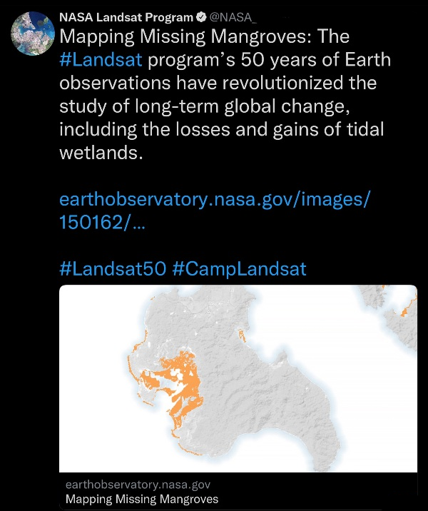
GreenPolicy360: Using the earth observation capabilities that are now becoming widely available, Craig Pittman discusses how satellite imagery was used to study Florida’s wetlands. The database of satellite 'before and after' digital scanning imaging documents profound changes and losses to wetlands, with resulting losses to wildlife, biodiversity, and natural eco-systems. The damage is generational as the consequences range from more vulnerable coastline/shorelines as extreme weather events/hurricanes surge inland with new destructive force as nature's resilient-to-surge flooding barriers are removed. The role of wetlands in cleaning fresh water, throughout Florida, as wetlands recharge aquifers is being lost. Wetlands are interconnected to environmental health in immeasurable ways that science is realizing. Craig Pittman and Matthew Waite reveal the deep threat Florida, and Florida politics, faces and must deal with now before losses become irreversible. One way to protect wetlands is through what we call a "Living Coastline" ...
"Living Coastlines, Living Shorelines"
GreenPolicy360: Join Our "Living Coastlines, Living Shorelines" Action
Managed Wetlands Can Protect Shorelines and Communities
Eco-system Designs (e.g. Mangrove biospheres) Are Natural Solutions
Eco-systems Proved Defense Against Hurricanes/Typhoons/Extreme Weather/Ocean Surges/Flooding
Eco-systems Managed with Local Support Can Work Better than Sea Walls and Constructed Barriers
GreenPolicy360: With a special thanks to a 'father' of Landsat - Rep. George E. Brown
🌎
Pages in category "Estuary"
The following 5 pages are in this category, out of 5 total.
Media in category "Estuary"
The following 64 files are in this category, out of 64 total.
- A scorching year, what about the 360 warming data.jpg 600 × 706; 106 KB
- A War on Science.png 800 × 389; 705 KB
- Bill Nye The Planet's on Fire.jpg 800 × 675; 106 KB
- Climate Legacy of Biden.jpg 600 × 687; 265 KB
- Climate News Dec 4 2023 in Dubai.png 800 × 1,037; 649 KB
- Climate Plans Enforcement - Resources - GreenPolicy.png 768 × 897; 686 KB
- Climate poll - Florida.png 640 × 267; 36 KB
- COP28 News - Dec 13 2023.png 800 × 898; 410 KB
- Cradle of Civilization - and climate change.jpg 640 × 360; 70 KB
- EarthScience Missions via the EOS - 2022.png 800 × 219; 139 KB
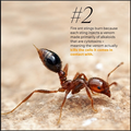
- EO and Fire Ants in the US - on World Wildlife Day.png 768 × 811; 663 KB
- EO Snapshot 6-29-2016 10-44-49 AM.png 839 × 768; 907 KB
- ESG Fight - Feb 2023.png 396 × 194; 88 KB
- Estuary in Clearwater on Tampa Bay.jpg 3,584 × 2,016; 1.5 MB
- Eukaryotic Cell SCU.jpg 716 × 1,024; 799 KB
- Fire Ants.png 601 × 600; 603 KB
- Floating adaptations - GCA - for sea-level rise - circa 2023.png 600 × 732; 273 KB
- Florida via NASA 2022.png 800 × 1,020; 1.12 MB
- Florida Wildlife Corridor - 2022 illustration.png 800 × 628; 473 KB
- Florida Wildlife Corridor FLWC Water Benefits December 2022.png 768 × 886; 109 KB
- Global Climate Change textbook-Edition2.jpg 604 × 680; 96 KB
- GreenPolicy360 - May-10-2024.png 790 × 694; 320 KB
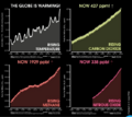
- Huge heat anomaly in 2023 - by Gavin Schmidt.png 735 × 857; 172 KB
- Hurricane-Proofing-Home-2024-Miami-Florida.png 658 × 600; 652 KB
- James Hansen 2024.jpg 600 × 658; 110 KB
- Leah Stokes - UCSB - Prof Climate and Energy Policy.png 640 × 476; 295 KB
- Mapping changes in global temperature 1850-2022.png 656 × 680; 180 KB
- Mauna Loa-NOAA-Keeling Curve data at risk.png 800 × 730; 352 KB
- NDCs 2025.png 600 × 722; 403 KB
- NOAA - NCEI report on US temps 2023-2024.jpg 600 × 561; 109 KB
- NOAA extreme weather events charting.png 663 × 600; 288 KB
- NOAA report on heat records broken in US - 2023.jpg 600 × 480; 229 KB
- Oceans hottest in 2022.png 800 × 501; 358 KB
- Our Fragile Moment.jpg 612 × 480; 80 KB
- Our Fragile Moment.png 301 × 448; 360 KB
- Planet Dove satellite image over Dubai.png 800 × 791; 1.58 MB
- Planetary-Scale Threat.jpeg 640 × 593; 101 KB
- Record tumble - climate change.png 727 × 333; 27 KB
- Remembering E.O. Wilson and Thomas Lovejoy.jpg 640 × 327; 56 KB
- Republican Party 2024 Climate Strategy.png 589 × 344; 44 KB
- Shell lawsuit Feb 2023.png 768 × 534; 229 KB
- T-Bay Estuary.jpg 423 × 216; 29 KB
- Telling stories of solutions for the climate crisis.jpg 600 × 640; 121 KB
- Temperature - SST World via Climate Change Institute - 2023 chart.png 800 × 509; 144 KB
- Temperature World - chart via Climate Change Institute.jpg 800 × 509; 67 KB
- Ten thousand islands -- Marco island.jpg 640 × 360; 30 KB
- The Climate Dictionary - as of 2023.png 600 × 727; 200 KB
- The Gulf.jpg 327 × 498; 31 KB
- The Trump cabinet picks positions on climate.jpg 556 × 480; 110 KB
- Timeline-climate-change-history-485-million years.jpg 800 × 276; 42 KB
- Tipping Points.png 320 × 388; 71 KB
- Trump promise to oil ceo gathering - 1.png 440 × 108; 19 KB
- Trump promise to oil ceo gathering - 2.png 480 × 495; 291 KB
- Trump promise to oil ceo gathering - 3.png 480 × 284; 270 KB
- Trump promise to oil ceo gathering - 4.png 480 × 480; 333 KB
- Update - James Hansen July 2023 'We are fools'.png 595 × 800; 610 KB
- US Election 2024 impacts our climate legacy.png 600 × 800; 719 KB
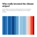
- Who really invented the climate stripes - Climate Change Education.png 600 × 600; 234 KB
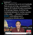
- Winning on the climate legis - AOC.png 480 × 519; 249 KB
- Zack Labe - climate viz - June 2024.png 675 × 600; 261 KB
- Biodiversity
- Biogeosciences
- Biosphere
- Climate Policy
- Earth Science
- Eco-ethics
- Environmental Protection
- Florida
- GreenPolicy360
- Money in Politics
- Natural Resources
- Natural Rights
- Nature
- Ocean Science
- Planet Citizens
- Planet Citizens, Planet Scientists
- Sea-Level Rise & Mitigation
- Seventh Generation Sustainability
- Toxics and Pollution
- Water Pollution
- Water Quality
- Wetlands

