Category:Antarctica
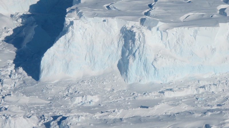
Thwaites Glacier, Antarctica
2019
What Happens in the South Doesn't Stay in the South
• Via National Geographic / Watching Thwaites Glacier Up Close and Personal by Elizabeth Rush
The Thwaites Glacier is often considered one of the most important when it comes to changes in sea level....
Along with Thwaites the overwhelming majority of the world’s glaciers have begun to withdraw...
Lately, I have been wondering if it might be possible to think of calving events as both a physical sign of the cracks our very lives press into the ice and also, as the definition suggests, a kind of birth. A rapturous moment where we might glimpse the opportunities that come with inhabiting an age of earth-shaking transformation, transformation that some human beings more than others set in motion, and that we, all of us together, have the power to slow and to shape.
The calving event in the unnamed bay is another sign that Thwaites is giving way, that the very thing we feared might come to pass looks like it might already be underway. The extent to which what follows breeds only further devastation or a shift in how we choose to inhabit the Earth, that much is, at least partially, up to us. Perhaps these bergs peeling away from Thwaites are sentinels urging us towards new politics (enter Flood Forum USA, a nation-wide coalition of flood survivors that are fighting for more just storm recovery, and the Green New Deal, its increasing supporters insisting that equity be chief among its guiding principles), new ways of relating to each other and the more-than-human-world.
On the bridge there is a hand-made sign tacked above the outdated navigational charts. It reads Never forget: The ice is telling you what to do and not you are telling the ice what to do. Thwaites speaks, its calving a message we must now labor to hear.
Elizabeth Rush is the author of Rising: Dispatches from the New American Shore. She teaches creative nonfiction at Brown University. This article was supported by a National Geographic Storytelling Grant, the National Science Foundation’s Antarctic Artist and Writer in Residence program.
Scientists Detect an Enormous Cavity Growing Beneath Antarctica
- http://advances.sciencemag.org/content/5/1/eaau3433
- https://www.news.com.au/technology/environment/climate-change/thwaites-glacier-has-an-enormous-cavity-beneath-it-melted-by-warm-ocean-waters/news-story/d76c01e23593eab1d85324db89c3cd79
- Researchers say the cavity would once have been large enough to hold some 14 billion tonnes of ice. Even more disturbing, the researchers say it lost most of this ice volume over the last three years alone.
- "We have suspected for years that the Thwaites glacier was not tightly attached to the bedrock beneath it," says glaciologist Eric Rignot from the University of California, Irvine, and NASA's Jet Propulsion Laboratory (JPL) in Pasadena, California.
- "Thanks to a new generation of satellites, we can finally see the detail."
- "For global sea-level change in the next century, this Thwaites glacier is almost the entire story."
- Rignot and fellow researchers discovered the cavity using ice-penetrating radar as part of NASA's Operation IceBridge, with additional data supplied by German and French scientists.
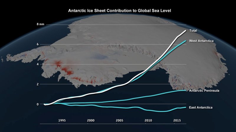
- Antarctica is losing ice 6 times faster today than in 1980s
- Antarctic melting study... 'reasons for concern'
Read this research data thread and Antarctic sea-level rise connection from @chriscmooney, environmental reporter from the Washington Post:
- ·················································································································
Scientists release the most accurate, high-resolution terrain map ever created (2018)
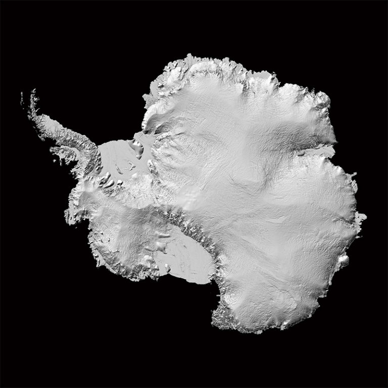
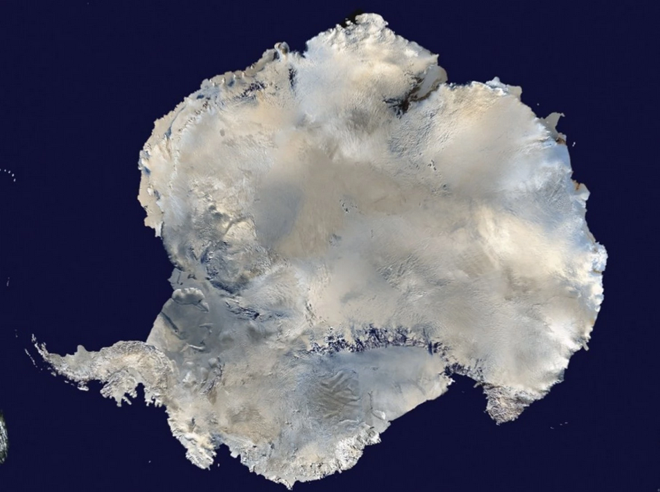
- The new Antarctic map shows a resolution of 2 to 8 meters – compared to the previous standard of 1,000 meters.
Reference Elevation Model of Antarctica / Release 1
Accurate Antarctica / Phys.org
Large-format poster map of the Reference Elevation Model of Antarctica (REMA), rendered with a hillshade. Does not include any cartographic elements.
http://maps.apps.pgc.umn.edu/id/2364
Large-format poster map of the Reference Elevation Model of Antarctica (REMA), rendered with a hillshade. Includes cartographic elements such as place name labels, graticules...
http://maps.apps.pgc.umn.edu/id/2365
Use the links below to browse the directory for the entire REMA dataset. Refer to Documentation to see the directory structure, naming schemes, and download contents.
HTTP: http://data.pgc.umn.edu/elev/dem/setsm/REMA
FTP: ftp://ftp.data.pgc.umn.edu/elev/dem/setsm/REMA
"Considering that Antarctica is the highest, driest, and one of the most remote places on Earth, we now have an incredible topographic model to measure against in the future," said Paul Morin, a University of Minnesota earth sciences researcher and the director of the Polar Geospatial Center.
"Up until now, we've had a better map of Mars than we've had of Antarctica," said Ian Howat, professor of earth sciences and director of the Byrd Polar and Climate Research Center at The Ohio State University. "Now it is the best-mapped continent on Earth."
"It is the highest-resolution terrain map by far of any continent,’ said Ian Howat, professor of Earth sciences and director of the Byrd Polar and Climate Research Center at The Ohio State University.
- ·······································································
- Antarctic Treaty System
- NASA IceBridge Antarctica
- Antarctica's Flowing Ice
····················································································
2018
Antarctic Melt Needs to be Monitored More Closely
··········
2017
- How active are newly discovered Antarctic volcanoes?
- A new volcanic province: an inventory of subglacial volcanoes in West Antarctica
- ...the biggest cluster of volcanoes in the world.
The study, published in the Geological Society Special Publications series, does not indicate whether the volcanoes are active but the team is trying to find out.
As Dr. Robert Bingham, a glacier expert and one of the paper's authors noted to the Guardian, "The big question is: how active are these volcanoes?"
"That is something we need to determine as quickly as possible," Bingham continued. "Anything that causes the melting of ice—which an eruption certainly would—is likely to speed up the flow of ice into the sea."
Ominously, other experts have warned that a reverse situation could also happen — volcanic activity can be triggered by thinning ice sheets from rising global temperatures.
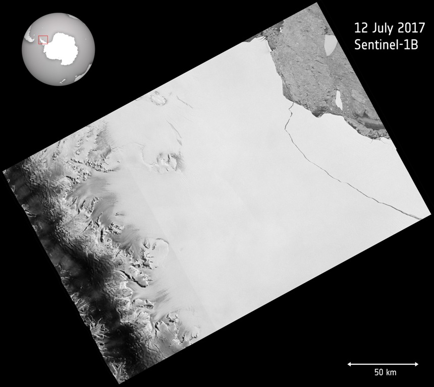
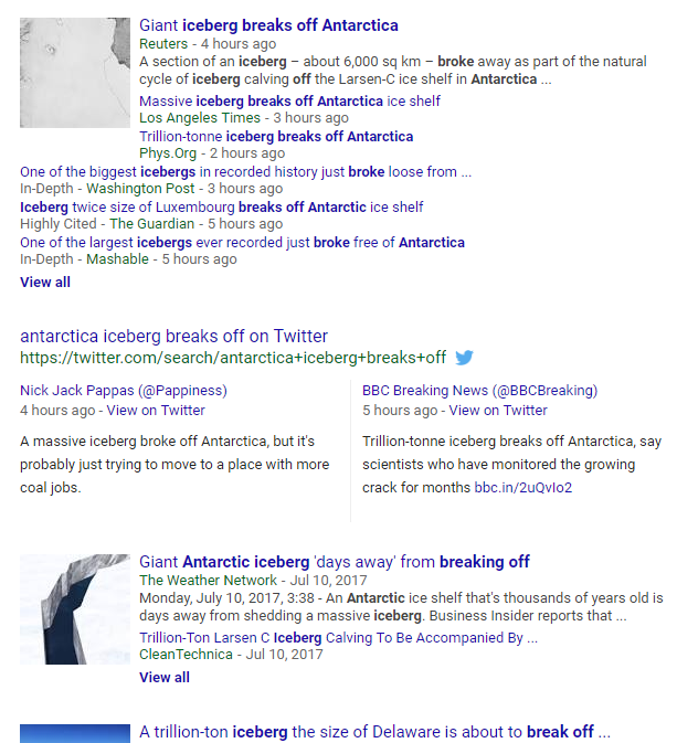
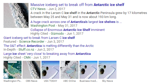
Trillion Ton Iceberg Breaks Off
- _____________________________________________________________________
- ___________________________________________________________
- The Future of the US Antarctica Station and Research
Subcategories
This category has the following 4 subcategories, out of 4 total.
C
E
S
Pages in category "Antarctica"
The following 31 pages are in this category, out of 31 total.
C
E
G
- Glasgow Climate Summit - Pledges, Promises, Declarations - What's Next Up
- Global Climate Action Summit
- Green Stories of the Day
- Green Stories of the Day - GreenPolicy360 Archive
- GreenPolicy360 Archive Highlights 2013
- GreenPolicy360 Archive Highlights 2014
- GreenPolicy360 Archive Highlights 2015
- GreenPolicy360 Archive Highlights 2016
- GreenPolicy360 Archive Highlights 2017
- GreenPolicy360 Archive Highlights 2018
- GreenPolicy360 Archive Highlights 2019
- GreenPolicy360 Archive Highlights 2020
- GreenPolicy360 Archive Highlights 2023
S
T
Media in category "Antarctica"
The following 184 files are in this category, out of 384 total.
(previous page) (next page)- ICESAT mission.png 640 × 271; 319 KB
- IEA - Support for Fossil Fuels - re 2021.jpg 559 × 800; 143 KB
- IEA News 1.jpg 480 × 400; 64 KB
- IEA News 2.jpg 480 × 475; 55 KB
- IEA News 3.jpg 480 × 496; 57 KB
- IEA News 4.jpg 480 × 530; 57 KB
- IEA News 5.jpg 480 × 539; 62 KB
- Inhofe and the Snowball.png 640 × 329; 396 KB
- IPCC Report - Feb 2022.jpg 448 × 291; 113 KB
- IPCC report August 9-2021 (1).jpg 745 × 380; 156 KB
- IPCC report August 9-2021 (2).jpg 745 × 428; 171 KB
- It's Hot the Times UK Says... Act Now or else - July 2022.png 800 × 416; 568 KB
- James Hansen 2024.jpg 600 × 658; 110 KB
- James Inhofe -- and Project 2025.png 640 × 670; 566 KB
- January-May 2020 temp anomaly.jpg 680 × 380; 54 KB
- Jerry Brown re EPA - 19 June 2019.jpg 699 × 798; 126 KB
- Jerry Brown-Climate Week, NYC, Sept2018.jpg 800 × 534; 242 KB
- Jerry Brown-Global Climate Action Summit.png 800 × 453; 900 KB
- Jerry-Brown-quote.jpg 800 × 552; 69 KB
- John Kerry - Climate Envoy - 2021-09-26.png 640 × 410; 349 KB
- Journey of a Climate Pixel - May 2022.png 800 × 399; 114 KB
- June 2019 - NASA GISS data - hottest on record.jpg 640 × 560; 58 KB
- Katharine Hayhoe - Nov 26, 2019.jpg 508 × 466; 80 KB
- Lamar accuses March 2017.png 800 × 439; 245 KB
- Lamar re science and Trumps truth.png 627 × 607; 206 KB
- Lamar Smith Denial Offensive.png 393 × 307; 224 KB
- Lamar's science.png 584 × 537; 204 KB
- Launching soon.png 657 × 468; 225 KB
- LDCs face the climate crisis, raise the alarm - Nov 2021.png 419 × 226; 126 KB
- Leah Stokes - UCSB - Prof Climate and Energy Policy.png 640 × 476; 295 KB
- Like a speeding freight train.png 640 × 600; 492 KB
- LMDCs make their case at the Glasgow climate summit.png 427 × 480; 259 KB
- Manchin kills the Biden climate plan.jpg 800 × 438; 71 KB
- Manchin News - Dec 20 2021.png 600 × 588; 307 KB
- Manchin News 2 - Dec 20 2021.png 600 × 600; 329 KB
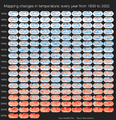
- Mapping changes in global temperature 1850-2022.png 656 × 680; 180 KB
- Mascot for Glasgow intl climate conference.jpg 575 × 396; 76 KB
- Maya Lin Ghost Forest 5-17-2021.jpg 618 × 454; 123 KB
- McKibben 350.org logo.jpg 300 × 170; 7 KB
- McKibben re Manchin - Dec 2021.png 370 × 368; 261 KB
- Methane cuts pledge - COP27.png 399 × 336; 164 KB
- Methane emissions to be cut - COP26 pledges.png 640 × 464; 140 KB
- Methane Reduction proposal passes in EU Parliament - May 2023.png 620 × 600; 552 KB
- MethaneSat - 1.jpg 350 × 336; 58 KB
- MethaneSat - 2.PNG 448 × 336; 172 KB
- MethaneSat - 3.PNG 448 × 303; 248 KB
- Methods to enforce climate pledges-NDCs - Dec 2021.png 539 × 480; 333 KB
- Michael E Mann -- act with hope not fear.jpg 720 × 1,024; 122 KB
- Michael E Mann, act with hope not fear.jpg 1,246 × 1,772; 256 KB
- Michael Mann - Susan Joy Hassol after Glasgow.jpg 460 × 1,616; 299 KB
- Monitoring Greenhouse Gases from Satellite Missions 2021-2030.png 801 × 386; 143 KB
- Montreal Protocol - effects study 2021.jpg 640 × 401; 76 KB
- Moving to Higher Ground.png 568 × 473; 307 KB
- Mulvaney says no lifestyle change.jpg 561 × 779; 128 KB
- NASA co2-graph-061219.jpg 800 × 500; 214 KB
- National Climate Pledges Must Be Enforced.png 800 × 520; 122 KB
- National Climate Task Force - first mtg Feb 11 2021.jpg 591 × 654; 144 KB
- NationalGeographic SouthPole melt West Antarctica 2016.jpg 630 × 438; 89 KB
- NDC Tracker - 2020.jpg 800 × 340; 50 KB
- New Climate Model.jpg 777 × 412; 70 KB
- New Definitions of National Security.png 447 × 198; 9 KB
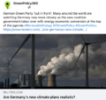
- New German government announces far reaching climate plans.png 632 × 600; 446 KB
- NOAA Climate.Gov.png 589 × 99; 7 KB
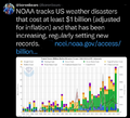
- NOAA extreme weather events charting.png 663 × 600; 288 KB
- NOAA undergoes political changes - Oct 2020.jpg 800 × 719; 135 KB
- Nobel Prize 2021.jpg 551 × 473; 212 KB
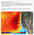
- North America West Coast hot - Aug 2023.png 484 × 501; 308 KB
- Not to worry 2016.png 539 × 401; 347 KB
- NYT - Nov 1 - Day 1 headlines from Glasgow Climate Summit.png 600 × 800; 103 KB
- Oceans hottest in 2022.png 800 × 501; 358 KB
- Oct 21, 2021 - On Eve of International Climate Summit.jpg 733 × 466; 119 KB
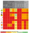
- Oil gas climate change response plans - circa 2022.png 729 × 837; 335 KB
- Oil profits and US gas prices.png 378 × 336; 163 KB
- On the heat beat... NYT reporting-June 21 2024.png 613 × 649; 147 KB
- Our Biggest Experiment - by Alice Bell.jpg 333 × 499; 40 KB
- Our Fragile Moment.jpg 612 × 480; 80 KB
- Our Fragile Moment.png 301 × 448; 360 KB
- Paleoclimate-at the Museum of Natural History-2.png 800 × 449; 418 KB
- Per capita CO2 emissions - to 2020.png 640 × 442; 153 KB
- Picturing Earth from the International Space Station.jpg 800 × 470; 112 KB
- Planet Dove satellite image over Dubai.png 800 × 791; 1.58 MB
- Planet Earth temperature taking - a recent history.png 800 × 584; 618 KB
- Politics and Science in the House un-Science Committee.png 619 × 352; 198 KB
- Pope meeting with oil execs - June 2019.png 640 × 360; 589 KB
- Production Gap - productiongap.org.png 600 × 762; 225 KB
- Production Gap - UN report on fossil fuel production.png 600 × 664; 342 KB
- Race to Zero - circa January 2022.png 480 × 591; 138 KB
- RacetoZero - Dec 2020 UNFCCC.jpg 585 × 518; 95 KB
- Record tumble - climate change.png 727 × 333; 27 KB
- REMA Antarctica 9-7-2018.png 800 × 419; 377 KB
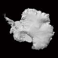
- REMA-hillshade-rendering-800px-768x768.jpg 768 × 768; 75 KB
- Republican Party 2024 Climate Strategy.png 589 × 344; 44 KB
- Rising Seas, refugees, Phys.org Land Use July 2017.png 488 × 385; 190 KB
- Saudi Arabia and Middle East - Hot in May 2024.png 640 × 410; 506 KB
- Scale of energy use-2000-2016.jpg 800 × 673; 69 KB
- School strike for climate countries.png 800 × 411; 106 KB
- Science & Solutions - 2020 - Project Drawdown - NCSE Conf.jpg 800 × 351; 56 KB
- Science & Solutions - 2020 - Project Drawdown - NCSE.jpg 800 × 261; 66 KB
- Science and Climate Hearing March29,2017.png 800 × 281; 240 KB
- SCOTUS EPA decision - June 30 2022.jpg 794 × 778; 168 KB
- Sea Wall of Miami +++.jpg 526 × 220; 48 KB
- Sea-Level Rise Twice as High as Previously Predicted.png 701 × 225; 92 KB
- Shell lawsuit Feb 2023.png 768 × 534; 229 KB
- Short Circuiting Policy - by Leah Stokes.jpg 595 × 423; 94 KB
- Slash emission now or face climate disaster.jpg 800 × 579; 94 KB
- Solar panel price - 1976-2019.png 596 × 612; 92 KB
- South Florida Floodwaters.png 640 × 449; 251 KB
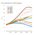
- SSP Baselines-projections 2018-2100.png 393 × 406; 42 KB
- State of the paris agreement nov2019.jpg 800 × 570; 178 KB
- Story telling and science education.png 515 × 480; 171 KB
- StratDem Strategic Demands.png 768 × 1,024; 626 KB
- Strike - Sept 20.jpg 754 × 754; 44 KB
- Supreme Court decision on GHG emission cost metric - May 2022.png 640 × 442; 419 KB
- Surviving Victory conf Sept20,2006.pdf ; 2.16 MB
- Telling stories of solutions for the climate crisis.jpg 600 × 640; 121 KB
- Temperature - SST World via Climate Change Institute - 2023 chart.png 800 × 509; 144 KB
- Temperature World - chart via Climate Change Institute.jpg 800 × 509; 67 KB
- Temperatures New Normal is Not Normal.jpg 582 × 461; 56 KB
- The Carbon Dioxide Theory of Climatic Change, by Gilbert Plass, 1956.jpg 798 × 1,202; 397 KB
- The Climate Dictionary - as of 2023.png 600 × 727; 200 KB
- The New Climate War - Irish Times review 2021.jpg 792 × 2,048; 373 KB
- There is no Planet B Macron to US Congress-Apr25,2018.png 800 × 781; 1,014 KB
- Thin Blue difference - approx 12 miles high.jpg 527 × 229; 37 KB
- Thin Blue difference.jpg 527 × 673; 147 KB
- Threat Environment - TBay Times Series on Climate Change Impacts.png 556 × 864; 166 KB
- Thwaites Glacier-2020.jpg 800 × 236; 37 KB
- Thwaites-West-Antarctica-Glaciers.jpg 800 × 450; 43 KB
- Thwaites.jpg 800 × 449; 103 KB
- Time for a Planet Update - Oct 31 2021.png 722 × 600; 852 KB
- Time Nov 10 2022 COP27.jpg 600 × 600; 92 KB
- Timeline-climate-change-history-485-million years.jpg 800 × 276; 42 KB
- Tipping Points - 2020.jpg 680 × 453; 65 KB
- Toles - Dali - Climate.jpg 449 × 407; 51 KB
- Too Hot - FT.png 600 × 651; 220 KB
- Too Hot in US - 2.png 800 × 221; 124 KB
- Too Hot July 17 2023.png 640 × 439; 162 KB
- Too Hot US June 2022.png 695 × 543; 483 KB
- Too Hot, a new heat record - Nov 18 2023.png 788 × 680; 680 KB
- Toward the Hothouse.png 800 × 337; 160 KB
- Tracking Biden's Environmental Record - WaPo - Feb 2021.jpg 766 × 326; 64 KB
- Tracking Biden's Environmental Record - WaPo listing - Feb 2021.jpg 588 × 397; 35 KB
- Tropical Cyclone - Hurricane Population Displacement Risks.jpg 800 × 385; 56 KB
- Trump digs coal-2.jpg 800 × 533; 46 KB
- Trump guts climate policy 3-28-2017 10-26-34 AM.png 569 × 205; 36 KB
- Trump promise to oil ceo gathering - 1.png 440 × 108; 19 KB
- Trump promise to oil ceo gathering - 2.png 480 × 495; 291 KB
- Trump promise to oil ceo gathering - 3.png 480 × 284; 270 KB
- Trump promise to oil ceo gathering - 4.png 480 × 480; 333 KB
- UN - Tipping Point for Climate Action.png 690 × 600; 601 KB
- UN Climate Summit News (1).pdf ; 1.85 MB
- UN NDC Registry - website database.png 798 × 392; 575 KB
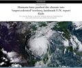
- Unprecedented report - IPCC Aug-9-2021.jpg 800 × 666; 165 KB
- Update - James Hansen July 2023 'We are fools'.png 595 × 800; 610 KB
- US Annual Temperatures 1901-2020 Average Comparison.jpg 604 × 843; 242 KB
- US EPA to reverse methane rules.jpg 592 × 745; 175 KB
- US Quits Climate Accord.jpg 795 × 233; 40 KB
- Usable climate science is adaptation science-Adam Sobel May 2021.jpg 702 × 664; 155 KB
- Venice flooding.png 530 × 516; 109 KB
- We are all in this together-IPCC report-August 2021.jpg 513 × 768; 183 KB
- We must flatten the curve, yes ... August 2020.jpg 800 × 421; 99 KB
- Wheeler-Mulvaney-repeal of Clean Power Plan-June19,2019.jpg 800 × 640; 145 KB
- When your house is on fire.jpg 589 × 473; 77 KB
- Where carbon emission come from - gleick tw 2018.jpg 640 × 460; 41 KB
- Which countries pollute the most ~2017.jpg 800 × 422; 69 KB
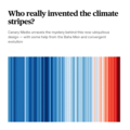
- Who really invented the climate stripes - Climate Change Education.png 600 × 600; 234 KB
- Winning on the climate legis - AOC.png 480 × 519; 249 KB
- Worlds glaciers melting faster - Nature report - Apr 2021-1.jpg 800 × 561; 94 KB
- Worlds glaciers melting faster - Nature report - Apr 2021-2.jpg 800 × 628; 108 KB
- WV v EPA SCOTUS poll - June 27 2022 before court decision.png 623 × 480; 126 KB
- Youth Climate Strikes-March15,2019.jpg 707 × 639; 159 KB
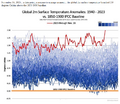
- Zack Labe - climate viz - June 2024.png 675 × 600; 261 KB
