Category:Planet API: Difference between revisions
Siterunner (talk | contribs) No edit summary |
Siterunner (talk | contribs) No edit summary |
||
| (7 intermediate revisions by the same user not shown) | |||
| Line 1: | Line 1: | ||
<addthis /> | |||
[[File:Featured.png]] | |||
<big>''An API for the Planet'' [http://t.co/dfsywixUg6 ''#PlanetLabs @Open Source Conference'']</big> | |||
[http://www.greenpolicy360.net/w/Planet_Labs_Doves_Fly '''''Planet Labs, flying Doves'''''] ''in unprecedented Flocks observing Planet Earth with 'rapid cadence' imaging opening possibilities never before offered'' | |||
[https://www.planet.com/ '''''About Planet Labs'''''] [https://www.planet.com/docs/ '''''Documentation'''''] [https://www.planet.com/docs/v0/scenes/#introduction '''''Intro'''''] | [https://www.planet.com/ '''''About Planet Labs'''''] [https://www.planet.com/docs/ '''''Documentation'''''] [https://www.planet.com/docs/v0/scenes/#introduction '''''Intro'''''] | ||
| Line 28: | Line 29: | ||
[http://www.planet.com/ Planet Labs] [https://www.planet.com/pulse/ Pulse] [http://www.greenpolicy360.net/mw/images/Doves_close-up-of-cubesats-leaving-nanoracks-deployer-2014-02-11_m.jpg] [http://www.greenpolicy360.net/mw/images/Doves_launched_from_ISS_float_against_Earth_horizon_m.jpg] [http://gizmodo.com/meet-the-flockers-iss-launches-low-cost-earth-imaging-1517232660] | [http://www.planet.com/ Planet Labs] [https://www.planet.com/pulse/ Pulse] [http://www.greenpolicy360.net/mw/images/Doves_close-up-of-cubesats-leaving-nanoracks-deployer-2014-02-11_m.jpg] [http://www.greenpolicy360.net/mw/images/Doves_launched_from_ISS_float_against_Earth_horizon_m.jpg] [http://gizmodo.com/meet-the-flockers-iss-launches-low-cost-earth-imaging-1517232660] | ||
<H2>''Citizens of the Planet'' -- ''#PlanetCitizens''</H2> | |||
| Line 60: | Line 64: | ||
[http://api-test.echo.nasa.gov/echo/apis.html ''Earth Observing System (ECHO) - Earth Science Data Information Systems API''] | [http://api-test.echo.nasa.gov/echo/apis.html ''Earth Observing System (ECHO) - Earth Science Data Information Systems API''] | ||
[http://www.nesdis.noaa.gov/about_nesdis.html ''National Oceanic and Atmospheric Administration - National Environmental Satellite, Data, and Information Service (NESDIS)''] | |||
[http://www.nesdis.noaa.gov/ '''''NOAA Data Centers'''''] | |||
: ''http://www.ncdc.noaa.gov/'' | |||
: ''http://www.nodc.noaa.gov/'' | |||
: ''http://www.ngdc.noaa.gov/'' | |||
[http://www.nnvl.noaa.gov/view/ ''NOAA View Data Exploration Tool''] | |||
____________________________________________________________________________________________________________________________________________ | ____________________________________________________________________________________________________________________________________________ | ||
| Line 88: | Line 101: | ||
____________________________________________________________________________________________________________________________________________ | ____________________________________________________________________________________________________________________________________________ | ||
=='''''Google Earth Outreach'''''== | =='''''Google Earth Outreach'''''== | ||
| Line 93: | Line 107: | ||
[[File:Rebecca Google Outreach.jpg]] | [[File:Rebecca Google Outreach.jpg]] | ||
[http://www.google.com/earth/outreach/tools/earthengine.html '''''Google Earth Engine'''''] | [http://www.google.com/earth/outreach/tools/earthengine.html '''''Google Earth Engine & Outreach'''''] | ||
''Google Earth Engine is an online environment monitoring platform that makes available to the entire world a dynamic digital model of our planet that is updated daily.'' | ''Google Earth Engine is an online environment monitoring platform that makes available to the entire world a dynamic digital model of our planet that is updated daily.'' | ||
| Line 107: | Line 121: | ||
'''''Recent Earth Outreach network extensions include --''''' | '''''Recent Earth Outreach network extensions include --''''' | ||
'''''Global Fishing Watch and Forest Watch''''' | [http://www.greenpolicy360.net/w/File:G_Earth_Outreach.jpg '''''Global Fishing Watch and Forest Watch'''''] | ||
'''''Join in !''''' | '''''Join in !''''' | ||
| Line 126: | Line 140: | ||
[[Image:GFW1a.jpeg | link=http://GlobalForestWatch.org]] | [[Image:GFW1a.jpeg | link=http://GlobalForestWatch.org]] | ||
'''''http://GlobalForestWatch.org''''' | |||
[http://www.wri.org/our-work/project/global-forest-watch '''''World Resources Institute Forest Watch'''''] | [http://www.wri.org/our-work/project/global-forest-watch '''''World Resources Institute Forest Watch'''''] | ||
[http://google-latlong.blogspot.com/2014/02/monitoring-worlds-forests-with-global.html '''''Monitoring the Planet's Forests'''''] | [http://google-latlong.blogspot.com/2014/02/monitoring-worlds-forests-with-global.html '''''Monitoring the Planet's Forests'''''] | ||
| Line 140: | Line 154: | ||
[https://plus.google.com/+StevenSchmidt1/posts/2ntxMkhNpf5 '''''Thank you Rebecca, #PlanetCitizen'''''] | [https://plus.google.com/+StevenSchmidt1/posts/2ntxMkhNpf5 '''''Thank you Rebecca, #PlanetCitizen'''''] | ||
○ ○ ○ ○ | |||
[http://www.programmableweb.com/news/google-earth-api-set-execution/2014/12/12 ''Dec 2014 News re: Google Earth API''] | [http://www.programmableweb.com/news/google-earth-api-set-execution/2014/12/12 ''Dec 2014 News re: Google Earth API''] | ||
Google promises expansion of Google Earth to other 3D mapping products after Dec 2015. As to what, and when, we'll wait and see... | ''Google promises expansion of Google Earth to other 3D mapping products after Dec 2015. As to what, and when, we'll wait and see...'' | ||
○ ○ ○ ○ | ○ ○ ○ ○ | ||
== '''''More APIs for the Planet & Connected Planet Citizens''''' == | == '''''More APIs for the Planet & Connected Planet Citizens''''' == | ||
| Line 156: | Line 173: | ||
[http://www.gbif.org/ ''Global Biodiversity Information, free and open access to biodiversity data''] - [http://data.gbif.org/terms.htm ''Global Biodiversity / Terms''] | [http://www.gbif.org/ ''Global Biodiversity Information, free and open access to biodiversity data''] - [http://data.gbif.org/terms.htm ''Global Biodiversity / Terms''] | ||
○ ○ ○ ○ | |||
[[File:Floating forest of kelp.jpg | link=http://www.greenpolicy360.net/w/Planet_Citizens,_Planet_Scientists]] | |||
; <big><big> ''Floating Forests'' </big></big> | |||
'''''Help with the Kelp, Join in''''' -- ''be a'' '''''Be a Planet Citizen, Planet Scientist''''' -- ''http://www.floatingforests.org/'' | |||
[http://earthobservatory.nasa.gov/Features/FloatingForests/page1.php ''Floating Forests - Earth Observatory/NASA-Landsat''] | |||
[http://blog.floatingforests.org/2014/08/ ''Origin of Floating Forests Project''] | |||
[http://www.greenpolicy360.net/w/Planet_Citizens,_Planet_Scientists ''Planet Citizen, Planet Scientist''] | |||
''Kyle Cavanaugh had an idea. “These forests change so rapidly and on a variety of different time scales—months to years to decades—so we needed a long record with consistent, repeated observations,” Cavanaugh said. He devised a method to use Landsat satellite data to monitor kelp forests. | |||
''A few things made Landsat an obvious resource. Since the 1970s, the satellites have had a regular collection schedule (twice monthly). Their data and images are managed by the U.S. Geological Survey and are reliably stored in an archive that dates back more than forty years. And Landsat’s images are calibrated, or standardized, across different generations of satellites, making it possible to compare data collected across several decades... | |||
''Landsat measures the energy reflected and emitted from Earth at many different wavelengths. By knowing how features on Earth reflect or absorb energy at certain wavelengths, scientists can map and measure changes to the surface. The most important feature for the kelp researchers is Landsat’s near-infrared band, which measures wavelengths of light that are just outside our visual range. Healthy vegetation strongly reflects near-infrared energy, so this band is often used in plant studies. Also, water absorbs a lot of near-infrared energy and reflects little, making the band particularly good for mapping boundaries between land and water. | |||
''“The near-infrared is key for identifying kelp from surrounding water,” Cavanaugh explained. “Like other types of photosynthesizing vegetation, giant kelp have high reflectance in the near infrared. This makes the kelp canopy really stand out from the surrounding water.” | |||
○ | |||
''After a recent meeting on kelp forests and climate change, researchers Byrnes, Cavanaugh, and other colleagues set out to consolidate all of the available kelp forest data from around the world. They wanted to take a step toward understanding how climate change is affecting kelp globally, but they quickly discovered they had a sparse patchwork of information. | |||
''Byrnes was struck with a thought. They had used Landsat to expand their studies across time, so why not use Landsat to expand their studies around the world? Could Landsat be used to establish global trends in kelp forest extent? The answer was yes, but the problem was eyeballs. | |||
''Unlike research on terrestrial vegetation—which uses Landsat data and powerful computer processing arrays to make worldwide calculations—distinguishing kelp forests requires manual interpretation. While kelp forests pop out to the human eye in near-infrared imagery, computers looking at the data numerically can confuse kelp patches with land vegetation. Programs and coded logic that separate aquatic vegetation from land vegetation can be confounded by things like clouds, sunglint, and sea foam... | |||
''"Automated classification methods just don’t produce acceptable levels of accuracy..." | |||
''Byrnes and Cavanaugh put together a science team and joined with '''Zooniverse''', a group that connects professional scientists with citizen scientists in order to help analyze large amounts of data. The result was the Floating Forests project. | |||
''https://www.zooniverse.org/#climate'' | |||
''https://www.zooniverse.org/#nature'' | |||
''The Floating Forest concept is all about getting more eyeballs on Landsat imagery. Citizen scientists—recruited via the Internet—are instructed in how to hunt for giant kelp in satellite imagery. They are then given Landsat images and asked to outline any giant kelp patches that they find. Their findings are crosschecked with those from other citizen scientists and then passed to the science team for verification. The size and location of these forests are catalogued and used to study global kelp trends. | |||
'''''Join in!''''' | |||
| Line 162: | Line 224: | ||
'''''Planet API''''' | #PlanetAPI | '''''Planet Citizen''''' | #PlanetCitizen | '''''Planet API''''' | #PlanetAPI | '''''Planet Citizen''''' | #PlanetCitizen | ||
'''''GreenPolicy360''''' | #Earth360 | #EarthImaging | #EarthMonitoring | '''''GreenPolicy360''''' | #Earth360 | #EarthImaging | #EarthMonitoring | ||
'''''GP360''''' | #EarthObservations | #EarthScience | #NewSpace | |||
''''' | [http://www.planetcitizen.org '''''www.planetcitizen.org'''''] | [http://www.earthpov.com '''''www.earthpov.com'''''] | ||
○ ○ ○ ○ | |||
[[Category:Earth Observations]] | |||
[[Category:Earth Science]] | |||
[[Category:Global Security]] | |||
[[Category:Internet]] | |||
[[Category:New Space]] | |||
[[Category:Planet API]] | |||
[[Category:Planet Citizen]] | |||
[[Category:Citizen Science]] | |||
[[Category:Planet Scientist]] | |||
[[Category:Planet Citizens, Planet Scientists]] | |||
[[Category:World Wide Web]] | |||
Latest revision as of 23:56, 3 May 2019
<addthis />
An API for the Planet #PlanetLabs @Open Source Conference
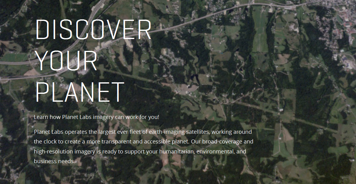
Planet Labs, flying Doves in unprecedented Flocks observing Planet Earth with 'rapid cadence' imaging opening possibilities never before offered
About Planet Labs Documentation Intro
Planet Labs/NYT Planet Labs, newly #ISS deployed Doves Smartphones in space!
Launch of new Flock of Dove Satellites to Image Earth
Planet Labs 'Dove' micro-satellites
New York Times / "Rapid cadence imagery, like Planet Labs is developing, helps us become better, more sustainable stewards of Earth."
Citizens of the Planet -- #PlanetCitizens
____________________________________________________________________________________________________________________________________________
Geo, Group on Earth Observations
____________________________________________________________________________________________________________________________________________
National Science and Technology Council / US Group on Earth Observations Council
The Federal Government invests more than $3 billion in civil Earth observations and data annually across multiple agencies, and leverages investments made by State, local and tribal governments, academia and industry...
The NASA OpenNEX Challenge to the Public -- Join In, Our Data is Yours
NASA/JPL focus on #PlanetEarth
Earth Observing System (ECHO) - Earth Science Data Information Systems API
NOAA View Data Exploration Tool
____________________________________________________________________________________________________________________________________________
Urthecast
Live views of #PlanetEarth from the #ISS
UrtheCast -- developing the world’s first Ultra HD video feed of Earth, streamed in full color from cameras on the International Space Station.
____________________________________________________________________________________________________________________________________________
"New Space"
Generation 1.0, an era of Micro-satellites and #EarthImaging
____________________________________________________________________________________________________________________________________________
Google Earth Outreach
Google Earth Engine & Outreach
Google Earth Engine is an online environment monitoring platform that makes available to the entire world a dynamic digital model of our planet that is updated daily.
The Google Earth Outreach Engine stores petabytes of satellite data and allows high-performance tools to analyze and interpret this information that can then be visualized on a map...
○ ○ ○ ○
Community of #PlanetCitizens observing, networking, sharing information, protecting #PlanetEarth...
○ ○ ○ ○
Recent Earth Outreach network extensions include --
Global Fishing Watch and Forest Watch
Join in !
○ ○ ○ ○
○ ○ ○ ○
Global Forest Watch launches - 2014
Google Outreach continues its impact
World Resources Institute Forest Watch
Monitoring the Planet's Forests
Thank you Rebecca, #PlanetCitizen
○ ○ ○ ○
Dec 2014 News re: Google Earth API
Google promises expansion of Google Earth to other 3D mapping products after Dec 2015. As to what, and when, we'll wait and see...
○ ○ ○ ○
More APIs for the Planet & Connected Planet Citizens
Global Biodiversity Information, free and open access to biodiversity data - Global Biodiversity / Terms
○ ○ ○ ○
- Floating Forests
Help with the Kelp, Join in -- be a Be a Planet Citizen, Planet Scientist -- http://www.floatingforests.org/
Floating Forests - Earth Observatory/NASA-Landsat
Origin of Floating Forests Project
Planet Citizen, Planet Scientist
Kyle Cavanaugh had an idea. “These forests change so rapidly and on a variety of different time scales—months to years to decades—so we needed a long record with consistent, repeated observations,” Cavanaugh said. He devised a method to use Landsat satellite data to monitor kelp forests.
A few things made Landsat an obvious resource. Since the 1970s, the satellites have had a regular collection schedule (twice monthly). Their data and images are managed by the U.S. Geological Survey and are reliably stored in an archive that dates back more than forty years. And Landsat’s images are calibrated, or standardized, across different generations of satellites, making it possible to compare data collected across several decades...
Landsat measures the energy reflected and emitted from Earth at many different wavelengths. By knowing how features on Earth reflect or absorb energy at certain wavelengths, scientists can map and measure changes to the surface. The most important feature for the kelp researchers is Landsat’s near-infrared band, which measures wavelengths of light that are just outside our visual range. Healthy vegetation strongly reflects near-infrared energy, so this band is often used in plant studies. Also, water absorbs a lot of near-infrared energy and reflects little, making the band particularly good for mapping boundaries between land and water.
“The near-infrared is key for identifying kelp from surrounding water,” Cavanaugh explained. “Like other types of photosynthesizing vegetation, giant kelp have high reflectance in the near infrared. This makes the kelp canopy really stand out from the surrounding water.”
○
After a recent meeting on kelp forests and climate change, researchers Byrnes, Cavanaugh, and other colleagues set out to consolidate all of the available kelp forest data from around the world. They wanted to take a step toward understanding how climate change is affecting kelp globally, but they quickly discovered they had a sparse patchwork of information.
Byrnes was struck with a thought. They had used Landsat to expand their studies across time, so why not use Landsat to expand their studies around the world? Could Landsat be used to establish global trends in kelp forest extent? The answer was yes, but the problem was eyeballs.
Unlike research on terrestrial vegetation—which uses Landsat data and powerful computer processing arrays to make worldwide calculations—distinguishing kelp forests requires manual interpretation. While kelp forests pop out to the human eye in near-infrared imagery, computers looking at the data numerically can confuse kelp patches with land vegetation. Programs and coded logic that separate aquatic vegetation from land vegetation can be confounded by things like clouds, sunglint, and sea foam...
"Automated classification methods just don’t produce acceptable levels of accuracy..."
Byrnes and Cavanaugh put together a science team and joined with Zooniverse, a group that connects professional scientists with citizen scientists in order to help analyze large amounts of data. The result was the Floating Forests project.
https://www.zooniverse.org/#climate
https://www.zooniverse.org/#nature
The Floating Forest concept is all about getting more eyeballs on Landsat imagery. Citizen scientists—recruited via the Internet—are instructed in how to hunt for giant kelp in satellite imagery. They are then given Landsat images and asked to outline any giant kelp patches that they find. Their findings are crosschecked with those from other citizen scientists and then passed to the science team for verification. The size and location of these forests are catalogued and used to study global kelp trends.
Join in!
○ ○ ○ ○
Planet API | #PlanetAPI | Planet Citizen | #PlanetCitizen
GreenPolicy360 | #Earth360 | #EarthImaging | #EarthMonitoring
GP360 | #EarthObservations | #EarthScience | #NewSpace
www.planetcitizen.org | www.earthpov.com
○ ○ ○ ○
Subcategories
This category has the following 6 subcategories, out of 6 total.
C
E
N
P
W
Pages in category "Planet API"
The following 48 pages are in this category, out of 48 total.
C
E
G
N
O
P
Media in category "Planet API"
The following 199 files are in this category, out of 199 total.
- 3M lawsuit re forever chemicals - June 2023.png 603 × 600; 357 KB
- A Fierce Green Fire.jpg 208 × 314; 13 KB
- About Baselines and Change.png 592 × 312; 33 KB
- Anthro-transport via globaia.org.jpg 800 × 450; 444 KB
- Anthropocene bks016.png 800 × 248; 227 KB
- Anthropocene Economist.png 775 × 349; 369 KB
- Anthropocene-550x360.png 550 × 360; 335 KB
- Anthropocene-crutzen.jpg 628 × 347; 79 KB
- Anthropocene-economist cover.jpg 750 × 320; 223 KB
- Anthropocene-nature March2015.jpg 747 × 407; 103 KB
- Anthropocene-the-geology-of-humanity.jpg 628 × 347; 79 KB
- API connect.jpg 490 × 120; 22 KB
- Apollo Earth 350x350.jpg 350 × 350; 32 KB
- April 28, 2016.png 586 × 415; 159 KB
- Aquifers earthsciencefromspace Grace CA3.png 772 × 652; 559 KB
- Aquifers global earth observations by grace20150616-16 m.jpg 800 × 450; 117 KB
- Aquifers global earth observations by grace20150616-16.jpg 1,600 × 900; 317 KB
- Aquifers globalstudy 2015.png 668 × 451; 299 KB
- Aquifers June2015 past the tipping point.png 533 × 615; 195 KB
- AskNatureAvatar s.png 200 × 200; 14 KB
- Astronaut-chris-hadfield-earth-photo.jpg 960 × 638; 105 KB
- Attack from Within - by Barb McQuade.png 600 × 630; 222 KB
- Biden re Earth Day 2023.png 640 × 400; 155 KB
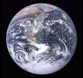
- Blue Marble photo - Apollo 17.jpg 642 × 605; 129 KB
- Blue Marble updated-August 2015.jpg 1,024 × 341; 109 KB
- Blue-Green & Planet Citizens, Planet Scientists.png 549 × 844; 94 KB
- Buckminster and a Geodesic Dome.jpg 600 × 600; 79 KB
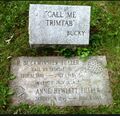
- Bucky Trimtab.jpg 348 × 336; 88 KB
- California's kelp forests and coastal biodiversity diminished.png 532 × 754; 307 KB
- Carbon Mapper - Launch - April 2021.jpg 800 × 323; 92 KB
- Carl Sagan at the Emerging Issues Forum - 1990.png 360 × 460; 192 KB
- Carl Sagan at the Emerging Issues Forum.png 747 × 600; 600 KB
- Carl Sagan, 1985.PNG 480 × 566; 331 KB
- Carl Sagan, the atmosphere unifies and connects all of our world.png 360 × 390; 229 KB
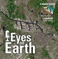
- Celebrating 50 Years of Landsat.png 600 × 610; 909 KB
- Climate and National Security.jpg 603 × 533; 157 KB
- Climate Change Poses a Widening Threat to National Security.png 600 × 781; 310 KB
- Climate Time Machine NASA Earth Science.png 981 × 571; 378 KB
- Computing and energy saving green solutions.jpg 521 × 476; 86 KB
- Copernicus EU logo.jpg 400 × 400; 41 KB
- Costs of War US Post 9-11 War Spending.jpg 800 × 305; 60 KB
- CSDA Program and Planet.jpg 800 × 379; 99 KB
- Cube Launch from the ISS via Tim Peake.png 640 × 409; 218 KB
- Dead Sea evaporation ponds.jpeg 800 × 600; 170 KB
- Democratising access to information about the planet Planet Labs.jpg 804 × 452; 43 KB
- Democratization of space Google June 2015.png 565 × 716; 114 KB
- Dove1 image.jpg 420 × 308; 26 KB
- Doves fly 2016.jpg 800 × 533; 89 KB
- DSCOVR looks back at earth from a million miles away m.jpg 1,004 × 469; 40 KB
- DSCOVR looks back at earth from a million miles away.jpg 1,446 × 670; 65 KB
- DSCOVR-EPIC ImagingofPlanetEarth 2.png 686 × 628; 449 KB
- DSCOVR-EPIC ImagingofPlanetEarth.png 316 × 266; 19 KB
- DSCOVR-EPIC-May13,2018.png 760 × 872; 598 KB
- Earth Breathing.jpg 800 × 450; 117 KB
- Earth Day and Climate at the Center.jpg 595 × 604; 131 KB
- Earth Emoji.png 50 × 50; 2 KB
- Earth from DSCOVR.jpg 1,024 × 1,024; 156 KB
- Earth from Orbit 2014 2 released by NASA Goddard Apr20,2015.png 759 × 435; 66 KB
- Earth from Orbit 2014 released by NASA Goddard Apr20,2015.png 760 × 433; 275 KB
- Earth in Human Hands Intro.png 622 × 423; 121 KB
- Earth mapped.png 800 × 783; 254 KB
- Earth Research Findings 2015 1.png 1,088 × 686; 1.49 MB
- Earth Research Findings 2015 2.png 1,088 × 241; 512 KB
- Earth topo observatory nasa 1024x512.jpg 1,024 × 512; 96 KB
- Earth visions.png 387 × 373; 231 KB
- EarthRightNow Earth Science satellite fleet circa 2015.jpg 1,500 × 1,125; 0 bytes
- Earthrise2015 m.png 703 × 449; 346 KB
- Earthrise2015.png 1,004 × 642; 558 KB
- Earths-Future .jpg 351 × 198; 41 KB
- Earths-Future-cover.jpg 251 × 325; 48 KB
- EarthView.png 800 × 541; 1.06 MB
- EcoExploring Maps.png 957 × 830; 1.54 MB
- Epic 1b 20160615154340 01.jpg 2,048 × 2,048; 250 KB
- Epicday260.gif 985 × 554; 2.76 MB
- ESA ers2-envisats-tandem s.jpg 451 × 298; 34 KB
- ESA Living Planet Symposium - Announcement.png 637 × 600; 508 KB
- ESA Living Planet Symposium - May 2022.png 700 × 600; 258 KB
- Eunice Foote Illustration climate.gov.jpg 620 × 296; 55 KB
- Feeling the Heat 1989.png 800 × 1,095; 400 KB
- Fox on Earth Day 2023.jpg 640 × 275; 58 KB
- Gateway to Astronaut Photography of Earth.png 1,024 × 409; 731 KB
- Gavin in Glasgow - Nov 10 2021.png 728 × 600; 378 KB
- Geoengineering the Climate 2009 Table 5.1 m.png 563 × 299; 61 KB
- Geosciences agriculture-farms nasa.jpg 461 × 350; 152 KB
- Geosciences satellite fields b.jpg 461 × 444; 186 KB
- Global Forest Watch top page 2014.png 800 × 416; 350 KB
- Google Earth Hello2.png 800 × 375; 863 KB
- Google Earth invite-just in time for Earth Day.jpg 395 × 336; 69 KB
- Group on Earth Observations.JPG 546 × 418; 33 KB
- Guarding Earths Water - from Space.jpg 578 × 496; 102 KB
- Haiku poems - Owl against a dusk sky - via Haiku Foundation.png 514 × 413; 144 KB
- Haikubox via RM citizen science.png 600 × 640; 466 KB
- Himawari Earth water vapor dynamics.png 768 × 774; 917 KB
- Human impact on the environment.png 1,026 × 228; 28 KB
- In nature, nothing exists alone.jpg 500 × 357; 26 KB
- Internet Freedom - Democracy Status - FH Map 2022-23.png 800 × 407; 127 KB
- Internet Trends 2018 Kleiner-Perkins by Mary Meeker.png 476 × 342; 28 KB
- Internet Users World-Region as of 2016.png 800 × 543; 131 KB
- Iss040e008179 earth's atmosphere .jpg 638 × 276; 19 KB
- Jason3-16-2.jpg 600 × 236; 54 KB
- Jigsaw Outline launch March 2018.png 633 × 565; 159 KB
- Journey of a Climate Pixel - May 2022.png 800 × 399; 114 KB
- Land Remote Sensing Policy Act of 1992.jpg 563 × 480; 144 KB
- Landsat 50th anniv Sept 2016.jpg 800 × 456; 94 KB
- Landsat at 50.png 800 × 713; 345 KB
- Landsat band imagery.png 800 × 400; 907 KB
- Landsat band imagery2.png 800 × 400; 907 KB
- Landsat data site.png 657 × 600; 499 KB
- Landsat Imaging the Past-1.png 767 × 744; 242 KB
- Landsat Imaging the Past-2.png 767 × 667; 329 KB
- Landsat Imaging the Past-3.png 767 × 560; 178 KB
- Landsat Imaging the Past-4.png 767 × 833; 496 KB
- Landsat Imaging the Past-5.png 767 × 870; 791 KB
- Landsat Imaging the Past-6.png 767 × 735; 385 KB
- Landsat launched 50 years ago today.png 528 × 779; 755 KB
- Landsat NASA - Feb 11 2023.png 763 × 600; 578 KB
- Landsat US collection of maps 1985-2021.png 768 × 775; 1,018 KB
- Landsat, a 50 year legacy.png 528 × 575; 288 KB
- LivingEarth2.png 800 × 503; 478 KB
- Mangroves and Coastal Wetlands tracked by Landsat.png 600 × 716; 245 KB
- Map of the World wiki commons m.png 679 × 314; 18 KB
- Map of the World wiki commons s.png 339 × 157; 13 KB
- Map of the World wiki commons.png 1,357 × 628; 19 KB
- Mediawiki1.jpg 135 × 135; 6 KB
- Mysterious circles around the world.png 733 × 600; 655 KB
- NASA Earth Science - Open Source Info.jpg 640 × 334; 60 KB
- NASA Earth science from space May2015.png 486 × 618; 260 KB
- NASA EPIC DSCOVR - July 6 2015.png 768 × 956; 687 KB
- NASA Gateway to Astronaut Photography of Earth.png 800 × 351; 485 KB
- NASA test mission to protect earth from asteroid - Nov 2021.png 508 × 800; 424 KB
- NASA-DSCOVR and GreenPolicy360-July2016.png 577 × 575; 96 KB
- NASAblog iss051e050137.jpg 800 × 450; 27 KB
- Navigate with Knowledge - StratDem - GreenPolicy360.jpg 800 × 534; 62 KB
- Ocean acidification NOAA s.jpg 359 × 211; 24 KB
- OCO-3 video.jpg 640 × 371; 76 KB
- OCO-3 video2.jpg 640 × 376; 45 KB
- Orbital-Perspective-The-Key-Is-We.jpg 626 × 353; 90 KB
- Overview Effect by Frank White updated Third edition.jpg 300 × 478; 53 KB
- Ozone monitoring South Pole thru 2012.jpg 2,020 × 1,800; 1.9 MB
- PACE - NASA Everything on Earth Is Connected.png 600 × 264; 70 KB
- PACE - NASA Jan 17 2024.png 600 × 662; 465 KB
- Pale Blue Dot - The Book by Carl Sagan 2.jpg 330 × 143; 17 KB
- Pale Blue Dot from Cassini July 19,2013.jpg 800 × 593; 47 KB
- Pale blue dot from Saturn via Cassini 2013 1280x720.jpg 1,280 × 720; 54 KB
- Pale-blue-dot.jpg 1,680 × 1,050; 248 KB
- Permaculture-observation tip.jpg 480 × 540; 86 KB
- Planet 4-15-2021 10-22-51 AM.jpg 592 × 672; 106 KB
- Planet and plan for an Earthdata platform.png 600 × 600; 280 KB
- Planet API PlanetLabs 2.png 957 × 531; 111 KB
- Planet Explorer Beta March 2017.png 579 × 340; 194 KB
- Planet Explorer beta1.png 637 × 384; 0 bytes
- Planet Labs and NanoRacks launch from the ISS Feb 2014.jpg 800 × 533; 98 KB
- Planet Labs Dove-sat-01.jpg 670 × 380; 64 KB
- Planet Labs, 'this is our Dove' Nov 2014.jpg 320 × 180; 10 KB
- Planetcitizens.org.png 768 × 768; 900 KB
- PlanetLabs homepage2016.png 480 × 559; 411 KB
- Profits of War - $14 Trillion - Read the Brown Univ-Watson Instit Report.PNG 800 × 1,002; 261 KB
- RACHEL CARSON - 1949.jpg 600 × 600; 102 KB
- Rachel Carson courtesy of Rachel Carson Estate.jpg 640 × 776; 264 KB
- Rachel Carson ecology - ecosystem.png 800 × 388; 0 bytes
- Rachel Carson Institute.png 800 × 522; 189 KB
- Rachel carson1 NYT-Illustration by Valero Doval.png 784 × 469; 0 bytes
- Rachel Lost Woods After Silent Spring m.png 800 × 196; 101 KB
- Reefscape.png 582 × 567; 537 KB
- Rep. George E Brown and a young student remembering.png 640 × 325; 109 KB
- RevDem.png 225 × 75; 5 KB
- River basins - watersheds.jpg 800 × 214; 111 KB
- Shifting Baseline Syndrome - threats to ecosystems biodiversity.png 431 × 534; 322 KB
- Shifting Baselines 2.jpg 600 × 600; 140 KB
- Space stations - July 26 2022.png 544 × 462; 270 KB
- SSEP--Inspire and Educate.jpg 2,250 × 295; 71 KB
- Steven J Schmidt, May 2023.png 363 × 484; 383 KB
- StratDem logo4.png 316 × 100; 10 KB
- Sudan ancient formation.jpeg 800 × 600; 212 KB
- TEEB for BUSINESS.png 324 × 52; 13 KB
- The A-Train.jpg 670 × 453; 244 KB
- Time for Facts and Science.jpg 144 × 604; 45 KB
- Time to Advance New Definitions of National Security.jpg 652 × 833; 104 KB
- Timelapse.png 800 × 566; 676 KB
- UCS-EPA-Oct16,2017.png 492 × 544; 148 KB
- UN Mapping the World.png 740 × 477; 584 KB
- Urthecast-the earth video camera.jpg 302 × 198; 15 KB
- US River basins - watersheds.jpg 800 × 477; 131 KB
- USGS Groundwater depletion map 2013.png 794 × 490; 238 KB
- Virtual Earth cover.png 800 × 479; 833 KB
- Vital signs 1.png 853 × 507; 362 KB
- Vital Signs, Taking the Pulse of the Planet Sept2014.png 853 × 453; 421 KB
- Water shortage 4B people sci report-2016.png 853 × 233; 148 KB
- Welcome to Earth View from Google.png 709 × 395; 395 KB
- WikiLeaks - Vault 7 - Mediagazer.png 647 × 576; 167 KB
- WikiLeaks -Vault7 - Techmeme.png 586 × 797; 200 KB
- World Map - Mercator projection v Google maps.jpg 800 × 545; 101 KB

