LANDSAT and Virginia Tower Norwood: Difference between revisions
Siterunner (talk | contribs) No edit summary |
Siterunner (talk | contribs) No edit summary |
||
| (14 intermediate revisions by the same user not shown) | |||
| Line 1: | Line 1: | ||
<big><big>'''Multispectral Imagery'''</big></big> | |||
[[File:Landsat band imagery.png]] | |||
Virginia Digital 'Multispectral Invention' Changed Earth Imaging and Earth Science Forever ... | |||
[[File:Digital.png]] | |||
<small>(At the beginning of Virginia's career - 1948)</small> | |||
[[File:Virginia Norwood - 1948.jpg]] | |||
<big><big>'''A Story of the Genius of Virginia Tower Norwood & Launch of Landsat's Earth Science Mission'''</big></big> | |||
GreenPolicy360 Siterunner: ''A visionary woman scientist-engineer fought to change how US satellites viewed our planet - the military said no go, but Virginia Norwood Tower prevailed and won. The world today is better and more scientifically capable thanks to Virginia's skill - and perseverance...'' | |||
<big>'''''Back to the beginning'''''</big> | |||
''The U.S. Interior Department, U.S. Geological Survey, NASA, and leadership from the US Congress and [https://science.house.gov/about/history-and-jurisdiction Congressional Science and Technology Committee] were responsible for the start uo of Earth Science from Space missions, beginning with building the original Landsat program (which overcame much opposition within the military). [https://landsat.gsfc.nasa.gov/about/history ERTS-1, the Earth Resources Technology Satellite], as the original Landsat satellite was officially first called, was 'greenlighted' to go as a real time earth observation mission in 1970. The vast digital database it gathered has proven over the years the wisdom of the visionaries who first proposed, drafted legislation creating, funding, then engineering, testing, launching and ably defending the Landsat mission from critics over the decades. Now the results are being re-considered for the unique value they provide in guiding policy discussion, debate and decisions. The Landsat library of imagery, millions of images, multispectrum observations of change on earth over the first fifty years of the mission's existence, are seen in a new light.'' | |||
[[File:Landsat NASA - Feb 11 2023.png]] | [[File:Landsat NASA - Feb 11 2023.png]] | ||
[[File: | [[File:Landsat 50th anniv Sept 2016.jpg]] | ||
: [[File:Landsat, a 50 year legacy.png]] | |||
:::: <small>* http://www.greenpolicy360.net/mw/images/Landsat8DataUsersHandbook.pdf</small> | |||
| |||
<big><big>'''Envisioned as an Intergenerational Science Mission'''</big></big> | |||
: <big><big>'''[[Landsat data users handbook]]'''</big></big> | |||
| Line 17: | Line 59: | ||
''In the late 1960s, the director of the US Geological Survey wanted to take photographs of the Earth from space to help manage land resources | ''In the late 1960s, the director of the US Geological Survey wanted to take photographs of the Earth from space to help manage land resources. [Ed: With the support of Congressman George Brown of the satellite missions oversight committee, and partnering with NASA,] a plan was hatched to send new satellites into space. Working on an advanced design team in Hughes’ space and communications division, Norwood formed the idea that would define her legacy. She gathered feedback from agriculture, meteorology and geology experts to develop a scanner to record different light and energy spectra. Although it used existing technology made for (lower-altitude) agricultural observations, she adapted the tech to meet the Geological Survey’s and NASA’s goals.'' | ||
''However, she faced numerous obstacles in securing a spot for her Multispectral Scanner System (MSS) on the launch satellite. It was already hauling an enormous three-camera system developed by RCA using television tube technology, which the agencies viewed as the primary imaging source. To get the MSS onboard, Norwood was tasked with scaling back its size to no more than 100 lbs, a significant downsizing; the RCA system took up most of the satellite’s 4,000 lb. payload.'' | ''However, she faced numerous obstacles in securing a spot for her '''Multispectral Scanner System (MSS)''' on the launch satellite. It was already hauling an enormous three-camera system developed by RCA using television tube technology, which the agencies viewed as the primary imaging source. To get the MSS onboard, Norwood was tasked with scaling back its size to no more than 100 lbs, a significant downsizing; the RCA system took up most of the satellite’s 4,000 lb. payload.'' | ||
''She reduced the device to recording only four energy bands (down from its original seven) to ensure it would make the trip as a secondary measurement system. The satellite launched on July 23rd, 1972, and the MSS captured its first images — of Oklahoma’s Ouachita Mountains — two days later. The results exceeded all expectations, forcing a quick reevaluation of the satellite payload’s hierarchy. Norwood’s system performed better and was more reliable than the clunky RCA project, which caused power surges and had to be shut down for good two weeks into the mission.'' | ''She reduced the device to recording only four energy bands (down from its original seven) to ensure it would make the trip as a secondary measurement system. The satellite launched on July 23rd, 1972, and the MSS captured its first images — of Oklahoma’s Ouachita Mountains — two days later. The results exceeded all expectations, forcing a quick reevaluation of the satellite payload’s hierarchy. Norwood’s system performed better and was more reliable than the clunky RCA project, which caused power surges and had to be shut down for good two weeks into the mission.'' | ||
| Line 42: | Line 84: | ||
: '''She Fought 'The Man', [https://en.wikipedia.org/wiki/Military%E2%80%93industrial_complex <big> 'The MIC'</big>], and She Won''' | : '''She Fought 'The Man', [https://en.wikipedia.org/wiki/Military%E2%80%93industrial_complex <big> 'The MIC'</big>], and She Won''' | ||
:: The Pentagon-favored military contractors and their big-money video spying systems lost out to the vision and talent of | :: The President Eisenhower described 'military-industrial-complex' (MIC) demanded video imaging systems on satellites, Virginia proosed her newly invented digital camera scanning, data system | ||
::: The Pentagon-favored military contractors and their corporate big-money supported video spying systems lost out to the vision and talent of Virginia Norwood | |||
::: Tower Norwood's digital scanning instrument, initially rejected and opposed by 'Top Brass' Pentagon generals, proved its value and prevailed | :::: Tower Norwood's digital scanning instrument, initially rejected and opposed by 'Top Brass' Pentagon generals, proved its value and prevailed | ||
| Line 66: | Line 110: | ||
'''Beginning with Virginia's 'Invention', Five Decades+ of Unique Earth Science Imaging from Space''' | '''Beginning with Virginia's 'Invention', Five Decades+ of Unique Earth Science Imaging from Space''' | ||
: From Landsat to today Earth Observing | : From Landsat to today's fleet of satellites monitoring our home planet, [https://www.greenpolicy360.net/w/File:Earth_Observing_System_-_fleet_of_satellites.png '''an Earth Observing System (EOS)'''], the Multispectral Scanning System gathers Earth Science Data | ||
:: A Profoundly Vital Resource of Digital Data Mapping Earth's Systems, Providing the Dynamic Observations for Science and Policy Decisions | :: A Profoundly Vital Resource of Digital Data Mapping Earth's Systems, Providing the Dynamic Observations for Science and Policy Decisions | ||
| Line 88: | Line 132: | ||
* https://www.greenpolicy360.net/w/Category:Earth_System_Science | * https://www.greenpolicy360.net/w/Category:Earth_System_Science | ||
In the late 1960s and early 70s, Congressman George Brown on the Science and Technology Committee was pressing forward with NASA's development of the first array of earth science satellite missions. Near the top of his list of project missions was LANDSAT 1. | |||
Representative Brown was out in front of "Big Science". In his decades on the House Science, Space & Technology Committee, he worked to expand the reach of science. He knew that [https://www.greenpolicy360.net/w/File:You_can_manage_only_what_you_can_measure_Dr_David_Crisp,_OCO-2,_June_2014_m.jpg good data enabled good policy decisions]. He pressed for first-generation earth science satellites and ongoing earth monitoring missions and data sharing. | |||
<big>'''[[George E. Brown Jr]]'''</big> | |||
* <small>https://www.greenpolicy360.net/w/George_E._Brown_Jr</small> | |||
Among his many initiatives, George Brown was a key figure in proposing, establishing, and then saving the [https://landsat.gsfc.nasa.gov/ '''Landsat mission and its decades of earth science programs.'''] [http://www.nytimes.com/1989/03/02/us/last-civilian-photography-satellites-to-shut-down.html '''Landsat's unique 'open-access' database of Earth Science imaging'''] profoundly changed the way we see our home planet. The Landsat mission's earth science, thanks to visionaries like George E. Brown and Virginia Tower Norwood, created a digital and dynamic database documenting earth's changes over decades. When science naysayers and politicians such as President Reagan attempted to end the Landsat mission budget and shut the Landsat program down, George Brown intervened and led the opposition. Landsat's earth science technology continued to be a model for all [https://www.greenpolicy360.net/w/Earth_Science_Research_from_Space earth science research missions from space] and is now moving into its fifth decade with [http://landsat.gsfc.nasa.gov/?p=10391 Landsat 9.] | |||
* https://landsat.gsfc.nasa.gov/landsat-9 | |||
* https://www.sciencedirect.com/science/article/abs/pii/S0034425720303382?dgcid=coauthor#f0005 | |||
* https://landsat.gsfc.nasa.gov/landsat-1-3/landsat-1 | |||
* https://www.greenpolicy360.net/w/Earth_Science_Research_from_Space | |||
:[[File:Landsat 9 Launches - 1.jpg]] | |||
:[[File:Landsat 9 Launches - 2.jpg]] | |||
| Line 155: | Line 226: | ||
🌎 | 🌎 | ||
<big><big><big>'''Virginia Tower Norwood's Vision'''</big></big></big> | <big><big><big>'''Virginia Tower Norwood's Vision'''</big></big></big> | ||
| Line 320: | Line 335: | ||
The multispectral imaging and data resources of the Landsat programs have continued on for over a half century. The earth science, the measuring and monitoring of Landsat with multispectral imaging have improved over the years and the technology shared with myriad scientific programs studying Earth's systems. The result of work of visionary #PlanetCitizens like Virginia Tower Norwood and Rep. George E. Brown, has continued on and on, a legacy that keeps on giving... | The multispectral imaging and data resources of the Landsat programs have continued on for over a half century. The earth science, the measuring and monitoring of Landsat with multispectral imaging have improved over the years and the technology shared with myriad scientific programs studying Earth's systems. The result of work of visionary #PlanetCitizens like Virginia Tower Norwood and Rep. George E. Brown, has continued on and on, a legacy that keeps on giving... | ||
Latest revision as of 15:59, 26 December 2023
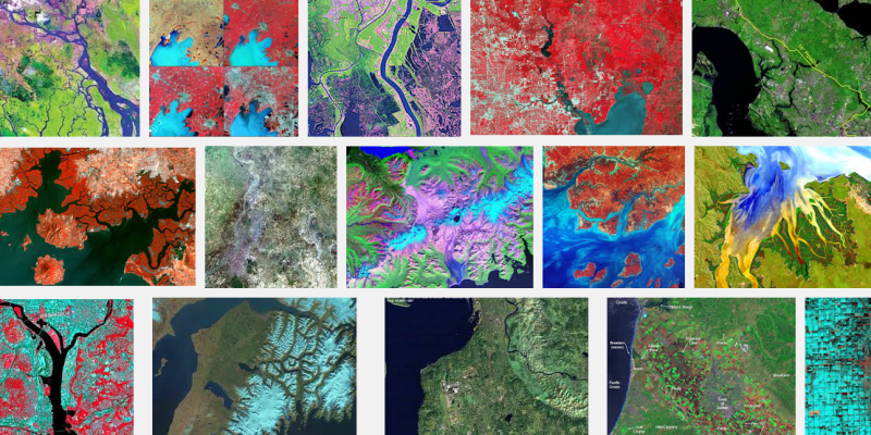
Multispectral Imagery
Virginia Digital 'Multispectral Invention' Changed Earth Imaging and Earth Science Forever ...
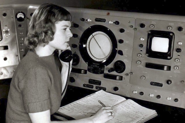
(At the beginning of Virginia's career - 1948)
A Story of the Genius of Virginia Tower Norwood & Launch of Landsat's Earth Science Mission
GreenPolicy360 Siterunner: A visionary woman scientist-engineer fought to change how US satellites viewed our planet - the military said no go, but Virginia Norwood Tower prevailed and won. The world today is better and more scientifically capable thanks to Virginia's skill - and perseverance...
Back to the beginning
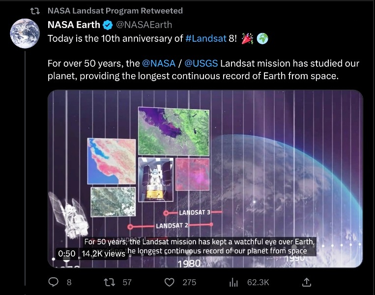
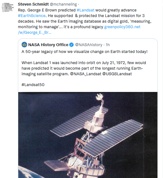
The U.S. Interior Department, U.S. Geological Survey, NASA, and leadership from the US Congress and Congressional Science and Technology Committee were responsible for the start uo of Earth Science from Space missions, beginning with building the original Landsat program (which overcame much opposition within the military). ERTS-1, the Earth Resources Technology Satellite, as the original Landsat satellite was officially first called, was 'greenlighted' to go as a real time earth observation mission in 1970. The vast digital database it gathered has proven over the years the wisdom of the visionaries who first proposed, drafted legislation creating, funding, then engineering, testing, launching and ably defending the Landsat mission from critics over the decades. Now the results are being re-considered for the unique value they provide in guiding policy discussion, debate and decisions. The Landsat library of imagery, millions of images, multispectrum observations of change on earth over the first fifty years of the mission's existence, are seen in a new light.
Envisioned as an Intergenerational Science Mission
GreenPolicy360: Virginia Was a #PlanetCitizen
- In Memory of Virginia Tower Norwood
- On the Passing in March 2023 of a True Hero, a Woman Who Invented the Digital Imaging System Making Earth Science from Space Possible
- Virginia Enabled and Changed the Way Humanity Sees Our Planet and Provided an Irreplaceable, Unique, First Generation of Earth Science
In the late 1960s, the director of the US Geological Survey wanted to take photographs of the Earth from space to help manage land resources. [Ed: With the support of Congressman George Brown of the satellite missions oversight committee, and partnering with NASA,] a plan was hatched to send new satellites into space. Working on an advanced design team in Hughes’ space and communications division, Norwood formed the idea that would define her legacy. She gathered feedback from agriculture, meteorology and geology experts to develop a scanner to record different light and energy spectra. Although it used existing technology made for (lower-altitude) agricultural observations, she adapted the tech to meet the Geological Survey’s and NASA’s goals.
However, she faced numerous obstacles in securing a spot for her Multispectral Scanner System (MSS) on the launch satellite. It was already hauling an enormous three-camera system developed by RCA using television tube technology, which the agencies viewed as the primary imaging source. To get the MSS onboard, Norwood was tasked with scaling back its size to no more than 100 lbs, a significant downsizing; the RCA system took up most of the satellite’s 4,000 lb. payload.
She reduced the device to recording only four energy bands (down from its original seven) to ensure it would make the trip as a secondary measurement system. The satellite launched on July 23rd, 1972, and the MSS captured its first images — of Oklahoma’s Ouachita Mountains — two days later. The results exceeded all expectations, forcing a quick reevaluation of the satellite payload’s hierarchy. Norwood’s system performed better and was more reliable than the clunky RCA project, which caused power surges and had to be shut down for good two weeks into the mission.
Landsat quickly became the de facto method of surveying the Earth’s surface. Norwood continued to improve the system, leading the development of Landsat 2, 3, 4 and 5. Landsat 8 and 9, the current versions monitoring the effects of climate change today, are still based on her initial concept. Her other projects included leading the microwave group in Hughes Aircraft’s missile lab and designing the ground-control communications equipment for NASA’s Surveyor lunar lander.
She reportedly had no issue with the “the mother of Landsat” moniker her peers gave her. “Yes, I like it, and it’s apt,” she said. “I created it, I birthed it, and I fought for it.”
(Via Engadget / April 2023)
🌎
March 2023
GreenPolicy360 Remembers and Celebrates the Life of the Woman 'Who Brought Us the World'
- She Fought 'The Man', 'The MIC', and She Won
- The President Eisenhower described 'military-industrial-complex' (MIC) demanded video imaging systems on satellites, Virginia proosed her newly invented digital camera scanning, data system
- The Pentagon-favored military contractors and their corporate big-money supported video spying systems lost out to the vision and talent of Virginia Norwood
- Tower Norwood's digital scanning instrument, initially rejected and opposed by 'Top Brass' Pentagon generals, proved its value and prevailed
Virginia Tower Norwood, ‘Mother’ of Satellite Imaging Systems, Dies at 96
- A pioneer in aerospace, she invented a technology that has enabled scientists to map and study the earth for more than 50 years
Beginning with Virginia's 'Invention', Five Decades+ of Unique Earth Science Imaging from Space
- From Landsat to today's fleet of satellites monitoring our home planet, an Earth Observing System (EOS), the Multispectral Scanning System gathers Earth Science Data
- A Profoundly Vital Resource of Digital Data Mapping Earth's Systems, Providing the Dynamic Observations for Science and Policy Decisions
Multispectral Eyes in the Sky: Virginia Tower Norwood, 'The Mother of Landsat'
George & Virginia: Their Vision Is a Profound Legacy
GreenPolicy360 Siterunner Steve Schmidt: Back in the 60s and 70s, my friend George E. Brown was a key force in the U.S. Congress creating a first generation of earth science missions from space, remote imaging it was called. I was fortunate to have become close to George and his work as we each, in shared politics and initiatives, attempted to advance environmental protection and the science necessary to 'measure, monitor and manage' earth's systems. George was often called the father of the Landsat mission and its programs and in his role on the government's oversight committee in the House of Representatives, and a Chairman of the Space, Science and Technology committee over decades, Congressman Brown worked to set in motion a constellation of earth science research programs. One his collaborators with Landsat and its pioneering studies, research, data and unique digital databases of knowledge was Virginia Tower Norwood. Together George and Virginia, can be called the father and mother of Landsat and earth science imaging that is a generational gift enabling us, today's generation of scientists, the public and political/educational groups around the world and NASA/NOAA/USGS and international science and space programs to manage earth's living systems.
In the late 1960s and early 70s, Congressman George Brown on the Science and Technology Committee was pressing forward with NASA's development of the first array of earth science satellite missions. Near the top of his list of project missions was LANDSAT 1.
Representative Brown was out in front of "Big Science". In his decades on the House Science, Space & Technology Committee, he worked to expand the reach of science. He knew that good data enabled good policy decisions. He pressed for first-generation earth science satellites and ongoing earth monitoring missions and data sharing.
Among his many initiatives, George Brown was a key figure in proposing, establishing, and then saving the Landsat mission and its decades of earth science programs. Landsat's unique 'open-access' database of Earth Science imaging profoundly changed the way we see our home planet. The Landsat mission's earth science, thanks to visionaries like George E. Brown and Virginia Tower Norwood, created a digital and dynamic database documenting earth's changes over decades. When science naysayers and politicians such as President Reagan attempted to end the Landsat mission budget and shut the Landsat program down, George Brown intervened and led the opposition. Landsat's earth science technology continued to be a model for all earth science research missions from space and is now moving into its fifth decade with Landsat 9.
🌎
August 2020
NASA / Landsat Science
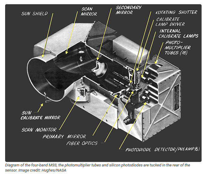
Take out a yardstick. Flip it over to the metric side and measure out 89 centimeters long, 59 centimeters wide and 40 centimeters tall. Imagine an object that size weighing about 105 pounds (48 kg). This should give you a feel for the size of the Multispectral Scanner System that flew on the first Landsat satellite. That’s the compact size of the instrument that initiated repetitive observation of Earth’s landmasses from space—the instrument that has defined much of modern remote sensing.
The Multispectral Scanning System (MSS)
Virginia Tower Norwood decided to quantize the MSS data into 6-bits. Both image data and calibration data (from the onboard internal lamp calibrator) were sent to the ground digitally. Even though the digital MSS data had a small dynamic range (able to show only 64 different radiance values), it could be calibrated, so images could be confidently compared from date-to-date and place-to-place.
The MSS radiometrically-corrected digital data pioneered quantitative satellite remote sensing, taking the science of Earth observation digital, where it has stayed ever since...
(NASA) Virginia Norwood was born six and a half years after American women had won the right to vote. The country was growing to accept that women could think for themselves.
When she was a young girl, Norwood’s father, an Army officer with a master’s degree in physics, who taught at Carnegie Tech (now Carnegie Mellon University), encouraged her to consider being a physicist or mathematician. He provided her first slide rule at age 9 and many years of math puzzles.
She was good in both math and physics and decided early on that she wanted to go to MIT. Her senior year in high school, she scored very high on her math aptitude tests. A counselor told her she should consider being a librarian. She paid no heed to that advice.
Because MIT was a land grant college, it accepted women at a time when many technical universities did not. Norwood applied and was admitted with a partial scholarship in 1944; three years later she graduated, at age 20, with a degree in mathematical physics.
Finding a technical job in 1947 was a challenge. When asked for her salary requirements at Sikorsky Aircraft in Stratford, Connecticut, she stated the common starting salary for a technician. The interviewer scoffed, telling her no woman at the company had ever made anything close to that. She kept looking.
She ended up selling blouses at a department store in New Haven, until she was hired to teach business arithmetic to returning WWII vets at New Haven Junior College. A highlight of that period was that she was able to audit graduate math classes at Yale where her husband was teaching. “They were very nice to me at Yale, and I benefitted from the opportunity to expand my math foundation,” Norwood relates.
A year after graduating from MIT, both she and her husband were hired by the US Army Signal Corps Laboratories in Fort Monmouth, New Jersey (a federal employer that followed non-discriminatory hiring policies). She took engineering classes through a Rutgers Extension program while living in New Jersey. At the Signal Corps she started in weather radar, and soon designed a radar reflector for weather balloons that discovered previously untrackable winds at 1000 feet. Then she moved into microwave antenna design.
After five years at the Signal Corps Labs, Norwood and her husband headed to California where her husband had grown up. They both worked at Sylvania Electronic Defense Labs in Mountain View. Norwood set up Sylvania’s first antenna lab (buying equipment from a small local outfit run by Bill Hewlet and Dave Packard).
A year later, they moved to Los Angeles. By this time, Norwood’s credentials made her highly sought after. She entertained five or six different employment offers before settling on one from Hughes.
“The offer from Hughes Aircraft Company was not the most money, but I liked them and they were known to have the foremost antenna outfit in the country. They were doing slot arrays and all sorts of exciting, innovative things,” she says.
Her first day on the job there, the parking attendant told her women couldn’t park in the staff lot, that it was for technical staff only. She was a woman, she was the first female member of the company’s technical staff, and from that day forward a woman parked in the lot.
She was at Hughes for 36 years where she designed all kinds of antennae, communication links, optics, the Landsat scanners—and received two more patents. She retired in 1990.
Early on at Hughes when she was made head of the microwave division, a male engineer quit, saying he would not work for a woman. Another engineer there, a Rhodes Scholar no less, told her women, especially ones with children, had no business working at Hughes.
She never let such comments or actions deter her. And soon her creations were on the moon.
“Probably the most exciting time in my career was the day Surveyor landed in 1966—the first fully controlled, soft lunar landing—and started sending back pictures of the moon, on ‘my’ transmitter,” Norwood shares. “I was the engineer in charge of the transmitter, and my group designed the multiplier chain, the amplifier, and the crystal reference for the transmitter that sent the imaging data back to Earth.”
The more Hughes engineers got to know Norwood and the quality of her work, the less they focused on her gender. She was a creative engineer and designer with very sharp scientific and analytic abilities, she could communicate effectively, and she knew how to motivate her team to do their finest, most imaginative work.
As her co-recipient of the 1979 Pecora award, USGS scientist John DeNoyer, described in 2006, “She knew how to handle people. And she was very competent technically too. And you just don’t find people like that every day. Men or women.”
Her advice to aspiring scientists and engineers?
“Really learn the fundamentals of your trade. My solid math and physics foundation served me well for my whole career. Also, enjoy what you’re doing. If you are not having fun and continuing to learn new things, make changes.”
🌎
Virginia Tower Norwood's Vision
Here we focus on the amazing story of Virginia Tower Norwood who invented technology that made LANDSAT's digital spectral imaging possible. Her talent, her vision forever changed the field of earth science. In many ways, while inventing and convincing the reluctant aerospace men around her that digital imaging was the way to go, she was also continuing to be a first mover, graduating from MIT and creating a path of success for a next generation of women as scientists and engineers who would change the world.
The following excerpt from the MIT June magazine cover story shows us what went into the first LANDSAT mission -- an ongoing earth imaging and research data bank that is now going on fifty plus years. LANDSAT 9 is about to be launched and the open source archive of digital multispectral imagery is an unprecedented and unequaled font of knowledge tracking changes of Earth's systems and resources over time, a scientific treasure.
Virginia T. Norwood: The Mother of Landsat
"The woman who brought us the world"
Via MIT Technology Review
A half-century ago, Virginia Tower Norwood, MIT 1947, invented the first multispectral scanner to image Earth from space. Landsat 1 and its successors have been scanning the planet continuously ever since.
Getting ready for Earth’s close-up
She knew NASA and the US Geological Survey were talking about building a satellite to observe Earth and monitor its resources. “With a satellite, you can get up to mountaintops and all the places the geologists would like to know about and didn’t have data for,” she says. NASA was planning to equip the satellite with return beam vidicon (RBV) cameras—television cameras similar to those used for the moon missions. The idea was to capture freeze-frame analog images of Earth using three RBVs with different filters to record the green, red, and near-infrared sections of the electromagnetic spectrum.
Norwood thought that a multispectral scanner (MSS) could be more useful. Such a scanner would be able to capture both visible and invisible light and sort it into more than just three spectral bands, creating a treasure trove of information. One band, for example, would allow the study of water quality; another would reveal the vigor of crops; a third could show chlorophyll absorption; others could be used to determine soil moisture or the density of snowpack.
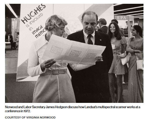
In fact, (Labor Dept) agronomists had already been sending spectrometers up in planes to collect such data on a sampling of fields. But a satellite scanner would gather images on a continuous basis, letting agronomists monitor precisely how many acres of specific crops were growing, potentially anywhere in the world. Arborists could spot early signs of disease and blight in trees and take action before they spread. Those managing dams and watersheds would have regular feeds of data on soil moisture and flooding. Census managers could track how quickly wild and agricultural land became urbanized, and economists could gauge the relative economic prosperity of neighborhoods by comparing the extent of their green space.
What’s more, the scanner would be digital. Its detectors would capture individual pixels, each representing an area roughly the size of a football field. Those pixels would be strung together to form lines of data that could then be compiled to form images line by line. Digital images could be analyzed with computers, and data from different spectral bands could be compared—offering far more precision than visual analysis of analog images. And that ability to analyze spectral data made it possible to identify the material being imaged. For example, fields of wheat and corn would look the same from space but could be distinguished by their unique spectral signatures. The possible uses of a multispectral scanner seemed endless.
Norwood pitched her idea to the top brass at Hughes and was given $100,000 to develop a prototype to show NASA.
She met with potential users to find out what sorts of data they needed, and zeroed in on the six spectral bands that would be most useful. Then she set about designing a system that could efficiently image those bands and relay the data back to Earth.
NASA had determined that the satellite would orbit around the poles at a height of 500 nautical miles. As it traveled from north to south while the planet rotated beneath it, Norwood’s scanner would need to record the light reflected off a diagonal strip of Earth 100 nautical miles wide. With each orbit, Earth would have rotated, and a new 100-nautical-mile strip would be lined up for scanning. Over the course of 18 days, the entire planet could be scanned — and then the whole process would repeat. The scanner would always be in the same relation to the sun at each latitude, so the lighting would be consistent when the strips were pieced together.
Norwood realized from the outset that the scanner couldn’t withstand the wear and tear of moving back and forth to capture the width of the strip. So she had the idea of using a mirror that would pivot back and forth to reflect the light into it. The incoming light would be filtered into the six spectral bands, and then directed to separate detectors for each band. To keep up with the speed of orbit, the scanner would need to capture six lines at a time, so each spectral band needed six sensors. The sensor data would be digitized and sent to receiving stations on the ground, where it could be decoded into images for each spectral band or combined as needed to create composite images.
Norwood was adamant that the data stream should be digital. NASA had serious reservations, doubting that the six-bit MSS data could produce high-quality images. But she knew that a continuous analog signal would be difficult to process accurately. Going digital would make it possible to calibrate the photon levels from each sensor very precisely. “And you do want it to be accurate,” she says: otherwise “you get a striped mess” when the data is reconstructed into images. So she worked with a microwave colleague at Hughes to figure out how best to digitize the sensor data. As the MSS imaged the US, data would be relayed to US ground stations in real time; images of the rest of the world would be stored on videotape until they could be beamed down to the US stations. (Later, ground stations would be established around the world.)
Ultimately... the MSS data would be the first data transmitted digitally from space. And it would set the standard for future quantitative remote sensing. ...
If some at Hughes were skeptical, many researchers at the US Geological Survey and NASA were convinced that the MSS couldn’t possibly yield useful data. They were all familiar with the vidicon television cameras used for Surveyor and early Apollo missions and accustomed to the full-frame analog images they captured. They balked at the idea of launching an untested mechanical device that scanned line by line—and relied on a banging mirror, of all things. The debate over which system should prevail dragged on for more than a year. “Mapmakers like myself were very suspicious of the multispectral scanner, which we could not believe would have geometric integrity,” USGS cartographer Alden Colvocoresses would later confess.
“The only ones that were really skeptical that I encountered really didn’t understand how it worked. They knew that there was a banging mirror,” Norwood says. “They just felt that was too crude.” Fortunately, she adds, she only had to convince her upper management—and they were all pretty smart people.
When NASA asked for a reduction in the scanner’s size, weight, and power requirements, Norwood and her team pared down the design from a six-band scanner to one with four bands. The prototype, which measured 89 by 59 by 40 centimeters, had a 9-by-13-inch oval mirror (made of beryllium so it could withstand the banging and wouldn’t warp or vibrate) and the controversial bumpers that made the engineers cringe. It weighed just 48 kilograms, or about 105 pounds.
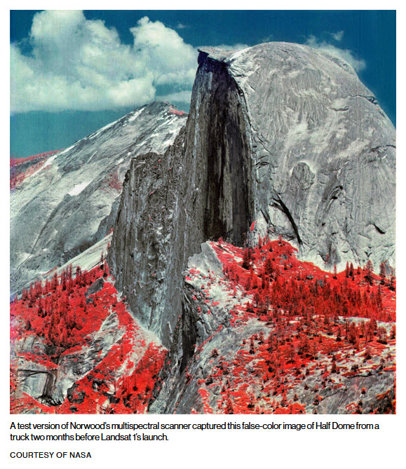
Norwood had researchers load a breadboard version of the scanner onto the back of a truck. It amounted to “just a bunch of boxes,” she says. “We could use all the weight we wanted.” They drove around California, scanning Half Dome, Yosemite Valley, and San Francisco’s skyline. Having labored so long over the specs, Norwood wasn’t surprised by the high quality of the test images.
NASA ended the RBV-versus-MSS debate by deciding to include both on the satellite. There wasn’t time or money to turn Norwood’s prototype into a final, refined product, so the prototype itself was used. As her daughter, Naomi Norwood, says, “Nobody expected it to work except my mom and some other people who worked on it.” Most people assumed that the vidicons would be valuable; the scanner was considered experimental. “The average person didn’t realize what a distorted picture a TV camera puts out,” Norwood says. “We wanted scientific precision.”
A stunning debut
On July 23, 1972, Norwood sat with her husband and younger son in the bleachers at California’s Vandenberg Air Force Base as the Earth Resources Technology Satellite (which would later be renamed Landsat 1) launched with her MSS prototype aboard. “I had never seen a rocket launch in person,” she says. “So that was exciting.”
Two days later, researchers convened at NASA’s Goddard Space Flight Center to see the first MSS data translated into images. When scenes of clouds gave way to wavy images of land, a technician complained about the “terrible” moiré pattern. But soon they realized that the image was of the Ouachita Mountains in Oklahoma, the wavy lines accurately representing the folds of the range. One geologist got tears in his eyes. “I was so wrong about this,” admitted another, who’d been an MSS skeptic. “I’m not going to eat crow. Not big enough. I’m going to eat raven.” ....
The data Norwood’s MSS was sending back to Earth — digitally — was yielding stunningly clear and sharp images.
“I’d go to meetings and people were just jumping up and down because they had discovered another use for the data,” she says. And not just scientists: for years, anyone in the world could purchase a Landsat image of any place on Earth for just $1.25. Image access and prices shifted over the decades — but in 2009, all Landsat images became available for free.
Norwood was involved in the next four versions of Landsat, which launched in 1975, 1978, 1982, and 1984; Landsats 4 and 5 flew not only versions of her four-band MSS but also her original design. (Called the “thematic mapper,” it scanned six spectral bands as she’d initially envisioned, plus one more...)
... the Landsat scanning program that she brought to life has been keeping an eye on the world since 1972. The scanners have continued to evolve over the years... Landsat 9 is scheduled to launch in September 2021. (GreenPolicy360: see below for latest on Landsat 9.)
Landsat’s impact has been far greater than (Siterunner: almost)_anyone could have imagined in 1972 (Siterunner: Rep. Brown envisioned, spoke and wrote about this future). Beyond playing a key role in ushering in the era of digital imaging, its scanners have chronicled the near disappearance of the Aral Sea between Kazakhstan and Uzbekistan, a lake that was the world’s fourth largest before two of its feeder rivers were diverted for agricultural use. Landsat’s images of the 1988 Yellowstone Park fires greatly advanced our understanding of fire science. It has also documented such things as the retreat of glaciers, the stunning growth of Beijing, and the eruption of Mount St. Helens in 1980.
GreenPolicy360 Siterunner: A GreenPolicy360 tip of the hat to Virginia Tower Norwood, a true Planet Citizen
······························································
Update: September 2021
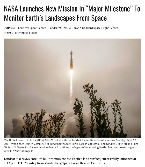
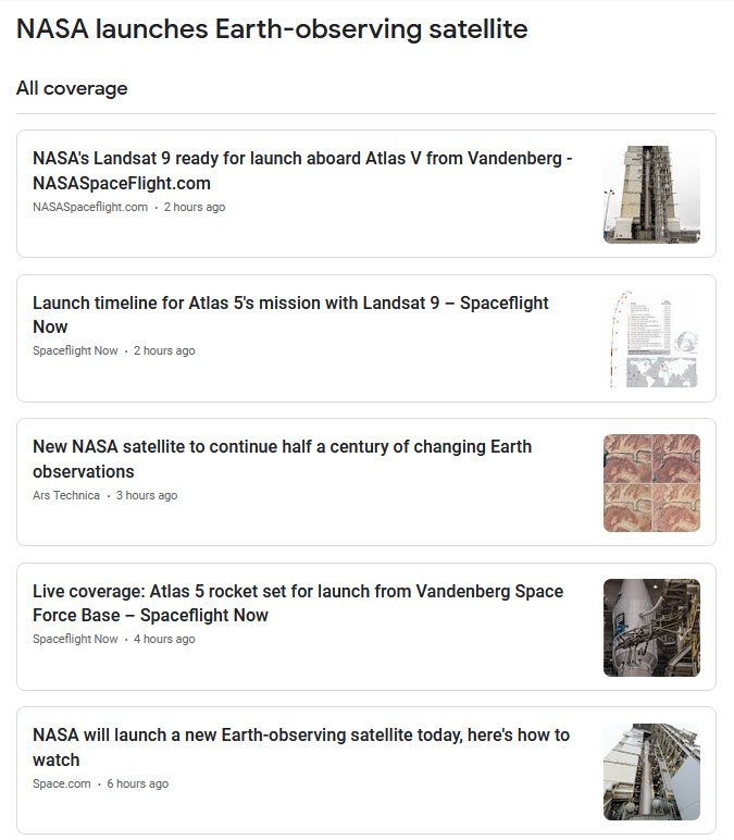
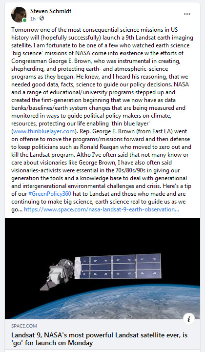
GreenPolicy360 Siterunner: LANDSAT 9 launched on September 27, 2021. Its open source archive of digital multispectral imagery, an unprecedented and unequaled font of knowledge tracking changes of Earth's systems and resources over time, will continue to grow as a scientific treasure.
The multispectral imaging and data resources of the Landsat programs have continued on for over a half century. The earth science, the measuring and monitoring of Landsat with multispectral imaging have improved over the years and the technology shared with myriad scientific programs studying Earth's systems. The result of work of visionary #PlanetCitizens like Virginia Tower Norwood and Rep. George E. Brown, has continued on and on, a legacy that keeps on giving...
🌎
Landsat, #PlanetCitizens, #PlanetScientists
Beginning with Visionaries in the 1960s
New Visions of Earth Imaging -- a Half Century of Earth Observations, Earth Science, Environmental Protection
Flashback 1989:
Reagan acts to end Landsat, Brown acts to save Landsat
(NY Times) The Federal Government yesterday ordered the shutdown of the last two American satellites in a series that pioneered the photography of the Earth from space....'
The process of notifying customers and turning off the Landsat satellites will take a month, giving backers of the spacecraft time to try to save them.
This is a damned outrage, and I'm going to do everything in my power to stop it from happening, said Representative George E. Brown Jr., a California Democrat who has long championed the civilian satellite system.
The shutdown of the two satellites would mark the United States' withdrawal from providing space photographs for civilian purposes, a field it founded. Foreign rivals, including the Soviet Union and France, now operate similar satellites...
A Generational Save
Congressman George Brown's political action saved the Landsat program. The Congressman out in front of "big science" for decades was a key figure in the Landsat program, the long-running database of imagery of Earth that is moving on to its fifth decade with Landsat 9 (and open access) as a result of Brown's efforts. On the House science committee for over 30 years, George led an array of science efforts, including one that greens look to as prescient -- he drafted legislation establishing the first national climate change research program via the National Climate Program Act of 1978. Congressman Brown, from 1964 until his untimely passing in 1999, was a mentor for Steven Schmidt, your GreenPolicy360 Siterunner.
🌎
Over Five Decades of Unique Earth Science Imaging from Space
- An Enduring, Vital Resource of Digital Data Mapping Earth's Systems
- Beginning with the Work of 'the MSS', the Multispectral Scanning System
- Atmosphere
- Atmospheric Science
- Biodiversity
- Citizen Science
- Clean Air
- Clean Water
- Climate Change
- Climate Policy
- Earth
- Earth360
- EarthPOV
- Earth Day
- Earth Imaging
- Earth Observations
- Earth Science
- Earth Science from Space
- Earth System Science
- Eco-nomics
- Ecological Economics
- Ecology Studies
- Environmental Laws
- Environmental Protection
- Environmental Security
- Environmental Security, National Security
- EOS eco Operating System
- Global Security
- Global Warming
- GreenPolicy360
- Land Use
- Maps
- NASA
- New Definitions of National Security
- NOAA
- Oceans
- Planet Citizen
- Planet Citizens
- Planet Citizens, Planet Scientists
- Pollution
- Resilience
- Rivers
- Strategic Demands
- Sustainability
- Sustainability Policies
- Toxics and Pollution
- US Environmental Protection Agency
- Water Quality
- Whole Earth
