Loading map...
{"format":"leaflet","minzoom":false,"maxzoom":false,"limit":5000,"offset":0,"link":"all","sort":[""],"order":[],"headers":"show","mainlabel":"","intro":"","outro":"","searchlabel":"... further results","default":"","import-annotation":false,"width":"auto","height":"350px","centre":false,"title":"","label":"","icon":"","lines":[],"polygons":[],"circles":[],"rectangles":[],"copycoords":false,"static":false,"zoom":false,"defzoom":14,"layers":["OpenStreetMap"],"image layers":[],"overlays":[],"resizable":false,"fullscreen":false,"scrollwheelzoom":true,"cluster":true,"clustermaxzoom":20,"clusterzoomonclick":true,"clustermaxradius":80,"clusterspiderfy":true,"geojson":"","clicktarget":"","showtitle":true,"hidenamespace":true,"template":"","userparam":"","activeicon":"","pagelabel":false,"ajaxcoordproperty":"","ajaxquery":"","locations":[{"text":"\u003Cb\u003E\u003Ca href=\"/w/100%25_Renewable_Town_in_Texas\" title=\"100% Renewable Town in Texas\"\u003E100% Renewable Town in Texas\u003C/a\u003E\u003C/b\u003E","title":"100% Renewable Town in Texas","link":"","lat":30.637013888889,"lon":-97.677563888889,"icon":""},{"text":"\u003Cb\u003E\u003Ca href=\"/w/AFSCME_Fair_Trade_Resolution\" title=\"AFSCME Fair Trade Resolution\"\u003EAFSCME Fair Trade Resolution\u003C/a\u003E\u003C/b\u003E","title":"AFSCME Fair Trade Resolution","link":"","lat":38.895036111111,"lon":-77.036541666667,"icon":""},{"text":"\u003Cb\u003E\u003Ca href=\"/w/AFSCME_Local_2627_Anti-war_Resolution\" title=\"AFSCME Local 2627 Anti-war Resolution\"\u003EAFSCME Local 2627 Anti-war Resolution\u003C/a\u003E\u003C/b\u003E","title":"AFSCME Local 2627 Anti-war Resolution","link":"","lat":40.712727777778,"lon":-74.006013888889,"icon":""},{"text":"\u003Cb\u003E\u003Ca href=\"/w/AFSCME_Resolution_Opposing_Sweatshops\" title=\"AFSCME Resolution Opposing Sweatshops\"\u003EAFSCME Resolution Opposing Sweatshops\u003C/a\u003E\u003C/b\u003E","title":"AFSCME Resolution Opposing Sweatshops","link":"","lat":38.895036111111,"lon":-77.036541666667,"icon":""},{"text":"\u003Cb\u003E\u003Ca href=\"/w/Abbotsford,_British_Columbia_Waterways_Protection\" title=\"Abbotsford, British Columbia Waterways Protection\"\u003EAbbotsford, British Columbia Waterways Protection\u003C/a\u003E\u003C/b\u003E","title":"Abbotsford, British Columbia Waterways Protection","link":"","lat":49.052116666667,"lon":-122.32947777778,"icon":""},{"text":"\u003Cb\u003E\u003Ca href=\"/w/Aberdeen,_NJ_Urging_the_Governor_to_Support_a_Moratorium_on_Revaluations\" title=\"Aberdeen, NJ Urging the Governor to Support a Moratorium on Revaluations\"\u003EAberdeen, NJ Urging the Governor to Support a Moratorium on Revaluations\u003C/a\u003E\u003C/b\u003E","title":"Aberdeen, NJ Urging the Governor to Support a Moratorium on Revaluations","link":"","lat":40.407113888889,"lon":-74.221627777778,"icon":""},{"text":"\u003Cb\u003E\u003Ca href=\"/w/Aberdeen,_Scotland_%22Fantastic_it%27s_not_Plastic%22_Campaign\" title=\"Aberdeen, Scotland \u0026quot;Fantastic it\u0026#039;s not Plastic\u0026quot; Campaign\"\u003EAberdeen, Scotland \"Fantastic it's not Plastic\" Campaign\u003C/a\u003E\u003C/b\u003E","title":"Aberdeen, Scotland \"Fantastic it's not Plastic\" Campaign","link":"","lat":57.148241666667,"lon":-2.0928083333333,"icon":""},{"text":"\u003Cb\u003E\u003Ca href=\"/w/Aberdeen,_Scotland_Sustainable_Purchasing_Policy\" title=\"Aberdeen, Scotland Sustainable Purchasing Policy\"\u003EAberdeen, Scotland Sustainable Purchasing Policy\u003C/a\u003E\u003C/b\u003E","title":"Aberdeen, Scotland Sustainable Purchasing Policy","link":"","lat":57.148241666667,"lon":-2.0928083333333,"icon":""},{"text":"\u003Cb\u003E\u003Ca href=\"/w/Abilene,_TX_Smoking_Restrictions_Ordinance\" title=\"Abilene, TX Smoking Restrictions Ordinance\"\u003EAbilene, TX Smoking Restrictions Ordinance\u003C/a\u003E\u003C/b\u003E","title":"Abilene, TX Smoking Restrictions Ordinance","link":"","lat":32.44645,"lon":-99.747591666667,"icon":""},{"text":"\u003Cb\u003E\u003Ca href=\"/w/Action_Plan_for_Bicycle_Friendly_Communities\" title=\"Action Plan for Bicycle Friendly Communities\"\u003EAction Plan for Bicycle Friendly Communities\u003C/a\u003E\u003C/b\u003E","title":"Action Plan for Bicycle Friendly Communities","link":"","lat":38.895036111111,"lon":-77.036541666667,"icon":""},{"text":"\u003Cb\u003E\u003Ca href=\"/w/Ada_County,_ID_Green_Building_Standards\" title=\"Ada County, ID Green Building Standards\"\u003EAda County, ID Green Building Standards\u003C/a\u003E\u003C/b\u003E","title":"Ada County, ID Green Building Standards","link":"","lat":43.644763888889,"lon":-114.01540833333,"icon":""},{"text":"\u003Cb\u003E\u003Ca href=\"/w/Adams_State_College,_CO_Green_Bikes_Program\" title=\"Adams State College, CO Green Bikes Program\"\u003EAdams State College, CO Green Bikes Program\u003C/a\u003E\u003C/b\u003E","title":"Adams State College, CO Green Bikes Program","link":"","lat":42.691616666667,"lon":-73.1045,"icon":""},{"text":"\u003Cb\u003E\u003Ca href=\"/w/Adelaide,_Australia_Introduces_World%27s_First_Solar-Powered_Electric_Bus\" title=\"Adelaide, Australia Introduces World\u0026#039;s First Solar-Powered Electric Bus\"\u003EAdelaide, Australia Introduces World's First Solar-Powered Electric Bus\u003C/a\u003E\u003C/b\u003E","title":"Adelaide, Australia Introduces World's First Solar-Powered Electric Bus","link":"","lat":-34.928180555556,"lon":138.59993055556,"icon":""},{"text":"\u003Cb\u003E\u003Ca href=\"/w/Adelaide,_Australia_Sustainable_Landscapes_Incentives_Program\" title=\"Adelaide, Australia Sustainable Landscapes Incentives Program\"\u003EAdelaide, Australia Sustainable Landscapes Incentives Program\u003C/a\u003E\u003C/b\u003E","title":"Adelaide, Australia Sustainable Landscapes Incentives Program","link":"","lat":-34.928180555556,"lon":138.59993055556,"icon":""},{"text":"\u003Cb\u003E\u003Ca href=\"/w/Adelphi_University,_NY_Policy_on_Hazing\" title=\"Adelphi University, NY Policy on Hazing\"\u003EAdelphi University, NY Policy on Hazing\u003C/a\u003E\u003C/b\u003E","title":"Adelphi University, NY Policy on Hazing","link":"","lat":40.719763888889,"lon":-73.651972222222,"icon":""},{"text":"\u003Cb\u003E\u003Ca href=\"/w/Adelphi_University,_NY_Statewide_Breast_Cancer_Hotline_and_Support_Program\" title=\"Adelphi University, NY Statewide Breast Cancer Hotline and Support Program\"\u003EAdelphi University, NY Statewide Breast Cancer Hotline and Support Program\u003C/a\u003E\u003C/b\u003E","title":"Adelphi University, NY Statewide Breast Cancer Hotline and Support Program","link":"","lat":37.971688888889,"lon":-100.87266111111,"icon":""},{"text":"\u003Cb\u003E\u003Ca href=\"/w/Afghanistan\" title=\"Afghanistan\"\u003EAfghanistan\u003C/a\u003E\u003C/b\u003E","title":"Afghanistan","link":"","lat":34.526644444444,"lon":69.184908333333,"icon":""},{"text":"\u003Cb\u003E\u003Ca href=\"/w/Agoura_Hills,_CA_Campaign_Reform\" title=\"Agoura Hills, CA Campaign Reform\"\u003EAgoura Hills, CA Campaign Reform\u003C/a\u003E\u003C/b\u003E","title":"Agoura Hills, CA Campaign Reform","link":"","lat":34.147911111111,"lon":-118.76570555556,"icon":""},{"text":"\u003Cb\u003E\u003Ca href=\"/w/Alamance_County,_NC_Recycling\" title=\"Alamance County, NC Recycling\"\u003EAlamance County, NC Recycling\u003C/a\u003E\u003C/b\u003E","title":"Alamance County, NC Recycling","link":"","lat":36.070266666667,"lon":-79.39925,"icon":""},{"text":"\u003Cb\u003E\u003Ca href=\"/w/Alameda_County,_CA_%222%25_for_Art%22_Ordinance\" title=\"Alameda County, CA \u0026quot;2% for Art\u0026quot; Ordinance\"\u003EAlameda County, CA \"2% for Art\" Ordinance\u003C/a\u003E\u003C/b\u003E","title":"Alameda County, CA \"2% for Art\" Ordinance","link":"","lat":37.609027777778,"lon":-121.89914166667,"icon":""},{"text":"\u003Cb\u003E\u003Ca href=\"/w/Alameda_County,_CA_County_Buildings_must_be_LEED_Certified\" title=\"Alameda County, CA County Buildings must be LEED Certified\"\u003EAlameda County, CA County Buildings must be LEED Certified\u003C/a\u003E\u003C/b\u003E","title":"Alameda County, CA County Buildings must be LEED Certified","link":"","lat":37.609027777778,"lon":-121.89914166667,"icon":""},{"text":"\u003Cb\u003E\u003Ca href=\"/w/Alameda_County,_CA_Establishing_a_County_Climate_Change_Leadership_Strategy\" title=\"Alameda County, CA Establishing a County Climate Change Leadership Strategy\"\u003EAlameda County, CA Establishing a County Climate Change Leadership Strategy\u003C/a\u003E\u003C/b\u003E","title":"Alameda County, CA Establishing a County Climate Change Leadership Strategy","link":"","lat":37.609027777778,"lon":-121.89914166667,"icon":""},{"text":"\u003Cb\u003E\u003Ca href=\"/w/Alameda_County,_CA_Establishing_an_Integrated_Pest_Management_Committee\" title=\"Alameda County, CA Establishing an Integrated Pest Management Committee\"\u003EAlameda County, CA Establishing an Integrated Pest Management Committee\u003C/a\u003E\u003C/b\u003E","title":"Alameda County, CA Establishing an Integrated Pest Management Committee","link":"","lat":37.609027777778,"lon":-121.89914166667,"icon":""},{"text":"\u003Cb\u003E\u003Ca href=\"/w/Alameda_County,_CA_Green_Building_Ordinance\" title=\"Alameda County, CA Green Building Ordinance\"\u003EAlameda County, CA Green Building Ordinance\u003C/a\u003E\u003C/b\u003E","title":"Alameda County, CA Green Building Ordinance","link":"","lat":37.609027777778,"lon":-121.89914166667,"icon":""},{"text":"\u003Cb\u003E\u003Ca href=\"/w/Alameda_County,_CA_Policy_on_Persistent_Bioaccumulative_Toxins\" title=\"Alameda County, CA Policy on Persistent Bioaccumulative Toxins\"\u003EAlameda County, CA Policy on Persistent Bioaccumulative Toxins\u003C/a\u003E\u003C/b\u003E","title":"Alameda County, CA Policy on Persistent Bioaccumulative Toxins","link":"","lat":37.609027777778,"lon":-121.89914166667,"icon":""},{"text":"\u003Cb\u003E\u003Ca href=\"/w/Alameda_County,_CA_Sexually_Exploited_Minors_Network\" title=\"Alameda County, CA Sexually Exploited Minors Network\"\u003EAlameda County, CA Sexually Exploited Minors Network\u003C/a\u003E\u003C/b\u003E","title":"Alameda County, CA Sexually Exploited Minors Network","link":"","lat":37.609027777778,"lon":-121.89914166667,"icon":""},{"text":"\u003Cb\u003E\u003Ca href=\"/w/Alameda_County,_CA_Stormwater_Quality_Management_Plan\" title=\"Alameda County, CA Stormwater Quality Management Plan\"\u003EAlameda County, CA Stormwater Quality Management Plan\u003C/a\u003E\u003C/b\u003E","title":"Alameda County, CA Stormwater Quality Management Plan","link":"","lat":37.609027777778,"lon":-121.89914166667,"icon":""},{"text":"\u003Cb\u003E\u003Ca href=\"/w/Alameda_County,_CA_%E2%80%9C2_Percent_for_Art%E2%80%9D_Ordinance\" title=\"Alameda County, CA \u201c2 Percent for Art\u201d Ordinance\"\u003EAlameda County, CA \u201c2 Percent for Art\u201d Ordinance\u003C/a\u003E\u003C/b\u003E","title":"Alameda County, CA \u201c2 Percent for Art\u201d Ordinance","link":"","lat":37.609027777778,"lon":-121.89914166667,"icon":""},{"text":"\u003Cb\u003E\u003Ca href=\"/w/Alameda,_CA_Iraq_Resolution\" title=\"Alameda, CA Iraq Resolution\"\u003EAlameda, CA Iraq Resolution\u003C/a\u003E\u003C/b\u003E","title":"Alameda, CA Iraq Resolution","link":"","lat":37.609027777778,"lon":-121.89914166667,"icon":""},{"text":"\u003Cb\u003E\u003Ca href=\"/w/Alaska_Pacific_University_Sustainability_Committee\" title=\"Alaska Pacific University Sustainability Committee\"\u003EAlaska Pacific University Sustainability Committee\u003C/a\u003E\u003C/b\u003E","title":"Alaska Pacific University Sustainability Committee","link":"","lat":61.216313888889,"lon":-149.89485277778,"icon":""},{"text":"\u003Cb\u003E\u003Ca href=\"/w/Albania\" title=\"Albania\"\u003EAlbania\u003C/a\u003E\u003C/b\u003E","title":"Albania","link":"","lat":41.328147222222,"lon":19.818444444444,"icon":""},{"text":"\u003Cb\u003E\u003Ca href=\"/w/Albany_County,_NY_Phase_Out_of_Trans_Fat\" title=\"Albany County, NY Phase Out of Trans Fat\"\u003EAlbany County, NY Phase Out of Trans Fat\u003C/a\u003E\u003C/b\u003E","title":"Albany County, NY Phase Out of Trans Fat","link":"","lat":42.598688888889,"lon":-73.9844,"icon":""},{"text":"\u003Cb\u003E\u003Ca href=\"/w/Albany_County,_NY_Resolution_Against_Child_Labor_and_Sweatshops\" title=\"Albany County, NY Resolution Against Child Labor and Sweatshops\"\u003EAlbany County, NY Resolution Against Child Labor and Sweatshops\u003C/a\u003E\u003C/b\u003E","title":"Albany County, NY Resolution Against Child Labor and Sweatshops","link":"","lat":42.598688888889,"lon":-73.9844,"icon":""},{"text":"\u003Cb\u003E\u003Ca href=\"/w/Albany_County,_NY_%E2%80%9CPesticide_Sunset%E2%80%9D\" title=\"Albany County, NY \u201cPesticide Sunset\u201d\"\u003EAlbany County, NY \u201cPesticide Sunset\u201d\u003C/a\u003E\u003C/b\u003E","title":"Albany County, NY \u201cPesticide Sunset\u201d","link":"","lat":42.598688888889,"lon":-73.9844,"icon":""},{"text":"\u003Cb\u003E\u003Ca href=\"/w/Albany_State_University,_GA_Environmental_Policy_and_Procedure\" title=\"Albany State University, GA Environmental Policy and Procedure\"\u003EAlbany State University, GA Environmental Policy and Procedure\u003C/a\u003E\u003C/b\u003E","title":"Albany State University, GA Environmental Policy and Procedure","link":"","lat":31.567880555556,"lon":-84.140580555556,"icon":""},{"text":"\u003Cb\u003E\u003Ca href=\"/w/Albany,_CA_Campaign_Finance_Reform\" title=\"Albany, CA Campaign Finance Reform\"\u003EAlbany, CA Campaign Finance Reform\u003C/a\u003E\u003C/b\u003E","title":"Albany, CA Campaign Finance Reform","link":"","lat":37.887161111111,"lon":-122.29835,"icon":""},{"text":"\u003Cb\u003E\u003Ca href=\"/w/Albany,_CA_Recognition_of_Ocean_View_Community_Garden\" title=\"Albany, CA Recognition of Ocean View Community Garden\"\u003EAlbany, CA Recognition of Ocean View Community Garden\u003C/a\u003E\u003C/b\u003E","title":"Albany, CA Recognition of Ocean View Community Garden","link":"","lat":37.887161111111,"lon":-122.29835,"icon":""},{"text":"\u003Cb\u003E\u003Ca href=\"/w/Albany,_CA_Resolution_on_Adopting_Integrated_Pest_Management_Policy\" title=\"Albany, CA Resolution on Adopting Integrated Pest Management Policy\"\u003EAlbany, CA Resolution on Adopting Integrated Pest Management Policy\u003C/a\u003E\u003C/b\u003E","title":"Albany, CA Resolution on Adopting Integrated Pest Management Policy","link":"","lat":37.887161111111,"lon":-122.29835,"icon":""},{"text":"\u003Cb\u003E\u003Ca href=\"/w/Albany,_NY_Citizens%27_Police_Review_Board\" title=\"Albany, NY Citizens\u0026#039; Police Review Board\"\u003EAlbany, NY Citizens' Police Review Board\u003C/a\u003E\u003C/b\u003E","title":"Albany, NY Citizens' Police Review Board","link":"","lat":42.651166666667,"lon":-73.754966666667,"icon":""},{"text":"\u003Cb\u003E\u003Ca href=\"/w/Albion_College,_MI_Sustainability_Council\" title=\"Albion College, MI Sustainability Council\"\u003EAlbion College, MI Sustainability Council\u003C/a\u003E\u003C/b\u003E","title":"Albion College, MI Sustainability Council","link":"","lat":42.243725,"lon":-84.7429,"icon":""},{"text":"\u003Cb\u003E\u003Ca href=\"/w/Albuquerque,_NM_%22Big-Box%22_Regulations\" title=\"Albuquerque, NM \u0026quot;Big-Box\u0026quot; Regulations\"\u003EAlbuquerque, NM \"Big-Box\" Regulations\u003C/a\u003E\u003C/b\u003E","title":"Albuquerque, NM \"Big-Box\" Regulations","link":"","lat":35.084102777778,"lon":-106.65098611111,"icon":""},{"text":"\u003Cb\u003E\u003Ca href=\"/w/Albuquerque,_NM_Alternative_Dispute_Resolution_Program\" title=\"Albuquerque, NM Alternative Dispute Resolution Program\"\u003EAlbuquerque, NM Alternative Dispute Resolution Program\u003C/a\u003E\u003C/b\u003E","title":"Albuquerque, NM Alternative Dispute Resolution Program","link":"","lat":35.084102777778,"lon":-106.65098611111,"icon":""},{"text":"\u003Cb\u003E\u003Ca href=\"/w/Albuquerque,_NM_Land_Use_Facilitation_Program\" title=\"Albuquerque, NM Land Use Facilitation Program\"\u003EAlbuquerque, NM Land Use Facilitation Program\u003C/a\u003E\u003C/b\u003E","title":"Albuquerque, NM Land Use Facilitation Program","link":"","lat":35.084102777778,"lon":-106.65098611111,"icon":""},{"text":"\u003Cb\u003E\u003Ca href=\"/w/Albuquerque,_NM_Renewable_Energy_Initiative\" title=\"Albuquerque, NM Renewable Energy Initiative\"\u003EAlbuquerque, NM Renewable Energy Initiative\u003C/a\u003E\u003C/b\u003E","title":"Albuquerque, NM Renewable Energy Initiative","link":"","lat":35.084102777778,"lon":-106.65098611111,"icon":""},{"text":"\u003Cb\u003E\u003Ca href=\"/w/Alexandria,_VA_Human_Rights\" title=\"Alexandria, VA Human Rights\"\u003EAlexandria, VA Human Rights\u003C/a\u003E\u003C/b\u003E","title":"Alexandria, VA Human Rights","link":"","lat":38.805108333333,"lon":-77.047022222222,"icon":""},{"text":"\u003Cb\u003E\u003Ca href=\"/w/Alexandria,_VA_Living_Wage\" title=\"Alexandria, VA Living Wage\"\u003EAlexandria, VA Living Wage\u003C/a\u003E\u003C/b\u003E","title":"Alexandria, VA Living Wage","link":"","lat":38.805108333333,"lon":-77.047022222222,"icon":""},{"text":"\u003Cb\u003E\u003Ca href=\"/w/Alexandria,_VA_Recycling\" title=\"Alexandria, VA Recycling\"\u003EAlexandria, VA Recycling\u003C/a\u003E\u003C/b\u003E","title":"Alexandria, VA Recycling","link":"","lat":38.805108333333,"lon":-77.047022222222,"icon":""},{"text":"\u003Cb\u003E\u003Ca href=\"/w/Alfred_University,_NY_%22Drawn_to_Diversity%22_Program\" title=\"Alfred University, NY \u0026quot;Drawn to Diversity\u0026quot; Program\"\u003EAlfred University, NY \"Drawn to Diversity\" Program\u003C/a\u003E\u003C/b\u003E","title":"Alfred University, NY \"Drawn to Diversity\" Program","link":"","lat":42.255861111111,"lon":-77.785708333333,"icon":""},{"text":"\u003Cb\u003E\u003Ca href=\"/w/Alfred_University,_NY_%22Trayless_Initiative%22\" title=\"Alfred University, NY \u0026quot;Trayless Initiative\u0026quot;\"\u003EAlfred University, NY \"Trayless Initiative\"\u003C/a\u003E\u003C/b\u003E","title":"Alfred University, NY \"Trayless Initiative\"","link":"","lat":42.255861111111,"lon":-77.785708333333,"icon":""},{"text":"\u003Cb\u003E\u003Ca href=\"/w/Algeria\" title=\"Algeria\"\u003EAlgeria\u003C/a\u003E\u003C/b\u003E","title":"Algeria","link":"","lat":36.772933333333,"lon":3.0588444444444,"icon":""},{"text":"\u003Cb\u003E\u003Ca href=\"/w/Alice_Springs,_Australia_Smoking_in_the_Workplace_Policy\" title=\"Alice Springs, Australia Smoking in the Workplace Policy\"\u003EAlice Springs, Australia Smoking in the Workplace Policy\u003C/a\u003E\u003C/b\u003E","title":"Alice Springs, Australia Smoking in the Workplace Policy","link":"","lat":-23.698388888889,"lon":133.88128888889,"icon":""},{"text":"\u003Cb\u003E\u003Ca href=\"/w/Allegany_County,_NY_in_Regards_to_Labeling_of_Depleted_Uranium_Shipments\" title=\"Allegany County, NY in Regards to Labeling of Depleted Uranium Shipments\"\u003EAllegany County, NY in Regards to Labeling of Depleted Uranium Shipments\u003C/a\u003E\u003C/b\u003E","title":"Allegany County, NY in Regards to Labeling of Depleted Uranium Shipments","link":"","lat":42.244605555556,"lon":-78.041927777778,"icon":""},{"text":"\u003Cb\u003E\u003Ca href=\"/w/Allegheny_College,_PA_Arts_and_Environment_Initiative\" title=\"Allegheny College, PA Arts and Environment Initiative\"\u003EAllegheny College, PA Arts and Environment Initiative\u003C/a\u003E\u003C/b\u003E","title":"Allegheny College, PA Arts and Environment Initiative","link":"","lat":41.648088888889,"lon":-80.145297222222,"icon":""},{"text":"\u003Cb\u003E\u003Ca href=\"/w/Allegheny_College,_PA_Creek_Connections\" title=\"Allegheny College, PA Creek Connections\"\u003EAllegheny College, PA Creek Connections\u003C/a\u003E\u003C/b\u003E","title":"Allegheny College, PA Creek Connections","link":"","lat":41.648088888889,"lon":-80.145297222222,"icon":""},{"text":"\u003Cb\u003E\u003Ca href=\"/w/Allegheny_College,_PA_Environmental_Guiding_Principles\" title=\"Allegheny College, PA Environmental Guiding Principles\"\u003EAllegheny College, PA Environmental Guiding Principles\u003C/a\u003E\u003C/b\u003E","title":"Allegheny College, PA Environmental Guiding Principles","link":"","lat":41.648088888889,"lon":-80.145297222222,"icon":""},{"text":"\u003Cb\u003E\u003Ca href=\"/w/Allegheny_College,_PA_Local_Foods_Network\" title=\"Allegheny College, PA Local Foods Network\"\u003EAllegheny College, PA Local Foods Network\u003C/a\u003E\u003C/b\u003E","title":"Allegheny College, PA Local Foods Network","link":"","lat":41.648088888889,"lon":-80.145297222222,"icon":""},{"text":"\u003Cb\u003E\u003Ca href=\"/w/Allegheny_College,_PA_Sustainable_Forestry_Project\" title=\"Allegheny College, PA Sustainable Forestry Project\"\u003EAllegheny College, PA Sustainable Forestry Project\u003C/a\u003E\u003C/b\u003E","title":"Allegheny College, PA Sustainable Forestry Project","link":"","lat":41.648088888889,"lon":-80.145297222222,"icon":""},{"text":"\u003Cb\u003E\u003Ca href=\"/w/Allegheny_County,_PA_Condemning_Predatory_Lending_Practices\" title=\"Allegheny County, PA Condemning Predatory Lending Practices\"\u003EAllegheny County, PA Condemning Predatory Lending Practices\u003C/a\u003E\u003C/b\u003E","title":"Allegheny County, PA Condemning Predatory Lending Practices","link":"","lat":40.459719444444,"lon":-79.976041666667,"icon":""},{"text":"\u003Cb\u003E\u003Ca href=\"/w/Allegheny_County,_PA_Sweatshop_Ordinance\" title=\"Allegheny County, PA Sweatshop Ordinance\"\u003EAllegheny County, PA Sweatshop Ordinance\u003C/a\u003E\u003C/b\u003E","title":"Allegheny County, PA Sweatshop Ordinance","link":"","lat":40.459719444444,"lon":-79.976041666667,"icon":""},{"text":"\u003Cb\u003E\u003Ca href=\"/w/Allen_Park,_MI_Living_Wage\" title=\"Allen Park, MI Living Wage\"\u003EAllen Park, MI Living Wage\u003C/a\u003E\u003C/b\u003E","title":"Allen Park, MI Living Wage","link":"","lat":42.259508333333,"lon":-83.210766666667,"icon":""},{"text":"\u003Cb\u003E\u003Ca href=\"/w/Allentown,_PA_%22Inside_Allentown%22\" title=\"Allentown, PA \u0026quot;Inside Allentown\u0026quot;\"\u003EAllentown, PA \"Inside Allentown\"\u003C/a\u003E\u003C/b\u003E","title":"Allentown, PA \"Inside Allentown\"","link":"","lat":40.602205555556,"lon":-75.471280555556,"icon":""},{"text":"\u003Cb\u003E\u003Ca href=\"/w/Alverno_College,_WI_Ability-Based_Curriculum\" title=\"Alverno College, WI Ability-Based Curriculum\"\u003EAlverno College, WI Ability-Based Curriculum\u003C/a\u003E\u003C/b\u003E","title":"Alverno College, WI Ability-Based Curriculum","link":"","lat":42.983752777778,"lon":-87.965483333333,"icon":""},{"text":"\u003Cb\u003E\u003Ca href=\"/w/American_University,_DC_Safe_Space_Sticker_Program\" title=\"American University, DC Safe Space Sticker Program\"\u003EAmerican University, DC Safe Space Sticker Program\u003C/a\u003E\u003C/b\u003E","title":"American University, DC Safe Space Sticker Program","link":"","lat":38.938044444444,"lon":-77.089391666667,"icon":""},{"text":"\u003Cb\u003E\u003Ca href=\"/w/American_University,_DC_Workplace_Conduct_Advisory_Team\" title=\"American University, DC Workplace Conduct Advisory Team\"\u003EAmerican University, DC Workplace Conduct Advisory Team\u003C/a\u003E\u003C/b\u003E","title":"American University, DC Workplace Conduct Advisory Team","link":"","lat":38.938044444444,"lon":-77.089391666667,"icon":""},{"text":"\u003Cb\u003E\u003Ca href=\"/w/Amherst_College,_MA_Cogeneration_Plant\" title=\"Amherst College, MA Cogeneration Plant\"\u003EAmherst College, MA Cogeneration Plant\u003C/a\u003E\u003C/b\u003E","title":"Amherst College, MA Cogeneration Plant","link":"","lat":42.370377777778,"lon":-72.516069444444,"icon":""},{"text":"\u003Cb\u003E\u003Ca href=\"/w/Amherst,_MA_Bottle_Battle_Campaign\" title=\"Amherst, MA Bottle Battle Campaign\"\u003EAmherst, MA Bottle Battle Campaign\u003C/a\u003E\u003C/b\u003E","title":"Amherst, MA Bottle Battle Campaign","link":"","lat":42.373194444444,"lon":-72.519875,"icon":""},{"text":"\u003Cb\u003E\u003Ca href=\"/w/Amherst,_MA_Fair_Trade_Resolution\" title=\"Amherst, MA Fair Trade Resolution\"\u003EAmherst, MA Fair Trade Resolution\u003C/a\u003E\u003C/b\u003E","title":"Amherst, MA Fair Trade Resolution","link":"","lat":42.373194444444,"lon":-72.519875,"icon":""},{"text":"\u003Cb\u003E\u003Ca href=\"/w/Amherst,_MA_Resolution_on_a_Legislative_Moratorium_on_Genetically_Engineered_Foods_%26_Crops\" title=\"Amherst, MA Resolution on a Legislative Moratorium on Genetically Engineered Foods \u0026amp; Crops\"\u003EAmherst, MA Resolution on a Legislative Moratorium on Genetically Engineered Foods \u0026amp; Crops\u003C/a\u003E\u003C/b\u003E","title":"Amherst, MA Resolution on a Legislative Moratorium on Genetically Engineered Foods \u0026 Crops","link":"","lat":42.373194444444,"lon":-72.519875,"icon":""},{"text":"\u003Cb\u003E\u003Ca href=\"/w/Anacortes,_WA_Establishing_an_Arts_Commission\" title=\"Anacortes, WA Establishing an Arts Commission\"\u003EAnacortes, WA Establishing an Arts Commission\u003C/a\u003E\u003C/b\u003E","title":"Anacortes, WA Establishing an Arts Commission","link":"","lat":48.516844444444,"lon":-122.61257222222,"icon":""},{"text":"\u003Cb\u003E\u003Ca href=\"/w/Anacortes,_WA_Promoting_the_Use_of_LEED_Standards_in_Construction\" title=\"Anacortes, WA Promoting the Use of LEED Standards in Construction\"\u003EAnacortes, WA Promoting the Use of LEED Standards in Construction\u003C/a\u003E\u003C/b\u003E","title":"Anacortes, WA Promoting the Use of LEED Standards in Construction","link":"","lat":48.516844444444,"lon":-122.61257222222,"icon":""},{"text":"\u003Cb\u003E\u003Ca href=\"/w/Anchorage_School_District,_AK_Environmentally_Sound_Practices\" title=\"Anchorage School District, AK Environmentally Sound Practices\"\u003EAnchorage School District, AK Environmentally Sound Practices\u003C/a\u003E\u003C/b\u003E","title":"Anchorage School District, AK Environmentally Sound Practices","link":"","lat":61.216313888889,"lon":-149.89485277778,"icon":""},{"text":"\u003Cb\u003E\u003Ca href=\"/w/Anchorage_School_District,_AK_Mixed_Paper_Recycling_Program\" title=\"Anchorage School District, AK Mixed Paper Recycling Program\"\u003EAnchorage School District, AK Mixed Paper Recycling Program\u003C/a\u003E\u003C/b\u003E","title":"Anchorage School District, AK Mixed Paper Recycling Program","link":"","lat":61.175877777778,"lon":-149.11073333333,"icon":""},{"text":"\u003Cb\u003E\u003Ca href=\"/w/Anchorage_School_District,_AK_Vending_Machines_to_Offer_Healthy_Choices\" title=\"Anchorage School District, AK Vending Machines to Offer Healthy Choices\"\u003EAnchorage School District, AK Vending Machines to Offer Healthy Choices\u003C/a\u003E\u003C/b\u003E","title":"Anchorage School District, AK Vending Machines to Offer Healthy Choices","link":"","lat":61.216313888889,"lon":-149.89485277778,"icon":""},{"text":"\u003Cb\u003E\u003Ca href=\"/w/Anchorage,_AK_GardenPlots_Policy\" title=\"Anchorage, AK GardenPlots Policy\"\u003EAnchorage, AK GardenPlots Policy\u003C/a\u003E\u003C/b\u003E","title":"Anchorage, AK GardenPlots Policy","link":"","lat":61.175877777778,"lon":-149.11073333333,"icon":""},{"text":"\u003Cb\u003E\u003Ca href=\"/w/Anchorage,_AK_Prohibition_of_Smoking_in_Public_Places_Ordinance\" title=\"Anchorage, AK Prohibition of Smoking in Public Places Ordinance\"\u003EAnchorage, AK Prohibition of Smoking in Public Places Ordinance\u003C/a\u003E\u003C/b\u003E","title":"Anchorage, AK Prohibition of Smoking in Public Places Ordinance","link":"","lat":61.175877777778,"lon":-149.11073333333,"icon":""},{"text":"\u003Cb\u003E\u003Ca href=\"/w/Anderson,_SC_Mayor%27s_Committee_on_Employment_of_People_with_Disabilities\" title=\"Anderson, SC Mayor\u0026#039;s Committee on Employment of People with Disabilities\"\u003EAnderson, SC Mayor's Committee on Employment of People with Disabilities\u003C/a\u003E\u003C/b\u003E","title":"Anderson, SC Mayor's Committee on Employment of People with Disabilities","link":"","lat":34.525833333333,"lon":-82.652961111111,"icon":""},{"text":"\u003Cb\u003E\u003Ca href=\"/w/Andorra\" title=\"Andorra\"\u003EAndorra\u003C/a\u003E\u003C/b\u003E","title":"Andorra","link":"","lat":42.497919444444,"lon":1.503225,"icon":""},{"text":"\u003Cb\u003E\u003Ca href=\"/w/Angola\" title=\"Angola\"\u003EAngola\u003C/a\u003E\u003C/b\u003E","title":"Angola","link":"","lat":-8.8272694444444,"lon":13.24395,"icon":""},{"text":"\u003Cb\u003E\u003Ca href=\"/w/Ann_Arbor,_MI_Genetic_Engineering_in_Food_and_Agriculture\" title=\"Ann Arbor, MI Genetic Engineering in Food and Agriculture\"\u003EAnn Arbor, MI Genetic Engineering in Food and Agriculture\u003C/a\u003E\u003C/b\u003E","title":"Ann Arbor, MI Genetic Engineering in Food and Agriculture","link":"","lat":42.281372222222,"lon":-83.748461111111,"icon":""},{"text":"\u003Cb\u003E\u003Ca href=\"/w/Ann_Arbor,_MI_Medicinal_Marijuana_Initiative\" title=\"Ann Arbor, MI Medicinal Marijuana Initiative\"\u003EAnn Arbor, MI Medicinal Marijuana Initiative\u003C/a\u003E\u003C/b\u003E","title":"Ann Arbor, MI Medicinal Marijuana Initiative","link":"","lat":42.281372222222,"lon":-83.748461111111,"icon":""},{"text":"\u003Cb\u003E\u003Ca href=\"/w/Ann_Arbor,_MI_Mercury_Thermometer_Ban\" title=\"Ann Arbor, MI Mercury Thermometer Ban\"\u003EAnn Arbor, MI Mercury Thermometer Ban\u003C/a\u003E\u003C/b\u003E","title":"Ann Arbor, MI Mercury Thermometer Ban","link":"","lat":42.281372222222,"lon":-83.748461111111,"icon":""},{"text":"\u003Cb\u003E\u003Ca href=\"/w/Ann_Arbor,_MI_Preferential_Voting_for_Mayor\" title=\"Ann Arbor, MI Preferential Voting for Mayor\"\u003EAnn Arbor, MI Preferential Voting for Mayor\u003C/a\u003E\u003C/b\u003E","title":"Ann Arbor, MI Preferential Voting for Mayor","link":"","lat":42.281372222222,"lon":-83.748461111111,"icon":""},{"text":"\u003Cb\u003E\u003Ca href=\"/w/Annapolis,_MD_Energy_Efficiency_Task_Force_Recommendations\" title=\"Annapolis, MD Energy Efficiency Task Force Recommendations\"\u003EAnnapolis, MD Energy Efficiency Task Force Recommendations\u003C/a\u003E\u003C/b\u003E","title":"Annapolis, MD Energy Efficiency Task Force Recommendations","link":"","lat":38.978638888889,"lon":-76.492786111111,"icon":""},{"text":"\u003Cb\u003E\u003Ca href=\"/w/Annapolis,_MD_Participation_in_Climate_Protection_Campaign\" title=\"Annapolis, MD Participation in Climate Protection Campaign\"\u003EAnnapolis, MD Participation in Climate Protection Campaign\u003C/a\u003E\u003C/b\u003E","title":"Annapolis, MD Participation in Climate Protection Campaign","link":"","lat":38.978638888889,"lon":-76.492786111111,"icon":""},{"text":"\u003Cb\u003E\u003Ca href=\"/w/Anti-idling_laws_and_rules_across_the_country\" title=\"Anti-idling laws and rules across the country\"\u003EAnti-idling laws and rules across the country\u003C/a\u003E\u003C/b\u003E","title":"Anti-idling laws and rules across the country","link":"","lat":38.895036111111,"lon":-77.036541666667,"icon":""},{"text":"\u003Cb\u003E\u003Ca href=\"/w/Antigua_and_Barbuda\" title=\"Antigua and Barbuda\"\u003EAntigua and Barbuda\u003C/a\u003E\u003C/b\u003E","title":"Antigua and Barbuda","link":"","lat":17.118455555556,"lon":-61.84485,"icon":""},{"text":"\u003Cb\u003E\u003Ca href=\"/w/Apache_Junction,_AZ_Citizen_Leadership_Institute\" title=\"Apache Junction, AZ Citizen Leadership Institute\"\u003EApache Junction, AZ Citizen Leadership Institute\u003C/a\u003E\u003C/b\u003E","title":"Apache Junction, AZ Citizen Leadership Institute","link":"","lat":33.415047222222,"lon":-111.54957777778,"icon":""},{"text":"\u003Cb\u003E\u003Ca href=\"/w/Appalachian_State_University,_NC_Apparel_Sourcing_and_Monitoring_Practices\" title=\"Appalachian State University, NC Apparel Sourcing and Monitoring Practices\"\u003EAppalachian State University, NC Apparel Sourcing and Monitoring Practices\u003C/a\u003E\u003C/b\u003E","title":"Appalachian State University, NC Apparel Sourcing and Monitoring Practices","link":"","lat":36.211352777778,"lon":-81.686091666667,"icon":""},{"text":"\u003Cb\u003E\u003Ca href=\"/w/Appalachian_State_University,_NC_Photovoltaic_System\" title=\"Appalachian State University, NC Photovoltaic System\"\u003EAppalachian State University, NC Photovoltaic System\u003C/a\u003E\u003C/b\u003E","title":"Appalachian State University, NC Photovoltaic System","link":"","lat":36.211352777778,"lon":-81.686091666667,"icon":""},{"text":"\u003Cb\u003E\u003Ca href=\"/w/Apple_Valley,_CA_Zero_Waste_Long-Term_Goal\" title=\"Apple Valley, CA Zero Waste Long-Term Goal\"\u003EApple Valley, CA Zero Waste Long-Term Goal\u003C/a\u003E\u003C/b\u003E","title":"Apple Valley, CA Zero Waste Long-Term Goal","link":"","lat":34.500830555556,"lon":-117.185875,"icon":""},{"text":"\u003Cb\u003E\u003Ca href=\"/w/Arcata,_CA_Calling_for_the_Immediate_Withdrawal_of_Troops_from_Afghanistan_and_Iraq\" title=\"Arcata, CA Calling for the Immediate Withdrawal of Troops from Afghanistan and Iraq\"\u003EArcata, CA Calling for the Immediate Withdrawal of Troops from Afghanistan and Iraq\u003C/a\u003E\u003C/b\u003E","title":"Arcata, CA Calling for the Immediate Withdrawal of Troops from Afghanistan and Iraq","link":"","lat":40.866516666667,"lon":-124.08283888889,"icon":""},{"text":"\u003Cb\u003E\u003Ca href=\"/w/Arcata,_CA_Consumer_Price_Index_Adjustments_to_Campaign_Contribution_Limitations\" title=\"Arcata, CA Consumer Price Index Adjustments to Campaign Contribution Limitations\"\u003EArcata, CA Consumer Price Index Adjustments to Campaign Contribution Limitations\u003C/a\u003E\u003C/b\u003E","title":"Arcata, CA Consumer Price Index Adjustments to Campaign Contribution Limitations","link":"","lat":40.866516666667,"lon":-124.08283888889,"icon":""},{"text":"\u003Cb\u003E\u003Ca href=\"/w/Arcata,_CA_Consumer_Price_Index_Adjustments_to_Campaign_Contribution_Limitations_2008\" title=\"Arcata, CA Consumer Price Index Adjustments to Campaign Contribution Limitations 2008\"\u003EArcata, CA Consumer Price Index Adjustments to Campaign Contribution Limitations 2008\u003C/a\u003E\u003C/b\u003E","title":"Arcata, CA Consumer Price Index Adjustments to Campaign Contribution Limitations 2008","link":"","lat":40.866516666667,"lon":-124.08283888889,"icon":""},{"text":"\u003Cb\u003E\u003Ca href=\"/w/Arcata,_CA_Nuclear_Weapons_Free_Zone_and_Peace_Commission\" title=\"Arcata, CA Nuclear Weapons Free Zone and Peace Commission\"\u003EArcata, CA Nuclear Weapons Free Zone and Peace Commission\u003C/a\u003E\u003C/b\u003E","title":"Arcata, CA Nuclear Weapons Free Zone and Peace Commission","link":"","lat":40.866516666667,"lon":-124.08283888889,"icon":""},{"text":"\u003Cb\u003E\u003Ca href=\"/w/Arcata,_CA_Ordinance_to_Regulate_Genetically_Engineered_Organisms\" title=\"Arcata, CA Ordinance to Regulate Genetically Engineered Organisms\"\u003EArcata, CA Ordinance to Regulate Genetically Engineered Organisms\u003C/a\u003E\u003C/b\u003E","title":"Arcata, CA Ordinance to Regulate Genetically Engineered Organisms","link":"","lat":40.866516666667,"lon":-124.08283888889,"icon":""},{"text":"\u003Cb\u003E\u003Ca href=\"/w/Arcata,_CA_Resolution_Supporting_the_%22Tobin_Tax%22\" title=\"Arcata, CA Resolution Supporting the \u0026quot;Tobin Tax\u0026quot;\"\u003EArcata, CA Resolution Supporting the \"Tobin Tax\"\u003C/a\u003E\u003C/b\u003E","title":"Arcata, CA Resolution Supporting the \"Tobin Tax\"","link":"","lat":40.866516666667,"lon":-124.08283888889,"icon":""},{"text":"\u003Cb\u003E\u003Ca href=\"/w/Arcata,_CA_Resolution_on_Corporate_Personhood\" title=\"Arcata, CA Resolution on Corporate Personhood\"\u003EArcata, CA Resolution on Corporate Personhood\u003C/a\u003E\u003C/b\u003E","title":"Arcata, CA Resolution on Corporate Personhood","link":"","lat":40.866516666667,"lon":-124.08283888889,"icon":""},{"text":"\u003Cb\u003E\u003Ca href=\"/w/Archuleta_County,_CO_Big_Box_Draft_Ordinance\" title=\"Archuleta County, CO Big Box Draft Ordinance\"\u003EArchuleta County, CO Big Box Draft Ordinance\u003C/a\u003E\u003C/b\u003E","title":"Archuleta County, CO Big Box Draft Ordinance","link":"","lat":37.269566666667,"lon":-107.01081666667,"icon":""},{"text":"\u003Cb\u003E\u003Ca href=\"/w/Argentina\" title=\"Argentina\"\u003EArgentina\u003C/a\u003E\u003C/b\u003E","title":"Argentina","link":"","lat":45.483847222222,"lon":9.2147666666667,"icon":""},{"text":"\u003Cb\u003E\u003Ca href=\"/w/Arkadelphia,_AR_Creating_a_Tree_City_USA_Advisory_Board\" title=\"Arkadelphia, AR Creating a Tree City USA Advisory Board\"\u003EArkadelphia, AR Creating a Tree City USA Advisory Board\u003C/a\u003E\u003C/b\u003E","title":"Arkadelphia, AR Creating a Tree City USA Advisory Board","link":"","lat":34.120930555556,"lon":-93.053783333333,"icon":""},{"text":"\u003Cb\u003E\u003Ca href=\"/w/Arlington_County,_VA_Climate_Stabilization_Declaration\" title=\"Arlington County, VA Climate Stabilization Declaration\"\u003EArlington County, VA Climate Stabilization Declaration\u003C/a\u003E\u003C/b\u003E","title":"Arlington County, VA Climate Stabilization Declaration","link":"","lat":38.876933333333,"lon":-77.089308333333,"icon":""},{"text":"\u003Cb\u003E\u003Ca href=\"/w/Arlington_County,_VA_Expressing_Concerns_with_Some_Aspects_of_the_US_Patriot_Act\" title=\"Arlington County, VA Expressing Concerns with Some Aspects of the US Patriot Act\"\u003EArlington County, VA Expressing Concerns with Some Aspects of the US Patriot Act\u003C/a\u003E\u003C/b\u003E","title":"Arlington County, VA Expressing Concerns with Some Aspects of the US Patriot Act","link":"","lat":38.876933333333,"lon":-77.089308333333,"icon":""},{"text":"\u003Cb\u003E\u003Ca href=\"/w/Arlington_County,_VA_Human_Rights\" title=\"Arlington County, VA Human Rights\"\u003EArlington County, VA Human Rights\u003C/a\u003E\u003C/b\u003E","title":"Arlington County, VA Human Rights","link":"","lat":38.876933333333,"lon":-77.089308333333,"icon":""},{"text":"\u003Cb\u003E\u003Ca href=\"/w/Arlington,_MA_Requires_Silver_LEED_Rating_for_All_New_Construction_and_Renovations\" title=\"Arlington, MA Requires Silver LEED Rating for All New Construction and Renovations\"\u003EArlington, MA Requires Silver LEED Rating for All New Construction and Renovations\u003C/a\u003E\u003C/b\u003E","title":"Arlington, MA Requires Silver LEED Rating for All New Construction and Renovations","link":"","lat":42.416377777778,"lon":-71.159477777778,"icon":""},{"text":"\u003Cb\u003E\u003Ca href=\"/w/Armenia\" title=\"Armenia\"\u003EArmenia\u003C/a\u003E\u003C/b\u003E","title":"Armenia","link":"","lat":40.177711111111,"lon":44.512622222222,"icon":""},{"text":"\u003Cb\u003E\u003Ca href=\"/w/Asheville,_NC_Adopting_LEED_Standards\" title=\"Asheville, NC Adopting LEED Standards\"\u003EAsheville, NC Adopting LEED Standards\u003C/a\u003E\u003C/b\u003E","title":"Asheville, NC Adopting LEED Standards","link":"","lat":35.595363888889,"lon":-82.550841666667,"icon":""},{"text":"\u003Cb\u003E\u003Ca href=\"/w/Asheville,_NC_Establishing_Energy_Goals_and_Benchmarks\" title=\"Asheville, NC Establishing Energy Goals and Benchmarks\"\u003EAsheville, NC Establishing Energy Goals and Benchmarks\u003C/a\u003E\u003C/b\u003E","title":"Asheville, NC Establishing Energy Goals and Benchmarks","link":"","lat":35.595363888889,"lon":-82.550841666667,"icon":""},{"text":"\u003Cb\u003E\u003Ca href=\"/w/Asheville,_NC_Revising_Open_Space_Requirements\" title=\"Asheville, NC Revising Open Space Requirements\"\u003EAsheville, NC Revising Open Space Requirements\u003C/a\u003E\u003C/b\u003E","title":"Asheville, NC Revising Open Space Requirements","link":"","lat":35.595363888889,"lon":-82.550841666667,"icon":""},{"text":"\u003Cb\u003E\u003Ca href=\"/w/Ashfield,_MA_Solar-Aquatic%C2%AE_Wastewater_Treatment_Plant\" title=\"Ashfield, MA Solar-Aquatic\u00ae Wastewater Treatment Plant\"\u003EAshfield, MA Solar-Aquatic\u00ae Wastewater Treatment Plant\u003C/a\u003E\u003C/b\u003E","title":"Ashfield, MA Solar-Aquatic\u00ae Wastewater Treatment Plant","link":"","lat":42.526038888889,"lon":-72.790913888889,"icon":""},{"text":"\u003Cb\u003E\u003Ca href=\"/w/Ashland,_OR_Adding_Youth_Liaisons_to_City_Committees_and_Commissions\" title=\"Ashland, OR Adding Youth Liaisons to City Committees and Commissions\"\u003EAshland, OR Adding Youth Liaisons to City Committees and Commissions\u003C/a\u003E\u003C/b\u003E","title":"Ashland, OR Adding Youth Liaisons to City Committees and Commissions","link":"","lat":42.19725,"lon":-122.7154,"icon":""},{"text":"\u003Cb\u003E\u003Ca href=\"/w/Ashland,_OR_Bicycle_and_Pedestrian_Commission\" title=\"Ashland, OR Bicycle and Pedestrian Commission\"\u003EAshland, OR Bicycle and Pedestrian Commission\u003C/a\u003E\u003C/b\u003E","title":"Ashland, OR Bicycle and Pedestrian Commission","link":"","lat":42.19725,"lon":-122.7154,"icon":""},{"text":"\u003Cb\u003E\u003Ca href=\"/w/Ashland,_OR_Fair_Housing\" title=\"Ashland, OR Fair Housing\"\u003EAshland, OR Fair Housing\u003C/a\u003E\u003C/b\u003E","title":"Ashland, OR Fair Housing","link":"","lat":42.19725,"lon":-122.7154,"icon":""},{"text":"\u003Cb\u003E\u003Ca href=\"/w/Ashland,_OR_Limiting_the_Use_of_Pesticides_in_the_City\" title=\"Ashland, OR Limiting the Use of Pesticides in the City\"\u003EAshland, OR Limiting the Use of Pesticides in the City\u003C/a\u003E\u003C/b\u003E","title":"Ashland, OR Limiting the Use of Pesticides in the City","link":"","lat":42.19725,"lon":-122.7154,"icon":""},{"text":"\u003Cb\u003E\u003Ca href=\"/w/Ashland,_OR_Prohibiting_Buses_and_Trucks_Idling_While_Parked\" title=\"Ashland, OR Prohibiting Buses and Trucks Idling While Parked\"\u003EAshland, OR Prohibiting Buses and Trucks Idling While Parked\u003C/a\u003E\u003C/b\u003E","title":"Ashland, OR Prohibiting Buses and Trucks Idling While Parked","link":"","lat":42.19725,"lon":-122.7154,"icon":""},{"text":"\u003Cb\u003E\u003Ca href=\"/w/Ashland,_OR_Public_Arts_Commission_Ordinance\" title=\"Ashland, OR Public Arts Commission Ordinance\"\u003EAshland, OR Public Arts Commission Ordinance\u003C/a\u003E\u003C/b\u003E","title":"Ashland, OR Public Arts Commission Ordinance","link":"","lat":42.19725,"lon":-122.7154,"icon":""},{"text":"\u003Cb\u003E\u003Ca href=\"/w/Ashland,_OR_Removal/Disposal_of_Non-Certified_Woodstoves_Upon_Conveyance_of_Real_Property\" title=\"Ashland, OR Removal/Disposal of Non-Certified Woodstoves Upon Conveyance of Real Property\"\u003EAshland, OR Removal/Disposal of Non-Certified Woodstoves Upon Conveyance of Real Property\u003C/a\u003E\u003C/b\u003E","title":"Ashland, OR Removal/Disposal of Non-Certified Woodstoves Upon Conveyance of Real Property","link":"","lat":42.19725,"lon":-122.7154,"icon":""},{"text":"\u003Cb\u003E\u003Ca href=\"/w/Ashland,_OR_Resolution_in_Support_of_IRV\" title=\"Ashland, OR Resolution in Support of IRV\"\u003EAshland, OR Resolution in Support of IRV\u003C/a\u003E\u003C/b\u003E","title":"Ashland, OR Resolution in Support of IRV","link":"","lat":42.19725,"lon":-122.7154,"icon":""},{"text":"\u003Cb\u003E\u003Ca href=\"/w/Ashland,_OR_Resolution_on_Climate_Protection\" title=\"Ashland, OR Resolution on Climate Protection\"\u003EAshland, OR Resolution on Climate Protection\u003C/a\u003E\u003C/b\u003E","title":"Ashland, OR Resolution on Climate Protection","link":"","lat":42.19725,"lon":-122.7154,"icon":""},{"text":"\u003Cb\u003E\u003Ca href=\"/w/Ashland,_OR_Resolution_to_Protect_Civil_Liberties\" title=\"Ashland, OR Resolution to Protect Civil Liberties\"\u003EAshland, OR Resolution to Protect Civil Liberties\u003C/a\u003E\u003C/b\u003E","title":"Ashland, OR Resolution to Protect Civil Liberties","link":"","lat":42.19725,"lon":-122.7154,"icon":""},{"text":"\u003Cb\u003E\u003Ca href=\"/w/Ashland,_OR_Restricting_the_Addition_of_Substances_to_Drinking_Water\" title=\"Ashland, OR Restricting the Addition of Substances to Drinking Water\"\u003EAshland, OR Restricting the Addition of Substances to Drinking Water\u003C/a\u003E\u003C/b\u003E","title":"Ashland, OR Restricting the Addition of Substances to Drinking Water","link":"","lat":42.19725,"lon":-122.7154,"icon":""},{"text":"\u003Cb\u003E\u003Ca href=\"/w/Ashland,_OR_Support_of_the_Endangered_Species_Act\" title=\"Ashland, OR Support of the Endangered Species Act\"\u003EAshland, OR Support of the Endangered Species Act\u003C/a\u003E\u003C/b\u003E","title":"Ashland, OR Support of the Endangered Species Act","link":"","lat":42.19725,"lon":-122.7154,"icon":""},{"text":"\u003Cb\u003E\u003Ca href=\"/w/Ashland,_OR_Tree_Preservation_and_Protection\" title=\"Ashland, OR Tree Preservation and Protection\"\u003EAshland, OR Tree Preservation and Protection\u003C/a\u003E\u003C/b\u003E","title":"Ashland, OR Tree Preservation and Protection","link":"","lat":42.19725,"lon":-122.7154,"icon":""},{"text":"\u003Cb\u003E\u003Ca href=\"/w/Ashtabula_County,_OH_Soil_And_Water_Conservation_District_Farmland_Preservation_Executive_Summary\" title=\"Ashtabula County, OH Soil And Water Conservation District Farmland Preservation Executive Summary\"\u003EAshtabula County, OH Soil And Water Conservation District Farmland Preservation Executive Summary\u003C/a\u003E\u003C/b\u003E","title":"Ashtabula County, OH Soil And Water Conservation District Farmland Preservation Executive Summary","link":"","lat":41.716722222222,"lon":-80.749469444444,"icon":""},{"text":"\u003Cb\u003E\u003Ca href=\"/w/Aspen,_CO_Adopts_the_Canary_Initiative\" title=\"Aspen, CO Adopts the Canary Initiative\"\u003EAspen, CO Adopts the Canary Initiative\u003C/a\u003E\u003C/b\u003E","title":"Aspen, CO Adopts the Canary Initiative","link":"","lat":39.191113888889,"lon":-106.82356111111,"icon":""},{"text":"\u003Cb\u003E\u003Ca href=\"/w/Aspen,_CO_Renewable_Energy\" title=\"Aspen, CO Renewable Energy\"\u003EAspen, CO Renewable Energy\u003C/a\u003E\u003C/b\u003E","title":"Aspen, CO Renewable Energy","link":"","lat":39.191113888889,"lon":-106.82356111111,"icon":""},{"text":"\u003Cb\u003E\u003Ca href=\"/w/Aspen,_CO_Wildlife_Protection\" title=\"Aspen, CO Wildlife Protection\"\u003EAspen, CO Wildlife Protection\u003C/a\u003E\u003C/b\u003E","title":"Aspen, CO Wildlife Protection","link":"","lat":39.191113888889,"lon":-106.82356111111,"icon":""},{"text":"\u003Cb\u003E\u003Ca href=\"/w/Athens-Clarke_County,_GA_Recycling_for_All_Policy\" title=\"Athens-Clarke County, GA Recycling for All Policy\"\u003EAthens-Clarke County, GA Recycling for All Policy\u003C/a\u003E\u003C/b\u003E","title":"Athens-Clarke County, GA Recycling for All Policy","link":"","lat":33.945869444444,"lon":-83.355780555556,"icon":""},{"text":"\u003Cb\u003E\u003Ca href=\"/w/Atherton,_CA_Thinking_Green_Think_Tank\" title=\"Atherton, CA Thinking Green Think Tank\"\u003EAtherton, CA Thinking Green Think Tank\u003C/a\u003E\u003C/b\u003E","title":"Atherton, CA Thinking Green Think Tank","link":"","lat":37.453772222222,"lon":-122.20582777778,"icon":""},{"text":"\u003Cb\u003E\u003Ca href=\"/w/Atlanta,_GA_Citizen_Review_Board\" title=\"Atlanta, GA Citizen Review Board\"\u003EAtlanta, GA Citizen Review Board\u003C/a\u003E\u003C/b\u003E","title":"Atlanta, GA Citizen Review Board","link":"","lat":33.748991666667,"lon":-84.390263888889,"icon":""},{"text":"\u003Cb\u003E\u003Ca href=\"/w/Atlanta,_GA_LEED_Building_Design\" title=\"Atlanta, GA LEED Building Design\"\u003EAtlanta, GA LEED Building Design\u003C/a\u003E\u003C/b\u003E","title":"Atlanta, GA LEED Building Design","link":"","lat":33.748991666667,"lon":-84.390263888889,"icon":""},{"text":"\u003Cb\u003E\u003Ca href=\"/w/Atlanta,_GA_Living_Wage\" title=\"Atlanta, GA Living Wage\"\u003EAtlanta, GA Living Wage\u003C/a\u003E\u003C/b\u003E","title":"Atlanta, GA Living Wage","link":"","lat":33.748991666667,"lon":-84.390263888889,"icon":""},{"text":"\u003Cb\u003E\u003Ca href=\"/w/Auburn_University,_AL_Campus_Bike_Committee\" title=\"Auburn University, AL Campus Bike Committee\"\u003EAuburn University, AL Campus Bike Committee\u003C/a\u003E\u003C/b\u003E","title":"Auburn University, AL Campus Bike Committee","link":"","lat":32.591952777778,"lon":-85.495977777778,"icon":""},{"text":"\u003Cb\u003E\u003Ca href=\"/w/Auburn,_NY_Voters_Approve_Municipal_Power_Ownership\" title=\"Auburn, NY Voters Approve Municipal Power Ownership\"\u003EAuburn, NY Voters Approve Municipal Power Ownership\u003C/a\u003E\u003C/b\u003E","title":"Auburn, NY Voters Approve Municipal Power Ownership","link":"","lat":42.932019444444,"lon":-76.567202777778,"icon":""},{"text":"\u003Cb\u003E\u003Ca href=\"/w/Auckland,_New_Zealand_City_Youth_Council\" title=\"Auckland, New Zealand City Youth Council\"\u003EAuckland, New Zealand City Youth Council\u003C/a\u003E\u003C/b\u003E","title":"Auckland, New Zealand City Youth Council","link":"","lat":-36.852094444444,"lon":174.76318055556,"icon":""},{"text":"\u003Cb\u003E\u003Ca href=\"/w/Auckland,_New_Zealand_Community_Gardens_Policy\" title=\"Auckland, New Zealand Community Gardens Policy\"\u003EAuckland, New Zealand Community Gardens Policy\u003C/a\u003E\u003C/b\u003E","title":"Auckland, New Zealand Community Gardens Policy","link":"","lat":-36.852094444444,"lon":174.76318055556,"icon":""},{"text":"\u003Cb\u003E\u003Ca href=\"/w/Auckland,_New_Zealand_Open_Space_Framework\" title=\"Auckland, New Zealand Open Space Framework\"\u003EAuckland, New Zealand Open Space Framework\u003C/a\u003E\u003C/b\u003E","title":"Auckland, New Zealand Open Space Framework","link":"","lat":-36.852094444444,"lon":174.76318055556,"icon":""},{"text":"\u003Cb\u003E\u003Ca href=\"/w/Auckland,_New_Zealand_Skate_Strategy\" title=\"Auckland, New Zealand Skate Strategy\"\u003EAuckland, New Zealand Skate Strategy\u003C/a\u003E\u003C/b\u003E","title":"Auckland, New Zealand Skate Strategy","link":"","lat":-36.852094444444,"lon":174.76318055556,"icon":""},{"text":"\u003Cb\u003E\u003Ca href=\"/w/Austin,_TX_%22Big_Box%22_Regulations\" title=\"Austin, TX \u0026quot;Big Box\u0026quot; Regulations\"\u003EAustin, TX \"Big Box\" Regulations\u003C/a\u003E\u003C/b\u003E","title":"Austin, TX \"Big Box\" Regulations","link":"","lat":30.271127777778,"lon":-97.7437,"icon":""},{"text":"\u003Cb\u003E\u003Ca href=\"/w/Austin,_TX_Anti-Chaining_Ordinance\" title=\"Austin, TX Anti-Chaining Ordinance\"\u003EAustin, TX Anti-Chaining Ordinance\u003C/a\u003E\u003C/b\u003E","title":"Austin, TX Anti-Chaining Ordinance","link":"","lat":30.271127777778,"lon":-97.7437,"icon":""},{"text":"\u003Cb\u003E\u003Ca href=\"/w/Austin,_TX_Anti-Sweatshop_Ordinance\" title=\"Austin, TX Anti-Sweatshop Ordinance\"\u003EAustin, TX Anti-Sweatshop Ordinance\u003C/a\u003E\u003C/b\u003E","title":"Austin, TX Anti-Sweatshop Ordinance","link":"","lat":30.271127777778,"lon":-97.7437,"icon":""},{"text":"\u003Cb\u003E\u003Ca href=\"/w/Austin,_TX_City_Employee_Mentoring/Tutoring_Program\" title=\"Austin, TX City Employee Mentoring/Tutoring Program\"\u003EAustin, TX City Employee Mentoring/Tutoring Program\u003C/a\u003E\u003C/b\u003E","title":"Austin, TX City Employee Mentoring/Tutoring Program","link":"","lat":30.271127777778,"lon":-97.7437,"icon":""},{"text":"\u003Cb\u003E\u003Ca href=\"/w/Austin,_TX_Commitment_to_the_Protection_of_Civil_Rights_and_Civil_Liberties\" title=\"Austin, TX Commitment to the Protection of Civil Rights and Civil Liberties\"\u003EAustin, TX Commitment to the Protection of Civil Rights and Civil Liberties\u003C/a\u003E\u003C/b\u003E","title":"Austin, TX Commitment to the Protection of Civil Rights and Civil Liberties","link":"","lat":30.271127777778,"lon":-97.7437,"icon":""},{"text":"\u003Cb\u003E\u003Ca href=\"/w/Austin,_TX_Efforts_to_Make_Austin_Leading_City_in_Nation_on_Climate_Change_Policies\" title=\"Austin, TX Efforts to Make Austin Leading City in Nation on Climate Change Policies\"\u003EAustin, TX Efforts to Make Austin Leading City in Nation on Climate Change Policies\u003C/a\u003E\u003C/b\u003E","title":"Austin, TX Efforts to Make Austin Leading City in Nation on Climate Change Policies","link":"","lat":30.271127777778,"lon":-97.7437,"icon":""},{"text":"\u003Cb\u003E\u003Ca href=\"/w/Austin,_TX_Eliminate_Purchase_of_Disposable_Plastic_Water_Bottles\" title=\"Austin, TX Eliminate Purchase of Disposable Plastic Water Bottles\"\u003EAustin, TX Eliminate Purchase of Disposable Plastic Water Bottles\u003C/a\u003E\u003C/b\u003E","title":"Austin, TX Eliminate Purchase of Disposable Plastic Water Bottles","link":"","lat":30.271127777778,"lon":-97.7437,"icon":""},{"text":"\u003Cb\u003E\u003Ca href=\"/w/Austin,_TX_Equal_Employment/Fair_Housing\" title=\"Austin, TX Equal Employment/Fair Housing\"\u003EAustin, TX Equal Employment/Fair Housing\u003C/a\u003E\u003C/b\u003E","title":"Austin, TX Equal Employment/Fair Housing","link":"","lat":30.271127777778,"lon":-97.7437,"icon":""},{"text":"\u003Cb\u003E\u003Ca href=\"/w/Austin,_TX_Living_Wage\" title=\"Austin, TX Living Wage\"\u003EAustin, TX Living Wage\u003C/a\u003E\u003C/b\u003E","title":"Austin, TX Living Wage","link":"","lat":30.271127777778,"lon":-97.7437,"icon":""},{"text":"\u003Cb\u003E\u003Ca href=\"/w/Austin,_TX_Minority-Owned_and_Women-Owned_Business_Enterprise_Procurement_Program\" title=\"Austin, TX Minority-Owned and Women-Owned Business Enterprise Procurement Program\"\u003EAustin, TX Minority-Owned and Women-Owned Business Enterprise Procurement Program\u003C/a\u003E\u003C/b\u003E","title":"Austin, TX Minority-Owned and Women-Owned Business Enterprise Procurement Program","link":"","lat":30.271127777778,"lon":-97.7437,"icon":""},{"text":"\u003Cb\u003E\u003Ca href=\"/w/Austin,_TX_Reducing_the_Use_of_Plastic_Bags\" title=\"Austin, TX Reducing the Use of Plastic Bags\"\u003EAustin, TX Reducing the Use of Plastic Bags\u003C/a\u003E\u003C/b\u003E","title":"Austin, TX Reducing the Use of Plastic Bags","link":"","lat":30.271127777778,"lon":-97.7437,"icon":""},{"text":"\u003Cb\u003E\u003Ca href=\"/w/Austin,_TX_Smart_Growth_Initiative\" title=\"Austin, TX Smart Growth Initiative\"\u003EAustin, TX Smart Growth Initiative\u003C/a\u003E\u003C/b\u003E","title":"Austin, TX Smart Growth Initiative","link":"","lat":30.271127777778,"lon":-97.7437,"icon":""},{"text":"\u003Cb\u003E\u003Ca href=\"/w/Austin,_TX_Sustainable_Communities_Initiative\" title=\"Austin, TX Sustainable Communities Initiative\"\u003EAustin, TX Sustainable Communities Initiative\u003C/a\u003E\u003C/b\u003E","title":"Austin, TX Sustainable Communities Initiative","link":"","lat":30.271127777778,"lon":-97.7437,"icon":""},{"text":"\u003Cb\u003E\u003Ca href=\"/w/Austin,_TX_Watershed_Protections\" title=\"Austin, TX Watershed Protections\"\u003EAustin, TX Watershed Protections\u003C/a\u003E\u003C/b\u003E","title":"Austin, TX Watershed Protections","link":"","lat":30.271127777778,"lon":-97.7437,"icon":""},{"text":"\u003Cb\u003E\u003Ca href=\"/w/Austin,_TX_Zero_Energy_Capable_Homes\" title=\"Austin, TX Zero Energy Capable Homes\"\u003EAustin, TX Zero Energy Capable Homes\u003C/a\u003E\u003C/b\u003E","title":"Austin, TX Zero Energy Capable Homes","link":"","lat":30.271127777778,"lon":-97.7437,"icon":""},{"text":"\u003Cb\u003E\u003Ca href=\"/w/Austin,_TX_Zero_Waste_Plan\" title=\"Austin, TX Zero Waste Plan\"\u003EAustin, TX Zero Waste Plan\u003C/a\u003E\u003C/b\u003E","title":"Austin, TX Zero Waste Plan","link":"","lat":30.271127777778,"lon":-97.7437,"icon":""},{"text":"\u003Cb\u003E\u003Ca href=\"/w/Australia\" title=\"Australia\"\u003EAustralia\u003C/a\u003E\u003C/b\u003E","title":"Australia","link":"","lat":-35.297591666667,"lon":149.10126666667,"icon":""},{"text":"\u003Cb\u003E\u003Ca href=\"/w/Austria\" title=\"Austria\"\u003EAustria\u003C/a\u003E\u003C/b\u003E","title":"Austria","link":"","lat":48.208352777778,"lon":16.372505555556,"icon":""},{"text":"\u003Cb\u003E\u003Ca href=\"/w/Avondale,_AZ_Affirming_the_Principles_of_Civil_Liberties\" title=\"Avondale, AZ Affirming the Principles of Civil Liberties\"\u003EAvondale, AZ Affirming the Principles of Civil Liberties\u003C/a\u003E\u003C/b\u003E","title":"Avondale, AZ Affirming the Principles of Civil Liberties","link":"","lat":33.435597222222,"lon":-112.34960277778,"icon":""},{"text":"\u003Cb\u003E\u003Ca href=\"/w/Azerbaijan\" title=\"Azerbaijan\"\u003EAzerbaijan\u003C/a\u003E\u003C/b\u003E","title":"Azerbaijan","link":"","lat":40.375588888889,"lon":49.8328,"icon":""},{"text":"\u003Cb\u003E\u003Ca href=\"/w/Bahamas\" title=\"Bahamas\"\u003EBahamas\u003C/a\u003E\u003C/b\u003E","title":"Bahamas","link":"","lat":25.078227777778,"lon":-77.338344444444,"icon":""},{"text":"\u003Cb\u003E\u003Ca href=\"/w/Bahrain\" title=\"Bahrain\"\u003EBahrain\u003C/a\u003E\u003C/b\u003E","title":"Bahrain","link":"","lat":26.223502777778,"lon":50.582244444444,"icon":""},{"text":"\u003Cb\u003E\u003Ca href=\"/w/Bainbridge_Island,_WA_In_Support_of_the_Violence_Against_Women_Act\" title=\"Bainbridge Island, WA In Support of the Violence Against Women Act\"\u003EBainbridge Island, WA In Support of the Violence Against Women Act\u003C/a\u003E\u003C/b\u003E","title":"Bainbridge Island, WA In Support of the Violence Against Women Act","link":"","lat":47.647666666667,"lon":-122.54611111111,"icon":""},{"text":"\u003Cb\u003E\u003Ca href=\"/w/Bainbridge_Island,_WA_Promoting_Renewable_Energy\" title=\"Bainbridge Island, WA Promoting Renewable Energy\"\u003EBainbridge Island, WA Promoting Renewable Energy\u003C/a\u003E\u003C/b\u003E","title":"Bainbridge Island, WA Promoting Renewable Energy","link":"","lat":47.626269444444,"lon":-122.52094166667,"icon":""},{"text":"\u003Cb\u003E\u003Ca href=\"/w/Ball_State_University,_IN_Endorsement_of_Sustainability\" title=\"Ball State University, IN Endorsement of Sustainability\"\u003EBall State University, IN Endorsement of Sustainability\u003C/a\u003E\u003C/b\u003E","title":"Ball State University, IN Endorsement of Sustainability","link":"","lat":40.209730555556,"lon":-85.411213888889,"icon":""},{"text":"\u003Cb\u003E\u003Ca href=\"/w/Ball_State_University,_IN_Green_Practices_in_Dining\" title=\"Ball State University, IN Green Practices in Dining\"\u003EBall State University, IN Green Practices in Dining\u003C/a\u003E\u003C/b\u003E","title":"Ball State University, IN Green Practices in Dining","link":"","lat":40.209722222222,"lon":-85.411116666667,"icon":""},{"text":"\u003Cb\u003E\u003Ca href=\"/w/Ball_State_University,_IN_Smoke-Free_Campus\" title=\"Ball State University, IN Smoke-Free Campus\"\u003EBall State University, IN Smoke-Free Campus\u003C/a\u003E\u003C/b\u003E","title":"Ball State University, IN Smoke-Free Campus","link":"","lat":40.209722222222,"lon":-85.411116666667,"icon":""},{"text":"\u003Cb\u003E\u003Ca href=\"/w/Baltimore,_MD_Calling_for_a_National_Withdrawal_from_Iraq\" title=\"Baltimore, MD Calling for a National Withdrawal from Iraq\"\u003EBaltimore, MD Calling for a National Withdrawal from Iraq\u003C/a\u003E\u003C/b\u003E","title":"Baltimore, MD Calling for a National Withdrawal from Iraq","link":"","lat":39.290880555556,"lon":-76.610758333333,"icon":""},{"text":"\u003Cb\u003E\u003Ca href=\"/w/Bangladesh\" title=\"Bangladesh\"\u003EBangladesh\u003C/a\u003E\u003C/b\u003E","title":"Bangladesh","link":"","lat":23.754452777778,"lon":90.393336111111,"icon":""},{"text":"\u003Cb\u003E\u003Ca href=\"/w/Barbados\" title=\"Barbados\"\u003EBarbados\u003C/a\u003E\u003C/b\u003E","title":"Barbados","link":"","lat":13.097783333333,"lon":-59.618419444444,"icon":""},{"text":"\u003Cb\u003E\u003Ca href=\"/w/Basalt,_CO_Instant_Runoff_Voting_for_Mayor\" title=\"Basalt, CO Instant Runoff Voting for Mayor\"\u003EBasalt, CO Instant Runoff Voting for Mayor\u003C/a\u003E\u003C/b\u003E","title":"Basalt, CO Instant Runoff Voting for Mayor","link":"","lat":39.368872222222,"lon":-107.032825,"icon":""},{"text":"\u003Cb\u003E\u003Ca href=\"/w/Bates_College,_ME_Local_Food_Initiative\" title=\"Bates College, ME Local Food Initiative\"\u003EBates College, ME Local Food Initiative\u003C/a\u003E\u003C/b\u003E","title":"Bates College, ME Local Food Initiative","link":"","lat":44.106083333333,"lon":-70.202322222222,"icon":""},{"text":"\u003Cb\u003E\u003Ca href=\"/w/Bath,_ME_Municipal_Resolution_for_Tax_Reform\" title=\"Bath, ME Municipal Resolution for Tax Reform\"\u003EBath, ME Municipal Resolution for Tax Reform\u003C/a\u003E\u003C/b\u003E","title":"Bath, ME Municipal Resolution for Tax Reform","link":"","lat":43.913366666667,"lon":-69.814030555556,"icon":""},{"text":"\u003Cb\u003E\u003Ca href=\"/w/Battle_Creek,_MI_Renewable_Energy_Policy\" title=\"Battle Creek, MI Renewable Energy Policy\"\u003EBattle Creek, MI Renewable Energy Policy\u003C/a\u003E\u003C/b\u003E","title":"Battle Creek, MI Renewable Energy Policy","link":"","lat":42.319255555556,"lon":-85.182427777778,"icon":""},{"text":"\u003Cb\u003E\u003Ca href=\"/w/Bay_County,_FL_Citizens%27_Academy\" title=\"Bay County, FL Citizens\u0026#039; Academy\"\u003EBay County, FL Citizens' Academy\u003C/a\u003E\u003C/b\u003E","title":"Bay County, FL Citizens' Academy","link":"","lat":30.248169444444,"lon":-85.659363888889,"icon":""},{"text":"\u003Cb\u003E\u003Ca href=\"/w/Beavercreek,_OH_Fair_Housing\" title=\"Beavercreek, OH Fair Housing\"\u003EBeavercreek, OH Fair Housing\u003C/a\u003E\u003C/b\u003E","title":"Beavercreek, OH Fair Housing","link":"","lat":39.709225,"lon":-84.063269444444,"icon":""},{"text":"\u003Cb\u003E\u003Ca href=\"/w/Beaverton_School_District,_OR_Sustainability_Policy\" title=\"Beaverton School District, OR Sustainability Policy\"\u003EBeaverton School District, OR Sustainability Policy\u003C/a\u003E\u003C/b\u003E","title":"Beaverton School District, OR Sustainability Policy","link":"","lat":45.526763888889,"lon":-122.83910277778,"icon":""},{"text":"\u003Cb\u003E\u003Ca href=\"/w/Beaverton,_OR_SAFE_Program\" title=\"Beaverton, OR SAFE Program\"\u003EBeaverton, OR SAFE Program\u003C/a\u003E\u003C/b\u003E","title":"Beaverton, OR SAFE Program","link":"","lat":45.487172222222,"lon":-122.80378055556,"icon":""},{"text":"\u003Cb\u003E\u003Ca href=\"/w/Belarus\" title=\"Belarus\"\u003EBelarus\u003C/a\u003E\u003C/b\u003E","title":"Belarus","link":"","lat":53.902472222222,"lon":27.561822222222,"icon":""},{"text":"\u003Cb\u003E\u003Ca href=\"/w/Belfast_Township,_PA_restrict_corporate_farming\" title=\"Belfast Township, PA restrict corporate farming\"\u003EBelfast Township, PA restrict corporate farming\u003C/a\u003E\u003C/b\u003E","title":"Belfast Township, PA restrict corporate farming","link":"","lat":39.886847222222,"lon":-78.137,"icon":""},{"text":"\u003Cb\u003E\u003Ca href=\"/w/Belfast,_Northern_Ireland_Local_Biodiversity_Action_Plan\" title=\"Belfast, Northern Ireland Local Biodiversity Action Plan\"\u003EBelfast, Northern Ireland Local Biodiversity Action Plan\u003C/a\u003E\u003C/b\u003E","title":"Belfast, Northern Ireland Local Biodiversity Action Plan","link":"","lat":54.596391666667,"lon":-5.9301833333333,"icon":""},{"text":"\u003Cb\u003E\u003Ca href=\"/w/Belgium\" title=\"Belgium\"\u003EBelgium\u003C/a\u003E\u003C/b\u003E","title":"Belgium","link":"","lat":50.846558333333,"lon":4.3516972222222,"icon":""},{"text":"\u003Cb\u003E\u003Ca href=\"/w/Belgrade,_ME_Recycling\" title=\"Belgrade, ME Recycling\"\u003EBelgrade, ME Recycling\u003C/a\u003E\u003C/b\u003E","title":"Belgrade, ME Recycling","link":"","lat":44.447508333333,"lon":-69.833222222222,"icon":""},{"text":"\u003Cb\u003E\u003Ca href=\"/w/Belize\" title=\"Belize\"\u003EBelize\u003C/a\u003E\u003C/b\u003E","title":"Belize","link":"","lat":17.2502,"lon":-88.770016666667,"icon":""},{"text":"\u003Cb\u003E\u003Ca href=\"/w/Bellevue,_WA_Affordable_Housing\" title=\"Bellevue, WA Affordable Housing\"\u003EBellevue, WA Affordable Housing\u003C/a\u003E\u003C/b\u003E","title":"Bellevue, WA Affordable Housing","link":"","lat":47.614422222222,"lon":-122.19233611111,"icon":""},{"text":"\u003Cb\u003E\u003Ca href=\"/w/Bellevue,_WA_Neighborhood_Mediation_Program\" title=\"Bellevue, WA Neighborhood Mediation Program\"\u003EBellevue, WA Neighborhood Mediation Program\u003C/a\u003E\u003C/b\u003E","title":"Bellevue, WA Neighborhood Mediation Program","link":"","lat":47.614422222222,"lon":-122.19233611111,"icon":""},{"text":"\u003Cb\u003E\u003Ca href=\"/w/Bellingham_School_District,_WA_Food_Plus!/Food_to_Flowers!\" title=\"Bellingham School District, WA Food Plus!/Food to Flowers!\"\u003EBellingham School District, WA Food Plus!/Food to Flowers!\u003C/a\u003E\u003C/b\u003E","title":"Bellingham School District, WA Food Plus!/Food to Flowers!","link":"","lat":48.75375,"lon":-122.46611944444,"icon":""},{"text":"\u003Cb\u003E\u003Ca href=\"/w/Bellingham_School_District,_WA_Pest_Management_Policy\" title=\"Bellingham School District, WA Pest Management Policy\"\u003EBellingham School District, WA Pest Management Policy\u003C/a\u003E\u003C/b\u003E","title":"Bellingham School District, WA Pest Management Policy","link":"","lat":48.75375,"lon":-122.46611944444,"icon":""},{"text":"\u003Cb\u003E\u003Ca href=\"/w/Bellingham,_WA_Adopting_Greenhouse_Gas_Reduction_Targets\" title=\"Bellingham, WA Adopting Greenhouse Gas Reduction Targets\"\u003EBellingham, WA Adopting Greenhouse Gas Reduction Targets\u003C/a\u003E\u003C/b\u003E","title":"Bellingham, WA Adopting Greenhouse Gas Reduction Targets","link":"","lat":48.7544,"lon":-122.47883611111,"icon":""},{"text":"\u003Cb\u003E\u003Ca href=\"/w/Bellingham,_WA_Bicycle_and_Pedestrian_Advisory_Committee\" title=\"Bellingham, WA Bicycle and Pedestrian Advisory Committee\"\u003EBellingham, WA Bicycle and Pedestrian Advisory Committee\u003C/a\u003E\u003C/b\u003E","title":"Bellingham, WA Bicycle and Pedestrian Advisory Committee","link":"","lat":48.7544,"lon":-122.47883611111,"icon":""},{"text":"\u003Cb\u003E\u003Ca href=\"/w/Bellingham,_WA_Endorses_Climate_Protection_Program\" title=\"Bellingham, WA Endorses Climate Protection Program\"\u003EBellingham, WA Endorses Climate Protection Program\u003C/a\u003E\u003C/b\u003E","title":"Bellingham, WA Endorses Climate Protection Program","link":"","lat":48.7544,"lon":-122.47883611111,"icon":""},{"text":"\u003Cb\u003E\u003Ca href=\"/w/Bellingham,_WA_Endorses_the_Earth_Charter\" title=\"Bellingham, WA Endorses the Earth Charter\"\u003EBellingham, WA Endorses the Earth Charter\u003C/a\u003E\u003C/b\u003E","title":"Bellingham, WA Endorses the Earth Charter","link":"","lat":48.7544,"lon":-122.47883611111,"icon":""},{"text":"\u003Cb\u003E\u003Ca href=\"/w/Bellingham,_WA_Environmentally_Preferable_Purchasing_Program\" title=\"Bellingham, WA Environmentally Preferable Purchasing Program\"\u003EBellingham, WA Environmentally Preferable Purchasing Program\u003C/a\u003E\u003C/b\u003E","title":"Bellingham, WA Environmentally Preferable Purchasing Program","link":"","lat":48.7544,"lon":-122.47883611111,"icon":""},{"text":"\u003Cb\u003E\u003Ca href=\"/w/Bellingham,_WA_Greenway_Advisory_Committee\" title=\"Bellingham, WA Greenway Advisory Committee\"\u003EBellingham, WA Greenway Advisory Committee\u003C/a\u003E\u003C/b\u003E","title":"Bellingham, WA Greenway Advisory Committee","link":"","lat":48.7544,"lon":-122.47883611111,"icon":""},{"text":"\u003Cb\u003E\u003Ca href=\"/w/Bellingham,_WA_Maximum_Size_of_Retail_Establishments\" title=\"Bellingham, WA Maximum Size of Retail Establishments\"\u003EBellingham, WA Maximum Size of Retail Establishments\u003C/a\u003E\u003C/b\u003E","title":"Bellingham, WA Maximum Size of Retail Establishments","link":"","lat":48.7544,"lon":-122.47883611111,"icon":""},{"text":"\u003Cb\u003E\u003Ca href=\"/w/Bellingham,_WA_Promoting_Use_of_LEED_Standards_in_Construction\" title=\"Bellingham, WA Promoting Use of LEED Standards in Construction\"\u003EBellingham, WA Promoting Use of LEED Standards in Construction\u003C/a\u003E\u003C/b\u003E","title":"Bellingham, WA Promoting Use of LEED Standards in Construction","link":"","lat":48.7544,"lon":-122.47883611111,"icon":""},{"text":"\u003Cb\u003E\u003Ca href=\"/w/Bellingham,_WA_Resolution_Opposing_Intervention_in_Iran\" title=\"Bellingham, WA Resolution Opposing Intervention in Iran\"\u003EBellingham, WA Resolution Opposing Intervention in Iran\u003C/a\u003E\u003C/b\u003E","title":"Bellingham, WA Resolution Opposing Intervention in Iran","link":"","lat":48.7544,"lon":-122.47883611111,"icon":""},{"text":"\u003Cb\u003E\u003Ca href=\"/w/Bellingham,_WA_Taking_a_Leadership_Role_in_Renewable_Energy\" title=\"Bellingham, WA Taking a Leadership Role in Renewable Energy\"\u003EBellingham, WA Taking a Leadership Role in Renewable Energy\u003C/a\u003E\u003C/b\u003E","title":"Bellingham, WA Taking a Leadership Role in Renewable Energy","link":"","lat":48.7544,"lon":-122.47883611111,"icon":""},{"text":"\u003Cb\u003E\u003Ca href=\"/w/Bellingham,_WA_Tax_Exemptions_For_Multi-Family_Housing\" title=\"Bellingham, WA Tax Exemptions For Multi-Family Housing\"\u003EBellingham, WA Tax Exemptions For Multi-Family Housing\u003C/a\u003E\u003C/b\u003E","title":"Bellingham, WA Tax Exemptions For Multi-Family Housing","link":"","lat":48.7544,"lon":-122.47883611111,"icon":""},{"text":"\u003Cb\u003E\u003Ca href=\"/w/Beloit_College,_WI_Diversity_Plan\" title=\"Beloit College, WI Diversity Plan\"\u003EBeloit College, WI Diversity Plan\u003C/a\u003E\u003C/b\u003E","title":"Beloit College, WI Diversity Plan","link":"","lat":42.500980555556,"lon":-89.015777777778,"icon":""},{"text":"\u003Cb\u003E\u003Ca href=\"/w/Beltrami_County,_MN_Communications_Tower_and_Wind_Energy_Conversion_System_Ordinance\" title=\"Beltrami County, MN Communications Tower and Wind Energy Conversion System Ordinance\"\u003EBeltrami County, MN Communications Tower and Wind Energy Conversion System Ordinance\u003C/a\u003E\u003C/b\u003E","title":"Beltrami County, MN Communications Tower and Wind Energy Conversion System Ordinance","link":"","lat":47.997852777778,"lon":-94.8799,"icon":""},{"text":"\u003Cb\u003E\u003Ca href=\"/w/Benicia,_CA_In_Support_of_Clean_Money_and_Fair_Elections\" title=\"Benicia, CA In Support of Clean Money and Fair Elections\"\u003EBenicia, CA In Support of Clean Money and Fair Elections\u003C/a\u003E\u003C/b\u003E","title":"Benicia, CA In Support of Clean Money and Fair Elections","link":"","lat":38.049363888889,"lon":-122.15857777778,"icon":""},{"text":"\u003Cb\u003E\u003Ca href=\"/w/Benicia,_CA_Regulation_of_Formula_Businesses\" title=\"Benicia, CA Regulation of Formula Businesses\"\u003EBenicia, CA Regulation of Formula Businesses\u003C/a\u003E\u003C/b\u003E","title":"Benicia, CA Regulation of Formula Businesses","link":"","lat":38.049363888889,"lon":-122.15857777778,"icon":""},{"text":"\u003Cb\u003E\u003Ca href=\"/w/Benin\" title=\"Benin\"\u003EBenin\u003C/a\u003E\u003C/b\u003E","title":"Benin","link":"","lat":6.4990722222222,"lon":2.6253361111111,"icon":""},{"text":"\u003Cb\u003E\u003Ca href=\"/w/Benson,_MN_Establishing_a_Renewable_Energy_Center\" title=\"Benson, MN Establishing a Renewable Energy Center\"\u003EBenson, MN Establishing a Renewable Energy Center\u003C/a\u003E\u003C/b\u003E","title":"Benson, MN Establishing a Renewable Energy Center","link":"","lat":45.314961111111,"lon":-95.600036111111,"icon":""},{"text":"\u003Cb\u003E\u003Ca href=\"/w/Benton_County,_OR_Bicycle_Transportation_Plan\" title=\"Benton County, OR Bicycle Transportation Plan\"\u003EBenton County, OR Bicycle Transportation Plan\u003C/a\u003E\u003C/b\u003E","title":"Benton County, OR Bicycle Transportation Plan","link":"","lat":44.494936111111,"lon":-123.40656666667,"icon":""},{"text":"\u003Cb\u003E\u003Ca href=\"/w/Benton_County,_OR_Multi-Species_Habitat_Conservation_Plan\" title=\"Benton County, OR Multi-Species Habitat Conservation Plan\"\u003EBenton County, OR Multi-Species Habitat Conservation Plan\u003C/a\u003E\u003C/b\u003E","title":"Benton County, OR Multi-Species Habitat Conservation Plan","link":"","lat":44.494936111111,"lon":-123.40656666667,"icon":""},{"text":"\u003Cb\u003E\u003Ca href=\"/w/Berea_College,_KY_Ecological_Design\" title=\"Berea College, KY Ecological Design\"\u003EBerea College, KY Ecological Design\u003C/a\u003E\u003C/b\u003E","title":"Berea College, KY Ecological Design","link":"","lat":37.57175,"lon":-84.290211111111,"icon":""},{"text":"\u003Cb\u003E\u003Ca href=\"/w/Berea_College,_KY_Ecological_Machine\" title=\"Berea College, KY Ecological Machine\"\u003EBerea College, KY Ecological Machine\u003C/a\u003E\u003C/b\u003E","title":"Berea College, KY Ecological Machine","link":"","lat":37.57175,"lon":-84.290211111111,"icon":""},{"text":"\u003Cb\u003E\u003Ca href=\"/w/Berea_College,_KY_Entrepreneurship_for_the_Public_Good\" title=\"Berea College, KY Entrepreneurship for the Public Good\"\u003EBerea College, KY Entrepreneurship for the Public Good\u003C/a\u003E\u003C/b\u003E","title":"Berea College, KY Entrepreneurship for the Public Good","link":"","lat":37.57175,"lon":-84.290211111111,"icon":""},{"text":"\u003Cb\u003E\u003Ca href=\"/w/Berea_College,_KY_Green_and_Socially_Responsible_Purchasing\" title=\"Berea College, KY Green and Socially Responsible Purchasing\"\u003EBerea College, KY Green and Socially Responsible Purchasing\u003C/a\u003E\u003C/b\u003E","title":"Berea College, KY Green and Socially Responsible Purchasing","link":"","lat":37.57175,"lon":-84.290211111111,"icon":""},{"text":"\u003Cb\u003E\u003Ca href=\"/w/Berea_College,_KY_Local_Food_Initiative\" title=\"Berea College, KY Local Food Initiative\"\u003EBerea College, KY Local Food Initiative\u003C/a\u003E\u003C/b\u003E","title":"Berea College, KY Local Food Initiative","link":"","lat":37.57175,"lon":-84.290211111111,"icon":""},{"text":"\u003Cb\u003E\u003Ca href=\"/w/Berea_College,_KY_Recycling_Program\" title=\"Berea College, KY Recycling Program\"\u003EBerea College, KY Recycling Program\u003C/a\u003E\u003C/b\u003E","title":"Berea College, KY Recycling Program","link":"","lat":37.57175,"lon":-84.290211111111,"icon":""},{"text":"\u003Cb\u003E\u003Ca href=\"/w/Berkeley,_CA_%22Stop_Cancer_Where_It_Starts%22\" title=\"Berkeley, CA \u0026quot;Stop Cancer Where It Starts\u0026quot;\"\u003EBerkeley, CA \"Stop Cancer Where It Starts\"\u003C/a\u003E\u003C/b\u003E","title":"Berkeley, CA \"Stop Cancer Where It Starts\"","link":"","lat":37.870838888889,"lon":-122.27286388889,"icon":""},{"text":"\u003Cb\u003E\u003Ca href=\"/w/Berkeley,_CA_Actions_to_Eliminate_Anthropogenic_Sources_of_Dioxin_Pollution\" title=\"Berkeley, CA Actions to Eliminate Anthropogenic Sources of Dioxin Pollution\"\u003EBerkeley, CA Actions to Eliminate Anthropogenic Sources of Dioxin Pollution\u003C/a\u003E\u003C/b\u003E","title":"Berkeley, CA Actions to Eliminate Anthropogenic Sources of Dioxin Pollution","link":"","lat":37.870838888889,"lon":-122.27286388889,"icon":""},{"text":"\u003Cb\u003E\u003Ca href=\"/w/Berkeley,_CA_Anti-War_Resolution\" title=\"Berkeley, CA Anti-War Resolution\"\u003EBerkeley, CA Anti-War Resolution\u003C/a\u003E\u003C/b\u003E","title":"Berkeley, CA Anti-War Resolution","link":"","lat":37.870838888889,"lon":-122.27286388889,"icon":""},{"text":"\u003Cb\u003E\u003Ca href=\"/w/Berkeley,_CA_Calling_for_an_End_to_Tax_Breaks_for_Millionaires\" title=\"Berkeley, CA Calling for an End to Tax Breaks for Millionaires\"\u003EBerkeley, CA Calling for an End to Tax Breaks for Millionaires\u003C/a\u003E\u003C/b\u003E","title":"Berkeley, CA Calling for an End to Tax Breaks for Millionaires","link":"","lat":37.870838888889,"lon":-122.27286388889,"icon":""},{"text":"\u003Cb\u003E\u003Ca href=\"/w/Berkeley,_CA_Designation_as_Automatic_Aggregator_of_Electricity\" title=\"Berkeley, CA Designation as Automatic Aggregator of Electricity\"\u003EBerkeley, CA Designation as Automatic Aggregator of Electricity\u003C/a\u003E\u003C/b\u003E","title":"Berkeley, CA Designation as Automatic Aggregator of Electricity","link":"","lat":37.870838888889,"lon":-122.27286388889,"icon":""},{"text":"\u003Cb\u003E\u003Ca href=\"/w/Berkeley,_CA_Endorsing_Prevention_of_Farm_Animal_Cruelty_Act\" title=\"Berkeley, CA Endorsing Prevention of Farm Animal Cruelty Act\"\u003EBerkeley, CA Endorsing Prevention of Farm Animal Cruelty Act\u003C/a\u003E\u003C/b\u003E","title":"Berkeley, CA Endorsing Prevention of Farm Animal Cruelty Act","link":"","lat":37.870838888889,"lon":-122.27286388889,"icon":""},{"text":"\u003Cb\u003E\u003Ca href=\"/w/Berkeley,_CA_Green_Purchasing_Policy\" title=\"Berkeley, CA Green Purchasing Policy\"\u003EBerkeley, CA Green Purchasing Policy\u003C/a\u003E\u003C/b\u003E","title":"Berkeley, CA Green Purchasing Policy","link":"","lat":37.870838888889,"lon":-122.27286388889,"icon":""},{"text":"\u003Cb\u003E\u003Ca href=\"/w/Berkeley,_CA_Instant_Runoff_Voting_for_City_Elections\" title=\"Berkeley, CA Instant Runoff Voting for City Elections\"\u003EBerkeley, CA Instant Runoff Voting for City Elections\u003C/a\u003E\u003C/b\u003E","title":"Berkeley, CA Instant Runoff Voting for City Elections","link":"","lat":37.870838888889,"lon":-122.27286388889,"icon":""},{"text":"\u003Cb\u003E\u003Ca href=\"/w/Berkeley,_CA_Living_Wage\" title=\"Berkeley, CA Living Wage\"\u003EBerkeley, CA Living Wage\u003C/a\u003E\u003C/b\u003E","title":"Berkeley, CA Living Wage","link":"","lat":37.870838888889,"lon":-122.27286388889,"icon":""},{"text":"\u003Cb\u003E\u003Ca href=\"/w/Berkeley,_CA_Marijuana_Ordinance\" title=\"Berkeley, CA Marijuana Ordinance\"\u003EBerkeley, CA Marijuana Ordinance\u003C/a\u003E\u003C/b\u003E","title":"Berkeley, CA Marijuana Ordinance","link":"","lat":37.870838888889,"lon":-122.27286388889,"icon":""},{"text":"\u003Cb\u003E\u003Ca href=\"/w/Berkeley,_CA_Needle_Exchange_Distribution_Program\" title=\"Berkeley, CA Needle Exchange Distribution Program\"\u003EBerkeley, CA Needle Exchange Distribution Program\u003C/a\u003E\u003C/b\u003E","title":"Berkeley, CA Needle Exchange Distribution Program","link":"","lat":37.870838888889,"lon":-122.27286388889,"icon":""},{"text":"\u003Cb\u003E\u003Ca href=\"/w/Berkeley,_CA_Nuclear_Free_Berkeley_Act\" title=\"Berkeley, CA Nuclear Free Berkeley Act\"\u003EBerkeley, CA Nuclear Free Berkeley Act\u003C/a\u003E\u003C/b\u003E","title":"Berkeley, CA Nuclear Free Berkeley Act","link":"","lat":37.870838888889,"lon":-122.27286388889,"icon":""},{"text":"\u003Cb\u003E\u003Ca href=\"/w/Berkeley,_CA_Opposing_Efforts_to_Impede_Local_Governments_from_Regulating_GE_Plants_and_Food\" title=\"Berkeley, CA Opposing Efforts to Impede Local Governments from Regulating GE Plants and Food\"\u003EBerkeley, CA Opposing Efforts to Impede Local Governments from Regulating GE Plants and Food\u003C/a\u003E\u003C/b\u003E","title":"Berkeley, CA Opposing Efforts to Impede Local Governments from Regulating GE Plants and Food","link":"","lat":37.870838888889,"lon":-122.27286388889,"icon":""},{"text":"\u003Cb\u003E\u003Ca href=\"/w/Berkeley,_CA_Peace_and_Justice_Commission_on_Becoming_a_Sanctuary_for_Conscientious_Objectors\" title=\"Berkeley, CA Peace and Justice Commission on Becoming a Sanctuary for Conscientious Objectors\"\u003EBerkeley, CA Peace and Justice Commission on Becoming a Sanctuary for Conscientious Objectors\u003C/a\u003E\u003C/b\u003E","title":"Berkeley, CA Peace and Justice Commission on Becoming a Sanctuary for Conscientious Objectors","link":"","lat":37.870838888889,"lon":-122.27286388889,"icon":""},{"text":"\u003Cb\u003E\u003Ca href=\"/w/Berkeley,_CA_Pest_Management_Policy\" title=\"Berkeley, CA Pest Management Policy\"\u003EBerkeley, CA Pest Management Policy\u003C/a\u003E\u003C/b\u003E","title":"Berkeley, CA Pest Management Policy","link":"","lat":37.870838888889,"lon":-122.27286388889,"icon":""},{"text":"\u003Cb\u003E\u003Ca href=\"/w/Berkeley,_CA_Polystyrene_Foam,_Degradable_and_Recyclable_Food_Packaging\" title=\"Berkeley, CA Polystyrene Foam, Degradable and Recyclable Food Packaging\"\u003EBerkeley, CA Polystyrene Foam, Degradable and Recyclable Food Packaging\u003C/a\u003E\u003C/b\u003E","title":"Berkeley, CA Polystyrene Foam, Degradable and Recyclable Food Packaging","link":"","lat":37.870838888889,"lon":-122.27286388889,"icon":""},{"text":"\u003Cb\u003E\u003Ca href=\"/w/Berkeley,_CA_Prohibition_on_Recyclable_Poaching\" title=\"Berkeley, CA Prohibition on Recyclable Poaching\"\u003EBerkeley, CA Prohibition on Recyclable Poaching\u003C/a\u003E\u003C/b\u003E","title":"Berkeley, CA Prohibition on Recyclable Poaching","link":"","lat":37.870838888889,"lon":-122.27286388889,"icon":""},{"text":"\u003Cb\u003E\u003Ca href=\"/w/Berkeley,_CA_Renewable_Energy\" title=\"Berkeley, CA Renewable Energy\"\u003EBerkeley, CA Renewable Energy\u003C/a\u003E\u003C/b\u003E","title":"Berkeley, CA Renewable Energy","link":"","lat":37.870838888889,"lon":-122.27286388889,"icon":""},{"text":"\u003Cb\u003E\u003Ca href=\"/w/Berkeley,_CA_Resolution_on_Corporate_Rights\" title=\"Berkeley, CA Resolution on Corporate Rights\"\u003EBerkeley, CA Resolution on Corporate Rights\u003C/a\u003E\u003C/b\u003E","title":"Berkeley, CA Resolution on Corporate Rights","link":"","lat":37.870838888889,"lon":-122.27286388889,"icon":""},{"text":"\u003Cb\u003E\u003Ca href=\"/w/Berkeley,_CA_School_Board_Resolution_Against_Irradiated_Meat\" title=\"Berkeley, CA School Board Resolution Against Irradiated Meat\"\u003EBerkeley, CA School Board Resolution Against Irradiated Meat\u003C/a\u003E\u003C/b\u003E","title":"Berkeley, CA School Board Resolution Against Irradiated Meat","link":"","lat":37.870838888889,"lon":-122.27286388889,"icon":""},{"text":"\u003Cb\u003E\u003Ca href=\"/w/Berkeley,_CA_School_District_Organic_and_Local_Food\" title=\"Berkeley, CA School District Organic and Local Food\"\u003EBerkeley, CA School District Organic and Local Food\u003C/a\u003E\u003C/b\u003E","title":"Berkeley, CA School District Organic and Local Food","link":"","lat":37.870838888889,"lon":-122.27286388889,"icon":""},{"text":"\u003Cb\u003E\u003Ca href=\"/w/Berkeley,_CA_Solid_Waste_Management_Commission_Becomes_Zero_Waste_Commission\" title=\"Berkeley, CA Solid Waste Management Commission Becomes Zero Waste Commission\"\u003EBerkeley, CA Solid Waste Management Commission Becomes Zero Waste Commission\u003C/a\u003E\u003C/b\u003E","title":"Berkeley, CA Solid Waste Management Commission Becomes Zero Waste Commission","link":"","lat":37.870838888889,"lon":-122.27286388889,"icon":""},{"text":"\u003Cb\u003E\u003Ca href=\"/w/Berkeley,_CA_Supporting_Debt_Cancellation_for_Impoverished_Countries\" title=\"Berkeley, CA Supporting Debt Cancellation for Impoverished Countries\"\u003EBerkeley, CA Supporting Debt Cancellation for Impoverished Countries\u003C/a\u003E\u003C/b\u003E","title":"Berkeley, CA Supporting Debt Cancellation for Impoverished Countries","link":"","lat":37.870838888889,"lon":-122.27286388889,"icon":""},{"text":"\u003Cb\u003E\u003Ca href=\"/w/Berkeley,_CA_Unified_School_District_Green_Procurement_and_Sustainable_Procedures_Policy\" title=\"Berkeley, CA Unified School District Green Procurement and Sustainable Procedures Policy\"\u003EBerkeley, CA Unified School District Green Procurement and Sustainable Procedures Policy\u003C/a\u003E\u003C/b\u003E","title":"Berkeley, CA Unified School District Green Procurement and Sustainable Procedures Policy","link":"","lat":37.870838888889,"lon":-122.27286388889,"icon":""},{"text":"\u003Cb\u003E\u003Ca href=\"/w/Bernards_Township,_NJ_Farmland_Preservation_Resolution\" title=\"Bernards Township, NJ Farmland Preservation Resolution\"\u003EBernards Township, NJ Farmland Preservation Resolution\u003C/a\u003E\u003C/b\u003E","title":"Bernards Township, NJ Farmland Preservation Resolution","link":"","lat":40.676208333333,"lon":-74.563355555556,"icon":""},{"text":"\u003Cb\u003E\u003Ca href=\"/w/Bethel_Township,_PA_Recycling_Ordinance\" title=\"Bethel Township, PA Recycling Ordinance\"\u003EBethel Township, PA Recycling Ordinance\u003C/a\u003E\u003C/b\u003E","title":"Bethel Township, PA Recycling Ordinance","link":"","lat":40.481877777778,"lon":-76.309069444444,"icon":""},{"text":"\u003Cb\u003E\u003Ca href=\"/w/Bethlehem,_PA_Fair_Housing\" title=\"Bethlehem, PA Fair Housing\"\u003EBethlehem, PA Fair Housing\u003C/a\u003E\u003C/b\u003E","title":"Bethlehem, PA Fair Housing","link":"","lat":40.617891666667,"lon":-75.378652777778,"icon":""},{"text":"\u003Cb\u003E\u003Ca href=\"/w/Bettendorf,_IA_City_Citizen_Academy:_Bettendorf_101\" title=\"Bettendorf, IA City Citizen Academy: Bettendorf 101\"\u003EBettendorf, IA City Citizen Academy: Bettendorf 101\u003C/a\u003E\u003C/b\u003E","title":"Bettendorf, IA City Citizen Academy: Bettendorf 101","link":"","lat":41.525380555556,"lon":-90.509863888889,"icon":""},{"text":"\u003Cb\u003E\u003Ca href=\"/w/Bhutan\" title=\"Bhutan\"\u003EBhutan\u003C/a\u003E\u003C/b\u003E","title":"Bhutan","link":"","lat":27.471355555556,"lon":89.633672222222,"icon":""},{"text":"\u003Cb\u003E\u003Ca href=\"/w/Binghamton,_NY_Bring_the_Troops_Home\" title=\"Binghamton, NY Bring the Troops Home\"\u003EBinghamton, NY Bring the Troops Home\u003C/a\u003E\u003C/b\u003E","title":"Binghamton, NY Bring the Troops Home","link":"","lat":42.098697222222,"lon":-75.912519444444,"icon":""},{"text":"\u003Cb\u003E\u003Ca href=\"/w/Binghamton,_NY_Endorses_Climate_Protection_Agreement\" title=\"Binghamton, NY Endorses Climate Protection Agreement\"\u003EBinghamton, NY Endorses Climate Protection Agreement\u003C/a\u003E\u003C/b\u003E","title":"Binghamton, NY Endorses Climate Protection Agreement","link":"","lat":42.098697222222,"lon":-75.912519444444,"icon":""},{"text":"\u003Cb\u003E\u003Ca href=\"/w/Binghamton,_NY_Recycling_Enhancement_Program\" title=\"Binghamton, NY Recycling Enhancement Program\"\u003EBinghamton, NY Recycling Enhancement Program\u003C/a\u003E\u003C/b\u003E","title":"Binghamton, NY Recycling Enhancement Program","link":"","lat":42.098697222222,"lon":-75.912519444444,"icon":""},{"text":"\u003Cb\u003E\u003Ca href=\"/w/Birmingham_Township,_PA_Environmental_Stream_Team\" title=\"Birmingham Township, PA Environmental Stream Team\"\u003EBirmingham Township, PA Environmental Stream Team\u003C/a\u003E\u003C/b\u003E","title":"Birmingham Township, PA Environmental Stream Team","link":"","lat":39.901797222222,"lon":-75.593138888889,"icon":""},{"text":"\u003Cb\u003E\u003Ca href=\"/w/Bismarck,_ND_Creating_a_Human_Relations_Commission\" title=\"Bismarck, ND Creating a Human Relations Commission\"\u003EBismarck, ND Creating a Human Relations Commission\u003C/a\u003E\u003C/b\u003E","title":"Bismarck, ND Creating a Human Relations Commission","link":"","lat":46.808327777778,"lon":-100.78373888889,"icon":""},{"text":"\u003Cb\u003E\u003Ca href=\"/w/Black_Hills_State_University,_SD_Sustainability_Initiatives\" title=\"Black Hills State University, SD Sustainability Initiatives\"\u003EBlack Hills State University, SD Sustainability Initiatives\u003C/a\u003E\u003C/b\u003E","title":"Black Hills State University, SD Sustainability Initiatives","link":"","lat":44.49815,"lon":-103.87285277778,"icon":""},{"text":"\u003Cb\u003E\u003Ca href=\"/w/Black_River_Falls,_WI_Regulation_of_Neighborhood_Electric_Vehicles\" title=\"Black River Falls, WI Regulation of Neighborhood Electric Vehicles\"\u003EBlack River Falls, WI Regulation of Neighborhood Electric Vehicles\u003C/a\u003E\u003C/b\u003E","title":"Black River Falls, WI Regulation of Neighborhood Electric Vehicles","link":"","lat":44.295213888889,"lon":-90.848413888889,"icon":""},{"text":"\u003Cb\u003E\u003Ca href=\"/w/Blacksburg,_VA_Task_Force_on_Climate_Protection_and_Sustainability\" title=\"Blacksburg, VA Task Force on Climate Protection and Sustainability\"\u003EBlacksburg, VA Task Force on Climate Protection and Sustainability\u003C/a\u003E\u003C/b\u003E","title":"Blacksburg, VA Task Force on Climate Protection and Sustainability","link":"","lat":37.229655555556,"lon":-80.413677777778,"icon":""},{"text":"\u003Cb\u003E\u003Ca href=\"/w/Bloomington,_IL_Special_Opportunities_Available_in_Recreation_(SOAR)\" title=\"Bloomington, IL Special Opportunities Available in Recreation (SOAR)\"\u003EBloomington, IL Special Opportunities Available in Recreation (SOAR)\u003C/a\u003E\u003C/b\u003E","title":"Bloomington, IL Special Opportunities Available in Recreation (SOAR)","link":"","lat":40.479783333333,"lon":-88.993913888889,"icon":""},{"text":"\u003Cb\u003E\u003Ca href=\"/w/Bloomington,_IN_Bicycle_and_Pedestrian_Safety_Commission\" title=\"Bloomington, IN Bicycle and Pedestrian Safety Commission\"\u003EBloomington, IN Bicycle and Pedestrian Safety Commission\u003C/a\u003E\u003C/b\u003E","title":"Bloomington, IN Bicycle and Pedestrian Safety Commission","link":"","lat":39.167038888889,"lon":-86.534288888889,"icon":""},{"text":"\u003Cb\u003E\u003Ca href=\"/w/Bloomington,_IN_Living_Wage\" title=\"Bloomington, IN Living Wage\"\u003EBloomington, IN Living Wage\u003C/a\u003E\u003C/b\u003E","title":"Bloomington, IN Living Wage","link":"","lat":39.167038888889,"lon":-86.534288888889,"icon":""},{"text":"\u003Cb\u003E\u003Ca href=\"/w/Blue_Earth_County,_MN_Creating_a_Greenprint_for_Tomorrow\" title=\"Blue Earth County, MN Creating a Greenprint for Tomorrow\"\u003EBlue Earth County, MN Creating a Greenprint for Tomorrow\u003C/a\u003E\u003C/b\u003E","title":"Blue Earth County, MN Creating a Greenprint for Tomorrow","link":"","lat":44.010972222222,"lon":-94.056063888889,"icon":""},{"text":"\u003Cb\u003E\u003Ca href=\"/w/Blue_Mountains,_Australia_Environments_Levy\" title=\"Blue Mountains, Australia Environments Levy\"\u003EBlue Mountains, Australia Environments Levy\u003C/a\u003E\u003C/b\u003E","title":"Blue Mountains, Australia Environments Levy","link":"","lat":-33.609741666667,"lon":150.405225,"icon":""},{"text":"\u003Cb\u003E\u003Ca href=\"/w/Blue_Springs,_MO_Smoking_Limitations_Within_the_City\" title=\"Blue Springs, MO Smoking Limitations Within the City\"\u003EBlue Springs, MO Smoking Limitations Within the City\u003C/a\u003E\u003C/b\u003E","title":"Blue Springs, MO Smoking Limitations Within the City","link":"","lat":39.017316666667,"lon":-94.282263888889,"icon":""},{"text":"\u003Cb\u003E\u003Ca href=\"/w/Bluffton_University,_OH_Environmental_Stewardship\" title=\"Bluffton University, OH Environmental Stewardship\"\u003EBluffton University, OH Environmental Stewardship\u003C/a\u003E\u003C/b\u003E","title":"Bluffton University, OH Environmental Stewardship","link":"","lat":40.896572222222,"lon":-83.899647222222,"icon":""},{"text":"\u003Cb\u003E\u003Ca href=\"/w/Boise_State_University,_ID_Campus_Sustainability_Initiatives_and_Actions\" title=\"Boise State University, ID Campus Sustainability Initiatives and Actions\"\u003EBoise State University, ID Campus Sustainability Initiatives and Actions\u003C/a\u003E\u003C/b\u003E","title":"Boise State University, ID Campus Sustainability Initiatives and Actions","link":"","lat":43.603169444444,"lon":-116.20261111111,"icon":""},{"text":"\u003Cb\u003E\u003Ca href=\"/w/Boise,_ID_Community_Garden_Policy\" title=\"Boise, ID Community Garden Policy\"\u003EBoise, ID Community Garden Policy\u003C/a\u003E\u003C/b\u003E","title":"Boise, ID Community Garden Policy","link":"","lat":43.616616666667,"lon":-116.20088611111,"icon":""},{"text":"\u003Cb\u003E\u003Ca href=\"/w/Boise,_ID_Green_Building_Standards_in_City_Owned_Buildings\" title=\"Boise, ID Green Building Standards in City Owned Buildings\"\u003EBoise, ID Green Building Standards in City Owned Buildings\u003C/a\u003E\u003C/b\u003E","title":"Boise, ID Green Building Standards in City Owned Buildings","link":"","lat":43.616616666667,"lon":-116.20088611111,"icon":""},{"text":"\u003Cb\u003E\u003Ca href=\"/w/Bolivia\" title=\"Bolivia\"\u003EBolivia\u003C/a\u003E\u003C/b\u003E","title":"Bolivia","link":"","lat":-19.047725,"lon":-65.259430555556,"icon":""},{"text":"\u003Cb\u003E\u003Ca href=\"/w/Boone,_NC_Zero_Waste_Plan\" title=\"Boone, NC Zero Waste Plan\"\u003EBoone, NC Zero Waste Plan\u003C/a\u003E\u003C/b\u003E","title":"Boone, NC Zero Waste Plan","link":"","lat":36.218786111111,"lon":-81.684002777778,"icon":""},{"text":"\u003Cb\u003E\u003Ca href=\"/w/Bosnia_and_Herzegovina\" title=\"Bosnia and Herzegovina\"\u003EBosnia and Herzegovina\u003C/a\u003E\u003C/b\u003E","title":"Bosnia and Herzegovina","link":"","lat":43.851977777778,"lon":18.386686111111,"icon":""},{"text":"\u003Cb\u003E\u003Ca href=\"/w/Boston_College,_MA_Anti-Sweatshop_Policy\" title=\"Boston College, MA Anti-Sweatshop Policy\"\u003EBoston College, MA Anti-Sweatshop Policy\u003C/a\u003E\u003C/b\u003E","title":"Boston College, MA Anti-Sweatshop Policy","link":"","lat":42.335447222222,"lon":-71.168266666667,"icon":""},{"text":"\u003Cb\u003E\u003Ca href=\"/w/Boston_College,_MA_Sustainability_Garden\" title=\"Boston College, MA Sustainability Garden\"\u003EBoston College, MA Sustainability Garden\u003C/a\u003E\u003C/b\u003E","title":"Boston College, MA Sustainability Garden","link":"","lat":42.335447222222,"lon":-71.168266666667,"icon":""},{"text":"\u003Cb\u003E\u003Ca href=\"/w/Boston_College,_MA_University_Smoking_Policy\" title=\"Boston College, MA University Smoking Policy\"\u003EBoston College, MA University Smoking Policy\u003C/a\u003E\u003C/b\u003E","title":"Boston College, MA University Smoking Policy","link":"","lat":42.335447222222,"lon":-71.168266666667,"icon":""},{"text":"\u003Cb\u003E\u003Ca href=\"/w/Boston_Green_Plan\" title=\"Boston Green Plan\"\u003EBoston Green Plan\u003C/a\u003E\u003C/b\u003E","title":"Boston Green Plan","link":"","lat":42.355433333333,"lon":-71.060511111111,"icon":""},{"text":"\u003Cb\u003E\u003Ca href=\"/w/Boston_University,_MA_Green_Construction\" title=\"Boston University, MA Green Construction\"\u003EBoston University, MA Green Construction\u003C/a\u003E\u003C/b\u003E","title":"Boston University, MA Green Construction","link":"","lat":42.350433333333,"lon":-71.1017,"icon":""},{"text":"\u003Cb\u003E\u003Ca href=\"/w/Boston_University,_MA_Green_Purchasing\" title=\"Boston University, MA Green Purchasing\"\u003EBoston University, MA Green Purchasing\u003C/a\u003E\u003C/b\u003E","title":"Boston University, MA Green Purchasing","link":"","lat":42.350433333333,"lon":-71.1017,"icon":""},{"text":"\u003Cb\u003E\u003Ca href=\"/w/Boston,_MA_CleanAir_CABS\" title=\"Boston, MA CleanAir CABS\"\u003EBoston, MA CleanAir CABS\u003C/a\u003E\u003C/b\u003E","title":"Boston, MA CleanAir CABS","link":"","lat":42.355433333333,"lon":-71.060511111111,"icon":""},{"text":"\u003Cb\u003E\u003Ca href=\"/w/Boston,_MA_Establishes_%22Solar_Boston%22\" title=\"Boston, MA Establishes \u0026quot;Solar Boston\u0026quot;\"\u003EBoston, MA Establishes \"Solar Boston\"\u003C/a\u003E\u003C/b\u003E","title":"Boston, MA Establishes \"Solar Boston\"","link":"","lat":42.355433333333,"lon":-71.060511111111,"icon":""},{"text":"\u003Cb\u003E\u003Ca href=\"/w/Boston,_MA_Open_Space_Plan\" title=\"Boston, MA Open Space Plan\"\u003EBoston, MA Open Space Plan\u003C/a\u003E\u003C/b\u003E","title":"Boston, MA Open Space Plan","link":"","lat":42.355433333333,"lon":-71.060511111111,"icon":""},{"text":"\u003Cb\u003E\u003Ca href=\"/w/Bothell,_WA_Carbon_Reduction_and_Independence_Energy_Plan\" title=\"Bothell, WA Carbon Reduction and Independence Energy Plan\"\u003EBothell, WA Carbon Reduction and Independence Energy Plan\u003C/a\u003E\u003C/b\u003E","title":"Bothell, WA Carbon Reduction and Independence Energy Plan","link":"","lat":47.762319444444,"lon":-122.20540277778,"icon":""},{"text":"\u003Cb\u003E\u003Ca href=\"/w/Botswana\" title=\"Botswana\"\u003EBotswana\u003C/a\u003E\u003C/b\u003E","title":"Botswana","link":"","lat":-24.658136111111,"lon":25.908847222222,"icon":""},{"text":"\u003Cb\u003E\u003Ca href=\"/w/Boulder_County,_CO_Adopting_a_Sustainable_Energy_Path\" title=\"Boulder County, CO Adopting a Sustainable Energy Path\"\u003EBoulder County, CO Adopting a Sustainable Energy Path\u003C/a\u003E\u003C/b\u003E","title":"Boulder County, CO Adopting a Sustainable Energy Path","link":"","lat":40.102555555556,"lon":-105.36320833333,"icon":""},{"text":"\u003Cb\u003E\u003Ca href=\"/w/Boulder_County,_CO_Partners_for_a_Clean_Environment\" title=\"Boulder County, CO Partners for a Clean Environment\"\u003EBoulder County, CO Partners for a Clean Environment\u003C/a\u003E\u003C/b\u003E","title":"Boulder County, CO Partners for a Clean Environment","link":"","lat":40.102555555556,"lon":-105.36320833333,"icon":""},{"text":"\u003Cb\u003E\u003Ca href=\"/w/Boulder_County,_CO_Prohibiting_Smoking_in_Public_Places\" title=\"Boulder County, CO Prohibiting Smoking in Public Places\"\u003EBoulder County, CO Prohibiting Smoking in Public Places\u003C/a\u003E\u003C/b\u003E","title":"Boulder County, CO Prohibiting Smoking in Public Places","link":"","lat":40.102555555556,"lon":-105.36320833333,"icon":""},{"text":"\u003Cb\u003E\u003Ca href=\"/w/Boulder_County,_CO_Purchasing_More_Hybrid_Electric_Vehicles\" title=\"Boulder County, CO Purchasing More Hybrid Electric Vehicles\"\u003EBoulder County, CO Purchasing More Hybrid Electric Vehicles\u003C/a\u003E\u003C/b\u003E","title":"Boulder County, CO Purchasing More Hybrid Electric Vehicles","link":"","lat":40.102555555556,"lon":-105.36320833333,"icon":""},{"text":"\u003Cb\u003E\u003Ca href=\"/w/Boulder_County,_CO_Supporting_the_Creation_of_a_Zero_Waste_Plan\" title=\"Boulder County, CO Supporting the Creation of a Zero Waste Plan\"\u003EBoulder County, CO Supporting the Creation of a Zero Waste Plan\u003C/a\u003E\u003C/b\u003E","title":"Boulder County, CO Supporting the Creation of a Zero Waste Plan","link":"","lat":40.102555555556,"lon":-105.36320833333,"icon":""},{"text":"\u003Cb\u003E\u003Ca href=\"/w/Boulder,_CO_Bans_Genetically_Engineered_Crops_from_City-Owned_Land\" title=\"Boulder, CO Bans Genetically Engineered Crops from City-Owned Land\"\u003EBoulder, CO Bans Genetically Engineered Crops from City-Owned Land\u003C/a\u003E\u003C/b\u003E","title":"Boulder, CO Bans Genetically Engineered Crops from City-Owned Land","link":"","lat":40.014986111111,"lon":-105.27054444444,"icon":""},{"text":"\u003Cb\u003E\u003Ca href=\"/w/Boulder,_CO_Children,_Youth_and_Family_Mediation\" title=\"Boulder, CO Children, Youth and Family Mediation\"\u003EBoulder, CO Children, Youth and Family Mediation\u003C/a\u003E\u003C/b\u003E","title":"Boulder, CO Children, Youth and Family Mediation","link":"","lat":40.014986111111,"lon":-105.27054444444,"icon":""},{"text":"\u003Cb\u003E\u003Ca href=\"/w/Boulder,_CO_Citizens_Pass_First_Carbon_Tax_in_Nation\" title=\"Boulder, CO Citizens Pass First Carbon Tax in Nation\"\u003EBoulder, CO Citizens Pass First Carbon Tax in Nation\u003C/a\u003E\u003C/b\u003E","title":"Boulder, CO Citizens Pass First Carbon Tax in Nation","link":"","lat":40.014986111111,"lon":-105.27054444444,"icon":""},{"text":"\u003Cb\u003E\u003Ca href=\"/w/Boulder,_CO_Declaring_a_Zero_Waste_Community\" title=\"Boulder, CO Declaring a Zero Waste Community\"\u003EBoulder, CO Declaring a Zero Waste Community\u003C/a\u003E\u003C/b\u003E","title":"Boulder, CO Declaring a Zero Waste Community","link":"","lat":40.014986111111,"lon":-105.27054444444,"icon":""},{"text":"\u003Cb\u003E\u003Ca href=\"/w/Boulder,_CO_Environmental_Purchasing_Policy\" title=\"Boulder, CO Environmental Purchasing Policy\"\u003EBoulder, CO Environmental Purchasing Policy\u003C/a\u003E\u003C/b\u003E","title":"Boulder, CO Environmental Purchasing Policy","link":"","lat":40.014986111111,"lon":-105.27054444444,"icon":""},{"text":"\u003Cb\u003E\u003Ca href=\"/w/Boulder,_CO_Prohibition_of_Discrimination\" title=\"Boulder, CO Prohibition of Discrimination\"\u003EBoulder, CO Prohibition of Discrimination\u003C/a\u003E\u003C/b\u003E","title":"Boulder, CO Prohibition of Discrimination","link":"","lat":40.014986111111,"lon":-105.27054444444,"icon":""},{"text":"\u003Cb\u003E\u003Ca href=\"/w/Bowdoin_College,_ME_Annual_Give_%26_Go_Sale\" title=\"Bowdoin College, ME Annual Give \u0026amp; Go Sale\"\u003EBowdoin College, ME Annual Give \u0026amp; Go Sale\u003C/a\u003E\u003C/b\u003E","title":"Bowdoin College, ME Annual Give \u0026 Go Sale","link":"","lat":43.908697222222,"lon":-69.961422222222,"icon":""},{"text":"\u003Cb\u003E\u003Ca href=\"/w/Bowdoin_College,_ME_Dining_Service_Environmental_Commitments\" title=\"Bowdoin College, ME Dining Service Environmental Commitments\"\u003EBowdoin College, ME Dining Service Environmental Commitments\u003C/a\u003E\u003C/b\u003E","title":"Bowdoin College, ME Dining Service Environmental Commitments","link":"","lat":43.908697222222,"lon":-69.961422222222,"icon":""},{"text":"\u003Cb\u003E\u003Ca href=\"/w/Bowdoin_College,_ME_Eliminates_Student_Loans,_Will_Convert_to_Grants\" title=\"Bowdoin College, ME Eliminates Student Loans, Will Convert to Grants\"\u003EBowdoin College, ME Eliminates Student Loans, Will Convert to Grants\u003C/a\u003E\u003C/b\u003E","title":"Bowdoin College, ME Eliminates Student Loans, Will Convert to Grants","link":"","lat":43.908697222222,"lon":-69.961422222222,"icon":""},{"text":"\u003Cb\u003E\u003Ca href=\"/w/Bowdoin_College,_ME_Hazing_Policy\" title=\"Bowdoin College, ME Hazing Policy\"\u003EBowdoin College, ME Hazing Policy\u003C/a\u003E\u003C/b\u003E","title":"Bowdoin College, ME Hazing Policy","link":"","lat":43.908697222222,"lon":-69.961422222222,"icon":""},{"text":"\u003Cb\u003E\u003Ca href=\"/w/Bowdoin_College,_ME_Introduces_Environmental_Management_System\" title=\"Bowdoin College, ME Introduces Environmental Management System\"\u003EBowdoin College, ME Introduces Environmental Management System\u003C/a\u003E\u003C/b\u003E","title":"Bowdoin College, ME Introduces Environmental Management System","link":"","lat":43.908697222222,"lon":-69.961422222222,"icon":""},{"text":"\u003Cb\u003E\u003Ca href=\"/w/Bowling_Green_State_University,_OH_Reaffirming_Commitment_to_Diversity\" title=\"Bowling Green State University, OH Reaffirming Commitment to Diversity\"\u003EBowling Green State University, OH Reaffirming Commitment to Diversity\u003C/a\u003E\u003C/b\u003E","title":"Bowling Green State University, OH Reaffirming Commitment to Diversity","link":"","lat":41.3795,"lon":-83.629788888889,"icon":""},{"text":"\u003Cb\u003E\u003Ca href=\"/w/Bowling_Green_State_University,_OH_Recycling_Program\" title=\"Bowling Green State University, OH Recycling Program\"\u003EBowling Green State University, OH Recycling Program\u003C/a\u003E\u003C/b\u003E","title":"Bowling Green State University, OH Recycling Program","link":"","lat":41.3795,"lon":-83.629788888889,"icon":""},{"text":"\u003Cb\u003E\u003Ca href=\"/w/Bozeman,_MT_%22Big_Box%22_Regulations\" title=\"Bozeman, MT \u0026quot;Big Box\u0026quot; Regulations\"\u003EBozeman, MT \"Big Box\" Regulations\u003C/a\u003E\u003C/b\u003E","title":"Bozeman, MT \"Big Box\" Regulations","link":"","lat":45.679430555556,"lon":-111.04404722222,"icon":""},{"text":"\u003Cb\u003E\u003Ca href=\"/w/Bozeman,_MT_Living_Wage\" title=\"Bozeman, MT Living Wage\"\u003EBozeman, MT Living Wage\u003C/a\u003E\u003C/b\u003E","title":"Bozeman, MT Living Wage","link":"","lat":45.679430555556,"lon":-111.04404722222,"icon":""},{"text":"\u003Cb\u003E\u003Ca href=\"/w/Bozeman,_MT_Supporting_the_Diversity_of_the_Community\" title=\"Bozeman, MT Supporting the Diversity of the Community\"\u003EBozeman, MT Supporting the Diversity of the Community\u003C/a\u003E\u003C/b\u003E","title":"Bozeman, MT Supporting the Diversity of the Community","link":"","lat":45.679430555556,"lon":-111.04404722222,"icon":""},{"text":"\u003Cb\u003E\u003Ca href=\"/w/Brattleboro,_VT_Fair_Trade\" title=\"Brattleboro, VT Fair Trade\"\u003EBrattleboro, VT Fair Trade\u003C/a\u003E\u003C/b\u003E","title":"Brattleboro, VT Fair Trade","link":"","lat":42.850758333333,"lon":-72.557291666667,"icon":""},{"text":"\u003Cb\u003E\u003Ca href=\"/w/Brazil\" title=\"Brazil\"\u003EBrazil\u003C/a\u003E\u003C/b\u003E","title":"Brazil","link":"","lat":-22.911013888889,"lon":-43.209372222222,"icon":""},{"text":"\u003Cb\u003E\u003Ca href=\"/w/Breckenridge,_CO_Medicinal_Marijuana_Initiative\" title=\"Breckenridge, CO Medicinal Marijuana Initiative\"\u003EBreckenridge, CO Medicinal Marijuana Initiative\u003C/a\u003E\u003C/b\u003E","title":"Breckenridge, CO Medicinal Marijuana Initiative","link":"","lat":39.482911111111,"lon":-106.04654722222,"icon":""},{"text":"\u003Cb\u003E\u003Ca href=\"/w/Brevard_County,_FL_Non-Native_Noxious_Invasive_Plant_Ordinance\" title=\"Brevard County, FL Non-Native Noxious Invasive Plant Ordinance\"\u003EBrevard County, FL Non-Native Noxious Invasive Plant Ordinance\u003C/a\u003E\u003C/b\u003E","title":"Brevard County, FL Non-Native Noxious Invasive Plant Ordinance","link":"","lat":28.210019444444,"lon":-80.799719444444,"icon":""},{"text":"\u003Cb\u003E\u003Ca href=\"/w/Bridgeport,_CT_Local_Scholarship_Fund\" title=\"Bridgeport, CT Local Scholarship Fund\"\u003EBridgeport, CT Local Scholarship Fund\u003C/a\u003E\u003C/b\u003E","title":"Bridgeport, CT Local Scholarship Fund","link":"","lat":41.179269444444,"lon":-73.188786111111,"icon":""},{"text":"\u003Cb\u003E\u003Ca href=\"/w/Brisbane,_Australia_2_Million_Trees_Project\" title=\"Brisbane, Australia 2 Million Trees Project\"\u003EBrisbane, Australia 2 Million Trees Project\u003C/a\u003E\u003C/b\u003E","title":"Brisbane, Australia 2 Million Trees Project","link":"","lat":-27.468969444444,"lon":153.0235,"icon":""},{"text":"\u003Cb\u003E\u003Ca href=\"/w/Brisbane,_Australia_Green_Buses\" title=\"Brisbane, Australia Green Buses\"\u003EBrisbane, Australia Green Buses\u003C/a\u003E\u003C/b\u003E","title":"Brisbane, Australia Green Buses","link":"","lat":-27.468969444444,"lon":153.0235,"icon":""},{"text":"\u003Cb\u003E\u003Ca href=\"/w/Brisbane,_Australia_In-Home_Energy_Monitor_Rebate_Program\" title=\"Brisbane, Australia In-Home Energy Monitor Rebate Program\"\u003EBrisbane, Australia In-Home Energy Monitor Rebate Program\u003C/a\u003E\u003C/b\u003E","title":"Brisbane, Australia In-Home Energy Monitor Rebate Program","link":"","lat":-27.468969444444,"lon":153.0235,"icon":""},{"text":"\u003Cb\u003E\u003Ca href=\"/w/Brisbane,_Australia_Invasive_Species_Management_Plan\" title=\"Brisbane, Australia Invasive Species Management Plan\"\u003EBrisbane, Australia Invasive Species Management Plan\u003C/a\u003E\u003C/b\u003E","title":"Brisbane, Australia Invasive Species Management Plan","link":"","lat":-27.468969444444,"lon":153.0235,"icon":""},{"text":"\u003Cb\u003E\u003Ca href=\"/w/Brisbane,_Australia_Plan_for_Action_on_Climate_Change_and_Energy\" title=\"Brisbane, Australia Plan for Action on Climate Change and Energy\"\u003EBrisbane, Australia Plan for Action on Climate Change and Energy\u003C/a\u003E\u003C/b\u003E","title":"Brisbane, Australia Plan for Action on Climate Change and Energy","link":"","lat":-27.468969444444,"lon":153.0235,"icon":""},{"text":"\u003Cb\u003E\u003Ca href=\"/w/Brisbane,_Australia_Solar_Hot_Water_Rebate_Program\" title=\"Brisbane, Australia Solar Hot Water Rebate Program\"\u003EBrisbane, Australia Solar Hot Water Rebate Program\u003C/a\u003E\u003C/b\u003E","title":"Brisbane, Australia Solar Hot Water Rebate Program","link":"","lat":-27.468969444444,"lon":153.0235,"icon":""},{"text":"\u003Cb\u003E\u003Ca href=\"/w/Brisbane,_Australia_Sustainability_Policy\" title=\"Brisbane, Australia Sustainability Policy\"\u003EBrisbane, Australia Sustainability Policy\u003C/a\u003E\u003C/b\u003E","title":"Brisbane, Australia Sustainability Policy","link":"","lat":-27.468969444444,"lon":153.0235,"icon":""},{"text":"\u003Cb\u003E\u003Ca href=\"/w/Brisbane,_Australia_Walking_and_Cycling_Plan\" title=\"Brisbane, Australia Walking and Cycling Plan\"\u003EBrisbane, Australia Walking and Cycling Plan\u003C/a\u003E\u003C/b\u003E","title":"Brisbane, Australia Walking and Cycling Plan","link":"","lat":-27.468969444444,"lon":153.0235,"icon":""},{"text":"\u003Cb\u003E\u003Ca href=\"/w/Brisbane,_CA_Green_Building_Requirements\" title=\"Brisbane, CA Green Building Requirements\"\u003EBrisbane, CA Green Building Requirements\u003C/a\u003E\u003C/b\u003E","title":"Brisbane, CA Green Building Requirements","link":"","lat":37.687163888889,"lon":-122.40279444444,"icon":""},{"text":"\u003Cb\u003E\u003Ca href=\"/w/Broken_Arrow,_OK_Youth_City_Council\" title=\"Broken Arrow, OK Youth City Council\"\u003EBroken Arrow, OK Youth City Council\u003C/a\u003E\u003C/b\u003E","title":"Broken Arrow, OK Youth City Council","link":"","lat":36.0526,"lon":-95.790819444444,"icon":""},{"text":"\u003Cb\u003E\u003Ca href=\"/w/Brooklin,_ME_Votes_to_be_GMO-Free_Zone\" title=\"Brooklin, ME Votes to be GMO-Free Zone\"\u003EBrooklin, ME Votes to be GMO-Free Zone\u003C/a\u003E\u003C/b\u003E","title":"Brooklin, ME Votes to be GMO-Free Zone","link":"","lat":44.266136111111,"lon":-68.569061111111,"icon":""},{"text":"\u003Cb\u003E\u003Ca href=\"/w/Brookline,_MA_Anti-Sweatshop_Resolution\" title=\"Brookline, MA Anti-Sweatshop Resolution\"\u003EBrookline, MA Anti-Sweatshop Resolution\u003C/a\u003E\u003C/b\u003E","title":"Brookline, MA Anti-Sweatshop Resolution","link":"","lat":42.332902777778,"lon":-71.118741666667,"icon":""},{"text":"\u003Cb\u003E\u003Ca href=\"/w/Broome_County,_NY_Resolution_Against_Child_Labor_and_Sweatshops\" title=\"Broome County, NY Resolution Against Child Labor and Sweatshops\"\u003EBroome County, NY Resolution Against Child Labor and Sweatshops\u003C/a\u003E\u003C/b\u003E","title":"Broome County, NY Resolution Against Child Labor and Sweatshops","link":"","lat":42.145561111111,"lon":-75.840411111111,"icon":""},{"text":"\u003Cb\u003E\u003Ca href=\"/w/Broward_County,_FL_Beach_Glass_Project\" title=\"Broward County, FL Beach Glass Project\"\u003EBroward County, FL Beach Glass Project\u003C/a\u003E\u003C/b\u003E","title":"Broward County, FL Beach Glass Project","link":"","lat":26.159808333333,"lon":-80.462363888889,"icon":""},{"text":"\u003Cb\u003E\u003Ca href=\"/w/Broward_County,_FL_Commission_on_the_Status_of_Women\" title=\"Broward County, FL Commission on the Status of Women\"\u003EBroward County, FL Commission on the Status of Women\u003C/a\u003E\u003C/b\u003E","title":"Broward County, FL Commission on the Status of Women","link":"","lat":26.123275,"lon":-80.144797222222,"icon":""},{"text":"\u003Cb\u003E\u003Ca href=\"/w/Broward_County,_FL_Diversity_Advisory_Council\" title=\"Broward County, FL Diversity Advisory Council\"\u003EBroward County, FL Diversity Advisory Council\u003C/a\u003E\u003C/b\u003E","title":"Broward County, FL Diversity Advisory Council","link":"","lat":26.159808333333,"lon":-80.462363888889,"icon":""},{"text":"\u003Cb\u003E\u003Ca href=\"/w/Brown_County,_WI_Diversity_Circles\" title=\"Brown County, WI Diversity Circles\"\u003EBrown County, WI Diversity Circles\u003C/a\u003E\u003C/b\u003E","title":"Brown County, WI Diversity Circles","link":"","lat":44.43835,"lon":-88.016708333333,"icon":""},{"text":"\u003Cb\u003E\u003Ca href=\"/w/Brown_University,_RI_%22Brown_is_Green_(BIG)%22\" title=\"Brown University, RI \u0026quot;Brown is Green (BIG)\u0026quot;\"\u003EBrown University, RI \"Brown is Green (BIG)\"\u003C/a\u003E\u003C/b\u003E","title":"Brown University, RI \"Brown is Green (BIG)\"","link":"","lat":41.818638888889,"lon":-71.4088,"icon":""},{"text":"\u003Cb\u003E\u003Ca href=\"/w/Brown_University,_RI_Brown_to_Brown_Home_Ownership_Program\" title=\"Brown University, RI Brown to Brown Home Ownership Program\"\u003EBrown University, RI Brown to Brown Home Ownership Program\u003C/a\u003E\u003C/b\u003E","title":"Brown University, RI Brown to Brown Home Ownership Program","link":"","lat":41.818638888889,"lon":-71.4088,"icon":""},{"text":"\u003Cb\u003E\u003Ca href=\"/w/Brown_University,_RI_Corporate_Responsibility_in_Investment_Policies\" title=\"Brown University, RI Corporate Responsibility in Investment Policies\"\u003EBrown University, RI Corporate Responsibility in Investment Policies\u003C/a\u003E\u003C/b\u003E","title":"Brown University, RI Corporate Responsibility in Investment Policies","link":"","lat":41.818638888889,"lon":-71.4088,"icon":""},{"text":"\u003Cb\u003E\u003Ca href=\"/w/Brunei\" title=\"Brunei\"\u003EBrunei\u003C/a\u003E\u003C/b\u003E","title":"Brunei","link":"","lat":4.8895444444444,"lon":114.94175833333,"icon":""},{"text":"\u003Cb\u003E\u003Ca href=\"/w/Buffalo,_NY_Living_Wage\" title=\"Buffalo, NY Living Wage\"\u003EBuffalo, NY Living Wage\u003C/a\u003E\u003C/b\u003E","title":"Buffalo, NY Living Wage","link":"","lat":42.886716666667,"lon":-78.878391666667,"icon":""},{"text":"\u003Cb\u003E\u003Ca href=\"/w/Buffalo,_NY_Recycling\" title=\"Buffalo, NY Recycling\"\u003EBuffalo, NY Recycling\u003C/a\u003E\u003C/b\u003E","title":"Buffalo, NY Recycling","link":"","lat":42.886716666667,"lon":-78.878391666667,"icon":""},{"text":"\u003Cb\u003E\u003Ca href=\"/w/Bulgaria\" title=\"Bulgaria\"\u003EBulgaria\u003C/a\u003E\u003C/b\u003E","title":"Bulgaria","link":"","lat":42.697702777778,"lon":23.321736111111,"icon":""},{"text":"\u003Cb\u003E\u003Ca href=\"/w/Burbank_Unified_School_District,_CA_Sustainable_Design_Standards\" title=\"Burbank Unified School District, CA Sustainable Design Standards\"\u003EBurbank Unified School District, CA Sustainable Design Standards\u003C/a\u003E\u003C/b\u003E","title":"Burbank Unified School District, CA Sustainable Design Standards","link":"","lat":34.165441666667,"lon":-118.32470277778,"icon":""},{"text":"\u003Cb\u003E\u003Ca href=\"/w/Burien,_WA_Promoting_the_Use_of_Apprentices_in_Public_Works_Projects\" title=\"Burien, WA Promoting the Use of Apprentices in Public Works Projects\"\u003EBurien, WA Promoting the Use of Apprentices in Public Works Projects\u003C/a\u003E\u003C/b\u003E","title":"Burien, WA Promoting the Use of Apprentices in Public Works Projects","link":"","lat":47.469916666667,"lon":-122.34852777778,"icon":""},{"text":"\u003Cb\u003E\u003Ca href=\"/w/Burkina_Faso\" title=\"Burkina Faso\"\u003EBurkina Faso\u003C/a\u003E\u003C/b\u003E","title":"Burkina Faso","link":"","lat":12.368186111111,"lon":-1.5270944444444,"icon":""},{"text":"\u003Cb\u003E\u003Ca href=\"/w/Burlington,_VT_Calling_for_the_Suspension_of_School_of_the_Americas\" title=\"Burlington, VT Calling for the Suspension of School of the Americas\"\u003EBurlington, VT Calling for the Suspension of School of the Americas\u003C/a\u003E\u003C/b\u003E","title":"Burlington, VT Calling for the Suspension of School of the Americas","link":"","lat":44.476161111111,"lon":-73.212905555556,"icon":""},{"text":"\u003Cb\u003E\u003Ca href=\"/w/Burlington,_VT_In_Support_of_Litigation_Against_EPA_Regarding_Global_Warming\" title=\"Burlington, VT In Support of Litigation Against EPA Regarding Global Warming\"\u003EBurlington, VT In Support of Litigation Against EPA Regarding Global Warming\u003C/a\u003E\u003C/b\u003E","title":"Burlington, VT In Support of Litigation Against EPA Regarding Global Warming","link":"","lat":44.476161111111,"lon":-73.212905555556,"icon":""},{"text":"\u003Cb\u003E\u003Ca href=\"/w/Burlington,_VT_In_Support_of_Universal_Health_Care\" title=\"Burlington, VT In Support of Universal Health Care\"\u003EBurlington, VT In Support of Universal Health Care\u003C/a\u003E\u003C/b\u003E","title":"Burlington, VT In Support of Universal Health Care","link":"","lat":44.476161111111,"lon":-73.212905555556,"icon":""},{"text":"\u003Cb\u003E\u003Ca href=\"/w/Burlington,_VT_Instant_Runoff_Voting_for_Mayor\" title=\"Burlington, VT Instant Runoff Voting for Mayor\"\u003EBurlington, VT Instant Runoff Voting for Mayor\u003C/a\u003E\u003C/b\u003E","title":"Burlington, VT Instant Runoff Voting for Mayor","link":"","lat":44.476161111111,"lon":-73.212905555556,"icon":""},{"text":"\u003Cb\u003E\u003Ca href=\"/w/Burlington,_VT_Medicinal_Marijuana\" title=\"Burlington, VT Medicinal Marijuana\"\u003EBurlington, VT Medicinal Marijuana\u003C/a\u003E\u003C/b\u003E","title":"Burlington, VT Medicinal Marijuana","link":"","lat":44.476161111111,"lon":-73.212905555556,"icon":""},{"text":"\u003Cb\u003E\u003Ca href=\"/w/Burlington,_VT_Nuclear_Disarmament_Day\" title=\"Burlington, VT Nuclear Disarmament Day\"\u003EBurlington, VT Nuclear Disarmament Day\u003C/a\u003E\u003C/b\u003E","title":"Burlington, VT Nuclear Disarmament Day","link":"","lat":44.476161111111,"lon":-73.212905555556,"icon":""},{"text":"\u003Cb\u003E\u003Ca href=\"/w/Burlington,_VT_Opposing_Unilateral_United_States%27_Military_Action_Against_Iraq\" title=\"Burlington, VT Opposing Unilateral United States\u0026#039; Military Action Against Iraq\"\u003EBurlington, VT Opposing Unilateral United States' Military Action Against Iraq\u003C/a\u003E\u003C/b\u003E","title":"Burlington, VT Opposing Unilateral United States' Military Action Against Iraq","link":"","lat":44.476161111111,"lon":-73.212905555556,"icon":""},{"text":"\u003Cb\u003E\u003Ca href=\"/w/Burlington,_VT_Sustainability\" title=\"Burlington, VT Sustainability\"\u003EBurlington, VT Sustainability\u003C/a\u003E\u003C/b\u003E","title":"Burlington, VT Sustainability","link":"","lat":44.476161111111,"lon":-73.212905555556,"icon":""},{"text":"\u003Cb\u003E\u003Ca href=\"/w/Burma/Myanmar\" title=\"Burma/Myanmar\"\u003EBurma/Myanmar\u003C/a\u003E\u003C/b\u003E","title":"Burma/Myanmar","link":"","lat":16.796713888889,"lon":96.160991666667,"icon":""},{"text":"\u003Cb\u003E\u003Ca href=\"/w/Burnaby,_British_Columbia_City_Energy_Retrofit_Program\" title=\"Burnaby, British Columbia City Energy Retrofit Program\"\u003EBurnaby, British Columbia City Energy Retrofit Program\u003C/a\u003E\u003C/b\u003E","title":"Burnaby, British Columbia City Energy Retrofit Program","link":"","lat":49.243380555556,"lon":-122.97254444444,"icon":""},{"text":"\u003Cb\u003E\u003Ca href=\"/w/Burnaby,_British_Columbia_Smoking_Regulations\" title=\"Burnaby, British Columbia Smoking Regulations\"\u003EBurnaby, British Columbia Smoking Regulations\u003C/a\u003E\u003C/b\u003E","title":"Burnaby, British Columbia Smoking Regulations","link":"","lat":49.243380555556,"lon":-122.97254444444,"icon":""},{"text":"\u003Cb\u003E\u003Ca href=\"/w/Burrville,_RI_Recycling\" title=\"Burrville, RI Recycling\"\u003EBurrville, RI Recycling\u003C/a\u003E\u003C/b\u003E","title":"Burrville, RI Recycling","link":"","lat":41.966111111111,"lon":-71.684722222222,"icon":""},{"text":"\u003Cb\u003E\u003Ca href=\"/w/Burundi\" title=\"Burundi\"\u003EBurundi\u003C/a\u003E\u003C/b\u003E","title":"Burundi","link":"","lat":-3.3638138888889,"lon":29.367502777778,"icon":""},{"text":"\u003Cb\u003E\u003Ca href=\"/w/Butler_University,_IN_R.E.A.C.H.\" title=\"Butler University, IN R.E.A.C.H.\"\u003EButler University, IN R.E.A.C.H.\u003C/a\u003E\u003C/b\u003E","title":"Butler University, IN R.E.A.C.H.","link":"","lat":39.840719444444,"lon":-86.17375,"icon":""},{"text":"\u003Cb\u003E\u003Ca href=\"/w/Cabo_Verde\" title=\"Cabo Verde\"\u003ECabo Verde\u003C/a\u003E\u003C/b\u003E","title":"Cabo Verde","link":"","lat":14.916280555556,"lon":-23.509508333333,"icon":""},{"text":"\u003Cb\u003E\u003Ca href=\"/w/Cairns_Regional_Council,_Australia_Public_Art_Policy\" title=\"Cairns Regional Council, Australia Public Art Policy\"\u003ECairns Regional Council, Australia Public Art Policy\u003C/a\u003E\u003C/b\u003E","title":"Cairns Regional Council, Australia Public Art Policy","link":"","lat":-17.344588888889,"lon":145.92695833333,"icon":""},{"text":"\u003Cb\u003E\u003Ca href=\"/w/Calabasas,_CA_Banning_the_Use_of_Polystyrene_for_Food_Packaging\" title=\"Calabasas, CA Banning the Use of Polystyrene for Food Packaging\"\u003ECalabasas, CA Banning the Use of Polystyrene for Food Packaging\u003C/a\u003E\u003C/b\u003E","title":"Calabasas, CA Banning the Use of Polystyrene for Food Packaging","link":"","lat":34.144663888889,"lon":-118.64409722222,"icon":""},{"text":"\u003Cb\u003E\u003Ca href=\"/w/Calabasas,_CA_Regulating_Second-Hand_Smoke_in_Multi-Family_Rental_Housing\" title=\"Calabasas, CA Regulating Second-Hand Smoke in Multi-Family Rental Housing\"\u003ECalabasas, CA Regulating Second-Hand Smoke in Multi-Family Rental Housing\u003C/a\u003E\u003C/b\u003E","title":"Calabasas, CA Regulating Second-Hand Smoke in Multi-Family Rental Housing","link":"","lat":34.144663888889,"lon":-118.64409722222,"icon":""},{"text":"\u003Cb\u003E\u003Ca href=\"/w/Calgary,_Alberta_Climate_Change_Policy\" title=\"Calgary, Alberta Climate Change Policy\"\u003ECalgary, Alberta Climate Change Policy\u003C/a\u003E\u003C/b\u003E","title":"Calgary, Alberta Climate Change Policy","link":"","lat":51.045605555556,"lon":-114.05754166667,"icon":""},{"text":"\u003Cb\u003E\u003Ca href=\"/w/Calgary,_Alberta_Integrated_Pest_Management_Policy\" title=\"Calgary, Alberta Integrated Pest Management Policy\"\u003ECalgary, Alberta Integrated Pest Management Policy\u003C/a\u003E\u003C/b\u003E","title":"Calgary, Alberta Integrated Pest Management Policy","link":"","lat":51.045605555556,"lon":-114.05754166667,"icon":""},{"text":"\u003Cb\u003E\u003Ca href=\"/w/Calgary,_Alberta_Tree_Protection_Bylaw\" title=\"Calgary, Alberta Tree Protection Bylaw\"\u003ECalgary, Alberta Tree Protection Bylaw\u003C/a\u003E\u003C/b\u003E","title":"Calgary, Alberta Tree Protection Bylaw","link":"","lat":51.045605555556,"lon":-114.05754166667,"icon":""},{"text":"\u003Cb\u003E\u003Ca href=\"/w/California_Global_Warming_Solutions_Act\" title=\"California Global Warming Solutions Act\"\u003ECalifornia Global Warming Solutions Act\u003C/a\u003E\u003C/b\u003E","title":"California Global Warming Solutions Act","link":"","lat":38.581061111111,"lon":-121.49389444444,"icon":""},{"text":"\u003Cb\u003E\u003Ca href=\"/w/Caloundra,_Australia_Biodiversity_Strategy_2006\" title=\"Caloundra, Australia Biodiversity Strategy 2006\"\u003ECaloundra, Australia Biodiversity Strategy 2006\u003C/a\u003E\u003C/b\u003E","title":"Caloundra, Australia Biodiversity Strategy 2006","link":"","lat":-26.798163888889,"lon":153.13544444444,"icon":""},{"text":"\u003Cb\u003E\u003Ca href=\"/w/Calvin_College,_MI_Dining_Services_Go_Green\" title=\"Calvin College, MI Dining Services Go Green\"\u003ECalvin College, MI Dining Services Go Green\u003C/a\u003E\u003C/b\u003E","title":"Calvin College, MI Dining Services Go Green","link":"","lat":42.931533333333,"lon":-85.58425,"icon":""},{"text":"\u003Cb\u003E\u003Ca href=\"/w/Cambodia\" title=\"Cambodia\"\u003ECambodia\u003C/a\u003E\u003C/b\u003E","title":"Cambodia","link":"","lat":11.573038888889,"lon":104.85780833333,"icon":""},{"text":"\u003Cb\u003E\u003Ca href=\"/w/Cambrian,_CA_School_District_Promoting_Adequate,_Equitable_and_Stable_Special_Education_Funding\" title=\"Cambrian, CA School District Promoting Adequate, Equitable and Stable Special Education Funding\"\u003ECambrian, CA School District Promoting Adequate, Equitable and Stable Special Education Funding\u003C/a\u003E\u003C/b\u003E","title":"Cambrian, CA School District Promoting Adequate, Equitable and Stable Special Education Funding","link":"","lat":37.256888888889,"lon":-121.93078888889,"icon":""},{"text":"\u003Cb\u003E\u003Ca href=\"/w/Cambridge,_MA_In_Support_of_Science-Based_Reductions_of_Our_Global_Warming_Pollution\" title=\"Cambridge, MA In Support of Science-Based Reductions of Our Global Warming Pollution\"\u003ECambridge, MA In Support of Science-Based Reductions of Our Global Warming Pollution\u003C/a\u003E\u003C/b\u003E","title":"Cambridge, MA In Support of Science-Based Reductions of Our Global Warming Pollution","link":"","lat":42.365633333333,"lon":-71.104002777778,"icon":""},{"text":"\u003Cb\u003E\u003Ca href=\"/w/Cambridge,_MA_In_Support_of_Small_Wind_Energy_Installations_within_the_City\" title=\"Cambridge, MA In Support of Small Wind Energy Installations within the City\"\u003ECambridge, MA In Support of Small Wind Energy Installations within the City\u003C/a\u003E\u003C/b\u003E","title":"Cambridge, MA In Support of Small Wind Energy Installations within the City","link":"","lat":42.365633333333,"lon":-71.104002777778,"icon":""},{"text":"\u003Cb\u003E\u003Ca href=\"/w/Cambridge,_MA_Living_Wage\" title=\"Cambridge, MA Living Wage\"\u003ECambridge, MA Living Wage\u003C/a\u003E\u003C/b\u003E","title":"Cambridge, MA Living Wage","link":"","lat":42.365633333333,"lon":-71.104002777778,"icon":""},{"text":"\u003Cb\u003E\u003Ca href=\"/w/Cambridge,_MA_Protection_of_the_Stratospheric_Ozone_Layer\" title=\"Cambridge, MA Protection of the Stratospheric Ozone Layer\"\u003ECambridge, MA Protection of the Stratospheric Ozone Layer\u003C/a\u003E\u003C/b\u003E","title":"Cambridge, MA Protection of the Stratospheric Ozone Layer","link":"","lat":42.365633333333,"lon":-71.104002777778,"icon":""},{"text":"\u003Cb\u003E\u003Ca href=\"/w/Cambridge,_MA_Reaffirms_its_Commitment_as_a_Sanctuary_City\" title=\"Cambridge, MA Reaffirms its Commitment as a Sanctuary City\"\u003ECambridge, MA Reaffirms its Commitment as a Sanctuary City\u003C/a\u003E\u003C/b\u003E","title":"Cambridge, MA Reaffirms its Commitment as a Sanctuary City","link":"","lat":42.365633333333,"lon":-71.104002777778,"icon":""},{"text":"\u003Cb\u003E\u003Ca href=\"/w/Cambridge,_MA_Resolution_on_Watershed_Protection\" title=\"Cambridge, MA Resolution on Watershed Protection\"\u003ECambridge, MA Resolution on Watershed Protection\u003C/a\u003E\u003C/b\u003E","title":"Cambridge, MA Resolution on Watershed Protection","link":"","lat":42.365633333333,"lon":-71.104002777778,"icon":""},{"text":"\u003Cb\u003E\u003Ca href=\"/w/Cambridge,_MA_proportional_representation\" title=\"Cambridge, MA proportional representation\"\u003ECambridge, MA proportional representation\u003C/a\u003E\u003C/b\u003E","title":"Cambridge, MA proportional representation","link":"","lat":42.365633333333,"lon":-71.104002777778,"icon":""},{"text":"\u003Cb\u003E\u003Ca href=\"/w/Camden,_England_Protection_of_Open_Space_Designations\" title=\"Camden, England Protection of Open Space Designations\"\u003ECamden, England Protection of Open Space Designations\u003C/a\u003E\u003C/b\u003E","title":"Camden, England Protection of Open Space Designations","link":"","lat":51.542797222222,"lon":-0.16248055555556,"icon":""},{"text":"\u003Cb\u003E\u003Ca href=\"/w/Cameroon\" title=\"Cameroon\"\u003ECameroon\u003C/a\u003E\u003C/b\u003E","title":"Cameroon","link":"","lat":3.8689861111111,"lon":11.521333333333,"icon":""},{"text":"\u003Cb\u003E\u003Ca href=\"/w/Canada\" title=\"Canada\"\u003ECanada\u003C/a\u003E\u003C/b\u003E","title":"Canada","link":"","lat":45.420877777778,"lon":-75.690111111111,"icon":""},{"text":"\u003Cb\u003E\u003Ca href=\"/w/Canada_Bay,_Australia_Nuclear_Free_Zone\" title=\"Canada Bay, Australia Nuclear Free Zone\"\u003ECanada Bay, Australia Nuclear Free Zone\u003C/a\u003E\u003C/b\u003E","title":"Canada Bay, Australia Nuclear Free Zone","link":"","lat":-33.848513888889,"lon":151.09758333333,"icon":""},{"text":"\u003Cb\u003E\u003Ca href=\"/w/Cape_Town,_South_Africa_Integrated_Waste_Exchange\" title=\"Cape Town, South Africa Integrated Waste Exchange\"\u003ECape Town, South Africa Integrated Waste Exchange\u003C/a\u003E\u003C/b\u003E","title":"Cape Town, South Africa Integrated Waste Exchange","link":"","lat":-33.925288888889,"lon":18.418522222222,"icon":""},{"text":"\u003Cb\u003E\u003Ca href=\"/w/Capitola,_CA_Environmentally_Acceptable_Packaging_Materials\" title=\"Capitola, CA Environmentally Acceptable Packaging Materials\"\u003ECapitola, CA Environmentally Acceptable Packaging Materials\u003C/a\u003E\u003C/b\u003E","title":"Capitola, CA Environmentally Acceptable Packaging Materials","link":"","lat":36.976291666667,"lon":-121.95405833333,"icon":""},{"text":"\u003Cb\u003E\u003Ca href=\"/w/Carbondale,_CO_Energy_and_Climate_Protection_Plan\" title=\"Carbondale, CO Energy and Climate Protection Plan\"\u003ECarbondale, CO Energy and Climate Protection Plan\u003C/a\u003E\u003C/b\u003E","title":"Carbondale, CO Energy and Climate Protection Plan","link":"","lat":39.400563888889,"lon":-107.21124166667,"icon":""},{"text":"\u003Cb\u003E\u003Ca href=\"/w/Carbondale,_CO_In_Support_of_the_Endangered_Species_Act\" title=\"Carbondale, CO In Support of the Endangered Species Act\"\u003ECarbondale, CO In Support of the Endangered Species Act\u003C/a\u003E\u003C/b\u003E","title":"Carbondale, CO In Support of the Endangered Species Act","link":"","lat":39.400563888889,"lon":-107.21124166667,"icon":""},{"text":"\u003Cb\u003E\u003Ca href=\"/w/Carbondale,_CO_Participation_in_the_Cities_for_Climate_Protection_Campaign\" title=\"Carbondale, CO Participation in the Cities for Climate Protection Campaign\"\u003ECarbondale, CO Participation in the Cities for Climate Protection Campaign\u003C/a\u003E\u003C/b\u003E","title":"Carbondale, CO Participation in the Cities for Climate Protection Campaign","link":"","lat":39.400563888889,"lon":-107.21124166667,"icon":""},{"text":"\u003Cb\u003E\u003Ca href=\"/w/Carbondale,_CO_Tree_Ordinance\" title=\"Carbondale, CO Tree Ordinance\"\u003ECarbondale, CO Tree Ordinance\u003C/a\u003E\u003C/b\u003E","title":"Carbondale, CO Tree Ordinance","link":"","lat":39.400563888889,"lon":-107.21124166667,"icon":""},{"text":"\u003Cb\u003E\u003Ca href=\"/w/Cardiff,_Wales_Developing_a_Climate_Change_Action_Plan\" title=\"Cardiff, Wales Developing a Climate Change Action Plan\"\u003ECardiff, Wales Developing a Climate Change Action Plan\u003C/a\u003E\u003C/b\u003E","title":"Cardiff, Wales Developing a Climate Change Action Plan","link":"","lat":51.481655555556,"lon":-3.1791944444444,"icon":""},{"text":"\u003Cb\u003E\u003Ca href=\"/w/Cardiff,_Wales_World%27s_First_Fairtrade_Capital\" title=\"Cardiff, Wales World\u0026#039;s First Fairtrade Capital\"\u003ECardiff, Wales World's First Fairtrade Capital\u003C/a\u003E\u003C/b\u003E","title":"Cardiff, Wales World's First Fairtrade Capital","link":"","lat":51.481655555556,"lon":-3.1791944444444,"icon":""},{"text":"\u003Cb\u003E\u003Ca href=\"/w/Carleton_College,_MN_%22Green_Carleton%22\" title=\"Carleton College, MN \u0026quot;Green Carleton\u0026quot;\"\u003ECarleton College, MN \"Green Carleton\"\u003C/a\u003E\u003C/b\u003E","title":"Carleton College, MN \"Green Carleton\"","link":"","lat":44.471836111111,"lon":-93.141458333333,"icon":""},{"text":"\u003Cb\u003E\u003Ca href=\"/w/Carleton_College,_MN_Diversity_Initiative_Group_(DIG)\" title=\"Carleton College, MN Diversity Initiative Group (DIG)\"\u003ECarleton College, MN Diversity Initiative Group (DIG)\u003C/a\u003E\u003C/b\u003E","title":"Carleton College, MN Diversity Initiative Group (DIG)","link":"","lat":44.471836111111,"lon":-93.141458333333,"icon":""},{"text":"\u003Cb\u003E\u003Ca href=\"/w/Carlsbad,_CA_Citizens%27_Academy\" title=\"Carlsbad, CA Citizens\u0026#039; Academy\"\u003ECarlsbad, CA Citizens' Academy\u003C/a\u003E\u003C/b\u003E","title":"Carlsbad, CA Citizens' Academy","link":"","lat":33.158094444444,"lon":-117.35059722222,"icon":""},{"text":"\u003Cb\u003E\u003Ca href=\"/w/Carlsbad,_CA_Livable_Communities\" title=\"Carlsbad, CA Livable Communities\"\u003ECarlsbad, CA Livable Communities\u003C/a\u003E\u003C/b\u003E","title":"Carlsbad, CA Livable Communities","link":"","lat":33.158094444444,"lon":-117.35059722222,"icon":""},{"text":"\u003Cb\u003E\u003Ca href=\"/w/Carlsbad,_CA_Three-Part-Art_Program\" title=\"Carlsbad, CA Three-Part-Art Program\"\u003ECarlsbad, CA Three-Part-Art Program\u003C/a\u003E\u003C/b\u003E","title":"Carlsbad, CA Three-Part-Art Program","link":"","lat":33.158094444444,"lon":-117.35059722222,"icon":""},{"text":"\u003Cb\u003E\u003Ca href=\"/w/Carnegie_Mellon_University,_PA_%22Go_for_Green%22_Vending\" title=\"Carnegie Mellon University, PA \u0026quot;Go for Green\u0026quot; Vending\"\u003ECarnegie Mellon University, PA \"Go for Green\" Vending\u003C/a\u003E\u003C/b\u003E","title":"Carnegie Mellon University, PA \"Go for Green\" Vending","link":"","lat":40.444188888889,"lon":-79.942719444444,"icon":""},{"text":"\u003Cb\u003E\u003Ca href=\"/w/Carnegie_Mellon_University,_PA_%22Sleep_is_Good%22_Initiative\" title=\"Carnegie Mellon University, PA \u0026quot;Sleep is Good\u0026quot; Initiative\"\u003ECarnegie Mellon University, PA \"Sleep is Good\" Initiative\u003C/a\u003E\u003C/b\u003E","title":"Carnegie Mellon University, PA \"Sleep is Good\" Initiative","link":"","lat":40.444188888889,"lon":-79.942719444444,"icon":""},{"text":"\u003Cb\u003E\u003Ca href=\"/w/Carnegie_Mellon_University,_PA_Freedom_of_Expression_Policy\" title=\"Carnegie Mellon University, PA Freedom of Expression Policy\"\u003ECarnegie Mellon University, PA Freedom of Expression Policy\u003C/a\u003E\u003C/b\u003E","title":"Carnegie Mellon University, PA Freedom of Expression Policy","link":"","lat":40.444188888889,"lon":-79.942719444444,"icon":""},{"text":"\u003Cb\u003E\u003Ca href=\"/w/Carnegie_Mellon_University,_PA_Living_Roofs\" title=\"Carnegie Mellon University, PA Living Roofs\"\u003ECarnegie Mellon University, PA Living Roofs\u003C/a\u003E\u003C/b\u003E","title":"Carnegie Mellon University, PA Living Roofs","link":"","lat":40.444188888889,"lon":-79.942719444444,"icon":""},{"text":"\u003Cb\u003E\u003Ca href=\"/w/Carnegie_Mellon_University,_PA_Recycling_Policy\" title=\"Carnegie Mellon University, PA Recycling Policy\"\u003ECarnegie Mellon University, PA Recycling Policy\u003C/a\u003E\u003C/b\u003E","title":"Carnegie Mellon University, PA Recycling Policy","link":"","lat":40.444188888889,"lon":-79.942719444444,"icon":""},{"text":"\u003Cb\u003E\u003Ca href=\"/w/Carnegie_Mellon_University,_PA_Wind_Energy_Policy\" title=\"Carnegie Mellon University, PA Wind Energy Policy\"\u003ECarnegie Mellon University, PA Wind Energy Policy\u003C/a\u003E\u003C/b\u003E","title":"Carnegie Mellon University, PA Wind Energy Policy","link":"","lat":40.444188888889,"lon":-79.942719444444,"icon":""},{"text":"\u003Cb\u003E\u003Ca href=\"/w/Carnegie_Mellon,_PA_University_Code_of_Workplace_Conduct_for_Trademark_Licensees\" title=\"Carnegie Mellon, PA University Code of Workplace Conduct for Trademark Licensees\"\u003ECarnegie Mellon, PA University Code of Workplace Conduct for Trademark Licensees\u003C/a\u003E\u003C/b\u003E","title":"Carnegie Mellon, PA University Code of Workplace Conduct for Trademark Licensees","link":"","lat":40.444188888889,"lon":-79.942719444444,"icon":""},{"text":"\u003Cb\u003E\u003Ca href=\"/w/Carrboro,_NC_Awarding_Building_Construction_Contracts_to_Minority_Businesses\" title=\"Carrboro, NC Awarding Building Construction Contracts to Minority Businesses\"\u003ECarrboro, NC Awarding Building Construction Contracts to Minority Businesses\u003C/a\u003E\u003C/b\u003E","title":"Carrboro, NC Awarding Building Construction Contracts to Minority Businesses","link":"","lat":35.909988888889,"lon":-79.075288888889,"icon":""},{"text":"\u003Cb\u003E\u003Ca href=\"/w/Carrboro,_NC_Creation_of_a_Zero_Waste_Plan\" title=\"Carrboro, NC Creation of a Zero Waste Plan\"\u003ECarrboro, NC Creation of a Zero Waste Plan\u003C/a\u003E\u003C/b\u003E","title":"Carrboro, NC Creation of a Zero Waste Plan","link":"","lat":35.909988888889,"lon":-79.075288888889,"icon":""},{"text":"\u003Cb\u003E\u003Ca href=\"/w/Carrboro,_NC_Least_Toxic_Integrated_Pest_Management_Policy\" title=\"Carrboro, NC Least Toxic Integrated Pest Management Policy\"\u003ECarrboro, NC Least Toxic Integrated Pest Management Policy\u003C/a\u003E\u003C/b\u003E","title":"Carrboro, NC Least Toxic Integrated Pest Management Policy","link":"","lat":35.909988888889,"lon":-79.075288888889,"icon":""},{"text":"\u003Cb\u003E\u003Ca href=\"/w/Carrboro,_NC_Resolution_Calling_for_a_Moratorium_on_Executions\" title=\"Carrboro, NC Resolution Calling for a Moratorium on Executions\"\u003ECarrboro, NC Resolution Calling for a Moratorium on Executions\u003C/a\u003E\u003C/b\u003E","title":"Carrboro, NC Resolution Calling for a Moratorium on Executions","link":"","lat":35.909988888889,"lon":-79.075288888889,"icon":""},{"text":"\u003Cb\u003E\u003Ca href=\"/w/Carrboro,_NC_Resolution_Regarding_Bicycle_Friendly_Communities\" title=\"Carrboro, NC Resolution Regarding Bicycle Friendly Communities\"\u003ECarrboro, NC Resolution Regarding Bicycle Friendly Communities\u003C/a\u003E\u003C/b\u003E","title":"Carrboro, NC Resolution Regarding Bicycle Friendly Communities","link":"","lat":35.909988888889,"lon":-79.075288888889,"icon":""},{"text":"\u003Cb\u003E\u003Ca href=\"/w/Cary,_NC_Bicycle_Plan\" title=\"Cary, NC Bicycle Plan\"\u003ECary, NC Bicycle Plan\u003C/a\u003E\u003C/b\u003E","title":"Cary, NC Bicycle Plan","link":"","lat":35.788288888889,"lon":-78.781208333333,"icon":""},{"text":"\u003Cb\u003E\u003Ca href=\"/w/Cary,_NC_Instant_Runoff_Voting_Pilot_Program\" title=\"Cary, NC Instant Runoff Voting Pilot Program\"\u003ECary, NC Instant Runoff Voting Pilot Program\u003C/a\u003E\u003C/b\u003E","title":"Cary, NC Instant Runoff Voting Pilot Program","link":"","lat":35.788288888889,"lon":-78.781208333333,"icon":""},{"text":"\u003Cb\u003E\u003Ca href=\"/w/Cary,_NC_Open_Space_and_Historic_Resources_Plan\" title=\"Cary, NC Open Space and Historic Resources Plan\"\u003ECary, NC Open Space and Historic Resources Plan\u003C/a\u003E\u003C/b\u003E","title":"Cary, NC Open Space and Historic Resources Plan","link":"","lat":35.788288888889,"lon":-78.781208333333,"icon":""},{"text":"\u003Cb\u003E\u003Ca href=\"/w/Cass_County,_MN_Materials_Exchange_Program\" title=\"Cass County, MN Materials Exchange Program\"\u003ECass County, MN Materials Exchange Program\u003C/a\u003E\u003C/b\u003E","title":"Cass County, MN Materials Exchange Program","link":"","lat":47.023411111111,"lon":-94.345461111111,"icon":""},{"text":"\u003Cb\u003E\u003Ca href=\"/w/Catawba_College,_NC_Climate_Commitment_Committee\" title=\"Catawba College, NC Climate Commitment Committee\"\u003ECatawba College, NC Climate Commitment Committee\u003C/a\u003E\u003C/b\u003E","title":"Catawba College, NC Climate Commitment Committee","link":"","lat":35.69155,"lon":-80.486008333333,"icon":""},{"text":"\u003Cb\u003E\u003Ca href=\"/w/Catholic_University_of_America,_DC_Smoke-Free_Policy\" title=\"Catholic University of America, DC Smoke-Free Policy\"\u003ECatholic University of America, DC Smoke-Free Policy\u003C/a\u003E\u003C/b\u003E","title":"Catholic University of America, DC Smoke-Free Policy","link":"","lat":38.939102777778,"lon":-76.999963888889,"icon":""},{"text":"\u003Cb\u003E\u003Ca href=\"/w/Cavan_County,_Ireland_Peace_III_Programme\" title=\"Cavan County, Ireland Peace III Programme\"\u003ECavan County, Ireland Peace III Programme\u003C/a\u003E\u003C/b\u003E","title":"Cavan County, Ireland Peace III Programme","link":"","lat":53.866983333333,"lon":-7.2008416666667,"icon":""},{"text":"\u003Cb\u003E\u003Ca href=\"/w/Cavan_County,_Ireland_RAPID_Programme\" title=\"Cavan County, Ireland RAPID Programme\"\u003ECavan County, Ireland RAPID Programme\u003C/a\u003E\u003C/b\u003E","title":"Cavan County, Ireland RAPID Programme","link":"","lat":53.866983333333,"lon":-7.2008416666667,"icon":""},{"text":"\u003Cb\u003E\u003Ca href=\"/w/Central_African_Republic\" title=\"Central African Republic\"\u003ECentral African Republic\u003C/a\u003E\u003C/b\u003E","title":"Central African Republic","link":"","lat":4.3635111111111,"lon":18.583591666667,"icon":""},{"text":"\u003Cb\u003E\u003Ca href=\"/w/Central_Connecticut_State_University_Recycling_Program\" title=\"Central Connecticut State University Recycling Program\"\u003ECentral Connecticut State University Recycling Program\u003C/a\u003E\u003C/b\u003E","title":"Central Connecticut State University Recycling Program","link":"","lat":41.650019444444,"lon":-72.734216666667,"icon":""},{"text":"\u003Cb\u003E\u003Ca href=\"/w/Chad\" title=\"Chad\"\u003EChad\u003C/a\u003E\u003C/b\u003E","title":"Chad","link":"","lat":12.119155555556,"lon":15.050275,"icon":""},{"text":"\u003Cb\u003E\u003Ca href=\"/w/Champaign,_IL_Human_Rights\" title=\"Champaign, IL Human Rights\"\u003EChampaign, IL Human Rights\u003C/a\u003E\u003C/b\u003E","title":"Champaign, IL Human Rights","link":"","lat":40.116483333333,"lon":-88.243094444444,"icon":""},{"text":"\u003Cb\u003E\u003Ca href=\"/w/Chandler,_AZ_Adopting_the_Green_Building_Program\" title=\"Chandler, AZ Adopting the Green Building Program\"\u003EChandler, AZ Adopting the Green Building Program\u003C/a\u003E\u003C/b\u003E","title":"Chandler, AZ Adopting the Green Building Program","link":"","lat":33.306202777778,"lon":-111.84118611111,"icon":""},{"text":"\u003Cb\u003E\u003Ca href=\"/w/Chandler,_AZ_Bicycle_Recycling_Program\" title=\"Chandler, AZ Bicycle Recycling Program\"\u003EChandler, AZ Bicycle Recycling Program\u003C/a\u003E\u003C/b\u003E","title":"Chandler, AZ Bicycle Recycling Program","link":"","lat":33.306202777778,"lon":-111.84118611111,"icon":""},{"text":"\u003Cb\u003E\u003Ca href=\"/w/Chandler,_AZ_City_Services_Academy\" title=\"Chandler, AZ City Services Academy\"\u003EChandler, AZ City Services Academy\u003C/a\u003E\u003C/b\u003E","title":"Chandler, AZ City Services Academy","link":"","lat":33.306202777778,"lon":-111.84118611111,"icon":""},{"text":"\u003Cb\u003E\u003Ca href=\"/w/Chapel_Hill,_NC_Bicycle_and_Pedestrian_Action_Plan\" title=\"Chapel Hill, NC Bicycle and Pedestrian Action Plan\"\u003EChapel Hill, NC Bicycle and Pedestrian Action Plan\u003C/a\u003E\u003C/b\u003E","title":"Chapel Hill, NC Bicycle and Pedestrian Action Plan","link":"","lat":35.913155555556,"lon":-79.055780555556,"icon":""},{"text":"\u003Cb\u003E\u003Ca href=\"/w/Charlemont,_MA_Resolution_on_a_Moratorium_on_Genetically_Engineered_Crops\" title=\"Charlemont, MA Resolution on a Moratorium on Genetically Engineered Crops\"\u003ECharlemont, MA Resolution on a Moratorium on Genetically Engineered Crops\u003C/a\u003E\u003C/b\u003E","title":"Charlemont, MA Resolution on a Moratorium on Genetically Engineered Crops","link":"","lat":42.627536111111,"lon":-72.874488888889,"icon":""},{"text":"\u003Cb\u003E\u003Ca href=\"/w/Charleston,_SC_Smoke-Free_Ordinance\" title=\"Charleston, SC Smoke-Free Ordinance\"\u003ECharleston, SC Smoke-Free Ordinance\u003C/a\u003E\u003C/b\u003E","title":"Charleston, SC Smoke-Free Ordinance","link":"","lat":32.788436111111,"lon":-79.939930555556,"icon":""},{"text":"\u003Cb\u003E\u003Ca href=\"/w/Charlottesville,_VA_Citizens_Committee_on_Environmental_Sustainability\" title=\"Charlottesville, VA Citizens Committee on Environmental Sustainability\"\u003ECharlottesville, VA Citizens Committee on Environmental Sustainability\u003C/a\u003E\u003C/b\u003E","title":"Charlottesville, VA Citizens Committee on Environmental Sustainability","link":"","lat":38.029305555556,"lon":-78.476677777778,"icon":""},{"text":"\u003Cb\u003E\u003Ca href=\"/w/Charlottesville,_VA_City_Hall_and_Police_Building_Green_Roof_Project\" title=\"Charlottesville, VA City Hall and Police Building Green Roof Project\"\u003ECharlottesville, VA City Hall and Police Building Green Roof Project\u003C/a\u003E\u003C/b\u003E","title":"Charlottesville, VA City Hall and Police Building Green Roof Project","link":"","lat":38.029305555556,"lon":-78.476677777778,"icon":""},{"text":"\u003Cb\u003E\u003Ca href=\"/w/Charlottesville,_VI_Raingarden\" title=\"Charlottesville, VI Raingarden\"\u003ECharlottesville, VI Raingarden\u003C/a\u003E\u003C/b\u003E","title":"Charlottesville, VI Raingarden","link":"","lat":38.029305555556,"lon":-78.476677777778,"icon":""},{"text":"\u003Cb\u003E\u003Ca href=\"/w/Chartwell_School,_CA_Green_Campus_Features\" title=\"Chartwell School, CA Green Campus Features\"\u003EChartwell School, CA Green Campus Features\u003C/a\u003E\u003C/b\u003E","title":"Chartwell School, CA Green Campus Features","link":"","lat":36.636308333333,"lon":-121.80260833333,"icon":""},{"text":"\u003Cb\u003E\u003Ca href=\"/w/Chatham_County,_NC_Environmental_Leadership_Policy\" title=\"Chatham County, NC Environmental Leadership Policy\"\u003EChatham County, NC Environmental Leadership Policy\u003C/a\u003E\u003C/b\u003E","title":"Chatham County, NC Environmental Leadership Policy","link":"","lat":35.715130555556,"lon":-79.253302777778,"icon":""},{"text":"\u003Cb\u003E\u003Ca href=\"/w/Chatham-Kent,_Ontario_Municipal_Youth_Council\" title=\"Chatham-Kent, Ontario Municipal Youth Council\"\u003EChatham-Kent, Ontario Municipal Youth Council\u003C/a\u003E\u003C/b\u003E","title":"Chatham-Kent, Ontario Municipal Youth Council","link":"","lat":42.418330555556,"lon":-82.089841666667,"icon":""},{"text":"\u003Cb\u003E\u003Ca href=\"/w/Chattanooga,_TN_%22Recycle_Right%22\" title=\"Chattanooga, TN \u0026quot;Recycle Right\u0026quot;\"\u003EChattanooga, TN \"Recycle Right\"\u003C/a\u003E\u003C/b\u003E","title":"Chattanooga, TN \"Recycle Right\"","link":"","lat":35.045722222222,"lon":-85.309488888889,"icon":""},{"text":"\u003Cb\u003E\u003Ca href=\"/w/Chattanooga,_TN_Public_Art_Plan\" title=\"Chattanooga, TN Public Art Plan\"\u003EChattanooga, TN Public Art Plan\u003C/a\u003E\u003C/b\u003E","title":"Chattanooga, TN Public Art Plan","link":"","lat":35.045722222222,"lon":-85.309488888889,"icon":""},{"text":"\u003Cb\u003E\u003Ca href=\"/w/Chattanooga,_TN_Sustainability_Plan\" title=\"Chattanooga, TN Sustainability Plan\"\u003EChattanooga, TN Sustainability Plan\u003C/a\u003E\u003C/b\u003E","title":"Chattanooga, TN Sustainability Plan","link":"","lat":35.045722222222,"lon":-85.309488888889,"icon":""},{"text":"\u003Cb\u003E\u003Ca href=\"/w/Cherry_Hills_Village,_CO_In_Support_of_Open_Space\" title=\"Cherry Hills Village, CO In Support of Open Space\"\u003ECherry Hills Village, CO In Support of Open Space\u003C/a\u003E\u003C/b\u003E","title":"Cherry Hills Village, CO In Support of Open Space","link":"","lat":39.641655555556,"lon":-104.959425,"icon":""},{"text":"\u003Cb\u003E\u003Ca href=\"/w/Chesterfield_County,_VA_Purchasing_Diversity_Initiative\" title=\"Chesterfield County, VA Purchasing Diversity Initiative\"\u003EChesterfield County, VA Purchasing Diversity Initiative\u003C/a\u003E\u003C/b\u003E","title":"Chesterfield County, VA Purchasing Diversity Initiative","link":"","lat":37.385997222222,"lon":-77.578508333333,"icon":""},{"text":"\u003Cb\u003E\u003Ca href=\"/w/Cheyenne,_WY_Urban_Forestry\" title=\"Cheyenne, WY Urban Forestry\"\u003ECheyenne, WY Urban Forestry\u003C/a\u003E\u003C/b\u003E","title":"Cheyenne, WY Urban Forestry","link":"","lat":41.139980555556,"lon":-104.82024722222,"icon":""},{"text":"\u003Cb\u003E\u003Ca href=\"/w/Chicago,_IL_Affordable_Housing_Plan\" title=\"Chicago, IL Affordable Housing Plan\"\u003EChicago, IL Affordable Housing Plan\u003C/a\u003E\u003C/b\u003E","title":"Chicago, IL Affordable Housing Plan","link":"","lat":41.875561111111,"lon":-87.624422222222,"icon":""},{"text":"\u003Cb\u003E\u003Ca href=\"/w/Chicago,_IL_Animal_Abuse_Training_Initiative\" title=\"Chicago, IL Animal Abuse Training Initiative\"\u003EChicago, IL Animal Abuse Training Initiative\u003C/a\u003E\u003C/b\u003E","title":"Chicago, IL Animal Abuse Training Initiative","link":"","lat":41.875561111111,"lon":-87.624422222222,"icon":""},{"text":"\u003Cb\u003E\u003Ca href=\"/w/Chicago,_IL_Big_Box_Living_Wage_and_Benefits\" title=\"Chicago, IL Big Box Living Wage and Benefits\"\u003EChicago, IL Big Box Living Wage and Benefits\u003C/a\u003E\u003C/b\u003E","title":"Chicago, IL Big Box Living Wage and Benefits","link":"","lat":41.875561111111,"lon":-87.624422222222,"icon":""},{"text":"\u003Cb\u003E\u003Ca href=\"/w/Chicago,_IL_Born_Learning_Initiative\" title=\"Chicago, IL Born Learning Initiative\"\u003EChicago, IL Born Learning Initiative\u003C/a\u003E\u003C/b\u003E","title":"Chicago, IL Born Learning Initiative","link":"","lat":41.875561111111,"lon":-87.624422222222,"icon":""},{"text":"\u003Cb\u003E\u003Ca href=\"/w/Chicago,_IL_Bottled_Water_Tax_Ordinance\" title=\"Chicago, IL Bottled Water Tax Ordinance\"\u003EChicago, IL Bottled Water Tax Ordinance\u003C/a\u003E\u003C/b\u003E","title":"Chicago, IL Bottled Water Tax Ordinance","link":"","lat":41.875561111111,"lon":-87.624422222222,"icon":""},{"text":"\u003Cb\u003E\u003Ca href=\"/w/Chicago,_IL_Chicago_Conservation_Corps_(C3)\" title=\"Chicago, IL Chicago Conservation Corps (C3)\"\u003EChicago, IL Chicago Conservation Corps (C3)\u003C/a\u003E\u003C/b\u003E","title":"Chicago, IL Chicago Conservation Corps (C3)","link":"","lat":41.875561111111,"lon":-87.624422222222,"icon":""},{"text":"\u003Cb\u003E\u003Ca href=\"/w/Chicago,_IL_Clean_Indoor_Air_Ordinance\" title=\"Chicago, IL Clean Indoor Air Ordinance\"\u003EChicago, IL Clean Indoor Air Ordinance\u003C/a\u003E\u003C/b\u003E","title":"Chicago, IL Clean Indoor Air Ordinance","link":"","lat":41.875561111111,"lon":-87.624422222222,"icon":""},{"text":"\u003Cb\u003E\u003Ca href=\"/w/Chicago,_IL_Energy_Plan\" title=\"Chicago, IL Energy Plan\"\u003EChicago, IL Energy Plan\u003C/a\u003E\u003C/b\u003E","title":"Chicago, IL Energy Plan","link":"","lat":41.875561111111,"lon":-87.624422222222,"icon":""},{"text":"\u003Cb\u003E\u003Ca href=\"/w/Chicago,_IL_Green_Homes_Program\" title=\"Chicago, IL Green Homes Program\"\u003EChicago, IL Green Homes Program\u003C/a\u003E\u003C/b\u003E","title":"Chicago, IL Green Homes Program","link":"","lat":41.875561111111,"lon":-87.624422222222,"icon":""},{"text":"\u003Cb\u003E\u003Ca href=\"/w/Chicago,_IL_Green_Roof_Grants_Program\" title=\"Chicago, IL Green Roof Grants Program\"\u003EChicago, IL Green Roof Grants Program\u003C/a\u003E\u003C/b\u003E","title":"Chicago, IL Green Roof Grants Program","link":"","lat":41.875561111111,"lon":-87.624422222222,"icon":""},{"text":"\u003Cb\u003E\u003Ca href=\"/w/Chicago,_IL_Invasive_Species_Ordinance\" title=\"Chicago, IL Invasive Species Ordinance\"\u003EChicago, IL Invasive Species Ordinance\u003C/a\u003E\u003C/b\u003E","title":"Chicago, IL Invasive Species Ordinance","link":"","lat":41.875561111111,"lon":-87.624422222222,"icon":""},{"text":"\u003Cb\u003E\u003Ca href=\"/w/Chicago,_IL_Public_Art\" title=\"Chicago, IL Public Art\"\u003EChicago, IL Public Art\u003C/a\u003E\u003C/b\u003E","title":"Chicago, IL Public Art","link":"","lat":41.875561111111,"lon":-87.624422222222,"icon":""},{"text":"\u003Cb\u003E\u003Ca href=\"/w/Chicago,_IL_Urging_a_Cessation_of_Combat_Operations_in_Iraq\" title=\"Chicago, IL Urging a Cessation of Combat Operations in Iraq\"\u003EChicago, IL Urging a Cessation of Combat Operations in Iraq\u003C/a\u003E\u003C/b\u003E","title":"Chicago, IL Urging a Cessation of Combat Operations in Iraq","link":"","lat":41.875561111111,"lon":-87.624422222222,"icon":""},{"text":"\u003Cb\u003E\u003Ca href=\"/w/Chile\" title=\"Chile\"\u003EChile\u003C/a\u003E\u003C/b\u003E","title":"Chile","link":"","lat":-33.437775,"lon":-70.65045,"icon":""},{"text":"\u003Cb\u003E\u003Ca href=\"/w/Chilliwack,_British_Columbia_Idle-Free_Policy\" title=\"Chilliwack, British Columbia Idle-Free Policy\"\u003EChilliwack, British Columbia Idle-Free Policy\u003C/a\u003E\u003C/b\u003E","title":"Chilliwack, British Columbia Idle-Free Policy","link":"","lat":49.170977777778,"lon":-121.95255,"icon":""},{"text":"\u003Cb\u003E\u003Ca href=\"/w/China\" title=\"China\"\u003EChina\u003C/a\u003E\u003C/b\u003E","title":"China","link":"","lat":40.190633333333,"lon":116.41214444444,"icon":""},{"text":"\u003Cb\u003E\u003Ca href=\"/w/Christchurch,_New_Zealand_Arts_Policy_and_Strategy\" title=\"Christchurch, New Zealand Arts Policy and Strategy\"\u003EChristchurch, New Zealand Arts Policy and Strategy\u003C/a\u003E\u003C/b\u003E","title":"Christchurch, New Zealand Arts Policy and Strategy","link":"","lat":-43.530955555556,"lon":172.63643333333,"icon":""},{"text":"\u003Cb\u003E\u003Ca href=\"/w/Christchurch,_New_Zealand_Computers_In_The_Community_Project\" title=\"Christchurch, New Zealand Computers In The Community Project\"\u003EChristchurch, New Zealand Computers In The Community Project\u003C/a\u003E\u003C/b\u003E","title":"Christchurch, New Zealand Computers In The Community Project","link":"","lat":-43.530955555556,"lon":172.63643333333,"icon":""},{"text":"\u003Cb\u003E\u003Ca href=\"/w/Christchurch,_New_Zealand_Equity_and_Access_for_People_with_Disabilities\" title=\"Christchurch, New Zealand Equity and Access for People with Disabilities\"\u003EChristchurch, New Zealand Equity and Access for People with Disabilities\u003C/a\u003E\u003C/b\u003E","title":"Christchurch, New Zealand Equity and Access for People with Disabilities","link":"","lat":-43.530955555556,"lon":172.63643333333,"icon":""},{"text":"\u003Cb\u003E\u003Ca href=\"/w/Christchurch,_New_Zealand_Integrated_Pest_Management_Policy\" title=\"Christchurch, New Zealand Integrated Pest Management Policy\"\u003EChristchurch, New Zealand Integrated Pest Management Policy\u003C/a\u003E\u003C/b\u003E","title":"Christchurch, New Zealand Integrated Pest Management Policy","link":"","lat":-43.530955555556,"lon":172.63643333333,"icon":""},{"text":"\u003Cb\u003E\u003Ca href=\"/w/Chula_Vista,_CA_Citizen%27s_Leadership_Academy\" title=\"Chula Vista, CA Citizen\u0026#039;s Leadership Academy\"\u003EChula Vista, CA Citizen's Leadership Academy\u003C/a\u003E\u003C/b\u003E","title":"Chula Vista, CA Citizen's Leadership Academy","link":"","lat":32.640052777778,"lon":-117.08419444444,"icon":""},{"text":"\u003Cb\u003E\u003Ca href=\"/w/Cincinnati,_OH_Climate_Protection_Action_Plan\" title=\"Cincinnati, OH Climate Protection Action Plan\"\u003ECincinnati, OH Climate Protection Action Plan\u003C/a\u003E\u003C/b\u003E","title":"Cincinnati, OH Climate Protection Action Plan","link":"","lat":39.101452777778,"lon":-84.512461111111,"icon":""},{"text":"\u003Cb\u003E\u003Ca href=\"/w/Cincinnati,_OH_Energy_Management_Pilot_Project\" title=\"Cincinnati, OH Energy Management Pilot Project\"\u003ECincinnati, OH Energy Management Pilot Project\u003C/a\u003E\u003C/b\u003E","title":"Cincinnati, OH Energy Management Pilot Project","link":"","lat":39.101452777778,"lon":-84.512461111111,"icon":""},{"text":"\u003Cb\u003E\u003Ca href=\"/w/Cincinnati,_OH_Promoting_Equal_Opportunity_and_Economic_Inclusion_in_Contracts\" title=\"Cincinnati, OH Promoting Equal Opportunity and Economic Inclusion in Contracts\"\u003ECincinnati, OH Promoting Equal Opportunity and Economic Inclusion in Contracts\u003C/a\u003E\u003C/b\u003E","title":"Cincinnati, OH Promoting Equal Opportunity and Economic Inclusion in Contracts","link":"","lat":39.101452777778,"lon":-84.512461111111,"icon":""},{"text":"\u003Cb\u003E\u003Ca href=\"/w/Citizens_Climate_Lobby\" title=\"Citizens Climate Lobby\"\u003ECitizens Climate Lobby\u003C/a\u003E\u003C/b\u003E","title":"Citizens Climate Lobby","link":"","lat":32.691519444444,"lon":-117.17669444444,"icon":""},{"text":"\u003Cb\u003E\u003Ca href=\"/w/Clackamas_County,_OR_Committee_for_Citizen_Involvement\" title=\"Clackamas County, OR Committee for Citizen Involvement\"\u003EClackamas County, OR Committee for Citizen Involvement\u003C/a\u003E\u003C/b\u003E","title":"Clackamas County, OR Committee for Citizen Involvement","link":"","lat":45.160883333333,"lon":-122.23050277778,"icon":""},{"text":"\u003Cb\u003E\u003Ca href=\"/w/Clackamas_County,_OR_Dispute_Resolution_Center\" title=\"Clackamas County, OR Dispute Resolution Center\"\u003EClackamas County, OR Dispute Resolution Center\u003C/a\u003E\u003C/b\u003E","title":"Clackamas County, OR Dispute Resolution Center","link":"","lat":45.160883333333,"lon":-122.23050277778,"icon":""},{"text":"\u003Cb\u003E\u003Ca href=\"/w/Clackamas_County,_OR_Environmental_Youth_Corps\" title=\"Clackamas County, OR Environmental Youth Corps\"\u003EClackamas County, OR Environmental Youth Corps\u003C/a\u003E\u003C/b\u003E","title":"Clackamas County, OR Environmental Youth Corps","link":"","lat":45.160883333333,"lon":-122.23050277778,"icon":""},{"text":"\u003Cb\u003E\u003Ca href=\"/w/Clackamas_County,_OR_Resolution_on_Sustainability\" title=\"Clackamas County, OR Resolution on Sustainability\"\u003EClackamas County, OR Resolution on Sustainability\u003C/a\u003E\u003C/b\u003E","title":"Clackamas County, OR Resolution on Sustainability","link":"","lat":45.160883333333,"lon":-122.23050277778,"icon":""},{"text":"\u003Cb\u003E\u003Ca href=\"/w/Clallam_County,_WA_Commitment_to_Address_Global_Warming\" title=\"Clallam County, WA Commitment to Address Global Warming\"\u003EClallam County, WA Commitment to Address Global Warming\u003C/a\u003E\u003C/b\u003E","title":"Clallam County, WA Commitment to Address Global Warming","link":"","lat":47.999838888889,"lon":-123.73734722222,"icon":""},{"text":"\u003Cb\u003E\u003Ca href=\"/w/Clallam_County,_WA_Streamkeepers\" title=\"Clallam County, WA Streamkeepers\"\u003EClallam County, WA Streamkeepers\u003C/a\u003E\u003C/b\u003E","title":"Clallam County, WA Streamkeepers","link":"","lat":47.999838888889,"lon":-123.73734722222,"icon":""},{"text":"\u003Cb\u003E\u003Ca href=\"/w/Clarence,_Australia_Corporate_Carbon_Reduction_Goals\" title=\"Clarence, Australia Corporate Carbon Reduction Goals\"\u003EClarence, Australia Corporate Carbon Reduction Goals\u003C/a\u003E\u003C/b\u003E","title":"Clarence, Australia Corporate Carbon Reduction Goals","link":"","lat":-42.862991666667,"lon":147.42849722222,"icon":""},{"text":"\u003Cb\u003E\u003Ca href=\"/w/Clarence,_Australia_Positive_Ageing_Plan\" title=\"Clarence, Australia Positive Ageing Plan\"\u003EClarence, Australia Positive Ageing Plan\u003C/a\u003E\u003C/b\u003E","title":"Clarence, Australia Positive Ageing Plan","link":"","lat":-42.862991666667,"lon":147.42849722222,"icon":""},{"text":"\u003Cb\u003E\u003Ca href=\"/w/Clark_College,_WA_%22Healthy_Penguin_Nation%22_Initiative\" title=\"Clark College, WA \u0026quot;Healthy Penguin Nation\u0026quot; Initiative\"\u003EClark College, WA \"Healthy Penguin Nation\" Initiative\u003C/a\u003E\u003C/b\u003E","title":"Clark College, WA \"Healthy Penguin Nation\" Initiative","link":"","lat":45.634230555556,"lon":-122.65277777778,"icon":""},{"text":"\u003Cb\u003E\u003Ca href=\"/w/Clark_County,_NV_Desert_Conservation_Program\" title=\"Clark County, NV Desert Conservation Program\"\u003EClark County, NV Desert Conservation Program\u003C/a\u003E\u003C/b\u003E","title":"Clark County, NV Desert Conservation Program","link":"","lat":36.346772222222,"lon":-115.09073611111,"icon":""},{"text":"\u003Cb\u003E\u003Ca href=\"/w/Clark_County,_NV_Diversity_Mission_Statement\" title=\"Clark County, NV Diversity Mission Statement\"\u003EClark County, NV Diversity Mission Statement\u003C/a\u003E\u003C/b\u003E","title":"Clark County, NV Diversity Mission Statement","link":"","lat":36.346772222222,"lon":-115.09073611111,"icon":""},{"text":"\u003Cb\u003E\u003Ca href=\"/w/Clark_County,_WA_Cruelty_to_Animals\" title=\"Clark County, WA Cruelty to Animals\"\u003EClark County, WA Cruelty to Animals\u003C/a\u003E\u003C/b\u003E","title":"Clark County, WA Cruelty to Animals","link":"","lat":45.766905555556,"lon":-122.49408611111,"icon":""},{"text":"\u003Cb\u003E\u003Ca href=\"/w/Clark_County,_WA_Environmentally_Responsible_Purchasing_Policy\" title=\"Clark County, WA Environmentally Responsible Purchasing Policy\"\u003EClark County, WA Environmentally Responsible Purchasing Policy\u003C/a\u003E\u003C/b\u003E","title":"Clark County, WA Environmentally Responsible Purchasing Policy","link":"","lat":45.766905555556,"lon":-122.49408611111,"icon":""},{"text":"\u003Cb\u003E\u003Ca href=\"/w/Clark_University,_MA_Making_a_Difference_(MAD)_Scholarship\" title=\"Clark University, MA Making a Difference (MAD) Scholarship\"\u003EClark University, MA Making a Difference (MAD) Scholarship\u003C/a\u003E\u003C/b\u003E","title":"Clark University, MA Making a Difference (MAD) Scholarship","link":"","lat":42.251469444444,"lon":-71.82295,"icon":""},{"text":"\u003Cb\u003E\u003Ca href=\"/w/Clark_University,_MA_President_Signs_National_Climate_Commitment_Pledge\" title=\"Clark University, MA President Signs National Climate Commitment Pledge\"\u003EClark University, MA President Signs National Climate Commitment Pledge\u003C/a\u003E\u003C/b\u003E","title":"Clark University, MA President Signs National Climate Commitment Pledge","link":"","lat":42.251469444444,"lon":-71.82295,"icon":""},{"text":"\u003Cb\u003E\u003Ca href=\"/w/Clatsop_County_Community_College,_OR_Living_Machine\" title=\"Clatsop County Community College, OR Living Machine\"\u003EClatsop County Community College, OR Living Machine\u003C/a\u003E\u003C/b\u003E","title":"Clatsop County Community College, OR Living Machine","link":"","lat":46.003372222222,"lon":-123.91598055556,"icon":""},{"text":"\u003Cb\u003E\u003Ca href=\"/w/Clay_County,_IA_Establishing_a_Local_Housing_Trust_Fund\" title=\"Clay County, IA Establishing a Local Housing Trust Fund\"\u003EClay County, IA Establishing a Local Housing Trust Fund\u003C/a\u003E\u003C/b\u003E","title":"Clay County, IA Establishing a Local Housing Trust Fund","link":"","lat":43.080936111111,"lon":-95.140775,"icon":""},{"text":"\u003Cb\u003E\u003Ca href=\"/w/Clay_County,_MN_Smoke-free_Policy\" title=\"Clay County, MN Smoke-free Policy\"\u003EClay County, MN Smoke-free Policy\u003C/a\u003E\u003C/b\u003E","title":"Clay County, MN Smoke-free Policy","link":"","lat":46.899491666667,"lon":-96.508819444444,"icon":""},{"text":"\u003Cb\u003E\u003Ca href=\"/w/Clemson,_SC_Smoking_Regulations_in_Public_Buildings_and_Vehicles\" title=\"Clemson, SC Smoking Regulations in Public Buildings and Vehicles\"\u003EClemson, SC Smoking Regulations in Public Buildings and Vehicles\u003C/a\u003E\u003C/b\u003E","title":"Clemson, SC Smoking Regulations in Public Buildings and Vehicles","link":"","lat":34.685075,"lon":-82.836411111111,"icon":""},{"text":"\u003Cb\u003E\u003Ca href=\"/w/Cleveland,_OH_Anti_Idling_Policy\" title=\"Cleveland, OH Anti Idling Policy\"\u003ECleveland, OH Anti Idling Policy\u003C/a\u003E\u003C/b\u003E","title":"Cleveland, OH Anti Idling Policy","link":"","lat":41.499658333333,"lon":-81.693677777778,"icon":""},{"text":"\u003Cb\u003E\u003Ca href=\"/w/Cleveland,_OH_Fair_Campaign_Finance_Commission\" title=\"Cleveland, OH Fair Campaign Finance Commission\"\u003ECleveland, OH Fair Campaign Finance Commission\u003C/a\u003E\u003C/b\u003E","title":"Cleveland, OH Fair Campaign Finance Commission","link":"","lat":41.499658333333,"lon":-81.693677777778,"icon":""},{"text":"\u003Cb\u003E\u003Ca href=\"/w/Cleveland,_OH_Resolution_Concerning_the_Labeling_of_Genetically_Manipulated_Foods\" title=\"Cleveland, OH Resolution Concerning the Labeling of Genetically Manipulated Foods\"\u003ECleveland, OH Resolution Concerning the Labeling of Genetically Manipulated Foods\u003C/a\u003E\u003C/b\u003E","title":"Cleveland, OH Resolution Concerning the Labeling of Genetically Manipulated Foods","link":"","lat":41.499658333333,"lon":-81.693677777778,"icon":""},{"text":"\u003Cb\u003E\u003Ca href=\"/w/Cocoa_Beach,_FL_Urging_Development_of_a_State_Global_Warming_Action_Plan\" title=\"Cocoa Beach, FL Urging Development of a State Global Warming Action Plan\"\u003ECocoa Beach, FL Urging Development of a State Global Warming Action Plan\u003C/a\u003E\u003C/b\u003E","title":"Cocoa Beach, FL Urging Development of a State Global Warming Action Plan","link":"","lat":28.318411111111,"lon":-80.609497222222,"icon":""},{"text":"\u003Cb\u003E\u003Ca href=\"/w/Colby_College,_ME_%22Green%22_Electricity_Initiative\" title=\"Colby College, ME \u0026quot;Green\u0026quot; Electricity Initiative\"\u003EColby College, ME \"Green\" Electricity Initiative\u003C/a\u003E\u003C/b\u003E","title":"Colby College, ME \"Green\" Electricity Initiative","link":"","lat":44.568477777778,"lon":-69.660025,"icon":""},{"text":"\u003Cb\u003E\u003Ca href=\"/w/Colby_College,_ME_Environmental_Literacy\" title=\"Colby College, ME Environmental Literacy\"\u003EColby College, ME Environmental Literacy\u003C/a\u003E\u003C/b\u003E","title":"Colby College, ME Environmental Literacy","link":"","lat":44.568477777778,"lon":-69.660025,"icon":""},{"text":"\u003Cb\u003E\u003Ca href=\"/w/Colby_College,_ME_Green_Dining_Initiatives\" title=\"Colby College, ME Green Dining Initiatives\"\u003EColby College, ME Green Dining Initiatives\u003C/a\u003E\u003C/b\u003E","title":"Colby College, ME Green Dining Initiatives","link":"","lat":44.561186111111,"lon":-69.658458333333,"icon":""},{"text":"\u003Cb\u003E\u003Ca href=\"/w/Colby_College,_ME_Green_Graduation\" title=\"Colby College, ME Green Graduation\"\u003EColby College, ME Green Graduation\u003C/a\u003E\u003C/b\u003E","title":"Colby College, ME Green Graduation","link":"","lat":44.568477777778,"lon":-69.660025,"icon":""},{"text":"\u003Cb\u003E\u003Ca href=\"/w/Colby_College,_ME_Recycling_Program\" title=\"Colby College, ME Recycling Program\"\u003EColby College, ME Recycling Program\u003C/a\u003E\u003C/b\u003E","title":"Colby College, ME Recycling Program","link":"","lat":44.561186111111,"lon":-69.658458333333,"icon":""},{"text":"\u003Cb\u003E\u003Ca href=\"/w/Colgate_University,_NY_Diversity_Council\" title=\"Colgate University, NY Diversity Council\"\u003EColgate University, NY Diversity Council\u003C/a\u003E\u003C/b\u003E","title":"Colgate University, NY Diversity Council","link":"","lat":42.815402777778,"lon":-75.539580555556,"icon":""},{"text":"\u003Cb\u003E\u003Ca href=\"/w/Colgate_University,_NY_Environmental_Initiative\" title=\"Colgate University, NY Environmental Initiative\"\u003EColgate University, NY Environmental Initiative\u003C/a\u003E\u003C/b\u003E","title":"Colgate University, NY Environmental Initiative","link":"","lat":42.815402777778,"lon":-75.539580555556,"icon":""},{"text":"\u003Cb\u003E\u003Ca href=\"/w/Colgate_University,_NY_Hunger_Outreach_Program\" title=\"Colgate University, NY Hunger Outreach Program\"\u003EColgate University, NY Hunger Outreach Program\u003C/a\u003E\u003C/b\u003E","title":"Colgate University, NY Hunger Outreach Program","link":"","lat":42.815402777778,"lon":-75.539580555556,"icon":""},{"text":"\u003Cb\u003E\u003Ca href=\"/w/College_of_William_and_Mary,_VA_Campus_Gardens_Act\" title=\"College of William and Mary, VA Campus Gardens Act\"\u003ECollege of William and Mary, VA Campus Gardens Act\u003C/a\u003E\u003C/b\u003E","title":"College of William and Mary, VA Campus Gardens Act","link":"","lat":37.269094444444,"lon":-76.72205,"icon":""},{"text":"\u003Cb\u003E\u003Ca href=\"/w/College_of_William_and_Mary,_VA_Faculty_Resolution_on_Burma\" title=\"College of William and Mary, VA Faculty Resolution on Burma\"\u003ECollege of William and Mary, VA Faculty Resolution on Burma\u003C/a\u003E\u003C/b\u003E","title":"College of William and Mary, VA Faculty Resolution on Burma","link":"","lat":37.269094444444,"lon":-76.72205,"icon":""},{"text":"\u003Cb\u003E\u003Ca href=\"/w/College_of_William_and_Mary,_VA_Know-Your-Rights_Cards_Act\" title=\"College of William and Mary, VA Know-Your-Rights Cards Act\"\u003ECollege of William and Mary, VA Know-Your-Rights Cards Act\u003C/a\u003E\u003C/b\u003E","title":"College of William and Mary, VA Know-Your-Rights Cards Act","link":"","lat":37.269094444444,"lon":-76.72205,"icon":""},{"text":"\u003Cb\u003E\u003Ca href=\"/w/College_of_William_and_Mary,_VA_President%27s_Climate_Commitment_Act\" title=\"College of William and Mary, VA President\u0026#039;s Climate Commitment Act\"\u003ECollege of William and Mary, VA President's Climate Commitment Act\u003C/a\u003E\u003C/b\u003E","title":"College of William and Mary, VA President's Climate Commitment Act","link":"","lat":37.269094444444,"lon":-76.72205,"icon":""},{"text":"\u003Cb\u003E\u003Ca href=\"/w/College_of_William_and_Mary,_VA_Statement_on_Diversity\" title=\"College of William and Mary, VA Statement on Diversity\"\u003ECollege of William and Mary, VA Statement on Diversity\u003C/a\u003E\u003C/b\u003E","title":"College of William and Mary, VA Statement on Diversity","link":"","lat":37.269094444444,"lon":-76.72205,"icon":""},{"text":"\u003Cb\u003E\u003Ca href=\"/w/College_of_the_Atlantic,_ME_Carbon_Net-Zero_Proclamation\" title=\"College of the Atlantic, ME Carbon Net-Zero Proclamation\"\u003ECollege of the Atlantic, ME Carbon Net-Zero Proclamation\u003C/a\u003E\u003C/b\u003E","title":"College of the Atlantic, ME Carbon Net-Zero Proclamation","link":"","lat":44.394075,"lon":-68.219991666667,"icon":""},{"text":"\u003Cb\u003E\u003Ca href=\"/w/College_of_the_Atlantic,_ME_Community_Organic_Garden\" title=\"College of the Atlantic, ME Community Organic Garden\"\u003ECollege of the Atlantic, ME Community Organic Garden\u003C/a\u003E\u003C/b\u003E","title":"College of the Atlantic, ME Community Organic Garden","link":"","lat":44.394075,"lon":-68.219991666667,"icon":""},{"text":"\u003Cb\u003E\u003Ca href=\"/w/College_of_the_Atlantic,_ME_Farm_to_Food\" title=\"College of the Atlantic, ME Farm to Food\"\u003ECollege of the Atlantic, ME Farm to Food\u003C/a\u003E\u003C/b\u003E","title":"College of the Atlantic, ME Farm to Food","link":"","lat":44.394075,"lon":-68.219991666667,"icon":""},{"text":"\u003Cb\u003E\u003Ca href=\"/w/College_of_the_Atlantic,_ME_Participatory_Governance\" title=\"College of the Atlantic, ME Participatory Governance\"\u003ECollege of the Atlantic, ME Participatory Governance\u003C/a\u003E\u003C/b\u003E","title":"College of the Atlantic, ME Participatory Governance","link":"","lat":44.394075,"lon":-68.219991666667,"icon":""},{"text":"\u003Cb\u003E\u003Ca href=\"/w/College_of_the_Atlantic,_ME_Sustainable_Campus\" title=\"College of the Atlantic, ME Sustainable Campus\"\u003ECollege of the Atlantic, ME Sustainable Campus\u003C/a\u003E\u003C/b\u003E","title":"College of the Atlantic, ME Sustainable Campus","link":"","lat":44.394075,"lon":-68.219991666667,"icon":""},{"text":"\u003Cb\u003E\u003Ca href=\"/w/College_of_the_Ozarks,_MO_%22Hard_Work_U.%22\" title=\"College of the Ozarks, MO \u0026quot;Hard Work U.\u0026quot;\"\u003ECollege of the Ozarks, MO \"Hard Work U.\"\u003C/a\u003E\u003C/b\u003E","title":"College of the Ozarks, MO \"Hard Work U.\"","link":"","lat":36.617958333333,"lon":-93.236502777778,"icon":""},{"text":"\u003Cb\u003E\u003Ca href=\"/w/Collier_County,_FL_Recycling\" title=\"Collier County, FL Recycling\"\u003ECollier County, FL Recycling\u003C/a\u003E\u003C/b\u003E","title":"Collier County, FL Recycling","link":"","lat":26.087963888889,"lon":-81.379494444444,"icon":""},{"text":"\u003Cb\u003E\u003Ca href=\"/w/Colombia\" title=\"Colombia\"\u003EColombia\u003C/a\u003E\u003C/b\u003E","title":"Colombia","link":"","lat":4.6533805555556,"lon":-74.083633333333,"icon":""},{"text":"\u003Cb\u003E\u003Ca href=\"/w/Columbia_County,_OR_Domestic_Violence_Council\" title=\"Columbia County, OR Domestic Violence Council\"\u003EColumbia County, OR Domestic Violence Council\u003C/a\u003E\u003C/b\u003E","title":"Columbia County, OR Domestic Violence Council","link":"","lat":45.928019444444,"lon":-123.08229166667,"icon":""},{"text":"\u003Cb\u003E\u003Ca href=\"/w/Columbia,_MO_%22GetAbout_Columbia%22\" title=\"Columbia, MO \u0026quot;GetAbout Columbia\u0026quot;\"\u003EColumbia, MO \"GetAbout Columbia\"\u003C/a\u003E\u003C/b\u003E","title":"Columbia, MO \"GetAbout Columbia\"","link":"","lat":38.951883333333,"lon":-92.333736111111,"icon":""},{"text":"\u003Cb\u003E\u003Ca href=\"/w/Columbia,_MO_%22Let%27s_Talk,_Columbia!%22\" title=\"Columbia, MO \u0026quot;Let\u0026#039;s Talk, Columbia!\u0026quot;\"\u003EColumbia, MO \"Let's Talk, Columbia!\"\u003C/a\u003E\u003C/b\u003E","title":"Columbia, MO \"Let's Talk, Columbia!\"","link":"","lat":38.951883333333,"lon":-92.333736111111,"icon":""},{"text":"\u003Cb\u003E\u003Ca href=\"/w/Columbia,_MO_Renewable_Energy_Standard\" title=\"Columbia, MO Renewable Energy Standard\"\u003EColumbia, MO Renewable Energy Standard\u003C/a\u003E\u003C/b\u003E","title":"Columbia, MO Renewable Energy Standard","link":"","lat":38.951883333333,"lon":-92.333736111111,"icon":""}],"imageLayers":[]}
The many fields of earth and environmental science are open to new ways of seeing, discovering and applying solutions using the latest digital, information technology.
Across the globe and in each local community, new IT capabilities are employing terrestrial data collections techniques and 'eyes in the sky' to deliver data into mapping platform and applications. We are using software platforms and tools to analyze our world and planet's systems in ways never before available.
Across most every industry, our new digital skills touch how we live and how we sustain our environment and improve the quality of our lives.
and many more opportunities in almost every field.
Take a look at just one 'case study' of how you can 'change the world' by using these new earth mapping tools.
and, of course ...
Recently with the development of miniature UAVs, aerial data collection is becoming possible with them. For example, the Aeryon Scout was used to map a 50-acre area with a Ground sample distance of 1 inch (2.54 cm) in only 12 minutes.
When data is captured, the user should consider if the data should be captured with either a relative accuracy or absolute accuracy, since this could not only influence how information will be interpreted but also the cost of data capture.


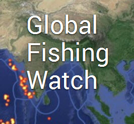


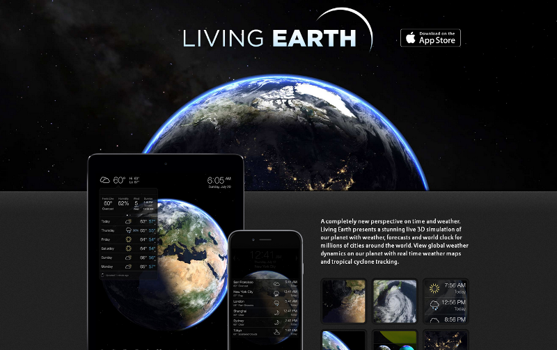
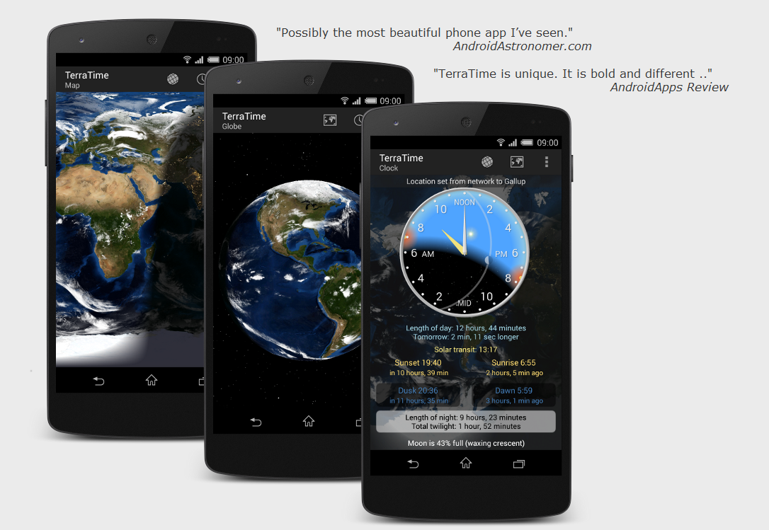
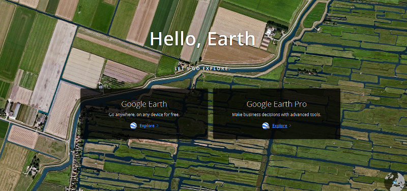
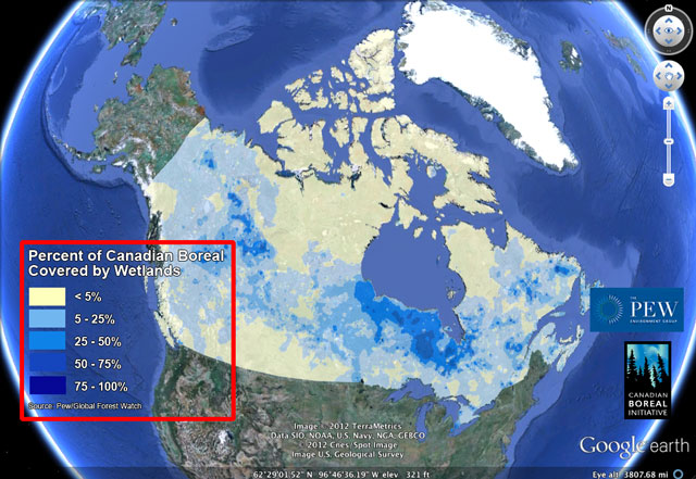