Virtual Earth: Difference between revisions
Siterunner (talk | contribs) No edit summary |
Siterunner (talk | contribs) No edit summary |
||
| Line 1: | Line 1: | ||
<H2>'''EcoExploring / Land Unit Mapping / Virtual Planet'''</H2> | <H2>'''Earth Science / EcoExploring / Land Unit Mapping / Virtual Planet'''</H2> | ||
[[File:EcoExploring Maps.png | link=http://ecoexplorer.arcgis.com/eco/maps.html]] | [[File:EcoExploring Maps.png | link=http://ecoexplorer.arcgis.com/eco/maps.html]] | ||
Revision as of 21:51, 13 February 2017
Earth Science / EcoExploring / Land Unit Mapping / Virtual Planet
○ ○ ○ ○ ○ ○ ○ ○
Where Am I?
AI Facebook Mapping, Citizen Mapping, United Nations Mapping
- Facebook’s artificial-intelligence software... capable of mapping more in a week than humanity has mapped in history
○
○

○ ○ ○ ○ ○ ○ ○ ○ ○ ○ ○ ○ ○ ○ ○ ○ ○ ○ ○ ○ ○ ○ ○ ○ ○ ○ ○
- New Maps of Global Ecological Land Units
http://ecoexplorer.arcgis.com/eco/maps.html
http://www.aag.org/global_ecosystems
http://www.aag.org/galleries/default-file/AAG_Global_Ecosyst_bklt300.pdf
http://www.wired.com/2015/02/new-map-shows-worlds-ecosystems-unprecedented-detail/
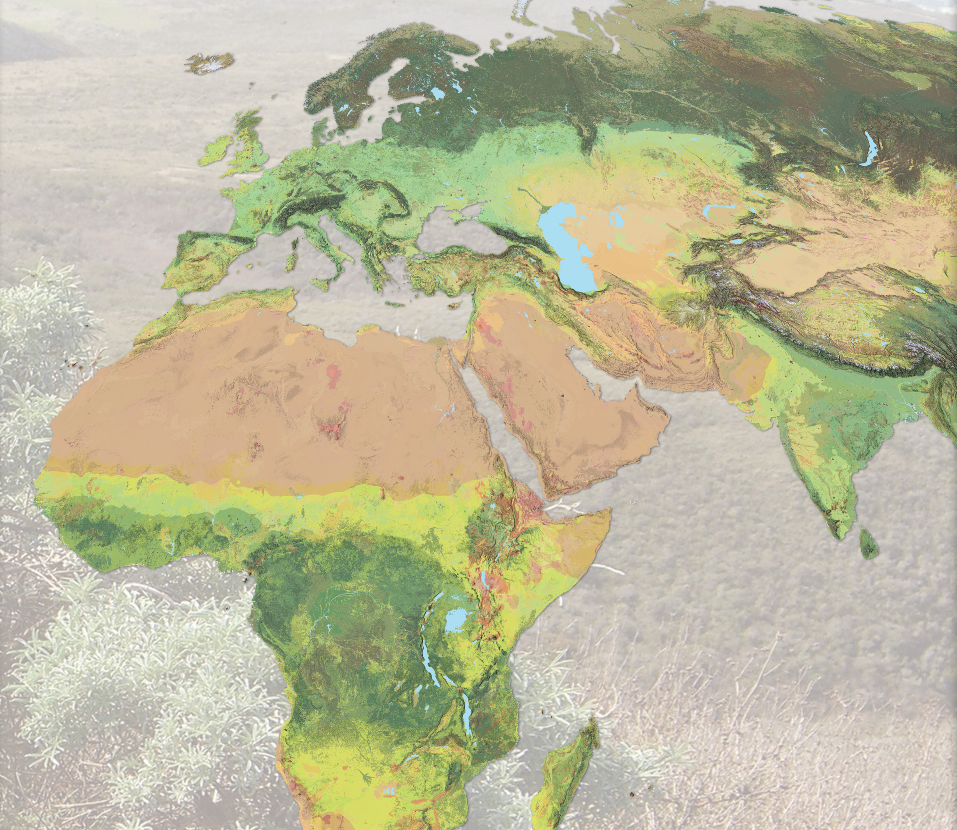
The Global Ecological Land Unit maps are the most detailed look ever at Earth’s ecosystems. Basically, it partitions the planet into squares 50 meters on a side—roughly the size of a couple of football fields. An ecosystem looks at lithology (that’s rocks and dirt), climate, topography, and land cover—from pristine forest to pavement. Each square on the map combines those categories of data, and every pixel can be described in a single sentence—say, warm, wet hills on volcanic rocks with mostly evergreen forests. Underneath: reams of reference. A world’s worth of data.
The US Geological Survey pulled that information from a wide swath of sources—soil surveys, digital elevation models, satellites, weather stations. But the agency didn’t have the computing power to chew it into meaningful maps. So, they partnered with ESRI, the titanic digital mapping company, which marshaled an army of geographers, analysts, and cartographers to knit everything together. Ecologists have always relied on maps made by experts based on their on-the-ground research. They were good, but subjective. Data is better. “It’s a huge confidence boost to the scientists that we are on the right track to understanding things in a comparable way,” says Charlie Frye, ESRI’s chief cartographer. After sharing it with veteran ecologists, Frye says they responded by telling him that this map showed them what they already knew, but at scales they’d never seen before.
And what’s good for research is good for conservation...
○ ○ ○ ○ ○ ○ ○ ○ ○ ○ ○ ○ ○ ○ ○ ○ ○ ○ ○ ○ ○ ○ ○
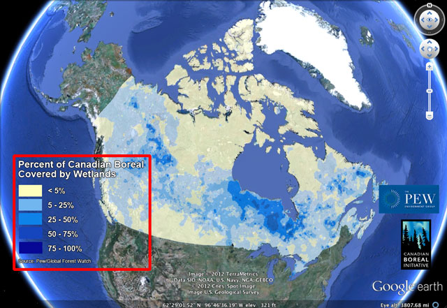
River Basins & Watersheds

Ecoregions
http://www.greenpolicy360.net/w/Category:Ecoregions
http://assets.panda.org/img/original/ecoregions_map.jpg
○ ○ ○ ○ ○ ○ ○ ○ ○ ○ ○ ○ ○ ○ ○ ○ ○ ○ ○ ○
- APPS
Smartphone Apps/Browser add-ons/extensions
○ ○ ○ ○ ○ ○ ○ ○ ○ ○
- Google Maps
Introducing Voyager & Earth View
○ ○ ○ ○ ○ ○ ○ ○ ○ ○ ○ ○ ○ ○ ○ ○ ○ ○ ○ ○
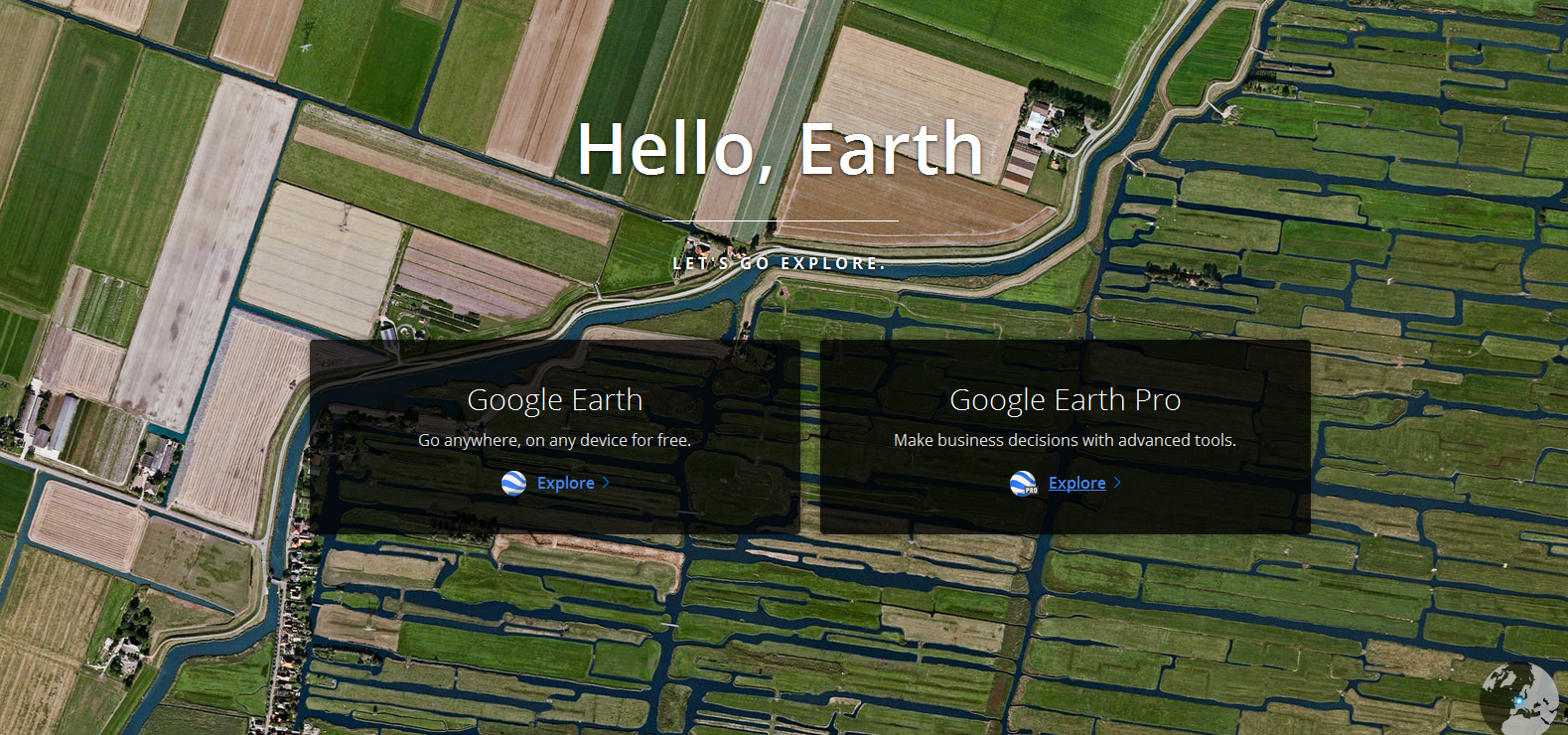
Google Earth Pro is now available to download free/February 2015 - http://google-latlong.blogspot.com/2015/01/google-earth-pro-is-now-free.html
Google Earth http://www.google.com/earth/
- Google Earth Outreach
http://www.google.com/earth/outreach/tutorials/mapper_temp.html
http://www.google.com/earth/outreach/tutorials/spreadsheet.html
http://www.google.com/earth/outreach/tutorials/spreadsheet3.html
http://www.google.com/earth/outreach/tutorials/mapseng_lite.html
§
- Microsoft Bing / Virtual Earth
Bing Maps Platform (previously Microsoft Virtual Earth) http://www.microsoft.com/maps/
§
- NASA Maps
Web-enabled LandSat Data http://weld.cr.usgs.gov/
NASA World Wind http://worldwind.arc.nasa.gov/java/ -- http://worldwind.arc.nasa.gov/java/
"World Wind lets you zoom from satellite altitude into any place on Earth. Leveraging Landsat satellite imagery and Radar Topography data, World Wind lets you experience Earth terrain in visually rich 3D..."
NASA Earth Observatory Global Maps http://earthobservatory.nasa.gov/GlobalMaps/?eocn=topnav&eoci=globalmaps
○ ○ ○ ○ ○ ○ ○ ○ ○ ○ ○ ○ ○ ○
More Maps Online
- ArcGIS Explorer a lightweight client for ArcGIS Server, supports WMS and many other GIS file formats.
- Bing Maps 3D interface runs inside Internet Explorer and Firefox, and uses NASA Blue Marble: Next Generation.
- Bhuvan is an India-specific virtual globe.
- Cesium, a WebGL virtual globe and map engine. Cesium is free and open-source software (Apache 2.0).
- CitySurf Globe, fast adaptation and transfer secured data due to special data storage structure, dynamic spatial data editing on 3D client monitor, data stored in Oracle SDO or PostGIS, flexible authorization models for different user groups (LDAP and Active Directory support) also excellent quality and fast 2D map rendering.
- driveme.in is a street view application for India.
- Earth3D, a program that visualizes the Earth in a real-time 3D view. It uses data from NASA, USGS, the CIA and the city of Osnabrück. Earth3D is free software (GPL).
- EarthBrowser, an Adobe Flash/AIR-based virtual globe with real-time weather forecasts, earthquakes, volcanoes, and webcams.
- Google Earth, satellite & aerial photos dataset (including commercial DigitalGlobe images) with international road dataset, the first popular virtual globe along with NASA World Wind.
- MapJack is a map feature covering areas in Canada, France, Latvia, Macau, Malaysia, Puerto Rico, Singapore, Sweden, Thailand, and the United States.
- Marble, part of the KDE, with data provided by OpenStreetMap, as well as NASA Blue Marble: Next Generation and others. Marble is Free and open-source software (LGPL).
- NASA World Wind, USGS topographic maps and several satellite and aerial image datasets, the first popular virtual globe along with Google Earth. World Wind is open-source software (NOSA).
- NORC is a street view web service for Central and Eastern Europe.
- OpenWebGlobe, a virtual globe SDK written in JavaScript using WebGL. OpenWebGlobe is free and open-source software (MIT).
- osgEarth is an open-source (LGPL) C++ SDK for global terrain rendering. It can pull data from web services(WMS, WCS, TMS) as well as many GDAL supported formats.
- PYXIS WorldView, integrates multisource local and remote GIS content on a discrete global Grid (spatial index) system for analysis and sharing.
- Science On A Sphere (SOS) Explorer, free virtual globe from National Oceanic and Atmospheric Administration (NOAA) enables users to explore the world and environmental data.
- Worldwide Telescope features an Earth mode with emphasis on data import/export, time-series support and a powerful Tour authoring environment.
○
Bank of America
Bank of America "Transforming World Atlas" / Maps (2016) -- http://www.bofaml.com/content/dam/boamlimages/documents/articles/ID16-305/bofaml_transforming_world_atlas_2nd_edition.pdf
"Space exploration to medical innovation, European migration to US immigration, inequality and poverty to the rise of women in the workforce, cyberwars and pandemics to the astonishing interconnectivity of today’s world..."
Themes and Trends / Seventy Maps
1.People – the allocation of scarce human resources
2.Innovation – the disruptive role of technology
3.Government – the role of public policy
4.Markets – the allocation of scarce financial capital
5.Earth – the allocation of scarce natural resources
○
○
○
○
○
Carto
○ ○ ○ ○ ○ ○ ○ ○ ○ ○ ○ ○ ○
- Earth Biosphere Mapping
○ ○ ○ ○ ○ ○ ○ ○ ○ ○ ○ ○ ○ ○ ○ ○ ○ ○ ○ ○ ○ ○ ○
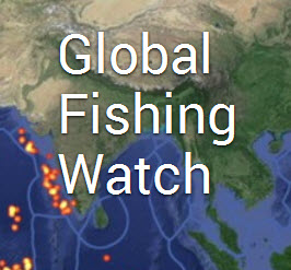
Global Fishing Watch launches
Google Earth Outreach Out in Front
Global Fishing Watch_launches [1]
Global Forest Watch launches - 2014
Google Outreach continues its impact

Monitoring the world's forests
○

Index Mundi -- http://www.indexmundi.com/factbook/countries
○
United Nations / National sites -- Environmental Data -- http://unstats.un.org/unsd/environment/clinks.htm
○
World Bank/Country Data -- http://data.worldbank.org/country
○
Environmental Performance Index (EPI) -- http://epi.yale.edu/reports/2016-report
○
Environmental Law -- http://www.globalenvironmentallaw.org/Site/COUNTRY_PROFILES.html
○
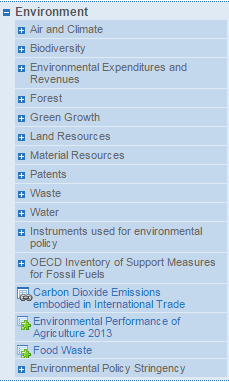
OECD (see Environmental Data) -- http://stats.oecd.org/index.aspx
○
Arable Land Percent - World
https://en.wikipedia.org/wiki/Arable_land

○


http://mashable.com/2015/06/16/groundwater-aquifers-depleted/
http://touch.latimes.com/#section/-1/article/p2p-83799955/
http://www.nzherald.co.nz/world/news/article.cfm?c_id=2&objectid=11466534
○
- Country
- Maps
- Aquifers
- Biodiversity
- Citizen Science
- Climate Change
- Desertification
- Digital Citizen
- Earth360
- EarthPOV
- Earth Imaging
- Earth Observations
- Earth Law
- Earth Science
- Earth Science from Space
- Ecology Studies
- Environmental Full-cost Accounting
- Environmental Protection
- Environmental Security
- Environmental Security, National Security
- EOS eco Operating System
- Externalities
- Forest
- Forests
- Land Ethic
- New Space
- Oceans
- Permaculture
- Planet API
- Planet Citizen
- Planet Scientist
- Planet Citizens, Planet Scientists
- Planetary Science
- Sustainability
- Sustainability Policies
- ThinBlueLayer
- Virtual Earth
- Virtual Planet
- Water
- Whole Earth
- Atmospheric Science
- Biogeosciences
- Cryosphere
- Geology
- Geophysics
- Geophysics and Geochemistry
- Hydrology
- Mineralogy
- Natural Resources
- Ocean Science
- Space Science and Space Physics