File:River basins - watersheds.jpg
Jump to navigation
Jump to search
No higher resolution available.
River_basins_-_watersheds.jpg (800 × 214 pixels, file size: 111 KB, MIME type: image/jpeg)
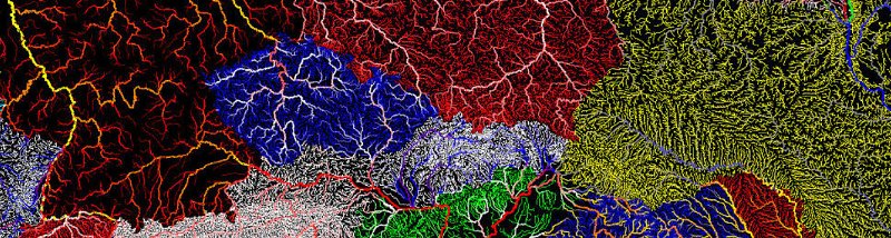
River Basins-Watershed Maps avail at GrasshopperGeography - https://www.etsy.com/shop/GrasshopperGeography?section_id=20096462
Read More / Oct 2016
- http://www.dailymail.co.uk/sciencetech/article-3860062/The-veins-America-Stunning-map-shows-river-basin-US.html
- http://www.greenpolicy360.net/w/Landsat_data_users_handbook
- Open-source QGIS software -- http://qgis.org/en/site/
File history
Click on a date/time to view the file as it appeared at that time.
| Date/Time | Thumbnail | Dimensions | User | Comment | |
|---|---|---|---|---|---|
| current | 15:55, 22 October 2016 | 800 × 214 (111 KB) | Siterunner (talk | contribs) |
You cannot overwrite this file.
File usage
The following 2 pages use this file:
Categories:
- Agricultural Economics
- Agriculture
- Democratization of Space
- Earth360
- EarthPOV
- Earth Art
- Earth Observations
- Earth Science
- Earth Science from Space
- Environmental Protection
- Global Security
- NASA
- New Space
- Planet API
- Planet Citizen
- Planet Citizens, Planet Scientists
- Whole Earth
- Alternative Agriculture
- Aquifers
- Appropriate Technology
- Biodiversity
- Bioneers
- Biogeosciences
- Bioregionalism
- Eco-nomics
- Ecology Studies
- Ecoregions
- EOS eco Operating System
- Farm-Related Policies
- Food
- Food-Related Policies
- Green Best Practices
- Land Ethic
- Permaculture
- Resilience
- Soil
- Sustainability
- Sustainability Policies
- Water
- Watersheds
- Wetlands
- Atmospheric Science
- Climate Change
- Climate Policy
- Planetary Science
- Virtual Earth
- Virtual Planet