Earth Imaging-New Space: Difference between revisions
Siterunner (talk | contribs) No edit summary |
Siterunner (talk | contribs) No edit summary |
||
| (107 intermediate revisions by the same user not shown) | |||
| Line 1: | Line 1: | ||
<big><big>''' 2024'''</big></big> | |||
[https://www.greenpolicy360.net/w/Category:Whole_Earth <big><big><big>'''Whole Earth'''</big></big></big>] | |||
🌎 | |||
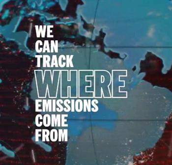
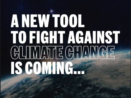
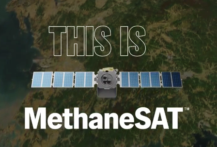
<big>'''The 2024 Launch of MethaneSat'''</big> | |||
MethaneSAT, a subsidiary of the nonprofit Environmental Defense Fund, selected Blue Canyon Technologies in 2020 to supply its donor-funded satellite. | |||
::'''[[Climate Plans Enforcement - Resources]]''' | |||
::* https://greenpolicy360.net/w/Climate_Plans_Enforcement_-_Resources | |||
:::: [[File:MethaneSat - 1.jpg]] | |||
:: [[File:MethaneSat - 2.PNG]] | |||
:: [[File:MethaneSat - 3.PNG]] | |||
:: * https://twitter.com/MethaneSAT/status/1748388037719904318 | |||
🌎 | |||
<big>'''[[Democratization of Space]]'''</big> | |||
: * https://greenpolicy360.net/w/Category:Democratization_of_Space | |||
<big>'''[[New Space]]</big> | |||
: * https://greenpolicy360.net/w/New_Space | |||
SJS/GreenPolicy360 Siterunner: | |||
Of the many firms that have come into existence in the last decade and now collect data set with satellites, Planet Labs was first to come onto our radar screen here in 2011. We have been following the evolution of the Planet Labs' story (now re-branded ''Planet'' @ Planet.com) from its mission statement to today. | |||
[[File:Living Earth.png]] | |||
<big>'''''Using Earth Space Research from Space to Protect & Preserve Life on Earth'''''</big> | |||
Information tech innovations in Earth Science in 2023 brought profound changes into the public sphere principally via ChatGPT and its large learning models and training AI/artificial intelligence systems. Utilizing collected, dynamic data sets a host of new value propositions have come from the fields of Earth imaging and "New Space" into companies around the world. GreenPolicy360 has followed one of the New Space companies, Planet Labs closely over the years. | |||
Let's take a look at recent updates to Planet's '''[[Planet API]]'''. | |||
'''Planet, the Company''' | |||
: ''Planet is driven by a mission to image all of Earth's landmass every day, and make global change visible, accessible and actionable.'' | |||
: * https://www.planet.com/company/ | |||
We, at GreenPolicy360, have a special interest in the work of Planet, as we were 'in at the beginning' as it were. We were there, in person, close up, when the original NASA mission statement, including these words -- “To understand and protect our home planet..." -- were being spoken of by a US representative serving on the Space and Technology committee responsible for policy and oversight. [https://www.greenpolicy360.net/w/George_E._Brown_Jr '''Congressman George Brown'''] from California showed your GreenPolicy360 Founder/Siterunner words that were motivating him to propose [https://www.greenpolicy360.net/w/Landsat_data_users_handbook '''Landsat missions'''] that came to be called 'Big Science', Earth Imaging/Earth Science and Atmospheric-Climate Science. For 30+ years Representative George E. Brown led the charge, as it were, to gather the data needed to make informed and wise decisions about our home Planet. | |||
A decade after George's passing away in 1999, youthful engineers from NASA 'spun off' from the 'home ship' to launch Planet Labs and their mission resonated with a mission we share. Our environmental work goes back to this mission and, as we have attempted to bring it into the light, it is again time to highlight Planet. | |||
Take a look at their most recent add-ons to what we call a '''[[Planet API]]'''. It's AI time, artificial intelligence applied to analyzing the Earth imaging data that has been gathered over a decade by Planet and is being queried and utilized in ways that Rep. Brown used to explain was his dream, as he, also an engineer, explained how the public-private partnerships, with universities and educators, using fleets of satellite with new digital imaging and data banks, would enable a new vision for citizens across the Earth. | |||
And now, here we are! Planet.com and GreenPolicy360.com, we're on mission .... | |||
* https://www.greenpolicy360.net/w/Environmental_movement | |||
* https://www.greenpolicy360.net/w/Earth_Day_Memories_on_the_50th_Anniversary | |||
<big>'''Understanding AI’s Impact on Space Data with Planet’s Head of Product'''</big> | |||
* https://payloadspace.com/understanding-ais-impact-on-space-data-with-planets-head-of-product/ | |||
<big>'''[[Planet API]]'''</big> | |||
* https://greenpolicy360.net/w/Planet_API | |||
* https://www.greenpolicy360.net/w/Planet_Labs_Doves_Fly | |||
: <big>'''[[Planet Citizens]]'''</big> | |||
: [[File:Earth-fave-icon3.png|link=https://www.greenpolicy360.net/w/PlanetCitizen]] | |||
: [https://www.greenpolicy360.net/w/Category:Strategic_Demands '''Strategic Demands'''] | |||
🦠 <big><big>'''[[Earth Science Vital Signs]]'''</big></big> | |||
* https://www.greenpolicy360.net/w/Earth_Science_Vital_Signs | |||
We, now at GreenPolicy360, are continuing on, presenting Earth science news, green politics and environmental movement recollections and highlights from the eco-journey: | |||
<big><big>New Ways to See & Experience Planet Earth</big></big> | |||
| |||
'''Earth Imaging-New Space''' | |||
Visit GreenPolicy360's story of Earth Science research from our decades of research, eco-activism and #PlanetCitizens education. | |||
Our eco operating system (eOS) includes: | |||
[[EarthPOV]] | |||
ThinBlueLayer.com - [[Look at how thin our atmosphere is]] | |||
[[Earth and Space, Politics]] | |||
[[New Definitions of National Security]] | |||
[[Earth Science Research from Space]] | |||
[[Micro-satellites]] | |||
[[Virtual Earth]] | |||
[[HelloEarth]] | |||
[[Earth Right Now]] | |||
[[Earth Science Vital Signs]] | |||
[[The Commons]] | |||
············· | |||
<big><big>''' 2023'''</big></big> | |||
<big>'''New Space Update:'''</big> | |||
Todd Master: | |||
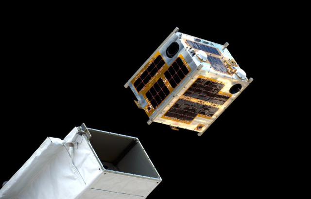
: ''What began with cubesat rideshare on other launchers has evolved into a low cost, quarterly-ish ride for about a million bucks for 100kg. There are entire businesses that are enabled by this that could not have existed 5 years ago.'' | |||
: ''This critical part of the space industry is enabled by SpaceX's focused efforts on reuse that make these types of launches economically viable. It's intriguing to consider how consequential a single company's contribution is to kick-starting a whole economic ecosystem.'' | |||
[[[[File:Cube Launch from the ISS via Tim Peake.png]] | |||
<small>Photo: Cube Launch from the International Space Station via Tim Peake</small> | |||
🌎 | |||
[[File:Planet and plan for an Earthdata platform.png]] | |||
'''The Founders of Planet (previously Planet Labs) Speak of the 360 Global Mapping Plan and #Earthdata Platform''' (2023) | |||
Watch the video, envision the future capabilities and continuing reach of #EarthScience | |||
* https://x.com/planet/status/1640439970706890753?s=20 | |||
<big><big>'''[[Planet API]]'''</big></big> | |||
* https://www.greenpolicy360.net/w/Planet_API | |||
🌎 | |||
[[File:Timelapse.png]] | |||
<big>'''Time to Try the Timelapse app at Google Earth!'''</big> | |||
: With a Tip of our GreenPolicy360 hat to digital mapping, earth science visionaries | |||
::George E. Brown (Landsat) and Rebecca Moore (Google Earth Outreach) | |||
* https://www.greenpolicy360.net/w/George_E._Brown_Jr | https://www.greenpolicy360.net/w/Landsat_data_users_handbook | |||
* https://en.wikipedia.org/wiki/Rebecca_Moore_(scientist) | https://www.greenpolicy360.net/w/File:Rebecca_Google_Outreach.jpg | |||
* https://twitter.com/ESA_EO/status/1639911818230390786 | |||
* https://t.co/HILNINfsWb | |||
Earth Imagery Key to Google Earth | |||
<small><small>* https://www.esa.int/Applications/Observing_the_Earth/Satellite_imagery_key_to_powering_Google_Earth</small></small> | |||
🌎 | |||
'Virtual' Earth and Ggogle Earth | |||
* https://www.greenpolicy360.net/w/Virtual_Earth | |||
* https://www.greenpolicy360.net/w/Google_Earth_Timelapse | |||
* https://www.greenpolicy360.net/w/Google_Earth | |||
* https://www.greenpolicy360.net/w/Category:Maps | |||
🌎 | |||
[[File:Recent Satellite Imagery of Earth - via Azavea.png]] | |||
: Via Azavea 2023 | |||
'''Google Earth''' | |||
* https://earth.google.com/web/ | |||
'''Bing Maps Aerial''' | |||
* https://www.arcgis.com/home/webmap/viewer.html?webmap=8651e4d585654f6b955564efe44d04e5#! | |||
'''Mapbox Satellite Live''' | |||
* https://www.mapbox.com/maps/satellite | |||
* https://www.mapbox.com/imagery | |||
'''HERE WeGo - Map View / Satellite''' | |||
* https://www.here.com/ - https://wego.here.com | |||
'''Zoom Earth''' | |||
* https://zoom.earth/ | |||
~ | |||
'''Airbus''' | |||
* https://www.airbus.com/en | |||
'''Blue Canyon Technologies''' | |||
* https://bluecanyontech.com/ | |||
'''Capella''' | |||
* https://www.capellaspace.com/ | |||
'''EagleView''' | |||
* https://www.eagleview.com/ | |||
'''Hexagon Geospatial''' | |||
* https://hexagon.com/solutions/geospatial-content | |||
'''ICEYE (US) | |||
* https://www.iceye.com/en-us/ | |||
* https://www.iceye.com/satellites | |||
'''LeoLabs''' | |||
* https://leolabs.space/ | |||
'''Maxxar''' | |||
* https://www.maxar.com/ | |||
'''Nearmap''' | |||
* https://www.nearmap.com/us/en | |||
'''Planet''' | '''[[Planet API]]''' | |||
* https://www.planet.com/ | |||
* https://developers.planet.com/docs/data/skysat/ | |||
* https://earth.esa.int/eogateway/missions/skysat | |||
'''SpaceX - Rideshare''' | |||
* https://www.spacex.com/rideshare/ | |||
'''Spire''' | |||
* https://spire.com/ | |||
* https://spire.com/about-us/ | |||
* https://spire.com/our-purpose/ | |||
'''Vexcel Imaging''' | |||
* https://www.vexcel-imaging.com/ | |||
🌎 | |||
<big><big>''' 2022'''</big></big> | |||
<big><big>''''New Space' | Democratization of Space / Earth Imaging'''</big></big> | |||
* https://www.greenpolicy360.net/w/Democratization_of_Space | |||
[[File:Earth and Moon, photos from Orion spaceship, NASA, Nov 28 2022.jpg]] | |||
🌎 | |||
<big><big>'''Time for Planet Citizen Action and a "CEOS", a Committee on Earth Observation Satellites'''</big></big> | |||
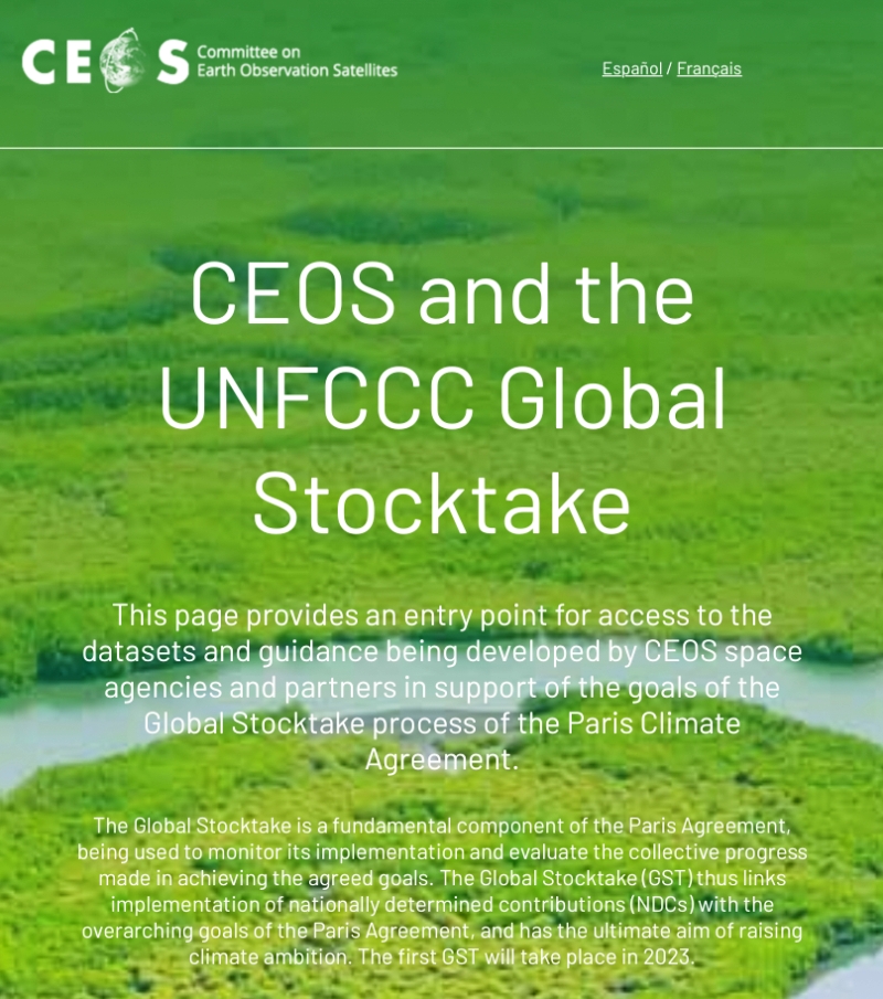
GreenPolicy360 welcomes the arrival of a global science mission, a "Global Stocktake", a collection of earth science data to be made available to the community of nations, to planet citizen activists and scientists, educational institutions, non-profits, NGOs, young and old to become tools for legal enforcement of national climate plans & pledges. | |||
[[File:Global Stocktake, the first GST.jpg]] | |||
<small>* https://www.greenpolicy360.net/w/File:Global_Stocktake,_the_first_GST.jpg</small> | |||
'''See GreenPolicy 2021 initiative for Legally Enforcing National Climate Plans''' | |||
Visit GreenPolicy360's "Climate Plans Enforcement" (Project-in-Dev 2021-2022) | |||
: "Turning National Climate Pledges & Promises into Reality" | |||
:* https://www.greenpolicy360.net/w/Climate_Plans_Enforcement_-_Resources | |||
:* https://www.greenpolicy360.net/w/File:Methods_to_enforce_climate_pledges-NDCs_-_Dec_2021.png | |||
🌎 | |||
<big><big>'''[[Planet API]]'''</big></big> | |||
'''Space private sector Q2 2022 reports via @thesheetztweetz:''' | |||
* https://www.cnbc.com/2022/09/10/space-sector-q2-results-mixed-performance-with-progress-and-delays.html | |||
CNBC breaks down the most recent quarterly reports for Aerojet Rocketdyne, AST SpaceMobile, Astra, BlackSky, Iridium, Maxar, Momentus, Mynaric, Redwire, Rocket Lab, Satellogic, Spire Global, Telesat, Terran Orbital, ViaSat, Virgin Galactic and Virgin Orbit. | |||
and Planet | https://www.cnbc.com/quotes/PL | |||
* https://www.greenpolicy360.net/w/Planet_API | |||
Planet Labs PBC, formerly dMY Technology Group, Inc. IV, is a provider of global, daily satellite imagery and geospatial solutions. The Company designs, builds, and operates the Earth observation fleet of imaging satellites, capturing, and compiling data from over three million images per day. The Company’s automated, cloud-native platform processes and manages data catalogue and extracts information. The Company’s platform includes imagery, insights, and machine learning that enables companies, governments, and communities around the world to make decisions about evolving world. Its platform and analytics products include Planet Application Programming Interfaces (APIs), Planet Applications, Planet Basemaps, Planet Fusion, and Planet Analytics Feeds. The Company provides mission-critical data, advanced insights, and software solutions, across agriculture, forestry, intelligence, education and finance companies and government agencies, enabling users to derive satellite imagery. | |||
$AJRD | $ASTS | $ASTR | $BKSY | $IRDM | $MAXR | $MNTS | $MYNA | $RDW | |||
$RKLB | $SATL | $SPIR | $TSAT | $LLAP | $VSAT | $SPCE | $VORB | |||
🌎 | |||
<big><big>'''Earth Science Research from Space: Methane emissions'''</big></big> | |||
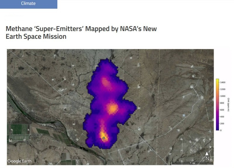
''Extremely large emitters — releasing more than 25 tons per hour — can be seen and tracked from near-earth orbit'' | |||
''Earth imaging data from a sensor aboard a European satellite, Sentinel 5'' | |||
* https://sentinel.esa.int/web/sentinel/missions/sentinel-5 | |||
''Using data from 2019 and 2020, (scientists) located about 1,200 of these ultra emitters, a large portion of them from Russia, Turkmenistan, the United States, the Middle East and Algeria.'' | |||
''Total emissions from these sites were estimated at about 9 million tons per year. In terms of its potential to warm the planet, that much methane is equivalent to about 275 million tons of carbon dioxide, which is the total carbon footprint of 40 million people, based on the global average per capita.'' | |||
[[File:NASA has a new mission... against Methane.png]] | |||
* <small>https://www.greenpolicy360.net/w/File:NASA_has_a_new_mission..._against_Methane.png</small> | |||
GreenPolicy360: | |||
'''Methane hot spots we're coming to find you, identify you, act to stop you and enforce climate laws.''' | |||
:'''"Super emitters", we have a message for you, you can't hide....''' | |||
:<small>* https://www.nasa.gov/feature/jpl/methane-super-emitters-mapped-by-nasa-s-new-earth-space-mission | |||
:* https://www.greenpolicy360.net/w/File:NASA_has_a_new_mission..._against_Methane.png</small> | |||
'''''Seen From Space: Huge Methane Leaks''''' | |||
* https://www.nytimes.com/2022/02/04/climate/methane-leaks-satellites.html | |||
* https://www.washingtonpost.com/climate-environment/2022/02/03/cracking-down-methane-ultra-emitters-is-quick-way-combat-climate-change-researchers-find/ | |||
* https://www.greenpolicy360.net/w/Earth_Science_Research_from_Space | |||
:<big>'''[[Copernicus EU]]'''</big> | |||
::: | :[[File:Copernicus EU logo.jpg|link=https://www.greenpolicy360.net/w/Copernicus_EU]] | ||
:<big>'''''Methane, We're Watching'''''</big> | |||
:: | :: * https://www.greenpolicy360.net/w/Copernicus_EU | ||
:: | ::: * https://hsat.space/satellites-sentinel-5/ | ||
| Line 29: | Line 444: | ||
:: | |||
::············································································································ | |||
::<big><big><big><big>[[New Space]]</big></big></big></big> | |||
::[[File:Geosciences satellite fields b.jpg]] | |||
::············································································································· | |||
<big><big>'''''[[Planet Labs Doves Fly]]'''''</big></big> | |||
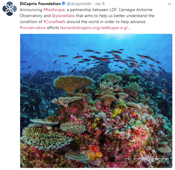
'''''PlanetLabs & [https://www.greenpolicy360.net/w/Bioneers Bioneer] Leonardo DiCaprio [https://www.greenpolicy360.net/w/File:Reefscape.png join up] with #Earth Vision''''' | |||
: ''Reefscape, Another New Way to View, Watch Over & Care for Our Common Home'' | |||
::<big>''[[The Commons]]''</big> | |||
[[File:Reefscape.png]] | |||
·········································································································································· | |||
[https://www.nature.com/articles/d41586-018-04478-6 <big><big>'''''US environmental group wins millions to develop methane-monitoring satellite'''''</big></big>] | |||
'''''The Environmental Defense Fund (EDF) is planning to be the first environmental group to send its own satellite into space''''' | |||
:''“We need good solid data so that we really can support global action on climate change, and we’ve got to do it fast,” says Steven Hamburg, the EDF’s chief scientist.'' | |||
:''The most detailed measurements currently available of atmospheric methane concentrations come from a sensor aboard the European Space Agency’s [https://www.greenpolicy360.net/w/Copernicus_EU '''Sentinel-5P spacecraft'''], which launched in '''October 2017'''. The Tropospheric Monitoring Instrument provides global coverage at a '''resolution of nearly 50 square kilometres''', but those measurements at this time do not capture the dispersed sources of emissions from oil and gas fields.'' | |||
:''Commercial firms have developed high-resolution sensors that can be placed aboard 10-centimetre-sided [https://www.nature.com/news/mini-satellites-prove-their-scientific-power-1.15051 '''CubeSats'''] to measure emissions from individual wells or other facilities. Those data are proprietary, however, and the measurements currently cannot be scaled up to the level of an entire oil and gas field.'' | |||
:''The Environmental Defense Fund team is designing '''MethaneSAT''' to provide more-precise measurements, at a '''resolution of 1 square kilometre''', with global coverage at least once a week.'' | |||
| Line 48: | Line 499: | ||
:: | ::[[File:You can manage only what you can measure Dr David Crisp, OCO-2, June 2014 m.jpg]] | ||
[[File:Earth Observing System - fleet of satellites.png]] | |||
:: | ::···································································································· | ||
: | <big><big><big>'''''Earth Science from Space'''''</big></big></big> | ||
:<big>'''''New Ways to See & Take 'Earth Action''''''</big> | |||
| Line 61: | Line 519: | ||
::<big><big>''''' | <big><big>'''[[Planet Citizen Action]]</big></big> | ||
:* https://www.greenpolicy360.net/w/Planet_Citizen_Action | |||
<big><big>'''[[Planet Citizens, Planet Scientists]]'''</big></big> | |||
:* https://www.greenpolicy360.net/w/Planet_Citizens,_Planet_Scientists | |||
::* http://www.greenpolicy360.net/w/File:PlanetLabs_homepage2016.png | |||
::* http://www.greenpolicy360.net/w/Planet_API | |||
::* http://www.greenpolicy360.net/w/Earth_Science_Research_from_Space | |||
::* http://www.greenpolicy360.net/w/Climate_News | |||
::* http://www.greenpolicy360.net/w/Category:Earth_Observations - | |||
::* http://www.greenpolicy360.net/w/New_Definitions_of_National_Security | |||
---- | |||
| |||
<big><big><big>'''Weather Watch'''</big></big></big> | |||
'''Eyes in the Sky: Atmospheric Science''' | |||
[[File:Hurricanes - Typhoons via NASA data.png]] | |||
<big><big>'''Weather Satellites'''</big></big> | |||
* https://en.wikipedia.org/wiki/Weather_satellite | |||
* https://en.wikipedia.org/wiki/Earth_observation_satellite | |||
* https://en.wikipedia.org/wiki/List_of_Earth_observation_satellites | |||
Meteorological Satellites (List of Weather Satellites) | |||
* https://commons.wikimedia.org/wiki/Category:Meteorological_satellites | |||
NOAA GOES Satellite Servers Data | |||
* https://www.star.nesdis.noaa.gov/goes/ | |||
* https://www.goes.noaa.gov/ | |||
* https://www.goes.noaa.gov/sat-explanation.html | |||
* https://www.goes.noaa.gov/f_himawari-8.html | |||
* https://www.goes.noaa.gov/msg.html | |||
Worldwide Tropical Cyclone Centers | |||
* https://www.nhc.noaa.gov/aboutrsmc.shtml | |||
NOAA Hurricane Research Division | |||
* https://www.aoml.noaa.gov/hurricane-research-division/ | |||
Archive / Wayback Machine / InternationalWeatherArchive.org (with viewer) | |||
<small><small>* https://web.archive.org/web/20100201214229/http://internationalweatherarchive.org/satellites/goesEast.aspx | |||
* https://web.archive.org/web/20100202021807/http://internationalweatherarchive.org/satellites/goesWest.aspx | |||
* https://web.archive.org/web/20100202032428/http://internationalweatherarchive.org/satellites/meteosat7.aspx | |||
* https://web.archive.org/web/20100202032500/http://internationalweatherarchive.org/satellites/meteosat9.aspx | |||
:: | * https://web.archive.org/web/20100202032505/http://internationalweatherarchive.org/satellites/mtsat1R.aspx</small></small> | ||
🌎 | |||
:: | ::<big><big>'''Ocean Science / Earth Science'''</big></big> | ||
:: | ::[[File:Rebecca Google Outreach.jpg]] | ||
:: | ::<big><big>'''Mapping Planet Citizen Action'''</big></big> | ||
:: [https://earthengine.google.com/ Google Earth Outreach] | |||
:: | :: [https://www.greenpolicy360.net/w/File:Rebecca_Google_Outreach.jpg Bioneer Rebecca Moore] | ||
::<big><big><u>'''''[[Global Fishing Watch]]'''''</u></big></big> | |||
::<big><big><u>'''''[[Global Forest Watch]]'''''</u></big></big> | |||
::: | ::* https://www.greenpolicy360.net/w/Global_Fishing_Watch | ||
::: | ::* https://www.greenpolicy360.net/w/Global_Forest_Watch | ||
::: | :::○ ○ ○ ○ ○ ○ ○ | ||
::: <big>'''[[The Commons]]'''</big> | |||
::: <big>'''[[Earth Science Research from Space]]'''</big> | |||
::: <big>'''[[Planet Citizens, Planet Scientists]]'''</big> | |||
::: <big>'''[[Planet Labs Doves Fly]]'''</big> | |||
::: <big>'''[[Virtual Earth]]'''</big> | |||
○ | :::○ ○ ○ ○ ○ ○ | ||
'''Planet Labs is now just 'Planet'''' | <big>'''Planet Labs is now just 'Planet''''</big> | ||
'''Announcement - June 12, 2016''' | : '''Planet Announcement - June 12, 2016''' | ||
:'''https://www.planet.com/pulse/meet-our-new-brand/''' | ::'''* https://www.planet.com/pulse/meet-our-new-brand/''' | ||
| Line 125: | Line 657: | ||
<big><big><big>'''Planet.com'''</big></big></big> | |||
: | :[http://t.co/dfsywixUg6 '''An API for the Planet'''] #PlanetLabs | ||
::Open Source Conference keynote [http://t.co/dfsywixUg6 ''API / An Open Sourced Discovery''] | |||
<big>'''''"In Space for betterment of life on Earth'''''''</big> | |||
: '' "Rapid cadence imagery, like Planet Labs is developing, helps us become better, more sustainable stewards of Earth."'' | |||
[http:// | :: [http://vimeo.com/88602839 ''Mission: Democratizing Access to Information About the Changing Planet''] | ||
[http:// | :[http://nyti.ms/1BzljLJ Planet Labs, newly deployed Doves] | ||
[http:// | :[http://aviationweek.com/space/smartphone-advances-drive-smallsats Smartphones++ in Space!] | ||
[http://www. | :[http://www.greenpolicy360.net/w/Doves_flocking_Planet_Labs#Micro-satellites_fly Launch of new Flock of Dove Satellites to Image Earth] | ||
[http://www. | :[http://www.greenpolicy360.net/mw/images/Dove_minisat_launch_from_ISS_m.png Doves fly] | ||
:[http://www.nasa.gov/mission_pages/station/research/news/girl_scouts_orbital_2/ Doves Flock] | |||
[http://bits.blogs.nytimes.com/2014/03/17/qa-with-steve-jurvetson-space-investor-and-rocket-maker/ ''Via the NYT ... Investing in Earth Imaging''] | :[http://www.planet.com/flock1/ Doves Flock 1] | ||
:[http://bits.blogs.nytimes.com/2014/03/17/qa-with-steve-jurvetson-space-investor-and-rocket-maker/ ''Via the NYT ... Investing in Earth Imaging''] | |||
| Line 166: | Line 701: | ||
<big>'''''2014 / 2013'''''</big> | <big>'''''2014 / 2013'''''</big> | ||
<big><big>'''Private-sector Business Joins Government-funded Space Enterprise'''</big></big> | |||
:'''NextGen #EarthScience in an era of #climatechange and #globalsecurity threats''' | |||
[http://spectrum.ieee.org/aerospace/satellites/9-earthimaging-startups-to-watch '''Nine 'New Space' startups to watch (our eyes are especially on "Planet Labs")'''] | |||
:* https://www.greenpolicy360.net/w/Category:Climate_Policy | |||
:* https://www.greenpolicy360.net/w/Category:Environmental_Protection | |||
:* https://www.greenpolicy360.net/w/Category:Environmental_Security | |||
:* https://newspaceglobal.com/ | |||
* BlackBridge -- http://www.blackbridge.com/ | * BlackBridge (acquired by Planet in 2015) -- http://www.blackbridge.com/ | ||
* Dauria -- http://dauriaspace.com/DigitalGlobe | * Dauria -- http://dauriaspace.com/DigitalGlobe | ||
:DigitalGlobe -- https://www.digitalglobe.com/] | :DigitalGlobe -- https://www.digitalglobe.com/] | [http://www.satimagingcorp.com/satellite-sensors/worldview-3/] [https://www.digitalglobe.com/imagery-completeness] [https://www.digitalglobe.com/products/platform/digitalglobe-crowdsourcing] | ||
* GeoEye -- http://en.wikipedia.org/wiki/GeoEye [http://www.satimagingcorp.com/satellite-sensors/geoeye-1/] | * GeoEye -- http://en.wikipedia.org/wiki/GeoEye [http://www.satimagingcorp.com/satellite-sensors/geoeye-1/] | ||
| Line 184: | Line 727: | ||
* GeoOptics -- http://geooptics.com/ | * GeoOptics -- http://geooptics.com/ | ||
* Isar Aerospace -- https://www.isaraerospace.com/about | |||
* '''Maxar''' -- https://www.maxar.com/ | https://www.maxar.com/space-infrastructure | https://www.maxar.com/products/satellite-imagery | https://en.wikipedia.org/wiki/WorldView-2 - https://en.wikipedia.org/wiki/WorldView-3 - https://en.wikipedia.org/wiki/QuickBird | |||
* NanoRacks -- http://nanoracks.com/ [http://nanoracks.com/about-us/our-history/] [http://nanoracks.com/products/smallsat-deployment/] | * NanoRacks -- http://nanoracks.com/ [http://nanoracks.com/about-us/our-history/] [http://nanoracks.com/products/smallsat-deployment/] | ||
| Line 197: | Line 744: | ||
* '''Planet Labs''' -- http://www.planet.com/ [https://www.planet.com/pulse/ Pulse] [http://www.greenpolicy360.net/mw/images/Doves_close-up-of-cubesats-leaving-nanoracks-deployer-2014-02-11_m.jpg] [http://www.greenpolicy360.net/mw/images/Doves_launched_from_ISS_float_against_Earth_horizon_m.jpg] [http://gizmodo.com/meet-the-flockers-iss-launches-low-cost-earth-imaging-1517232660] | * '''Planet Labs''' -- http://www.planet.com/ [https://www.planet.com/pulse/ Pulse] [http://www.greenpolicy360.net/mw/images/Doves_close-up-of-cubesats-leaving-nanoracks-deployer-2014-02-11_m.jpg] [http://www.greenpolicy360.net/mw/images/Doves_launched_from_ISS_float_against_Earth_horizon_m.jpg] [http://gizmodo.com/meet-the-flockers-iss-launches-low-cost-earth-imaging-1517232660] | ||
* RapidEye | * RapidEye (acquired by Planet Labs in 2015) | ||
* Skybox -- http://arstechnica.com/business/2014/06/google-buys-satellite-imaging-company-skybox-for-500-million/ [http://techcrunch.com/2014/05/23/google-close-to-snapping-up-satellite-startup-skybox-imaging-for-1b-say-sources/] [http://www.wired.com/2013/06/startup-skybox/] | * Skybox -- http://arstechnica.com/business/2014/06/google-buys-satellite-imaging-company-skybox-for-500-million/ [http://techcrunch.com/2014/05/23/google-close-to-snapping-up-satellite-startup-skybox-imaging-for-1b-say-sources/] [http://www.wired.com/2013/06/startup-skybox/] | ||
| Line 227: | Line 774: | ||
[[File:Geosciences agriculture-farms nasa.jpg]] | [[File:Geosciences agriculture-farms nasa.jpg]] | ||
○ | |||
<big><big>'''EarthPOV'''</big></big> | |||
[http://www.earthpov.com '''Here's looking at us -- EarthPOV.com'''] | |||
[http://www.planetcitizen.org '''What's Your Hashtag? #PlanetCitizen'''] | |||
[http://www.planetcitizens.com '''PlanetCitizens.org'''] | |||
<big>'''[[Democratization of Space]]'''</big> | |||
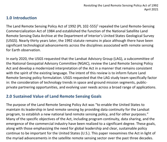
1992 | |||
[https://greenpolicy360.net/w/Landsat_data_users_handbook <big><big>'''the Landsat Mission'''</big></big> | |||
: Earth Imaging in the public sphere, with generational Earth Science data, travels on and on.. | |||
[[File:Land Remote Sensing Policy Act of 1992.jpg]] | |||
A Story of the Opening Up of 'Low Earth Orbit' Space Missions... | |||
(Via Wikipedia) ''WorldView Imaging Corporation was founded in January 1992 in Oakland, California in anticipation of the '''1992 Land Remote Sensing Policy Act''' (enacted in October 1992) which permitted private companies to enter the satellite imaging business.'' | |||
''In 1993, the company received the first high resolution commercial remote sensing satellite license issued under the 1992 Act.'' | |||
''The company was initially funded with private financing from Silicon Valley sources and interested corporations in North America, Europe and Japan.'' | |||
''In 1995, the company became EarthWatch Incorporated, merging WorldView with Ball Aerospace & Technologies Corp.'s commercial remote sensing operations. In September 2001, EarthWatch became DigitalGlobe.'' | |||
''In 2007, DigitalGlobe acquired online imagery provider GlobeXplorer to extend its imagery distribution capabilities via online APIs and web services. In 2011, DigitalGlobe was inducted into the Space Foundation's Space Technology Hall of Fame for its role in advancing commercial Earth-imaging satellites. In 2013, DigitalGlobe purchased GeoEye.'' | |||
''In October 2017, DigitalGlobe and MDA Holdings Company merged to become Maxar Technologies.'' | |||
'''Maxar Technologies''' | |||
* https://en.wikipedia.org/wiki/Maxar_Technologies | |||
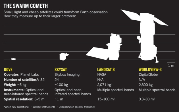
'''Skybox Imaging (Terra Bella) SkySat became part of Planet (Planet Labs)''' | |||
* https://en.wikipedia.org/wiki/SkySat | |||
* https://en.wikipedia.org/wiki/Planet_Labs | |||
[[File:Satellite -comparisons.jpg]] | |||
<small>* https://www.greenpolicy360.net/w/File:Satellite_-comparisons.jpg</small> | |||
| Line 233: | Line 839: | ||
[[Category:Democratization of Space]] | [[Category:Democratization of Space]] | ||
[[Category:Digital Citizen]] | [[Category:Digital Citizen]] | ||
[[Category:Earth360]] | |||
[[Category:Earth Imaging]] | [[Category:Earth Imaging]] | ||
[[Category:Earth Observations]] | [[Category:Earth Observations]] | ||
[[Category:Earth Science]] | [[Category:Earth Science]] | ||
[[Category:Earth Science from Space]] | [[Category:Earth Science from Space]] | ||
[[Category:Earth System Science]] | |||
[[Category:Eco-ethics]] | |||
[[Category:Eco-nomics]] | [[Category:Eco-nomics]] | ||
[[Category:Education]] | |||
[[Category:Environmental Security]] | [[Category:Environmental Security]] | ||
[[Category:Environmental Security, National Security]] | [[Category:Environmental Security, National Security]] | ||
[[Category:Food-Related Policies]] | |||
[[Category:Global Security]] | [[Category:Global Security]] | ||
[[Category:Land Use]] | |||
[[Category:Maps]] | |||
[[Category:NASA]] | [[Category:NASA]] | ||
[[Category:Nature]] | |||
[[Category:Networking]] | |||
[[Category:New Space]] | [[Category:New Space]] | ||
[[Category:Online Education]] | |||
[[Category:Planet Citizen]] | [[Category:Planet Citizen]] | ||
[[Category:Planet Citizens]] | |||
[[Category:Planet Scientist]] | [[Category:Planet Scientist]] | ||
[[Category:Planet Citizens, Planet Scientists]] | [[Category:Planet Citizens, Planet Scientists]] | ||
[[Category:Policies]] | |||
[[Category:US]] | |||
[[Category:Whole Earth]] | [[Category:Whole Earth]] | ||
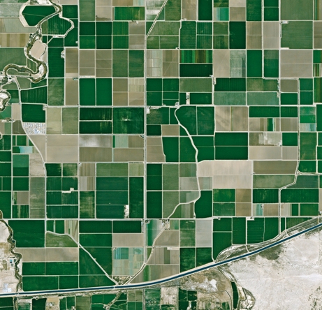
Latest revision as of 18:14, 3 June 2024
2024
🌎
The 2024 Launch of MethaneSat
MethaneSAT, a subsidiary of the nonprofit Environmental Defense Fund, selected Blue Canyon Technologies in 2020 to supply its donor-funded satellite.
🌎
SJS/GreenPolicy360 Siterunner:
Of the many firms that have come into existence in the last decade and now collect data set with satellites, Planet Labs was first to come onto our radar screen here in 2011. We have been following the evolution of the Planet Labs' story (now re-branded Planet @ Planet.com) from its mission statement to today.
Using Earth Space Research from Space to Protect & Preserve Life on Earth
Information tech innovations in Earth Science in 2023 brought profound changes into the public sphere principally via ChatGPT and its large learning models and training AI/artificial intelligence systems. Utilizing collected, dynamic data sets a host of new value propositions have come from the fields of Earth imaging and "New Space" into companies around the world. GreenPolicy360 has followed one of the New Space companies, Planet Labs closely over the years.
Let's take a look at recent updates to Planet's Planet API.
Planet, the Company
- Planet is driven by a mission to image all of Earth's landmass every day, and make global change visible, accessible and actionable.
We, at GreenPolicy360, have a special interest in the work of Planet, as we were 'in at the beginning' as it were. We were there, in person, close up, when the original NASA mission statement, including these words -- “To understand and protect our home planet..." -- were being spoken of by a US representative serving on the Space and Technology committee responsible for policy and oversight. Congressman George Brown from California showed your GreenPolicy360 Founder/Siterunner words that were motivating him to propose Landsat missions that came to be called 'Big Science', Earth Imaging/Earth Science and Atmospheric-Climate Science. For 30+ years Representative George E. Brown led the charge, as it were, to gather the data needed to make informed and wise decisions about our home Planet.
A decade after George's passing away in 1999, youthful engineers from NASA 'spun off' from the 'home ship' to launch Planet Labs and their mission resonated with a mission we share. Our environmental work goes back to this mission and, as we have attempted to bring it into the light, it is again time to highlight Planet.
Take a look at their most recent add-ons to what we call a Planet API. It's AI time, artificial intelligence applied to analyzing the Earth imaging data that has been gathered over a decade by Planet and is being queried and utilized in ways that Rep. Brown used to explain was his dream, as he, also an engineer, explained how the public-private partnerships, with universities and educators, using fleets of satellite with new digital imaging and data banks, would enable a new vision for citizens across the Earth.
And now, here we are! Planet.com and GreenPolicy360.com, we're on mission ....
- https://www.greenpolicy360.net/w/Environmental_movement
- https://www.greenpolicy360.net/w/Earth_Day_Memories_on_the_50th_Anniversary
Understanding AI’s Impact on Space Data with Planet’s Head of Product
We, now at GreenPolicy360, are continuing on, presenting Earth science news, green politics and environmental movement recollections and highlights from the eco-journey:
New Ways to See & Experience Planet Earth
Earth Imaging-New Space
Visit GreenPolicy360's story of Earth Science research from our decades of research, eco-activism and #PlanetCitizens education.
Our eco operating system (eOS) includes:
ThinBlueLayer.com - Look at how thin our atmosphere is
New Definitions of National Security
Earth Science Research from Space
·············
2023
New Space Update:
Todd Master:
- What began with cubesat rideshare on other launchers has evolved into a low cost, quarterly-ish ride for about a million bucks for 100kg. There are entire businesses that are enabled by this that could not have existed 5 years ago.
- This critical part of the space industry is enabled by SpaceX's focused efforts on reuse that make these types of launches economically viable. It's intriguing to consider how consequential a single company's contribution is to kick-starting a whole economic ecosystem.
Photo: Cube Launch from the International Space Station via Tim Peake
🌎
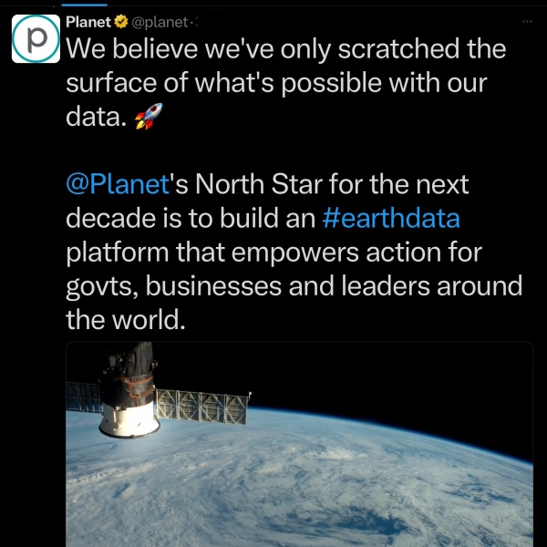
The Founders of Planet (previously Planet Labs) Speak of the 360 Global Mapping Plan and #Earthdata Platform (2023)
Watch the video, envision the future capabilities and continuing reach of #EarthScience
🌎
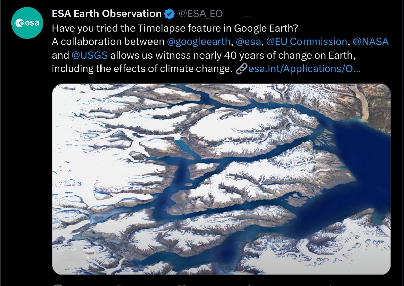
Time to Try the Timelapse app at Google Earth!
- With a Tip of our GreenPolicy360 hat to digital mapping, earth science visionaries
- George E. Brown (Landsat) and Rebecca Moore (Google Earth Outreach)
- https://www.greenpolicy360.net/w/George_E._Brown_Jr | https://www.greenpolicy360.net/w/Landsat_data_users_handbook
- https://en.wikipedia.org/wiki/Rebecca_Moore_(scientist) | https://www.greenpolicy360.net/w/File:Rebecca_Google_Outreach.jpg
Earth Imagery Key to Google Earth
* https://www.esa.int/Applications/Observing_the_Earth/Satellite_imagery_key_to_powering_Google_Earth
🌎
'Virtual' Earth and Ggogle Earth
🌎
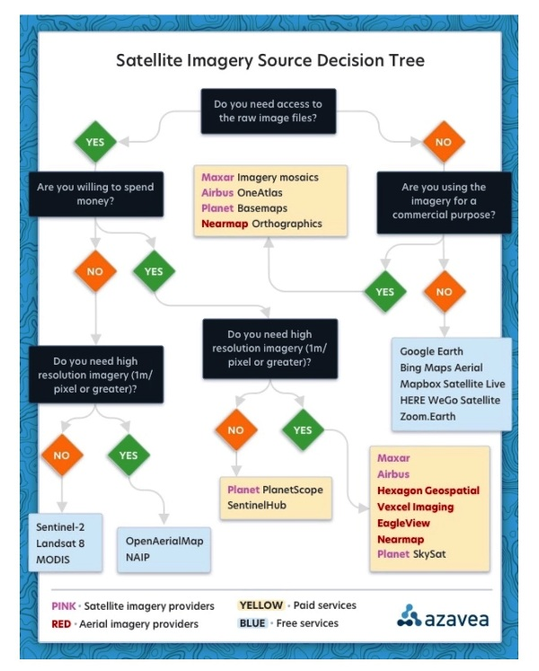
- Via Azavea 2023
Google Earth
Bing Maps Aerial
Mapbox Satellite Live
HERE WeGo - Map View / Satellite
Zoom Earth
~
Airbus
Blue Canyon Technologies
Capella
EagleView
Hexagon Geospatial
ICEYE (US)
LeoLabs
Maxxar
Nearmap
Planet | Planet API
- https://www.planet.com/
- https://developers.planet.com/docs/data/skysat/
- https://earth.esa.int/eogateway/missions/skysat
SpaceX - Rideshare
Spire
Vexcel Imaging
🌎
2022
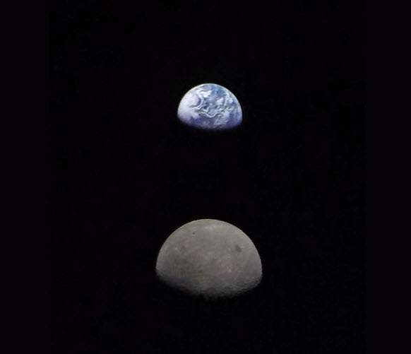
'New Space' | Democratization of Space / Earth Imaging
🌎
Time for Planet Citizen Action and a "CEOS", a Committee on Earth Observation Satellites
GreenPolicy360 welcomes the arrival of a global science mission, a "Global Stocktake", a collection of earth science data to be made available to the community of nations, to planet citizen activists and scientists, educational institutions, non-profits, NGOs, young and old to become tools for legal enforcement of national climate plans & pledges.
* https://www.greenpolicy360.net/w/File:Global_Stocktake,_the_first_GST.jpg
See GreenPolicy 2021 initiative for Legally Enforcing National Climate Plans
Visit GreenPolicy360's "Climate Plans Enforcement" (Project-in-Dev 2021-2022)
- "Turning National Climate Pledges & Promises into Reality"
🌎
Space private sector Q2 2022 reports via @thesheetztweetz:
CNBC breaks down the most recent quarterly reports for Aerojet Rocketdyne, AST SpaceMobile, Astra, BlackSky, Iridium, Maxar, Momentus, Mynaric, Redwire, Rocket Lab, Satellogic, Spire Global, Telesat, Terran Orbital, ViaSat, Virgin Galactic and Virgin Orbit.
and Planet | https://www.cnbc.com/quotes/PL
Planet Labs PBC, formerly dMY Technology Group, Inc. IV, is a provider of global, daily satellite imagery and geospatial solutions. The Company designs, builds, and operates the Earth observation fleet of imaging satellites, capturing, and compiling data from over three million images per day. The Company’s automated, cloud-native platform processes and manages data catalogue and extracts information. The Company’s platform includes imagery, insights, and machine learning that enables companies, governments, and communities around the world to make decisions about evolving world. Its platform and analytics products include Planet Application Programming Interfaces (APIs), Planet Applications, Planet Basemaps, Planet Fusion, and Planet Analytics Feeds. The Company provides mission-critical data, advanced insights, and software solutions, across agriculture, forestry, intelligence, education and finance companies and government agencies, enabling users to derive satellite imagery.
$AJRD | $ASTS | $ASTR | $BKSY | $IRDM | $MAXR | $MNTS | $MYNA | $RDW
$RKLB | $SATL | $SPIR | $TSAT | $LLAP | $VSAT | $SPCE | $VORB
🌎
Earth Science Research from Space: Methane emissions
Extremely large emitters — releasing more than 25 tons per hour — can be seen and tracked from near-earth orbit
Earth imaging data from a sensor aboard a European satellite, Sentinel 5
Using data from 2019 and 2020, (scientists) located about 1,200 of these ultra emitters, a large portion of them from Russia, Turkmenistan, the United States, the Middle East and Algeria.
Total emissions from these sites were estimated at about 9 million tons per year. In terms of its potential to warm the planet, that much methane is equivalent to about 275 million tons of carbon dioxide, which is the total carbon footprint of 40 million people, based on the global average per capita.
GreenPolicy360:
Methane hot spots we're coming to find you, identify you, act to stop you and enforce climate laws.
- "Super emitters", we have a message for you, you can't hide....
Seen From Space: Huge Methane Leaks
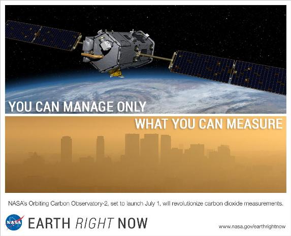
- Methane, We're Watching
- Detecting methane from space
- "There has been quite a buzz around this unique advancement in space, and the valuable data it will provide on methane, a powerful greenhouse gas that accounts for a quarter of the warming our planet is experiencing today. Curbing anthropogenic methane emissions is one of the most efficient and economical options available to slow the rate of warming over the next few decades, while efforts continue to reduce CO2 emissions worldwide."
- ············································································································
- ·············································································································
PlanetLabs & Bioneer Leonardo DiCaprio join up with #Earth Vision
- Reefscape, Another New Way to View, Watch Over & Care for Our Common Home
··········································································································································
US environmental group wins millions to develop methane-monitoring satellite
The Environmental Defense Fund (EDF) is planning to be the first environmental group to send its own satellite into space
- “We need good solid data so that we really can support global action on climate change, and we’ve got to do it fast,” says Steven Hamburg, the EDF’s chief scientist.
- The most detailed measurements currently available of atmospheric methane concentrations come from a sensor aboard the European Space Agency’s Sentinel-5P spacecraft, which launched in October 2017. The Tropospheric Monitoring Instrument provides global coverage at a resolution of nearly 50 square kilometres, but those measurements at this time do not capture the dispersed sources of emissions from oil and gas fields.
- Commercial firms have developed high-resolution sensors that can be placed aboard 10-centimetre-sided CubeSats to measure emissions from individual wells or other facilities. Those data are proprietary, however, and the measurements currently cannot be scaled up to the level of an entire oil and gas field.
- The Environmental Defense Fund team is designing MethaneSAT to provide more-precise measurements, at a resolution of 1 square kilometre, with global coverage at least once a week.
- ····································································································
Earth Science from Space
- New Ways to See & Take 'Earth Action'
Planet Citizens, Planet Scientists
Weather Watch
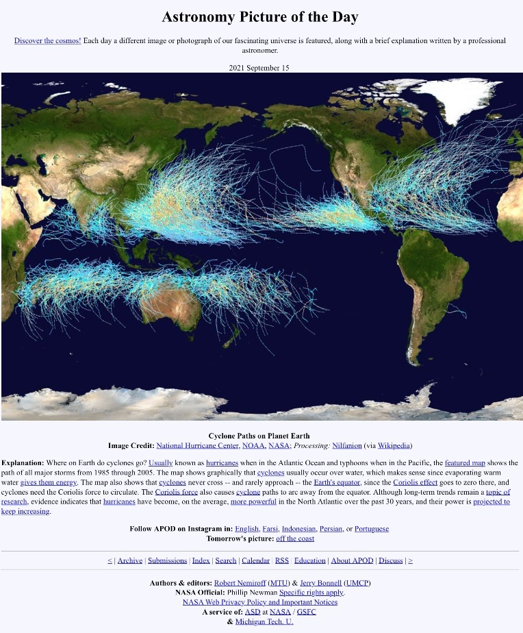
Eyes in the Sky: Atmospheric Science
Weather Satellites
Meteorological Satellites (List of Weather Satellites)
NOAA GOES Satellite Servers Data
Worldwide Tropical Cyclone Centers
NOAA Hurricane Research Division
Archive / Wayback Machine / InternationalWeatherArchive.org (with viewer)
🌎
- Ocean Science / Earth Science
- Mapping Planet Citizen Action
- ○ ○ ○ ○ ○ ○ ○
- ○ ○ ○ ○ ○ ○
Planet Labs is now just 'Planet'
- Planet Announcement - June 12, 2016
Planet.com
- An API for the Planet #PlanetLabs
- Open Source Conference keynote API / An Open Sourced Discovery
"In Space for betterment of life on Earth''
- "Rapid cadence imagery, like Planet Labs is developing, helps us become better, more sustainable stewards of Earth."
Visit Planet's Earth Images Gallery
○
Earth Imaging: Eyes in the Sky, Monitoring the Earth by Satellite
2014 / 2013
Private-sector Business Joins Government-funded Space Enterprise
- NextGen #EarthScience in an era of #climatechange and #globalsecurity threats
Nine 'New Space' startups to watch (our eyes are especially on "Planet Labs")
- BlackBridge (acquired by Planet in 2015) -- http://www.blackbridge.com/
- Dauria -- http://dauriaspace.com/DigitalGlobe
- DigitalGlobe -- https://www.digitalglobe.com/] | [1] [2] [3]
- GeoEye -- http://en.wikipedia.org/wiki/GeoEye [4]
- Firefly Space Systems -- http://www.fireflyspace.com/ [5]
- GeoOptics -- http://geooptics.com/
- Isar Aerospace -- https://www.isaraerospace.com/about
- Maxar -- https://www.maxar.com/ | https://www.maxar.com/space-infrastructure | https://www.maxar.com/products/satellite-imagery | https://en.wikipedia.org/wiki/WorldView-2 - https://en.wikipedia.org/wiki/WorldView-3 - https://en.wikipedia.org/wiki/QuickBird
- NanoRacks -- http://nanoracks.com/ [6] [7]
- NovaWurks -- http://www.novawurks.com/index.html
- OmniEarth [http://www.marketwatch.com/story/omniearth-announces-partnership-to-create-global-satellite-constellation-and-extensive-hosted-payload-opportunity-2014-05-20 [8] [9],
- OrbitLogic -- http://www.orbitlogic.com/
- PlanetiQ -- http://www.planetiq.com/
- Planet Labs -- http://www.planet.com/ Pulse [10] [11] [12]
- RapidEye (acquired by Planet Labs in 2015)
- Skybox -- http://arstechnica.com/business/2014/06/google-buys-satellite-imaging-company-skybox-for-500-million/ [13] [14]
- Teledyne --http://www.tbe.com/
- Tyvak Nano-Sat -- http://tyvak.com/
- Urthecast -- http://www.urthecast.com/
New Space
“With all these start-ups, the things you’ll be able to do with satellite images will grow exponentially.” - IEEE-May 2014
Moving from almost exclusively multi-billion dollar military/defense-communication satellite operations to nextgen 'small cap' startups and 'New Space' ventures and applications with earth systems monitoring, resources, sustainable business, and low-earth orbit.
○
EarthPOV
Here's looking at us -- EarthPOV.com
What's Your Hashtag? #PlanetCitizen
1992
[https://greenpolicy360.net/w/Landsat_data_users_handbook the Landsat Mission
- Earth Imaging in the public sphere, with generational Earth Science data, travels on and on..
A Story of the Opening Up of 'Low Earth Orbit' Space Missions...
(Via Wikipedia) WorldView Imaging Corporation was founded in January 1992 in Oakland, California in anticipation of the 1992 Land Remote Sensing Policy Act (enacted in October 1992) which permitted private companies to enter the satellite imaging business.
In 1993, the company received the first high resolution commercial remote sensing satellite license issued under the 1992 Act.
The company was initially funded with private financing from Silicon Valley sources and interested corporations in North America, Europe and Japan.
In 1995, the company became EarthWatch Incorporated, merging WorldView with Ball Aerospace & Technologies Corp.'s commercial remote sensing operations. In September 2001, EarthWatch became DigitalGlobe.
In 2007, DigitalGlobe acquired online imagery provider GlobeXplorer to extend its imagery distribution capabilities via online APIs and web services. In 2011, DigitalGlobe was inducted into the Space Foundation's Space Technology Hall of Fame for its role in advancing commercial Earth-imaging satellites. In 2013, DigitalGlobe purchased GeoEye.
In October 2017, DigitalGlobe and MDA Holdings Company merged to become Maxar Technologies.
Maxar Technologies
Skybox Imaging (Terra Bella) SkySat became part of Planet (Planet Labs)
* https://www.greenpolicy360.net/w/File:Satellite_-comparisons.jpg
- California
- Democratization of Space
- Digital Citizen
- Earth360
- Earth Imaging
- Earth Observations
- Earth Science
- Earth Science from Space
- Earth System Science
- Eco-ethics
- Eco-nomics
- Education
- Environmental Security
- Environmental Security, National Security
- Food-Related Policies
- Global Security
- Land Use
- Maps
- NASA
- Nature
- Networking
- New Space
- Online Education
- Planet Citizen
- Planet Citizens
- Planet Scientist
- Planet Citizens, Planet Scientists
- Policies
- US
- Whole Earth
- Atmospheric Science
- Biogeosciences
- Climate Change
- Cryosphere
- Geophysics and Geochemistry
- Mineralogy
- Geology
- Geophysics
- Hydrology
- Natural Resources
- Ocean Science
- Oceans
- Planetary Science
- Space Science and Space Physics
- Strategic Demands
- EarthPOV
- ISS
- Micro-satellites
- NanoRacks
- Planet API
- PlanetLabs
