Category:Cryosphere
http://en.wikipedia.org/wiki/Cryosphere
http://en.wikipedia.org/wiki/CryoSat
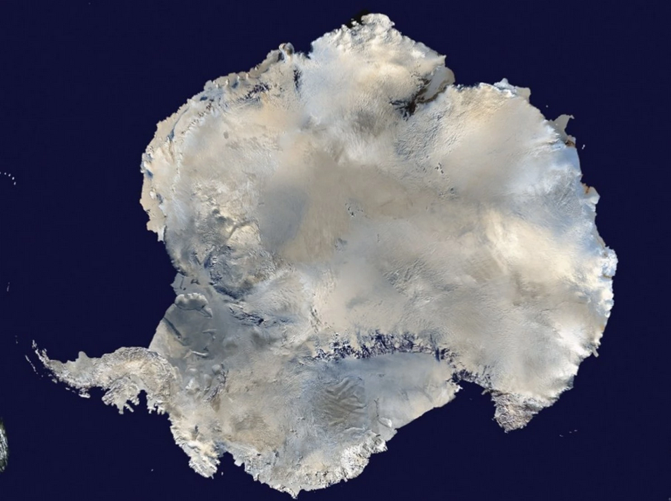
Antarctic Sea Ice
May 2015
[File:More ice destabilized in Southern Antarctica May2015.png | link=
-- Southern Antarctic Peninsula at risk of melt
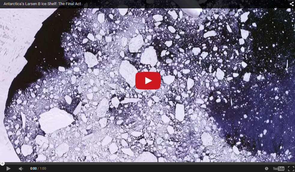
-- Antarctica's Larsen B Ice Shelf is likely to shatter into hundreds of icebergs before the end of the decade, according to a new NASA study
___________________
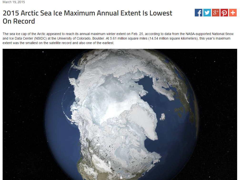
Arctic Sea Ice
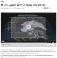
NASA Arctic Sea Ice -- 1999-2000
http://climate.nasa.gov/vital-signs/arctic-sea-ice/
___________________
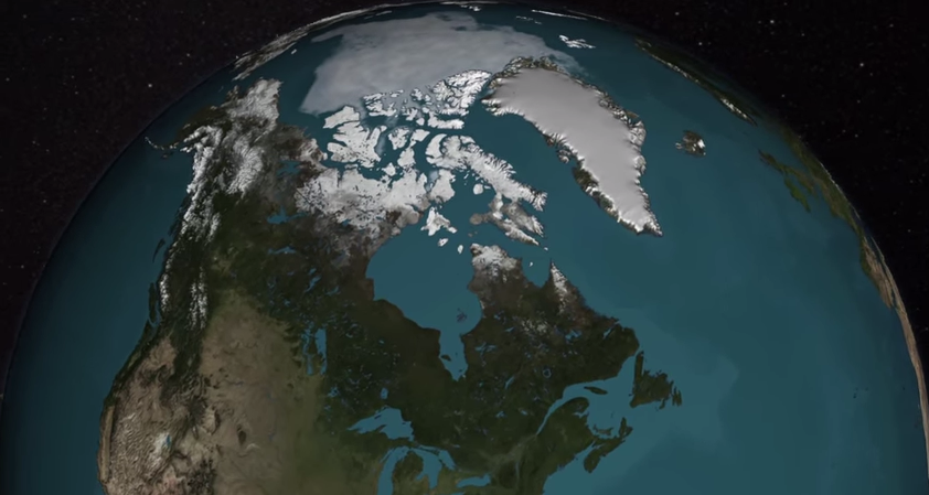
Greenland Sea Ice
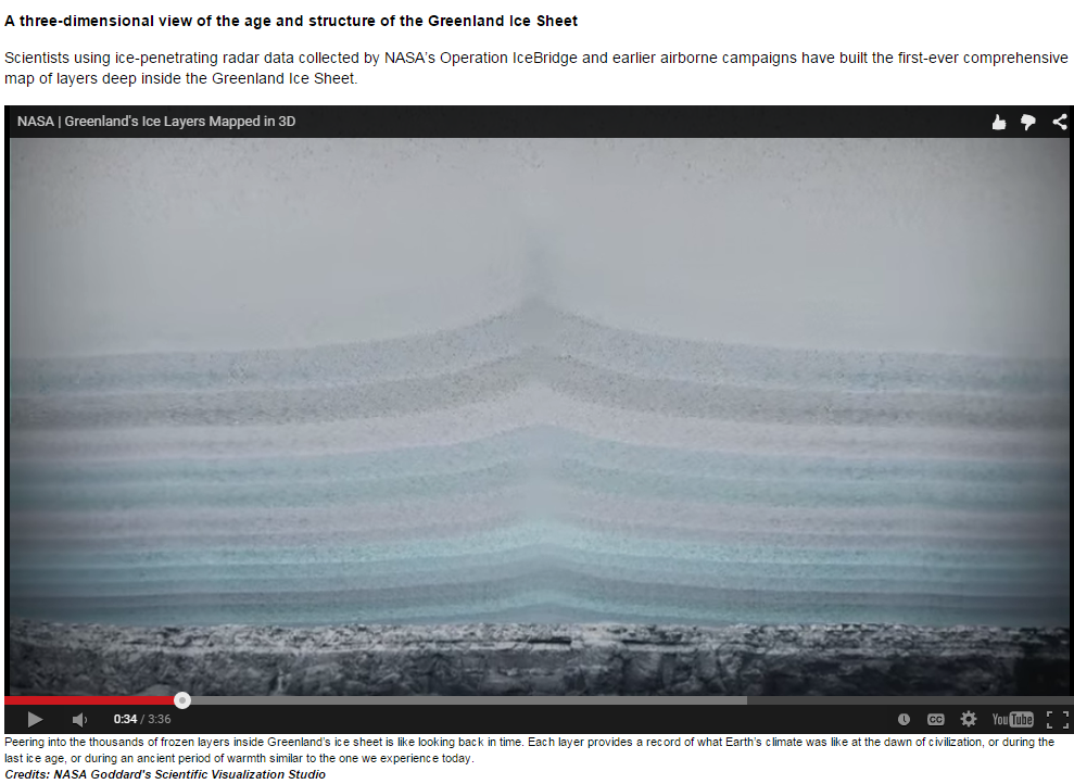
http://www.nasa.gov/content/goddard/nasa-data-peers-into-greenlands-ice-sheet
Greenland’s ice sheet is the second largest mass of ice on Earth, containing enough water to raise ocean levels by about 20 feet. The ice sheet has been losing mass over the past two decades and warming temperatures will mean more losses for Greenland. Scientists are studying ice from different climate periods in the past to better understand how the ice sheet might respond in the future...
-
Subcategories
This category has the following 7 subcategories, out of 7 total.
A
B
E
S
Pages in category "Cryosphere"
The following 29 pages are in this category, out of 29 total.
D
E
O
Media in category "Cryosphere"
The following 190 files are in this category, out of 190 total.
- 3-15-2016 12-29-07 PM.png 538 × 701; 201 KB
- 5 19 14 andrew antarcticaelevationchanges-640x547.jpg 640 × 547; 59 KB
- Against the Tide - Cover - by Cornelia Dean.jpg 308 × 475; 57 KB
- Aldis zone blog.jpg 500 × 498; 67 KB
- All Alone In the Night.png 831 × 426; 275 KB
- Antarctic Ice Shelf June 2017.png 600 × 337; 142 KB
- Antarctica from Blue Marble wiki.jpg 768 × 768; 133 KB
- Antarctica ice shelf-glaciers 2012.png 956 × 714; 805 KB
- Antarctica Larsen B Ice Shelf.png 983 × 575; 1.13 MB
- Antarctica NASA 1024x768.jpg 1,024 × 768; 250 KB
- April 28, 2016.png 586 × 415; 159 KB
- Arctic - Antarctic - Breaking.png 639 × 600; 903 KB
- Arctic mdl 1990-2010.jpg 720 × 667; 149 KB
- Arctic Sea Ice 2015.png 1,008 × 756; 542 KB
- Arctic Sea Ice Area graphic thru 2016.png 640 × 355; 382 KB
- Arctic sea ice National Geo.jpg 506 × 380; 87 KB
- Arctic Sea Ice News.png 800 × 439; 458 KB
- Arctic sea ice watch 25 yrs of ice cover change.png 697 × 386; 314 KB
- Arctic Sea Ice.png 525 × 103; 97 KB
- Arctic-asia mdl 1990-2010.jpg 720 × 667; 158 KB
- Away fly the Doves March4,2015.png 582 × 409; 167 KB
- Blue atmosphere from Astro Wheelock.jpg 800 × 532; 16 KB
- Blue fragile edge thin blue line.jpg 1,200 × 798; 26 KB
- Canary - 1.jpg 448 × 901; 144 KB
- Canary - 2.png 446 × 531; 264 KB
- Climate change is not moving at a glacial pace.png 448 × 532; 217 KB
- Climate Time Machine NASA Earth Science.png 981 × 571; 378 KB
- ClimateNews 360.jpg 172 × 172; 9 KB
- CO2 higher than in the past 5 million yrs.jpg 514 × 285; 62 KB
- Copernicus EU logo.jpg 400 × 400; 41 KB
- CopernicusEU - Sentinel5P Atmosphere Monitoring Mission - 2.jpg 795 × 1,477; 654 KB
- CopernicusEU - Sentinel5P Atmosphere Monitoring Mission.png 583 × 465; 222 KB
- Crystal Serenity cruises 2016.png 407 × 754; 274 KB
- Crystal Serenity.png 800 × 254; 468 KB
- Cyanobacteria Prochlorococcus worldmapping MIT.jpg 473 × 321; 60 KB
- Dawn above Earth-May 2018-AstroPOV.png 640 × 712; 204 KB
- Decline-Glacier-Mass-Balance Jill Pelto.jpg 653 × 440; 64 KB
- Dove1 image.jpg 420 × 308; 26 KB
- Doves launched from ISS float against Earth horizon m.jpg 807 × 537; 52 KB
- Doves launched from ISS float against Earth horizon s.jpg 553 × 368; 35 KB
- Doves launched from ISS float against Earth horizon.jpg 4,256 × 2,832; 564 KB
- DSCOVR EPIC - July 20 2022.png 532 × 612; 315 KB
- DSCOVR w EPICcam, PlasMag & NISTAR.png 1,219 × 785; 1.49 MB
- DSCOVR w EPICcam.png 800 × 515; 968 KB
- Earth 3D Overview.jpg 1,024 × 768; 190 KB
- Earth AI - Feb 2022.png 482 × 480; 192 KB
- Earth and atmosphere from Suomi.jpg 1,484 × 1,113; 349 KB
- Earth atmosphere and night 1024x551.jpg 1,024 × 551; 138 KB
- Earth atmosphere and night-1920x1080.jpg 1,920 × 1,080; 390 KB
- Earth atmosphere ISS October30,2014.jpg 590 × 392; 12 KB
- Earth atmosphere.jpg 1,440 × 1,080; 153 KB
- Earth Information Center - 2022 Graphic NASA.png 800 × 981; 868 KB
- Earth Information Center from NASA.jpg 800 × 577; 94 KB
- Earth mapped.png 800 × 783; 254 KB
- Earth Observing System - fleet of satellites.png 740 × 576; 557 KB
- Earth POV from the ISS Cupola-m.jpg 800 × 480; 71 KB
- Earth Research Findings 2015 1.png 1,088 × 686; 1.49 MB
- Earth Research Findings 2015 2.png 1,088 × 241; 512 KB
- Earth Right Now science.jpg 197 × 49; 3 KB
- Earth satellites in 3D.jpg 640 × 350; 213 KB
- Earth Science from Space-Monitoring Ice Melt.jpg 657 × 373; 60 KB
- Earth Science Vital Signs, Pulse of the Planet Climate Essentials.png 692 × 441; 207 KB
- Earth Science Vital Signs, Pulse of the Planet EOS NASA 2014.png 758 × 776; 366 KB
- Earth System Observatory-1.jpg 580 × 833; 129 KB
- Earth System Observatory-2.jpg 580 × 831; 69 KB
- Earth Viewing from the International Space Station.jpg 496 × 307; 45 KB
- Earth's atmosphere 1536x864.jpg 1,536 × 864; 48 KB
- Earth's atmosphere 3840x2160.jpg 3,840 × 2,160; 204 KB
- Earth's atmosphere 814x458.jpg 814 × 458; 23 KB
- Earth-Moon 768x432.jpg 768 × 432; 20 KB
- EarthDecadel Priorities-2018.jpg 779 × 529; 85 KB
- EarthPOV 1920x1080.jpg 1,920 × 1,080; 270 KB
- EarthRightNow Earth Science satellite fleet circa 2015.jpg 1,500 × 1,125; 0 bytes
- Earths-atmosphere-from-ISS.jpg 1,536 × 864; 114 KB
- EarthsAtmosphere 4628x1500.jpg 4,628 × 1,500; 1.45 MB
- Earthview ISS Shuttle.jpg 1,152 × 648; 0 bytes
- Earthview nasa date-unknown search1.jpg 768 × 432; 79 KB
- Environmental Security ThinBlueLayer.png 814 × 677; 469 KB
- ESA re ice loss - April 2023.png 640 × 432; 213 KB
- Estates at Acqualina - Sunny Isles Miami.jpg 746 × 600; 117 KB
- FaceApp Florida.jpg 640 × 428; 40 KB
- Feeling the Heat 1989.png 800 × 1,095; 400 KB
- Gavin in Glasgow - Nov 10 2021.png 728 × 600; 378 KB
- Globally-averaged temps thru 2015 via NASA Goddard.gif 480 × 270; 1.76 MB
- Google Earth Hello2.png 800 × 375; 863 KB
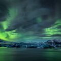
- Green dragon over Iceland 2015 Belegurshi.jpg 960 × 960; 57 KB
- Greenland ice sheet 3D.png 989 × 722; 0 bytes
- Greenland.png 842 × 449; 402 KB
- Group on Earth Observations.JPG 546 × 418; 33 KB
- How satellites monitor climate change circa 2016.png 599 × 327; 0 bytes
- How thin is earth's atmosphere.jpg 605 × 292; 61 KB
- Hurricanes - Typhoons via NASA data.png 764 × 924; 1,022 KB
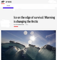
- Ice on edge of survival - Warming is changing the Arctic.png 480 × 508; 231 KB
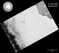
- Iceberg breaks off from Antarctica photo from ESA July 12, 2017.jpg 860 × 768; 116 KB
- Icebergia Time July 12, 2017.png 613 × 673; 135 KB
- Icebergia-2.png 1,343 × 480; 509 KB
- ICESAT mission.png 640 × 271; 319 KB
- ISS sunrise from space.jpg 1,024 × 768; 36 KB
- Jason2.jpg 416 × 200; 61 KB
- LANDSAT - NASA.jpg 622 × 415; 95 KB
- Landsat 50th anniv Sept 2016.jpg 800 × 456; 94 KB
- Landsat 9 about to launch.png 420 × 721; 355 KB
- Landsat 9 Launches - 1.jpg 600 × 693; 128 KB
- Landsat 9 Launches - 2.jpg 600 × 737; 250 KB
- Landsat at 50.png 800 × 713; 345 KB
- Landsat memories.png 535 × 473; 159 KB
- Landscape-of-Change Jill Pelto.jpg 653 × 441; 74 KB
- LivingEarth2.png 800 × 503; 478 KB
- Map of the World wiki commons m.png 679 × 314; 18 KB
- Map of the World wiki commons s.png 339 × 157; 13 KB
- Map of the World wiki commons.png 1,357 × 628; 19 KB
- Mapping the Earth with Google Earth Outreach.jpg 640 × 648; 109 KB
- Mar a lagoon tba.jpg 540 × 405; 40 KB
- Maya Lin Ghost Forest 5-17-2021.jpg 618 × 454; 123 KB
- Miami region sea level rise.gif 618 × 318; 191 KB
- Miami Reminder.jpg 411 × 292; 52 KB
- Miami sea level rise conf-May2018.jpg 800 × 600; 53 KB
- Miami-beach-waterworld-david-kamp.jpg 900 × 651; 222 KB
- MLT Geospace - the Edge.jpg 800 × 600; 22 KB
- More ice destabilized in Southern Antarctica May2015.png 915 × 266; 225 KB
- Move along Florida-May 2018.png 448 × 454; 342 KB
- Moving to Higher Ground.png 568 × 473; 307 KB
- NASA co2-graph-061219.jpg 800 × 500; 214 KB
- NASA Earth science from space May2015.png 486 × 618; 260 KB
- NASA EPIC DSCOVR - July 6 2015.png 768 × 956; 687 KB
- NASA Launch of Landsat 9 - Sept 27, 2021.jpg 675 × 772; 131 KB
- NASA's continuing vision and mission - as of 2005.png 640 × 414; 153 KB
- NASA-Debris-Kessler Syndrome.jpg 750 × 600; 76 KB
- NASAblog iss051e050137.jpg 800 × 450; 27 KB
- NationalGeographic SouthPole melt West Antarctica 2016.jpg 630 × 438; 89 KB
- Navigate with Knowledge - StratDem - GreenPolicy360.jpg 800 × 534; 62 KB
- Not to worry 2016.png 539 × 401; 347 KB
- OCO-2 carbon dioxide Sept2014-Sept2015.gif 530 × 353; 677 KB
- OCO-2 June 2015.jpg 720 × 405; 113 KB
- OCO-3 video.jpg 640 × 371; 76 KB
- OCO-3 video2.jpg 640 × 376; 45 KB
- Over the Sahara 'how thin the atmosphere is' from Tim Peake.jpg 1,024 × 305; 35 KB
- PACE - NASA Everything on Earth Is Connected.png 600 × 264; 70 KB
- PACE - NASA Jan 17 2024.png 600 × 662; 465 KB
- Permafrost.jpg 500 × 342; 58 KB
- Phytoplankton.jpg 600 × 600; 97 KB
- Piers Sellers Earth & Space.jpg 800 × 544; 0 bytes
- Planet and plan for an Earthdata platform.png 600 × 600; 280 KB
- Planet home page-2022.png 800 × 400; 392 KB
- Planet Labs and NanoRacks launch from the ISS Feb 2014.jpg 800 × 533; 98 KB
- Recent Satellite Imagery of Earth - via Azavea.png 600 × 747; 488 KB
- Reid Wiseman thinbluelayer m.jpg 980 × 200; 14 KB
- Reid Wiseman, at lunch pic.jpg 1,024 × 577; 21 KB
- REMA Antarctica 9-7-2018.png 800 × 419; 377 KB
- REMA-hillshade-rendering-800px-768x768.jpg 768 × 768; 75 KB
- Rising Seas, refugees, Phys.org Land Use July 2017.png 488 × 385; 190 KB
- Sea Wall of Miami +++.jpg 526 × 220; 48 KB
- Sea-Level Rise Twice as High as Previously Predicted.png 701 × 225; 92 KB
- SouthFloridaSLR 2s-.gif 800 × 471; 349 KB
- Space stations - July 26 2022.png 544 × 462; 270 KB
- Space-Quarterly-Earth Observations NanoRacks.png 671 × 812; 956 KB
- Space-Quarterly-NanoRacks Dec 2012.pdf ; 2.18 MB
- Spacestation.jpg 800 × 532; 331 KB
- SpaceX -NASA Dragon Crew Returns.png 448 × 247; 159 KB
- SSEP--Inspire and Educate.jpg 2,250 × 295; 71 KB
- The A-Train.jpg 670 × 453; 244 KB
- The Carbon Dioxide Theory of Climatic Change, by Gilbert Plass, 1956.jpg 798 × 1,202; 397 KB
- The Home Planet.jpg 257 × 334; 55 KB
- Thereisnoplanetb.com .jpg 940 × 198; 48 KB
- Thin blue and playing god.png 475 × 780; 202 KB
- Thin Blue Earth Atmosphere - @AstroSamantha.jpg 680 × 453; 14 KB
- Thin Blue Layer - Earth's Limb Horizon - Nov 2020.png 800 × 381; 506 KB
- Thinblue day319 2016 via Scott Kelly.jpg 1,024 × 683; 20 KB
- Thomas Pesquet - Overview.png 640 × 174; 78 KB
- Threat Environment - TBay Times Series on Climate Change Impacts.png 556 × 864; 166 KB
- Thriving on Our Changing Planet.png 495 × 369; 244 KB
- Timelapse.png 800 × 566; 676 KB
- Tropical Cyclone - Hurricane Population Displacement Risks.jpg 800 × 385; 56 KB
- UN Mapping the World.png 740 × 477; 584 KB
- UNFCCC logo.png 336 × 96; 20 KB
- Unified sea level rise - Southeast Florida.jpg 800 × 418; 70 KB
- Venice flooding.png 530 × 516; 109 KB
- Virgin Galactic Space Test Flight-April5,2018.png 563 × 305; 53 KB
- Virtual Earth cover.png 800 × 479; 833 KB
- Watching the Planet Breathe.jpg 560 × 380; 173 KB
- Watching the Planet Breathe2.jpg 1,235 × 615; 227 KB
- Watching the Planet Breathe3.jpg 1,000 × 405; 290 KB
- Where is global warming.jpg 1,024 × 768; 51 KB
- Wiki waves.jpg 1,920 × 1,320; 292 KB
- World Map - Mercator projection v Google maps.jpg 800 × 545; 101 KB
