Category:Hydrology: Difference between revisions
Jump to navigation
Jump to search
Siterunner (talk | contribs) (Created page with "http://en.wikipedia.org/wiki/Hydrology File:Water covers 70% of earths surface 1024x512.jpg") |
Siterunner (talk | contribs) No edit summary |
||
| Line 1: | Line 1: | ||
http://en.wikipedia.org/wiki/Hydrology | <addthis /> | ||
[[File:Featured.png]] | |||
* http://en.wikipedia.org/wiki/Hydrology | |||
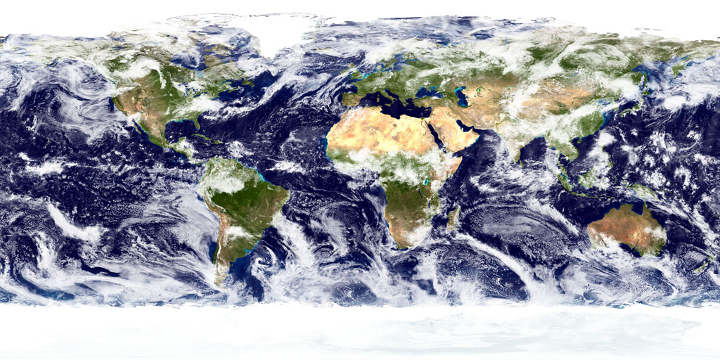
[[File:Water covers 70% of earths surface 1024x512.jpg]] | [[File:Water covers 70% of earths surface 1024x512.jpg]] | ||
Latest revision as of 19:24, 18 April 2019
Subcategories
This category has the following 5 subcategories, out of 5 total.
B
E
W
Pages in category "Hydrology"
The following 28 pages are in this category, out of 28 total.
A
E
O
Media in category "Hydrology"
The following 146 files are in this category, out of 146 total.
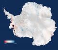
- 5 19 14 andrew antarcticaelevationchanges-640x547.jpg 640 × 547; 59 KB
- All Alone In the Night.png 831 × 426; 275 KB
- Amazon-rainforest (2).jpg 600 × 338; 68 KB
- Amazon-rainforest (3).jpg 300 × 225; 57 KB
- Amazon-rainforest.jpg 814 × 459; 142 KB
- April 28, 2016.png 586 × 415; 159 KB
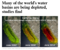
- Aquifers earthsciencefromspace Grace CA3.png 772 × 652; 559 KB
- Aquifers global earth observations by grace20150616-16 m.jpg 800 × 450; 117 KB
- Aquifers global earth observations by grace20150616-16.jpg 1,600 × 900; 317 KB
- Aquifers globalstudy 2015.png 668 × 451; 299 KB
- Aquifers June2015 past the tipping point.png 533 × 615; 195 KB
- Arctic sea ice watch 25 yrs of ice cover change.png 697 × 386; 314 KB
- Away fly the Doves March4,2015.png 582 × 409; 167 KB
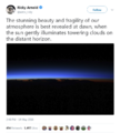
- Blue atmosphere from Astro Wheelock.jpg 800 × 532; 16 KB
- Blue fragile edge thin blue line.jpg 1,200 × 798; 26 KB
- Climate Time Machine NASA Earth Science.png 981 × 571; 378 KB
- Copernicus EU logo.jpg 400 × 400; 41 KB
- CopernicusEU - Sentinel5P Atmosphere Monitoring Mission - 2.jpg 795 × 1,477; 654 KB
- CopernicusEU - Sentinel5P Atmosphere Monitoring Mission.png 583 × 465; 222 KB
- Cyanobacteria Prochlorococcus worldmapping MIT.jpg 473 × 321; 60 KB
- Dawn above Earth-May 2018-AstroPOV.png 640 × 712; 204 KB
- Dead Sea evaporation ponds.jpeg 800 × 600; 170 KB
- Dove1 image.jpg 420 × 308; 26 KB
- Doves launched from ISS float against Earth horizon m.jpg 807 × 537; 52 KB
- Doves launched from ISS float against Earth horizon s.jpg 553 × 368; 35 KB
- Doves launched from ISS float against Earth horizon.jpg 4,256 × 2,832; 564 KB
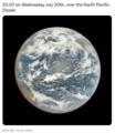
- DSCOVR EPIC - July 20 2022.png 532 × 612; 315 KB
- DSCOVR w EPICcam, PlasMag & NISTAR.png 1,219 × 785; 1.49 MB
- DSCOVR w EPICcam.png 800 × 515; 968 KB
- Earth 3D Overview.jpg 1,024 × 768; 190 KB
- Earth AI - Feb 2022.png 482 × 480; 192 KB
- Earth and atmosphere from Suomi.jpg 1,484 × 1,113; 349 KB
- Earth atmosphere and night 1024x551.jpg 1,024 × 551; 138 KB
- Earth atmosphere and night-1920x1080.jpg 1,920 × 1,080; 390 KB
- Earth atmosphere ISS October30,2014.jpg 590 × 392; 12 KB
- Earth atmosphere.jpg 1,440 × 1,080; 153 KB
- Earth Information Center - 2022 Graphic NASA.png 800 × 981; 868 KB
- Earth Information Center from NASA.jpg 800 × 577; 94 KB
- Earth mapped.png 800 × 783; 254 KB
- Earth Observing System - fleet of satellites.png 740 × 576; 557 KB
- Earth POV from the ISS Cupola-m.jpg 800 × 480; 71 KB
- Earth Research Findings 2015 1.png 1,088 × 686; 1.49 MB
- Earth Research Findings 2015 2.png 1,088 × 241; 512 KB
- Earth Right Now science.jpg 197 × 49; 3 KB
- Earth satellites in 3D.jpg 640 × 350; 213 KB
- Earth Science Vital Signs, Pulse of the Planet Climate Essentials.png 692 × 441; 207 KB
- Earth Science Vital Signs, Pulse of the Planet EOS NASA 2014.png 758 × 776; 366 KB
- Earth System Observatory-1.jpg 580 × 833; 129 KB
- Earth System Observatory-2.jpg 580 × 831; 69 KB
- Earth Viewing from the International Space Station.jpg 496 × 307; 45 KB
- Earth's atmosphere 1536x864.jpg 1,536 × 864; 48 KB
- Earth's atmosphere 3840x2160.jpg 3,840 × 2,160; 204 KB
- Earth's atmosphere 814x458.jpg 814 × 458; 23 KB
- Earth-Moon 768x432.jpg 768 × 432; 20 KB
- EarthDecadel Priorities-2018.jpg 779 × 529; 85 KB
- EarthPOV 1920x1080.jpg 1,920 × 1,080; 270 KB
- EarthRightNow Earth Science satellite fleet circa 2015.jpg 1,500 × 1,125; 0 bytes
- Earths-atmosphere-from-ISS.jpg 1,536 × 864; 114 KB
- Earths-Future .jpg 351 × 198; 41 KB
- Earths-Future-cover.jpg 251 × 325; 48 KB
- EarthsAtmosphere 4628x1500.jpg 4,628 × 1,500; 1.45 MB
- Earthview ISS Shuttle.jpg 1,152 × 648; 0 bytes
- Earthview nasa date-unknown search1.jpg 768 × 432; 79 KB
- Environmental Security ThinBlueLayer.png 814 × 677; 469 KB
- Feeling the Heat 1989.png 800 × 1,095; 400 KB
- Floating Forest Project .png 773 × 461; 932 KB
- Gavin in Glasgow - Nov 10 2021.png 728 × 600; 378 KB
- Globally-averaged temps thru 2015 via NASA Goddard.gif 480 × 270; 1.76 MB
- Google Earth Hello2.png 800 × 375; 863 KB
- Green dragon over Iceland 2015 Belegurshi.jpg 960 × 960; 57 KB
- Group on Earth Observations.JPG 546 × 418; 33 KB
- Guarding Earths Water - from Space.jpg 578 × 496; 102 KB
- How satellites monitor climate change circa 2016.png 599 × 327; 0 bytes
- How thin is earth's atmosphere.jpg 605 × 292; 61 KB
- ISS sunrise from space.jpg 1,024 × 768; 36 KB
- LANDSAT - NASA.jpg 622 × 415; 95 KB
- Landsat 50th anniv Sept 2016.jpg 800 × 456; 94 KB
- Landsat 9 about to launch.png 420 × 721; 355 KB
- Landsat 9 Launches - 1.jpg 600 × 693; 128 KB
- Landsat 9 Launches - 2.jpg 600 × 737; 250 KB
- Landsat at 50.png 800 × 713; 345 KB
- Landsat memories.png 535 × 473; 159 KB
- LivingEarth2.png 800 × 503; 478 KB
- Map of the World wiki commons m.png 679 × 314; 18 KB
- Map of the World wiki commons s.png 339 × 157; 13 KB
- Map of the World wiki commons.png 1,357 × 628; 19 KB
- Mapping the Earth with Google Earth Outreach.jpg 640 × 648; 109 KB
- MLT Geospace - the Edge.jpg 800 × 600; 22 KB
- NASA co2-graph-061219.jpg 800 × 500; 214 KB
- NASA Earth science from space May2015.png 486 × 618; 260 KB
- NASA EPIC DSCOVR - July 6 2015.png 768 × 956; 687 KB
- NASA Launch of Landsat 9 - Sept 27, 2021.jpg 675 × 772; 131 KB
- NASA's continuing vision and mission - as of 2005.png 640 × 414; 153 KB
- NASA-Debris-Kessler Syndrome.jpg 750 × 600; 76 KB
- NASAblog iss051e050137.jpg 800 × 450; 27 KB
- Navigate with Knowledge - StratDem - GreenPolicy360.jpg 800 × 534; 62 KB
- OCO-2 June 2015.jpg 720 × 405; 113 KB
- OCO-3 video.jpg 640 × 371; 76 KB
- OCO-3 video2.jpg 640 × 376; 45 KB
- Over the Sahara 'how thin the atmosphere is' from Tim Peake.jpg 1,024 × 305; 35 KB
- PACE - NASA Everything on Earth Is Connected.png 600 × 264; 70 KB
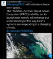
- PACE - NASA Jan 17 2024.png 600 × 662; 465 KB
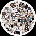
- Phytoplankton.jpg 600 × 600; 97 KB
- Piers Sellers Earth & Space.jpg 800 × 544; 0 bytes
- Planet and plan for an Earthdata platform.png 600 × 600; 280 KB
- Planet home page-2022.png 800 × 400; 392 KB
- Planet Labs and NanoRacks launch from the ISS Feb 2014.jpg 800 × 533; 98 KB
- Plankton Phytoplankton--'Climate Dance'.jpg 773 × 644; 161 KB
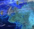
- Plankton swirl Jan 2015.jpg 720 × 480; 161 KB
- Rainfall-earthsciencefromspace.gif 530 × 299; 2.64 MB
- Recent Satellite Imagery of Earth - via Azavea.png 600 × 747; 488 KB
- Reid Wiseman, at lunch pic.jpg 1,024 × 577; 21 KB
- Space stations - July 26 2022.png 544 × 462; 270 KB
- Space-Quarterly-Earth Observations NanoRacks.png 671 × 812; 956 KB
- Space-Quarterly-NanoRacks Dec 2012.pdf ; 2.18 MB
- Spacestation.jpg 800 × 532; 331 KB
- SpaceX -NASA Dragon Crew Returns.png 448 × 247; 159 KB
- SSEP--Inspire and Educate.jpg 2,250 × 295; 71 KB
- Sudan ancient formation.jpeg 800 × 600; 212 KB
- The A-Train.jpg 670 × 453; 244 KB
- The Carbon Dioxide Theory of Climatic Change, by Gilbert Plass, 1956.jpg 798 × 1,202; 397 KB
- The Home Planet.jpg 257 × 334; 55 KB
- Thereisnoplanetb.com .jpg 940 × 198; 48 KB
- Thin blue and playing god.png 475 × 780; 202 KB
- Thin Blue Earth Atmosphere - @AstroSamantha.jpg 680 × 453; 14 KB
- Thin Blue Layer - Earth's Limb Horizon - Nov 2020.png 800 × 381; 506 KB
- Thinblue day319 2016 via Scott Kelly.jpg 1,024 × 683; 20 KB
- Thomas Pesquet - Overview.png 640 × 174; 78 KB
- Thriving on Our Changing Planet.png 495 × 369; 244 KB
- Timelapse.png 800 × 566; 676 KB
- UN Mapping the World.png 740 × 477; 584 KB
- UNFCCC logo.png 336 × 96; 20 KB
- USGS Groundwater depletion map 2013.png 794 × 490; 238 KB
- Virgin Galactic Space Test Flight-April5,2018.png 563 × 305; 53 KB
- Virtual Earth cover.png 800 × 479; 833 KB
- Watching the Planet Breathe.jpg 560 × 380; 173 KB
- Watching the Planet Breathe2.jpg 1,235 × 615; 227 KB
- Watching the Planet Breathe3.jpg 1,000 × 405; 290 KB
- Water covers 70% of earths surface 1024x512.jpg 1,024 × 512; 223 KB
- Water shortage 4B people sci report-2016.png 853 × 233; 148 KB
- Where is global warming.jpg 1,024 × 768; 51 KB
- World Map - Mercator projection v Google maps.jpg 800 × 545; 101 KB

