Category:Caribbean
Sea Level Rise
2014
Warning for Caribbean countries as sea level continues to rise
- ∞ Rising sea levels could have catastrophic effects for the Caribbean and would affect the poorest and most vulnerable in the region.
- ∞ Santo Domingo could be the fifth most affected city in the world
- ∞ To increase their resilience to climate change, the Caribbean is improving their ability to bring scientific evidence into the national development process
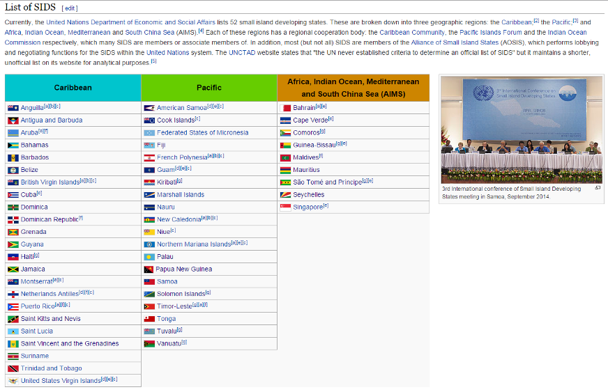
Bridgetown, June 2014 - Climate change-induced sea-level rise in the world's 52 small island nations - estimated to be up to four times the global average - continues to be the most pressing threat to their environment and socio-economic development with annual losses at the trillions of dollars due to increased vulnerability. An immediate shift in policies and investment towards renewable energy and green economic growth is required to avoid exacerbating these impacts, says a new report by the United Nations Environment Programme (UNEP)
Small Island Developing States (SIDS) -- 52 states listed as of 2016 -- https://en.wikipedia.org/wiki/Small_Island_Developing_States
https://upload.wikimedia.org/wikipedia/commons/thumb/e/e6/SIDS_map_en.svg/884px-SIDS_map_en.svg.png
Subcategories
This category has only the following subcategory.
S
Pages in category "Caribbean"
The following 16 pages are in this category, out of 16 total.
Media in category "Caribbean"
The following 26 files are in this category, out of 26 total.
- 3-15-2016 12-29-07 PM.png 538 × 701; 201 KB
- Against the Tide - Cover - by Cornelia Dean.jpg 308 × 475; 57 KB
- Aldis zone blog.jpg 500 × 498; 67 KB
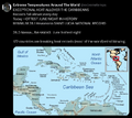
- Caribbean Sea hot - June night 2024.png 676 × 600; 386 KB
- CO2 higher than in the past 5 million yrs.jpg 514 × 285; 62 KB
- Flooding in South Florida.png 640 × 742; 293 KB
- Florida and climate change denial.png 640 × 192; 46 KB
- Global sea surface temperature 1982-2024.png 800 × 823; 566 KB
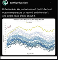
- Global sea surface temperature graph as of 2024.png 800 × 455; 654 KB
- Historic gulf of mexico warm water.png 800 × 306; 148 KB
- Historic heat in gulf of mexico.png 800 × 810; 590 KB
- Hurricanes - Typhoons via NASA data.png 764 × 924; 1,022 KB
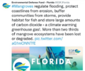
- Mangroves regulate flooding - EDF.png 568 × 473; 328 KB
- Maya Lin Ghost Forest 5-17-2021.jpg 618 × 454; 123 KB
- Moving to Higher Ground.png 568 × 473; 307 KB
- NationalGeographic SouthPole melt West Antarctica 2016.jpg 630 × 438; 89 KB
- Not to worry 2016.png 539 × 401; 347 KB
- Planet Earth temperature taking - a recent history.png 800 × 584; 618 KB
- Planting Corals Now.jpg 800 × 365; 72 KB
- Rising Seas, refugees, Phys.org Land Use July 2017.png 488 × 385; 190 KB
- Sea Wall of Miami +++.jpg 526 × 220; 48 KB
- Sea-Level Rise Twice as High as Previously Predicted.png 701 × 225; 92 KB
- Small Island Developing States SIDS list as of Jan 2016.png 872 × 563; 278 KB
- South Florida Floodwaters.png 640 × 449; 251 KB
- Threat Environment - TBay Times Series on Climate Change Impacts.png 556 × 864; 166 KB
- Tropical Cyclone - Hurricane Population Displacement Risks.jpg 800 × 385; 56 KB
