Category:Aquifers
Jump to navigation
Jump to search
Subcategories
This category has the following 9 subcategories, out of 9 total.
Pages in category "Aquifers"
The following 30 pages are in this category, out of 30 total.
G
Media in category "Aquifers"
The following 137 files are in this category, out of 137 total.
- 3-15-2016 12-29-07 PM.png 538 × 701; 201 KB
- 3M lawsuit re forever chemicals - June 2023.png 603 × 600; 357 KB
- AB 2480 Meadows and Forest Water Infrastructure.png 481 × 375; 248 KB
- About website of The Invading Sea.png 800 × 343; 126 KB
- Against the Tide - Cover - by Cornelia Dean.jpg 308 × 475; 57 KB
- Agriculture and seeds.jpg 1,920 × 1,080; 1.16 MB
- Aldis zone blog.jpg 500 × 498; 67 KB
- AOC March 26, 2019.jpg 597 × 433; 58 KB
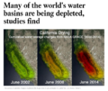
- Aquifers earthsciencefromspace Grace CA3.png 772 × 652; 559 KB
- Aquifers global earth observations by grace20150616-16 m.jpg 800 × 450; 117 KB
- Aquifers global earth observations by grace20150616-16.jpg 1,600 × 900; 317 KB
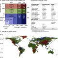
- Aquifers globalstudy 2015.png 668 × 451; 299 KB
- Aquifers June2015 past the tipping point.png 533 × 615; 195 KB
- Arable land percent world.png 1,357 × 628; 40 KB
- Barrier island hubris 6-29-2021.jpg 490 × 635; 111 KB
- Biggest climate related legislation in history - 1.png 800 × 188; 68 KB
- Bill Mollison 1928-2016.pdf ; 99 KB
- Bill Mollison courtesy of Permaculture magazine.jpg 460 × 300; 0 bytes
- Bill Mollison the day after his passing memories.png 1,381 × 651; 1.65 MB
- California's Central Valley Earth View June 2015.png 1,571 × 767; 0 bytes
- Caroline Lucas-Green New Deal.jpg 584 × 391; 71 KB
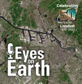
- Celebrating 50 Years of Landsat.png 600 × 610; 909 KB
- Challenge of Acting for the Commons.png 700 × 548; 175 KB
- Cisterns rebateprogram.jpg 628 × 390; 355 KB
- CO2 higher than in the past 5 million yrs.jpg 514 × 285; 62 KB
- Common Ground, the Movie.png 600 × 756; 775 KB
- Commons-concepts permanent culture now s.png 448 × 211; 75 KB
- Commons-concepts permanent culture now.png 830 × 391; 39 KB
- Desertification map.png 1,280 × 828; 588 KB
- Diane Walder in Miami Beach.jpg 775 × 787; 147 KB
- Disaster scenarios raise the stakes for Colorado River - 1.png 640 × 213; 56 KB
- Disaster scenarios raise the stakes for Colorado River - 2.png 640 × 154; 14 KB
- DJT - US message to world.jpg 800 × 266; 45 KB
- Dove1 image.jpg 420 × 308; 26 KB
- Dr Volts talks of lawns and their problems.jpg 492 × 376; 49 KB
- Drought Monitor Map - April 2022.png 800 × 459; 238 KB
- Earth mapped.png 800 × 783; 254 KB
- Earths-Future .jpg 351 × 198; 41 KB
- Earths-Future-cover.jpg 251 × 325; 48 KB
- Ecostress Mission-Aug 2020.jpg 640 × 311; 85 KB
- EPA and the Green Bank - Feb 2023.png 476 × 542; 244 KB
- Estates at Acqualina - Sunny Isles Miami.jpg 746 × 600; 117 KB
- FaceApp Florida.jpg 640 × 428; 40 KB
- Flooding in South Florida.png 640 × 742; 293 KB
- Florida and climate change denial.png 640 × 192; 46 KB
- Florida via NASA 2022.png 800 × 1,020; 1.12 MB
- Florida Wildlife Corridor - 2022 illustration.png 800 × 628; 473 KB
- Florida Wildlife Corridor FLWC Water Benefits December 2022.png 768 × 886; 109 KB
- FOOD.jpg 983 × 311; 117 KB
- Global Green New Deal.jpg 427 × 640; 32 KB
- Google Earth Hello2.png 800 × 375; 863 KB
- Green New Deal - Bloomberg Jan 29,2019.png 640 × 757; 589 KB
- Green New Deal - Resolution.pdf ; 55 KB
- Green New Deal - Strategic Demands - Oct 1, 2021.png 602 × 658; 245 KB
- Green Rain Barrels.jpg 576 × 768; 95 KB
- Green-New-Deal-December-2018-1.png 800 × 634; 207 KB
- Greenland ice sheet set to raise sea level significantly.png 640 × 340; 223 KB
- Groundwaterstudy 1.png 800 × 384; 237 KB
- Harvest the Rain cover .png 582 × 800; 1.06 MB
- Harvest the Rain reviews.png 800 × 879; 306 KB
- Hurricanes - Typhoons via NASA data.png 764 × 924; 1,022 KB
- Invading Seas warning 2024.png 757 × 587; 669 KB
- Kenny Ausubel quote.jpeg 415 × 163; 46 KB
- Land Remote Sensing Policy Act of 1992.jpg 563 × 480; 144 KB
- Landsat 50th anniv Sept 2016.jpg 800 × 456; 94 KB
- Landsat at 50.png 800 × 713; 345 KB
- Landsat band imagery2.png 800 × 400; 907 KB
- Landsat data site.png 657 × 600; 499 KB
- Landsat launched 50 years ago today.png 528 × 779; 755 KB
- Landsat NASA - Feb 11 2023.png 763 × 600; 578 KB
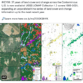
- Landsat US collection of maps 1985-2021.png 768 × 775; 1,018 KB
- Landsat, a 50 year legacy.png 528 × 575; 288 KB
- Lawn1.jpg 1,024 × 431; 135 KB
- Living Diversity or Not in Your Home Yard.png 436 × 640; 582 KB
- LivingEarth2.png 800 × 503; 478 KB
- Manchin again - July 15 2022.png 600 × 654; 523 KB
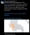
- Mangroves and Coastal Wetlands tracked by Landsat.png 600 × 716; 245 KB
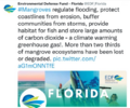
- Mangroves regulate flooding - EDF.png 568 × 473; 328 KB
- Map of the World wiki commons m.png 679 × 314; 18 KB
- Map of the World wiki commons s.png 339 × 157; 13 KB
- Map of the World wiki commons.png 1,357 × 628; 19 KB
- Mar a lagoon tba.jpg 540 × 405; 40 KB
- Maya Lin Ghost Forest 5-17-2021.jpg 618 × 454; 123 KB
- Miami region sea level rise.gif 618 × 318; 191 KB
- Miami Reminder.jpg 411 × 292; 52 KB
- Miami sea level rise conf-May2018.jpg 800 × 600; 53 KB
- Move along Florida-May 2018.png 448 × 454; 342 KB
- Moving to Higher Ground.png 568 × 473; 307 KB
- NationalGeographic SouthPole melt West Antarctica 2016.jpg 630 × 438; 89 KB
- New Economics Foundation logo.png 476 × 123; 9 KB
- Not to worry 2016.png 539 × 401; 347 KB
- Permaculture-observation tip.jpg 480 × 540; 86 KB
- Planet and plan for an Earthdata platform.png 600 × 600; 280 KB
- Rain Garden Design courtesy of www.PermaDesign.com Nate Downey.png 800 × 614; 601 KB
- RainBarrels UNM.jpg 450 × 224; 53 KB
- Rising Seas, refugees, Phys.org Land Use July 2017.png 488 × 385; 190 KB
- River basins - watersheds.jpg 800 × 214; 111 KB
- SCOTUS decision on water protection.png 535 × 424; 299 KB
- Sea levels surge along southern US coast.png 640 × 441; 69 KB
- Sea Wall of Miami +++.jpg 526 × 220; 48 KB
- Sea-Level Rise Twice as High as Previously Predicted.png 701 × 225; 92 KB
- Seeds of Change, published 1994.png 628 × 763; 915 KB
- Seeds of Change.jpg 260 × 346; 27 KB
- Shrinking Shores Florida.png 750 × 336; 328 KB
- Soil is the root stuff.jpg 483 × 960; 97 KB
- South Florida Floodwaters.png 640 × 449; 251 KB
- Space stations - July 26 2022.png 544 × 462; 270 KB
- Surprise climate deal.png 589 × 735; 83 KB
- Threat Environment - TBay Times Series on Climate Change Impacts.png 556 × 864; 166 KB
- Timelapse.png 800 × 566; 676 KB
- Toby Hemenway-RIP Dec2016.png 503 × 327; 32 KB
- Tropical Cyclone - Hurricane Population Displacement Risks.jpg 800 × 385; 56 KB
- UN Mapping the World.png 740 × 477; 584 KB
- Unified sea level rise - Southeast Florida.jpg 800 × 418; 70 KB
- US River basins - watersheds.jpg 800 × 477; 131 KB
- USGS Groundwater depletion map 2013.png 794 × 490; 238 KB
- Venice flooding.png 530 × 516; 109 KB
- Virtual Earth cover.png 800 × 479; 833 KB
- Water Action News - March 2023.png 640 × 277; 103 KB
- Water Risk Projects.jpg 1,140 × 518; 124 KB
- Water shortage 4B people sci report-2016.png 853 × 233; 148 KB
- Water stress by country.png 2,159 × 1,115; 584 KB
- Water stress index map maplecroft.jpg 518 × 303; 123 KB
- WaterAction - 2023.PNG 480 × 640; 300 KB
- Watershed monitoring earthscience m.png 572 × 360; 143 KB
- World Map - Mercator projection v Google maps.jpg 800 × 545; 101 KB
- Youth vote estimates 2016 primary.png 800 × 490; 257 KB


