Virtual Earth: Difference between revisions
Siterunner (talk | contribs) No edit summary |
Siterunner (talk | contribs) No edit summary |
||
| Line 48: | Line 48: | ||
○ ○ ○ ○ ○ ○ ○ ○ | ○ ○ ○ ○ ○ ○ ○ ○ | ||
'''''Google Earth Pro is now available to download free/February 2015''''' - ''http://google-latlong.blogspot.com/2015/01/google-earth-pro-is-now-free.html'' | |||
''Google Earth'' '''''http://www.google.com/earth/''''' | |||
; <big><big>''Google Earth Outreach''</big></big> | |||
[[File:Google Earth Outreach 2.jpg | link=http://www.google.com/earth/outreach/tutorials/screenoverlays.html]] | |||
[http://www.greenpolicy360.net/w/File:G_Earth_Outreach.jpg '''''Earth Outreach'''''] | |||
''http://www.google.com/earth/outreach/tutorials/mapper_temp.html'' | |||
''http://www.google.com/earth/outreach/tutorials/spreadsheet.html'' | |||
''http://www.google.com/earth/outreach/tutorials/spreadsheet3.html'' | |||
''http://www.google.com/earth/outreach/tutorials/mapseng_lite.html'' | |||
§ | |||
| Line 93: | Line 117: | ||
Revision as of 06:41, 20 February 2015
EcoExploring / Land Unit Mapping / Virtual Earth
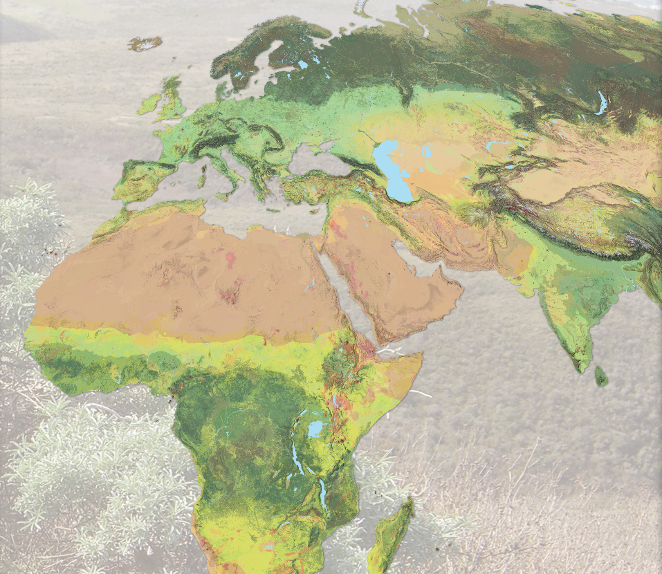
- New Maps of Global Ecological Land Units
February 2015
http://ecoexplorer.arcgis.com/eco/maps.html
http://www.aag.org/global_ecosystems
http://www.aag.org/galleries/default-file/AAG_Global_Ecosyst_bklt300.pdf
http://www.wired.com/2015/02/new-map-shows-worlds-ecosystems-unprecedented-detail/
The Global Ecological Land Unit maps are the most detailed look ever at Earth’s ecosystems. Basically, it partitions the planet into squares 50 meters on a side—roughly the size of a couple of football fields. An ecosystem looks at lithology (that’s rocks and dirt), climate, topography, and land cover—from pristine forest to pavement. Each square on the map combines those categories of data, and every pixel can be described in a single sentence—say, warm, wet hills on volcanic rocks with mostly evergreen forests. Underneath: reams of reference. A world’s worth of data.
The US Geological Survey pulled that information from a wide swath of sources—soil surveys, digital elevation models, satellites, weather stations. But the agency didn’t have the computing power to chew it into meaningful maps. So, they partnered with ESRI, the titanic digital mapping company, which marshaled an army of geographers, analysts, and cartographers to knit everything together. Ecologists have always relied on maps made by experts based on their on-the-ground research. They were good, but subjective. Data is better. “It’s a huge confidence boost to the scientists that we are on the right track to understanding things in a comparable way,” says Charlie Frye, ESRI’s chief cartographer. After sharing it with veteran ecologists, Frye says they responded by telling him that this map showed them what they already knew, but at scales they’d never seen before.
And what’s good for research is good for conservation...
○ ○ ○ ○ ○ ○ ○ ○ ○ ○ ○ ○ ○ ○ ○ ○ ○ ○ ○ ○ ○ ○ ○ ○ ○ ○
- APPS
Smartphone Apps/Browser add-ons/extensions
○ ○ ○ ○ ○ ○ ○ ○
Google Earth Pro is now available to download free/February 2015 - http://google-latlong.blogspot.com/2015/01/google-earth-pro-is-now-free.html
Google Earth http://www.google.com/earth/
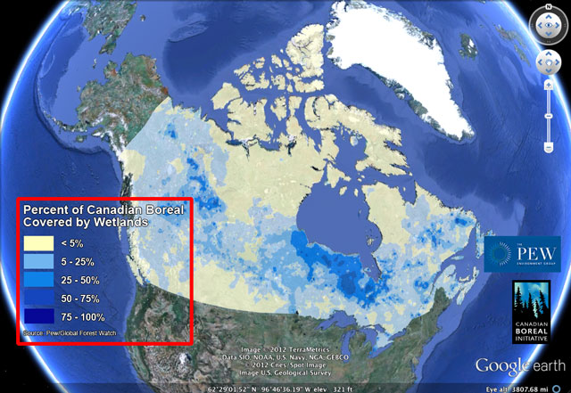
- Google Earth Outreach
http://www.google.com/earth/outreach/tutorials/mapper_temp.html
http://www.google.com/earth/outreach/tutorials/spreadsheet.html
http://www.google.com/earth/outreach/tutorials/spreadsheet3.html
http://www.google.com/earth/outreach/tutorials/mapseng_lite.html
§
- Microsoft Bing / Virtual Earth
Bing Maps Platform (previously Microsoft Virtual Earth) http://www.microsoft.com/maps/
§
FlashEarth http://www.flashearth.com/
World Atlas (iOS) https://itunes.apple.com/us/app/atlas-by-collins/id560461884
§
- NASA Maps
Web-enabled LandSat Data http://weld.cr.usgs.gov/
NASA World Wind http://worldwind.arc.nasa.gov/java/ -- http://worldwind.arc.nasa.gov/java/
"World Wind lets you zoom from satellite altitude into any place on Earth. Leveraging Landsat satellite imagery and Radar Topography data, World Wind lets you experience Earth terrain in visually rich 3D..."
NASA Earth Observatory Global Maps http://earthobservatory.nasa.gov/GlobalMaps/?eocn=topnav&eoci=globalmaps
○ ○ ○ ○
○ ○ ○ ○
GIS / ExpertGPS / Global Mapper / GPS TrackMaker
○ ○ ○ ○
○ ○ ○ ○ ○ ○ ○ ○ ○ ○ ○ ○
- Earth Biosphere Mapping