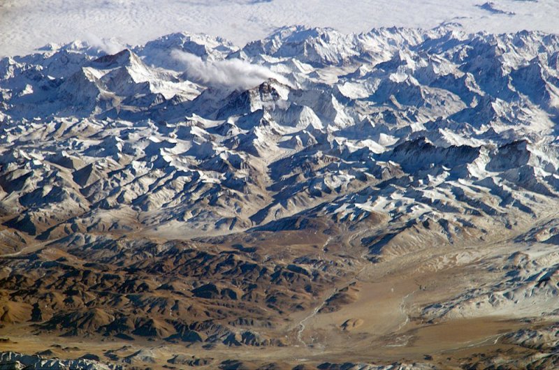
File:Everest - Long lens photo from the ISS.jpg
Everest_-_Long_lens_photo_from_the_ISS.jpg (800 × 530 pixels, file size: 139 KB, MIME type: image/jpeg)
from the International Space Station...
Mount Everest (Nepali: Sagarmatha सगरमाथा; Tibetan: Chomolungma ཇོ་མོ་གླང་མ; Chinese: Zhumulangma 珠穆朗玛) is Earth's highest mountain above sea level, located in the Mahalangur Himal sub-range of the Himalayas. The China–Nepal border runs across its summit point.
The current official elevation of 8,848 m (29,029 ft), recognised by China and Nepal, was established by a 1955 Indian survey and subsequently confirmed by a Chinese survey in 1975.
(Editorial comment: Two elevations are often cited, 8,848 meters and 8,8850 meters. The 8,848 meter measurement is the height of the rock, and 8,850 meters add the snow-ice above the rock and therefore measures the height if you to be standing on the summit. Repeat: if you were to be standing on the summit... the summit of Planet Earth, that is, if you were to be standing on top of the world ;-)
Himalayas / https://en.wikipedia.org/wiki/Himalayas
Sagarmatha National Park / https://en.wikipedia.org/wiki/Sagarmatha_National_Park
Sacred Himalayan Landscape / https://en.wikipedia.org/wiki/Sacred_Himalayan_Landscape

~
File history
Click on a date/time to view the file as it appeared at that time.
| Date/Time | Thumbnail | Dimensions | User | Comment | |
|---|---|---|---|---|---|
| current | 16:42, 29 June 2020 | | 800 × 530 (139 KB) | Siterunner (talk | contribs) |
You cannot overwrite this file.
File usage
The following 2 pages use this file: