File:DSCOVR-EPIC ImagingofPlanetEarth.png: Difference between revisions
Siterunner (talk | contribs) No edit summary |
Siterunner (talk | contribs) No edit summary |
||
| (11 intermediate revisions by the same user not shown) | |||
| Line 1: | Line 1: | ||
<addthis /> | |||
'''View DSCOVR Images''' -- http://epic.gsfc.nasa.gov/ | |||
[https://www.greenpolicy360.net/w/Earth_Science_Research_from_Space Earth Science Research from Space] | : [http://www.earthpov.com EarthPOV.com] | ||
: [https://www.greenpolicy360.net/w/Earth_Science_Research_from_Space Earth Science Research from Space] | |||
[[File:DSCOVR-Day before Christmas2015.jpg]] | [[File:DSCOVR-Day before Christmas2015.jpg]] | ||
<big>'''PLANET EARTH SEEN from DSCOVR's EPIC CAMERA'''</big> | |||
: '''E'''arth '''P'''olychromatic '''I'''maging '''C'''amera | |||
'''Daily Views of Earth Available on New NASA Mission Website''' | |||
: http://epic.gsfc.nasa.gov/ | |||
: http://www.nesdis.noaa.gov/DSCOVR/ | |||
<big><font color=blue>○ ○ ○ ○ ○ ○ ○ ○ ○ ○ ○ ○ ○ ○ ○ ○</font></big> | |||
<big>'''America’s first operational deep space satellite'''</big> | |||
'''DSCOVR successfully launched on February 11, 2015 from Cape Canaveral, Florida. It took the satellite just over 100 days to reach its final orbit at Lagrange point 1, orbiting nearly one million miles from Earth. Positioned between the sun and Earth, DSCOVR is able to maintain a constant view of the sun and sun-lit side of Earth.''' | |||
: https://www.nesdis.noaa.gov/content/dscovr-deep-space-climate-observatory | |||
'''The Deep Space Climate Observatory / DSCOVR, maintains the real-time solar wind monitoring capabilities which are critical to the accuracy and lead time of NOAA's space weather alerts and forecasts.''' | |||
: [https://www.nesdis.noaa.gov/sites/default/files/asset/document/dscovr_program_overview_info_sheet.pdf DSCOVR Mission Program Overview (PDF)] | |||
<big><font color=blue>○ ○ ○ ○ ○ ○ ○ ○ ○ ○ ○ ○ ○ ○ ○ ○</font></big> | |||
<big>''' 'Over the Mid East' on December 24, 2015'''</big> | |||
[[File:Over the Mid East on December 24, 2015 from DSCOVR-EPIC.jpg]] | |||
○ | |||
Latest revision as of 20:27, 7 March 2018
<addthis />
View DSCOVR Images -- http://epic.gsfc.nasa.gov/
PLANET EARTH SEEN from DSCOVR's EPIC CAMERA
- Earth Polychromatic Imaging Camera
Daily Views of Earth Available on New NASA Mission Website
○ ○ ○ ○ ○ ○ ○ ○ ○ ○ ○ ○ ○ ○ ○ ○
America’s first operational deep space satellite
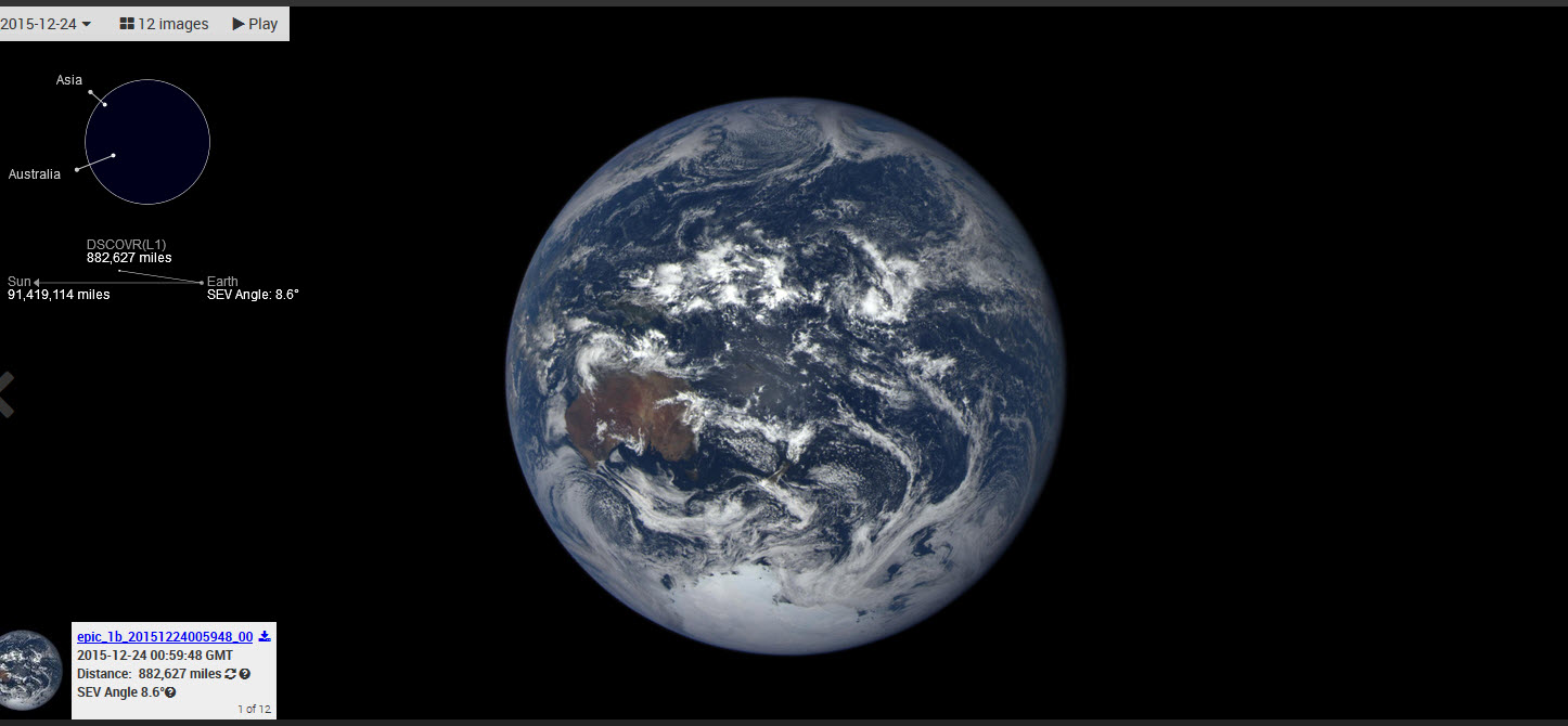
DSCOVR successfully launched on February 11, 2015 from Cape Canaveral, Florida. It took the satellite just over 100 days to reach its final orbit at Lagrange point 1, orbiting nearly one million miles from Earth. Positioned between the sun and Earth, DSCOVR is able to maintain a constant view of the sun and sun-lit side of Earth.
The Deep Space Climate Observatory / DSCOVR, maintains the real-time solar wind monitoring capabilities which are critical to the accuracy and lead time of NOAA's space weather alerts and forecasts.
○ ○ ○ ○ ○ ○ ○ ○ ○ ○ ○ ○ ○ ○ ○ ○
'Over the Mid East' on December 24, 2015
○
File history
Click on a date/time to view the file as it appeared at that time.
| Date/Time | Thumbnail | Dimensions | User | Comment | |
|---|---|---|---|---|---|
| current | 09:32, 19 November 2015 |  | 316 × 266 (19 KB) | Siterunner (talk | contribs) | http://epic.gsfc.nasa.gov/ [http://www.earthpov.com EarthPOV.com] Category:Biosphere Category:Democratization of Space Category:Earth360 Category:EarthPOV Category:Earth Observations Category:Earth Science [[Category:Environme... |
You cannot overwrite this file.
File usage
The following 4 pages use this file:

