File:REMA-hillshade-rendering-800px-768x768.jpg
Original file (768 × 768 pixels, file size: 75 KB, MIME type: image/jpeg)
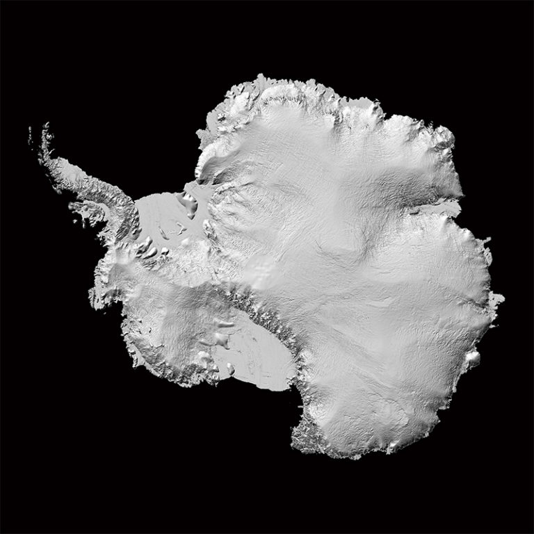
New Antarctic data sets/maps .... 2 to 8 meter resolution compared to previous standard of 1,000 meters
The Reference Elevation Model of Antarctica
September 2018
"Up until now, we've had a better map of Mars than we've had of Antarctica," said Ian Howat, professor of earth sciences and director of the Byrd Polar and Climate Research Center at The Ohio State University. "Now it is the best-mapped continent on Earth."
"It is the highest-resolution terrain map by far of any continent,’ said Ian Howat, professor of Earth sciences and director of the Byrd Polar and Climate Research Center at The Ohio State University.
"Considering that Antarctica is the highest, driest, and one of the most remote places on Earth, we now have an incredible topographic model to measure against in the future," said Paul Morin, a University of Minnesota earth sciences researcher and the director of the Polar Geospatial Center.
About 99 percent of Antarctica is covered in ice. This new map provides unprecedented detail that will help scientists measure the impact of climate change over time.
Reference Elevation Model of Antarctica / Release 1
Accurate Antarctica / Phys.org
Image Credit: National Geospatial-Intelligence Agency
○
File history
Click on a date/time to view the file as it appeared at that time.
| Date/Time | Thumbnail | Dimensions | User | Comment | |
|---|---|---|---|---|---|
| current | 18:45, 8 September 2018 | | 768 × 768 (75 KB) | Siterunner (talk | contribs) |
You cannot overwrite this file.
File usage
The following 3 pages use this file: