File:Guarding Earths Water - from Space.jpg
Guarding_Earths_Water_-_from_Space.jpg (578 × 496 pixels, file size: 102 KB, MIME type: image/jpeg)
<addthis />
Agnieszka Lukaszczyk@AgnieszkaSpace
Senior Director, European Affairs, Planet
https://twitter.com/AgnieszkaSpace/status/1265956960135979009
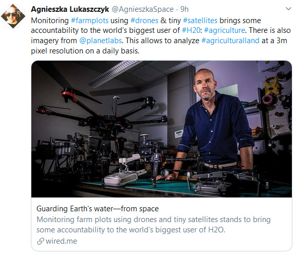
Monitoring #farmplots using #drones & tiny #satellites brings some accountability to the world’s biggest user of #H20: #agriculture.
There is also imagery from @planetlabs. This allows to analyze #agricultural land at a 3m pixel resolution on a daily basis.

- ○ ○ ○ ○ ○ ○ ○ ○ ○ ○ ○ ○ ○ ○ ○ ○ ○
Monitoring farm plots using drones and tiny satellites stands to bring some accountability to the world’s biggest user of H20: agriculture
Matthew McCabe is talking from his lab, the Hydrology and Land Observation (HALO) lab at KAUST in Saudi Arabia. The Australian professor want to help avert a world water crisis.
In many parts of the world, consumption of fresh water in homes is metered and billed accordingly. In agriculture, by far the world’s biggest user of water, that doesn’t happen. Most farmers simply pump up groundwater and use it at will; often, the only expense is the fuel required to get it to the surface.
Given depleting groundwater, and wider concerns over food security, that’s a problem.
The lab's mission is to help avert a world water crisis through metering the H2O used in agriculture.
~
Early on in the research, (the research) team estimated, for the first time, the amount of water used to grow food annually in Saudi Arabia: 24 billion cubic meters. To put that in perspective, it is more than ten times what the country produces through costly desalination.
“We had to go and map the fields, know what they were growing, and then run our models to predict water use. Now we have a water-accounting framework that didn’t exist before, and no country really has at the resolution we provide.”
The vision for the methods is much broader, however. Just as the KAUST-HALO university team works with the Saudi government to provide metrics on farming and water use, McCabe sees a future in which this is mapped globally, to help ensure food security.
If a price was put on water in agriculture, and its usage monitored from space using the techniques developed at KAUST, it would give a boost to water conservation, says McCabe.
“It’s metering from space... [imagine clicking] on a field anywhere in the world and saying ‘this is the crop that they’re growing, and this is stage it is at — when it was planted — and this is when it will be harvested, this is how much water it used, this is the nutrient deficit in that part of the field.’ So it really is to provide a precision agriculture system for everywhere.”
○
Earth Science Research from Space
Planet Citizens, Planet Scientists
○
File history
Click on a date/time to view the file as it appeared at that time.
| Date/Time | Thumbnail | Dimensions | User | Comment | |
|---|---|---|---|---|---|
| current | 20:50, 28 May 2020 | | 578 × 496 (102 KB) | Siterunner (talk | contribs) |
You cannot overwrite this file.
File usage
The following page uses this file:
- Anthropocene
- Atmospheric Science
- Biogeosciences
- Climate Change
- Democratization of Space
- Desertification
- Earth360
- EarthPOV
- Earth Imaging
- Earth Observations
- Earth Science
- Earth Science from Space
- Environmental Security
- Environmental Security, National Security
- Fisheries
- Food
- Food-Related Policies
- Geology
- Geophysics
- Geophysics and Geochemistry
- Global Security
- Global Warming
- Hydrology
- Micro-satellites
- Mineralogy
- NanoRacks
- NASA
- Natural Resources
- New Space
- Ocean Science
- Oceans
- PlanetLabs
- Planet Citizen
- Planet API
- Planet Scientist
- Planet Citizens, Planet Scientists
- Strategic Demands
- Water
- Water Saving
- Whole Earth