File:Google Earth invite-just in time for Earth Day.jpg
Google_Earth_invite-just_in_time_for_Earth_Day.jpg (395 × 336 pixels, file size: 69 KB, MIME type: image/jpeg)
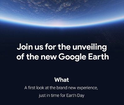
April 2021, look what's new at Google Earth!!

Timelapse from Google Earth
- Welcome to Timelapse!
Rebecca Moore, Director, Google Earth, Earth Engine & Outreach:
- To explore Timelapse in Google Earth, go to g.co/Timelapse — choose any place on the planet where you want to see time in motion.


Rebecca Moore: Timelapse has been developed using 24 million satellite images from the past 37 years -- from 1984 to 2020 -- before being compiled into an interactive 4D experience.
"Making a planet-sized timelapse video required a significant amount of what we call 'pixel crunching' in Earth Engine, Google's cloud platform for geospatial analysis … it took more than 2 million processing hours across thousands of machines in Google Cloud to compile 20 petabytes of satellite imagery into a single 4.4 terapixel-sized video mosaic -- that's the equivalent of 530,000 videos in 4K resolution."
Rebecca: For the past 15 years, billions of people have turned to Google Earth to explore our planet from endless vantage points. You might have peeked at Mount Everest or flown through your hometown. Since launching Google Earth, we've focused on creating a 3D replica of the world that reflects our planet in magnificent detail with features that both entertain and empower everyone to create positive change.
In the biggest update to Google Earth since 2017, you can now see our planet in an entirely new dimension — time. With Timelapse in Google Earth, 24 million satellite photos from the past 37 years have been compiled into an interactive 4D experience. Now anyone can watch time unfold and witness nearly four decades of planetary change.
Our planet has seen rapid environmental change in the past half-century — more than any other point in human history. Many of us have experienced these changes in our own communities; I myself was among the thousands of Californians evacuated from their homes during the state’s wildfires last year. For other people, the effects of climate change feel abstract and far away, like melting ice caps and receding glaciers. With Timelapse in Google Earth, we have a clearer picture of our changing planet right at our fingertips — one that shows not just problems but also solutions, as well as mesmerizingly beautiful natural phenomena that unfold over decades.
Understand the causes of Earth’s change
We worked with experts at Carnegie Mellon University's CREATE Lab to create the technology behind Timelapse, and we worked with them again to make sense of what we were seeing.
As we looked at what was happening, five themes emerged: forest change, urban growth, warming temperatures, sources of energy, and our world’s fragile beauty. Google Earth takes you on a guided tour of each topic to better understand them.
Making a planet-sized timelapse video required a significant amount of what we call “pixel crunching” in Earth Engine, Google's cloud platform for geospatial analysis. To add animated Timelapse imagery to Google Earth, we gathered more than 24 million satellite images from 1984 to 2020, representing quadrillions of pixels. It took more than two million processing hours across thousands of machines in Google Cloud to compile 20 petabytes of satellite imagery into a single 4.4 terapixel-sized video mosaic — that’s the equivalent of 530,000 videos in 4K resolution! And all this computing was done inside our carbon-neutral, 100% renewable energy-matched data centers, which are part of our commitments to help build a carbon-free future.
As far as we know, Timelapse in Google Earth is the largest video on the planet, of our planet. And creating it required out-of-this-world collaboration. This work was possible because of the U.S. government and European Union’s commitments to open and accessible data. Not to mention their herculean efforts to launch rockets, rovers, satellites and astronauts into space in the spirit of knowledge and exploration. Timelapse in Google Earth simply wouldn’t have been possible without NASA and the United States Geological Survey’s Landsat program, the world’s first (and longest-running) civilian Earth observation program, and the European Union’s Copernicus program with its Sentinel satellites.

SJS/GreenPolicy360 Siterunner:
A tip of our GreenPolicy360 hat to George E. Brown Jr who envisioned the Landsat's mission, the beginning of earth imaging and open access to the data and as a science leader in the US Congress supported, expanded and protected the earth science mission over the decades. The launch now, in April 2021, of Timelapse by Google Earth realizes a next step in George's decades-long quest to bring knowledge of our home planet to all citizens.
and a salute to our friend and fellow Bioneer, Rebecca Moore, who first proposed Google Earth Outreach and has led many follow on initiatives, now including Timelapse, utilizing the Landsat database and its decades of images to bring us an unprecedented vision of earth's changes over time.


···················································································
Ready for the new (2017) Google Earth?
Voila!
Google Earth for Chrome and Android. An iOS version is in the works!
Watch the Earth "Voyager" video - https://youtu.be/O-XidwKsKAE
The guided tours, which Google calls “Voyager,” aren’t just some hacked together algorithmic mess, they’re led by scientists and documentarians. At launch there are 50 tours available of places like Gombe National Park, a variety of North America’s National Parks, or a tour of Frank Gehry’s buildings. Google also teams up with BBC and Planet Earth, so you can zoom in on different locations from the show and learn more. (Thorin Klosowski)
April 2017
Google Earth‘s VR variant is getting a new feature that allows you to search for any place where you want to go, in addition to receiving support for Oculus and its Touch Controllers, Google announced on Tuesday. The new search function, when activated, prompts a VR keyboard that you can manipulate with your respective headset’s controllers. Once you’ve found a destination, you’ll be able to warp there instantly. With Google Earth VR now having full Oculus support, the same version that’s on Steam for HTC Vive users will now work with the Oculus Rift headset, and the app is also available in the Oculus store. (Daniel Fuller)
🌎
File history
Click on a date/time to view the file as it appeared at that time.
| Date/Time | Thumbnail | Dimensions | User | Comment | |
|---|---|---|---|---|---|
| current | 15:47, 18 April 2017 | | 395 × 336 (69 KB) | Siterunner (talk | contribs) |
You cannot overwrite this file.
File usage
The following 5 pages use this file: