Earth Science Research from Space
Geoscience: Eye in the Sky, Monitoring the Earth by Satellite
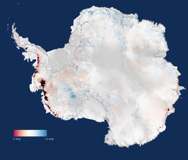
The Antarctic: Big Melt Accelerates
New assessments of impacts of global warming come from Europe's Cryosat spacecraft, which has a radar instrument specifically designed to measure the Antarctic ice sheet.
The CryoSat is part of the Living Planet Programme of the European Space Agency [3], managed by the Earth Observation Programmes.[4]
- GOCE – Gravity Field and Steady-State Ocean Circulation Explorer - was launched on March 17, 2009.
- SMOS – Soil Moisture and Ocean Salinity satellite[3][4] will study ocean salinity and soil moisture; it was launched in 2 November 2009.
- CryoSat is designed to map the Earth's ice cover. CryoSat-1 was lost in 2005. CryoSat-2 was launched 8 April 2010.
- Swarm – is a trio of satellites to map the Earth's magnetism.[6] The SWARM constellation was launched successfully on 22 November 2013.
- Aeolus – Atmospheric Dynamics Mission will use an innovative laser to measure winds. Due for launch in 2015.
- EarthCARE – Earth Clouds Aerosols and Radiation Explorer will examine the formation and effects of clouds. Due for launch in 2016.
- BIOMASS is designed to calculate the amount of carbon stored in the world's forests, and to monitor for any changes over the course of its five-year mission. Due to launch in 2020.
The European Space Agency's mission: To benefit citizens "asking for a better quality of life on earth. They want greater security and economic wealth, and they also want to pursue their dreams, to increase their knowledge, and they want younger people to be attracted to the pursuit of science and technology... ESA's purpose shall be to provide for, and to promote, for exclusively peaceful purposes, cooperation among European States in space research and technology and their space applications, with a view to their being used for scientific purposes..."
Earth Sciences #GeoScience #EarthMonitoring
Best green practices...
