PlanetCitizen
PlanetCitizen News
- New Ways to See and Experience Planet Earth
April 2015
Updated: Earthviews from Above
○ ○ ○ ○ ○ ○ ○ ○ ○ ○ ○ ○ ○ ○ ○ ○ ○
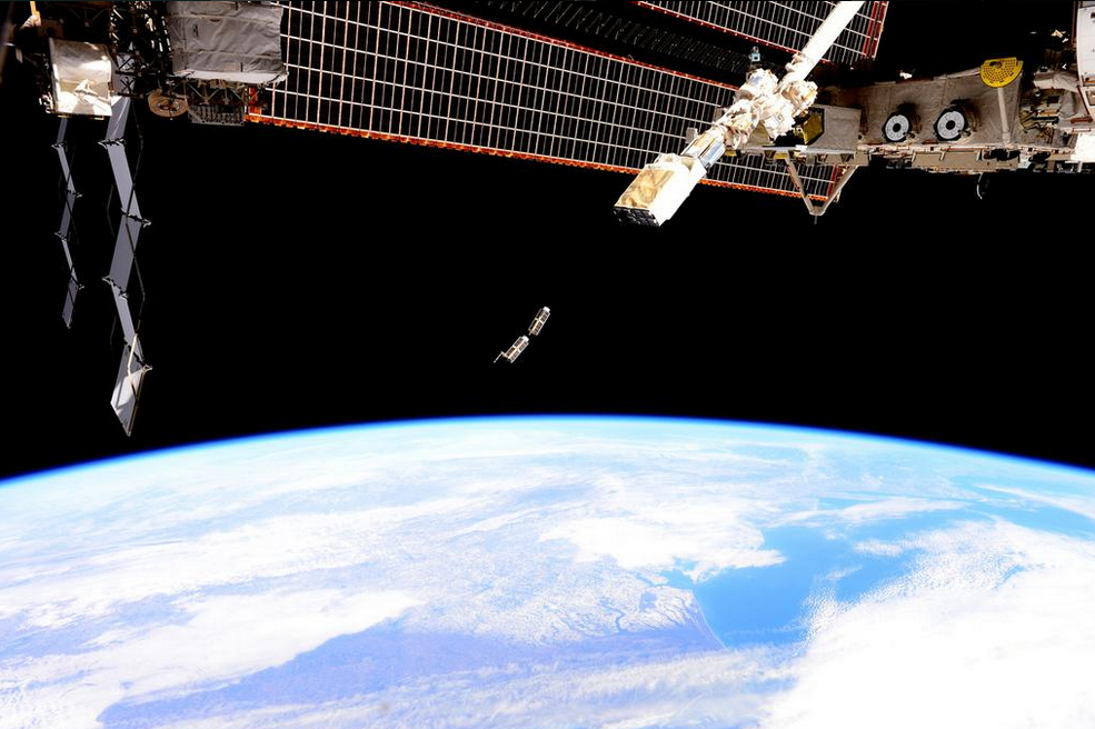
- Planet Labs 'Doves' fly from the ISS!
○ ○ ○ ○ ○ ○ ○ ○ ○ ○ ○ ○ ○ ○
- #Earth360 Updates
March 2015
Update: In addition to a new NASA DSCOVR/EPIC site in development and a selection of #Earth360 images planned to be made available online daily beginning in August, there will be unprecedented accompanying data/imagery made avail for #EarthScience and climate/atmospheric monitoring. The shift by NASA to #environmentalsecurity continues on an historic path...
The following is from a NASA Goddard communication, March 11th to us @PlanetCitizen, discussing additional calibrated data products to come from DSCOVR...
>The individual 10 different wavelength EPIC data will be served from the Atmospheric Science Data Center (ASDC) at Langley (https://eosweb.larc.nasa.gov) Once we will be active, on the left side of this page DSCOVR will appear as a project. Clicking on it will give you a list of available products.
>Later on, the science products (ozone map, Aerosol map, Cloud height map, vegetation index) will be also served from here.
Our beta Planet Citizen site will be expanding soon to highlight these new EPIC images of our Whole Earth.
February 2015
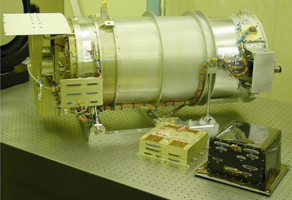
The DSCOVR satellite with its EPIC cam, PlasMag & NISTAR instrument package is on the way... a million mile journey and in approx four months, DSCOVR will "light up", be tested, and begin delivering data to Earth. In its historic mission, DSCOVR and its EPIC imaging system will begin sending near real-time images of Earth and these will be provided online...
Planet Citizen will be assisting in delivering this amazing imagery of our planet as NASA/NOAA begin uploading and serving EPIC's data imagery of the whole Earth, #Earth360.
○
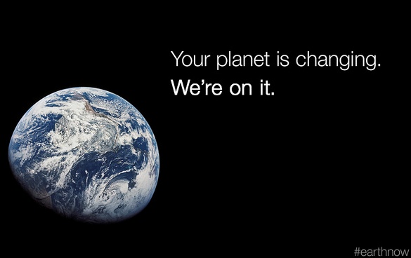
It's been decades since December 7, 1972 when the only picture ever snapped by a human of the whole earth was captured -- our iconic "Blue Marble" Planet Earth. NASA engineers named the historic image -- AS17-148-22727'
As we have been recalling the history, we haven't had returned to us a 'whole earth' image since 1972. Today, the Associated Press reports Sen. Bill Nelson, D-Florida, pointing out from Washington that there hasn't been a "full, sunlit picture of the Earth since Apollo 17 in 1972 - NASA's last manned moon-landing mission". Subsequent images "have been stitched together", the Senator explained, for composite shots. The Florida Senator has an exceptional point of view re: this amazing fact, as he was an astronaut who flew on the Space Shuttle from Florida's "Space Coast". In January 1986, Nelson spent six days orbiting Earth as a payload specialist aboard space shuttle Columbia. His NASA bio adds "The experience gave him a new perspective on the Earth’s fragile environment and a greater appreciation of the importance of our nation’s space exploration program."
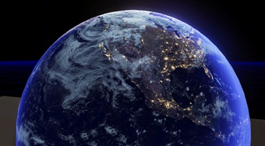
The DSCOVR satellite launches into deep orbit with multiple missions -- to monitor space weather and, due to the satellite's orbital distance from Earth (1 mil miles), DSCOVR will be sending back daily images of the whole earth via its EPIC image-taking system and via its NISTAR system measuring earth's earth's temperature, our "radiation balance" ("albedo").
○
"DSCOVR will be beaming back a steady stream of images of our home planet from space... with the images expected to be available online the next day."
"They'll be posted on a website for the public to see," said Steven Clarke, director of NASA's Joint Agency Satellite Division. "I think it will be an inspiration for people to see the sunlit disk of the Earth."
○
"Most impressive from DSCOVR will be the images of us, Planet Earth 360°. To see and to experience #Earth360 daily, it's going to be a spectacular re-reminder of our place in the cosmos..." - Steven Schmidt
○
"Scientists will soon get a steady stream of data about how both the Earth and the Sun are doing, for years to come."
And us? The livestream of our planet will amaze, inform, immerse and inspire. Online the images from DSCOVR and EPIC will light up world with new visions of our home planet.
"Some kid, somewhere, is likely to be paying attention, enjoy the view, and ask questions. And who knows where that kid will end up."
Consider how years ago now, NASA put out a call about launching services for this mission -- Guess who was one of those who replied? A young visionary dreaming of what could be even before his SpaceX was ready to go... Elon Musk. The iconic whole earth photos of Earth had inspired him to move his technology plans toward a space & earth connection - Elon's a #PlanetCitizen and we are #PlanetCitizens with him...
http://en.wikipedia.org/wiki/SpaceX
○ ○ ○ ○ ○ ○
Air & Space
DSCOVR and EPIC... For many Earth scientists, the centerpiece of the satellite is the National Institute of Standards Advanced Radiometer, or NISTAR, named for the Maryland-based government laboratory that designed it. The apparatus was built to shed light on Earth’s “radiation balance”—the radiation we receive from our sun minus the radiation we reflect back into space. The difference is retained by our planet as heat, and is calculated by measuring Earth’s reflectivity, called the albedo. Data showing whether Earth’s albedo is decreasing, meaning the atmosphere is retaining more heat because of greenhouse gases or other reasons, could be a significant piece of the climate puzzle.
What is revolutionary isn’t the basic technology for tracking albedo — it is measuring it from the million-mile perspective out at L1. Most satellites circle the planet at about one-thousandth of that distance, so their readings encompass only a small slice of land, a view that shifts rapidly as they circle the planet every two hours or so. Different climate zones — ice caps, deserts, tropical forests—have different reflectivities, independent of the atmosphere, which needs to be factored in to the overall measurement; it’s virtually impossible to create a whole-Earth portrait from a deck of low-orbit snapshots. “By the time you stitch together all the separate bits of data, the margin of error is too large to be useful,” Dr. Asrar at NASA says.
DSCOVR is "like having a thermometer for the whole planet.” It’s not a perfect gauge, NASA’s Dr. Adam Szabo cautions. “Earth is… a sphere that reflects light in all directions. So a measurement from any one point will not be the final word. But it will still be very important for the conversation about climate change.”
○ ○ ○ ○ ○ ○ ○ ○ ○ ○ ○ ○ ○ ○ ○ ○ ○ ○ ○ ○ ○ ○ ○ ○ ○ ○ ○ ○ ○ ○ ○ ○ ○ ○ ○ ○
- Overview and Perspective
See and experience the Earth in new ways
January 2015
|
|
○ ○ ○ ○ ○ ○ ○ ○
As the New Year Dawns, Earth from Space
○ ○ ○ ○ ○ ○ ○ ○
December 2014
- "Game changer"
OCO-2 begins to measure atmospheric CO2 levels with unprecedented science
Historic Orbiting Carbon Observatory Satellite Sends Back Most Detailed CO2 View Ever / Dec 18, 2014
The 'Initial Level 1 round' of data was made available to the public on Dec 30, 2014.
A full Level 2 set of CO2 data is scheduled to be available in March for scientists and the public "planet citizens" to download and explore.
Phys.org - Discovery - Weather - Nature
Sample Data -- OCO-2 Data Portal
○
For #PlanetCitizen gazing, visit the "Blue Marble" Collection
○ ○ ○ ○ ○ ○ ○ ○
November 2014
Up Here, #EarthPOV Earth's Observation's new website Vid Watch Look Greening
○ ○ ○ ○ ○ ○ ○ ○
October 2014
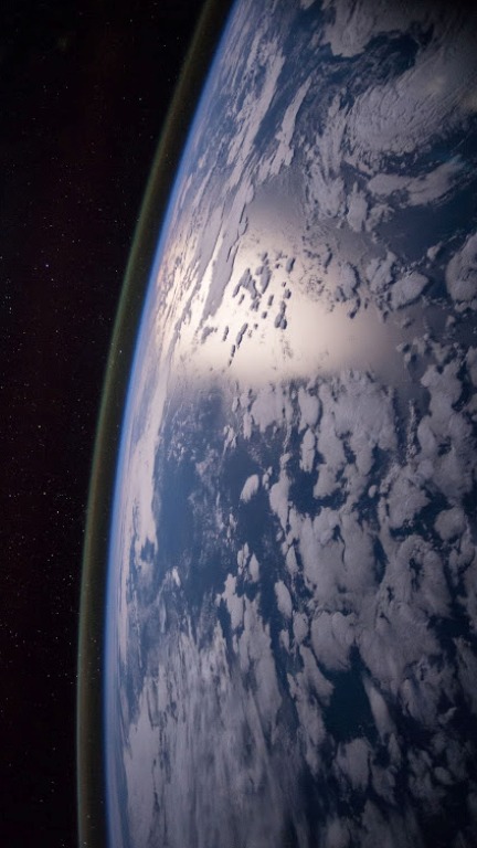
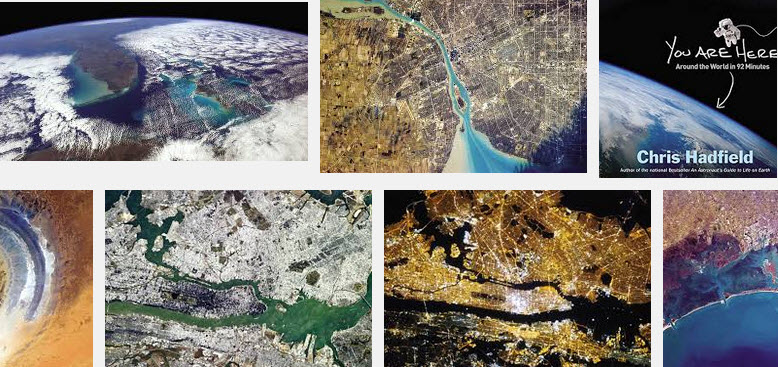
Looking out at our Planet from the International Space Station [1]
Where are you? Find Astropix of your place on #PlanetEarth
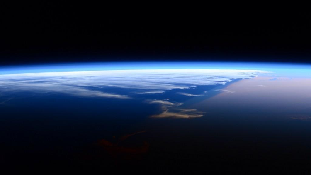
Perspective, real perspective... A "thin" layer of atmosphere...
○ ○ ○ ○ ○ ○ ○ ○
About PlanetCitizen
#PlanetCitizen #EarthPOV
A coming era of #Earth360 exploration, using the tools of the digital age and Internet connectivity, is making it possible to see a connected, whole Planet Earth and to begin studying life-enabling systems (and life-threatening changes) as with means never before possible. Space- and earth-based observation platforms are delivering "intelligence reports" in effect, strategic insights that can broaden our knowledge and perceptions of who we are and how we respond to our global, common future.
In unprecedented ways, intelligence about our planet's systems can be shared and networked via the worldwide web and larger Internet linking us whatever our nation and wherever our community.
We look out at a critical, developing field of #EnvironmentalSecurity as a generation of Planet Citizen voyagers.
- PlanetCitizen holds a simple value proposition:
- Cleaner air and water and food is a good thing. Reducing pollution is a necessary thing. Health of our environment is a vital thing.
- Science is essential to 'measure and manage' #PlanetEarth in sustainable, productive, life enhancing ways.
_______________________________________________________________________
An API for the Planet #PlanetLabs @Open Source Conference
With the Planet-Lab Platform, Connect to our Planet as Citizens of the Planet
Mission: Democratizing Access to Information About the Changing Planet
Planet Labs/NYT Planet Labs, newly #ISS deployed Doves Smartphones in space!
Launch of new Flock of Dove Satellites to Image Earth Doves fly Doves flock
Planet Labs 'Dove' micro-satellites [2]
"Rapid cadence imagery, like Planet Labs is developing, helps us become better, more sustainable stewards of Earth."
Planet Labs Planet Labs Pulse [3] [4] [5]
_____________________________________________________
Environmental Security @Strategic Demands
21st Century definitions of national and international security
A realization that "Security is indivisible" is on the horizon and security definitions are changing as a result of the dynamics of interactive networks.
The sharing of information is creating a new science of networking. Information is being looked at as never before and #earthscience data is now being collected by networked computers across an interconnected world. In historic ways, open data is being publicly distributed far beyond the restrictive policies of previous times and closed-loop systems.
Today #earthsciences are at the cusp of a rich new world of information. As we share these new realizations, images, data, experiences and understandings, we can be certain of a new, growing awareness of our planet and our 'citizenship' together.
Even now, we have inklings of what is coming. Let's look at one called OCO-2. With the launch of OCO-2, a "game changer", in the summer of 2014, the data of #Earth360 will grow in unprecedented ways as this first orbiting observatory of global warming conditions takes to space and begins to report home - I am OCO-2
Although the Orbiting Carbon Observatory is just the beginning, the future of #earthobserving is here as we see in new ways and observe our environment with new information never before accessible. Space-imaging is opening up amazing views, with 3D and big-screens and home theaters. Coming soon will be views beyond IMAX as companies like Virgin and SpaceX carry citizen travelers into orbit. Educational and scientific information about our communities is being shared, and linked to, and distributed around the Net. From space, the earth is borderless and with vision of the planet as a common #biosphere and #ecosystem comes responsibility for our shared security.
Onto first steps... We are all connected and wherever we are, geographically, nationally, we share a common ground. Let's look at our home and with an 'overview' from space, see the 'Big Picture' and let's look at the details, let's manage and sustain our earth resources and, as we go, look to our shared quality of life onboard the "only home we've ever known."
Here's to our future and future of #Environmental Security
○ ○ ○ ○ ○ ○ ○ ○
The Big Picture: Earth from Space
The world of space is a world in flux. The term "New Space" has come to represent a first generation of start ups that are designing, building and launching small, mini- and micro-satellites. New players are challenging the old system of governments that spend billions to explore, commercialize and militarize space. Barriers to entry are being broken and start-up companies are launching flocks of satellite birds into space. Earth monitoring is going planetary and nextgen companies are at the forefront, even as the "old" establishment is shifting to address threats to the environment.
Let's go there to this new world, not a 'new world order' but a world that is being connected and is sharing, linking and seeing the bigger picture. The way we observe and 'feel' about our planet is changing in one generation.
Beginning with the first Whole Earth pictures relayed from the Apollo voyages to the Moon, we have for the first time in history experienced a vision of our planet from afar -- we are, we realize, a 'blue' oasis in space.
Now, thirty+ years after the Apollo images of #planetearth360 returned, we find everyday "citizens of the planet" planning to go into space and a new generation of New Space mini-sats sending full-spectrum imaging back with an array of new views of our planet. Apollo's famous iconic images are being enhanced with new ways of seeing and experiencing our planet -- and opening new possibilities to secure our environment for ages to come.
Let's start by looking at an astro-space establishment, the images of earth and data about earth being sent back from space by established multi-billion dollar companies/ government companies and 'New Space' companies that are now on radar and reporting back with multi-spectra #Earth360 data.
Start with NEX, NASA's version of crowdsourcing... NASA's social media experiment. Ready? Are you interested in using your digital skills to help the government/NASA with environmental security? Perhaps you might start here - The NEX Challenge
Add your talent to the grand project of seeing with an EarthPOV -- so that we can make informed decisions and policy... [6]
Observe, consider, act - "The Big Picture"
NextGen #earthscience in an era of #climatechange and #globalsecurity threats...
Join up with GreenPolicy360 and share our GreenLinks and GP360 Open Data. Time to get going -- planet citizens @work
○ ○ ○ ○
○ ○ ○ ○
August 2014
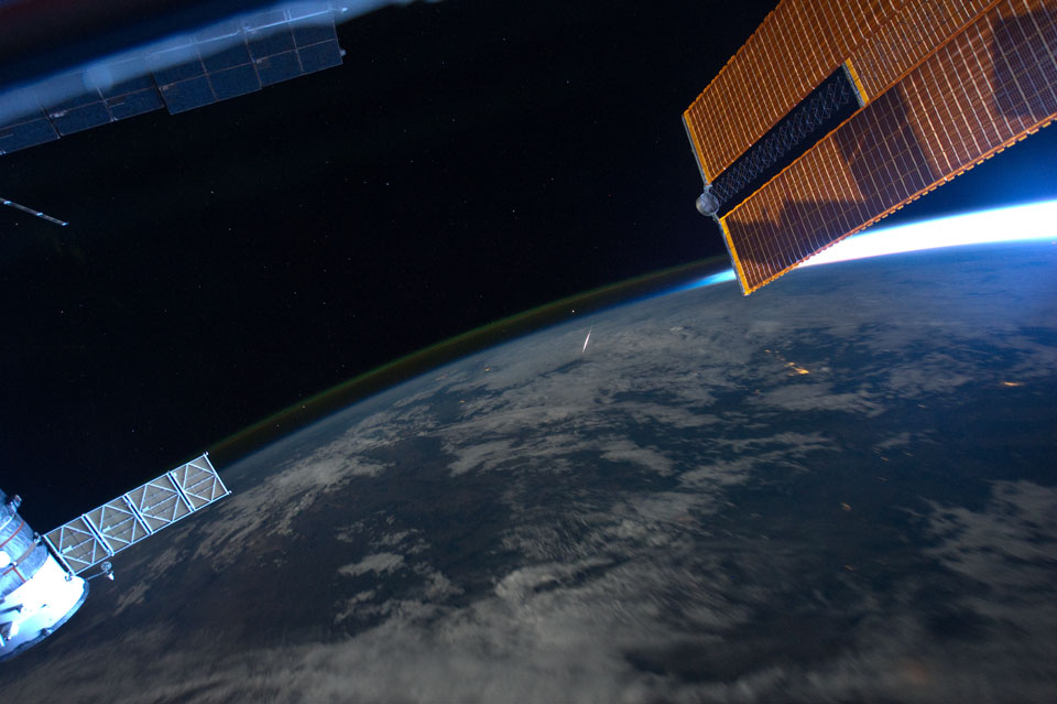
Citizens of planet earth typically watch meteor showers by looking up. But this remarkable view, captured on 8/13/11 by astronaut Ron Garan, caught a Perseid meteor by looking down. From Garan's perspective onboard the ISS orbiting at an altitude of about 380 kilometers, the Perseid meteors streak below. The glowing comet dust grains are traveling at about 60 kilometers per second through the denser atmosphere around 100 kilometers above Earth's surface. -- SETI Institute [7]
Lettuce in space [8] Come to think of it - Where is Bruce Dern these days? Silent Running and...
Douglas Trumbull's VFX vision in Silent Running and beyond continues on in our memory banks [9] [10] [11] [12]
○ ○ ○ ○ ○ ○ ○ ○ ○ ○ ○ ○ ○ ○ ○ ○
Environmental Security
PlanetCitizen, a forward-looking vision for "Greening our Blue Planet"
Planet Citizen - www.planetcitizen.org
#PlanetCitizens - www.planetcitizens.net
Planet Citizens, Planet Scientists
○ ○ ○ ○ ○ ○ ○ ○ ○ ○ ○ ○ ○ ○ ○ ○
-- #Earth360 #Earth #EarthPOV #EarthScience #EarthObservations
-- #OverviewEffect #OverviewInstitute #SpaceshipEarth
-- #OrbitalPerspective #GlobalPerspective #FragileOasis
-- #Astronauts #ISS #InternationalSpaceStation #SpaceStation #SpaceExploration #SpaceX #Space #Orbit
-- #HumanEvolution #ParadigmShift #WorldView #CognitiveShift
-- #PlanetCitzen #PlanetEarth #Environment #Environmental #EnvironmentalImpact #EnvironmentalSecurity #Sustainability
