File:EPIC cam.jpg
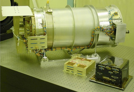
EPIC_cam.jpg (570 × 391 pixels, file size: 84 KB, MIME type: image/jpeg)
Feb 10, 2015
The DSCOVR (Deep Space Climate Observatory) satellite will be sending back daily images of the 'whole earth'...
"DSCOVR will be beaming back a steady stream of images of our home planet from space, a photo of Earth ever two hours, with the images expected to be available online the next day."
"They'll be posted on a website for the public to see," said Steven Clarke, director of NASA's Joint Agency Satellite Division. "I think it will be an inspiration for people to see the sunlit disk of the Earth."
"We are all 'planet citizens'" - #GreenPolicy360
○
"To see and to experience #Earth360 daily, it's going to be a spectacular re-reminder of our place in the cosmos..." - Steven Schmidt
http://www.greenpolicy360.net/w/Whole_Earth
○
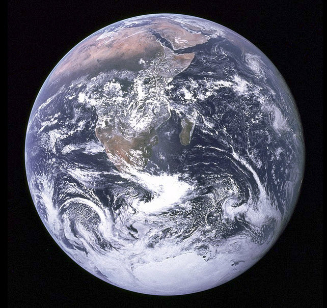
February 8, 2015 -- On December 7, 1972, the only picture ever snapped by a human of the whole earth was captured -- our iconic "Blue Marble"... The Apollo 17 mission returned to Earth from the Moon and NASA named the famous 70mm Hasselblad image that became the most reproduced image in history -- AS17-148-22727
○
As we have been recalling the history, there hasn't been a 'whole earth' image since 1972. Today, Feb 10, the Associated Press reports Sen. Bill Nelson, D-Florida, also pointing out from Washington that there hasn't been a full, sunlit picture of the Earth since Apollo 17 in 1972 - NASA's last manned moon-landing mission. Subsequent images have been stitched together, the Senator noted, for composite shots. He has an exceptional point of view as he was an astronaut -- In January 1986, Nelson spent six days orbiting Earth as a payload specialist aboard space shuttle Columbia. His NASA bio adds "That experience gave him a new perspective on the Earth’s fragile environment and a greater appreciation of the importance of our nation’s space exploration program."
Launched delayed -- here in Florida where we are, the DSCOVR (Deep Space Climate Observatory) mission remains on hold; high winds forced another delay today -- the new launch is scheduled for Feb 11th.
The satellite will go up with multiple missions -- to monitor space weather and, due to the satellite's orbital distance from Earth (1 mil miles), DSCOVR will be sending back daily images of the 'whole earth' and measuring earth's earth's temperature, our "radiation balance" ("albedo").
○
The "Original" Whole Earth image -- Dec 1972
... the first photograph taken of the whole round Earth and the only one ever snapped by a human being
Dec 7, 1972 -- the only picture ever snapped by a human of the whole earth is captured -- our "Blue Marble"
http://www.greenpolicy360.net/w/File:Whole_Earth_1972_Apollo_17.jpg
○
File history
Click on a date/time to view the file as it appeared at that time.
| Date/Time | Thumbnail | Dimensions | User | Comment | |
|---|---|---|---|---|---|
| current | 00:48, 13 February 2015 |  | 570 × 391 (84 KB) | Siterunner (talk | contribs) | Category:Earth Science Caegory:Green Graphics Category:Earth360 |
You cannot overwrite this file.
File usage
The following 2 pages use this file:

