Whole Earth: Difference between revisions
Siterunner (talk | contribs) No edit summary |
Siterunner (talk | contribs) No edit summary |
||
| Line 14: | Line 14: | ||
○ ○ ○ ○ | ○ ○ ○ ○ | ||
'''Feb | '''Feb 10, 2015''' From here in Florida, another mission is scheduled to go up, not w/ humans snapping pics but a mission intended to monitor space weather and, due to its distance from Earth (1 mil miles), the DSCOVR (Deep Space Climate Observatory) will be sending back daily images of the 'whole earth'... | ||
○ | ''"DSCOVR will be beaming back a steady stream of images of our home planet from space, a photo of Earth ever two hours, with the images expected to be available online the next day."'' | ||
''"They'll be posted on a website for the public to see," said Steven Clarke, director of NASA's Joint Agency Satellite Division. "I think it will be an inspiration for people to see the sunlit disk of the Earth."'' | |||
And of course they'll be numbered by NASA ;- | |||
○ | |||
"What will be the most impressive, after forty some years, will be the images of us, Planet Earth." -- #GreenPolicy360 | |||
"To see and to experience #Earth360 daily, it's going to be a spectacular re-reminder of our place in the cosmos..." -- Steven Schmidt | |||
○ | |||
The earth facing camera is called EPIC -- [http://www.nesdis.noaa.gov/DSCOVR/pdf/DSCOVR%20-%20EPIC%20Instrument%20Info%20Sheet.pdf The Earth Polychromatic Imaging Camera (EPIC)] is an imager that provides global spectral images of the entire sunlit face of Earth, as viewed from an orbit around Lagrangian point 1 (L1) — the neutral gravity point between Earth and the sun. | The earth facing camera is called EPIC -- [http://www.nesdis.noaa.gov/DSCOVR/pdf/DSCOVR%20-%20EPIC%20Instrument%20Info%20Sheet.pdf The Earth Polychromatic Imaging Camera (EPIC)] is an imager that provides global spectral images of the entire sunlit face of Earth, as viewed from an orbit around Lagrangian point 1 (L1) — the neutral gravity point between Earth and the sun. | ||
Revision as of 10:28, 10 February 2015
... the first photograph taken of the whole round Earth and the only one ever snapped by a human being
Dec 7, 1972 -- the only picture ever snapped by a human of the whole earth is captured -- our "Blue Marble"
http://www.greenpolicy360.net/w/File:Whole_Earth_1972_Apollo_17.jpg
NASA named the 70mm Hasselblad image -- AS17-148-22727
○ ○ ○ ○
Feb 10, 2015 From here in Florida, another mission is scheduled to go up, not w/ humans snapping pics but a mission intended to monitor space weather and, due to its distance from Earth (1 mil miles), the DSCOVR (Deep Space Climate Observatory) will be sending back daily images of the 'whole earth'...
"DSCOVR will be beaming back a steady stream of images of our home planet from space, a photo of Earth ever two hours, with the images expected to be available online the next day."
"They'll be posted on a website for the public to see," said Steven Clarke, director of NASA's Joint Agency Satellite Division. "I think it will be an inspiration for people to see the sunlit disk of the Earth."
And of course they'll be numbered by NASA ;-
○
"What will be the most impressive, after forty some years, will be the images of us, Planet Earth." -- #GreenPolicy360
"To see and to experience #Earth360 daily, it's going to be a spectacular re-reminder of our place in the cosmos..." -- Steven Schmidt
○
The earth facing camera is called EPIC -- The Earth Polychromatic Imaging Camera (EPIC) is an imager that provides global spectral images of the entire sunlit face of Earth, as viewed from an orbit around Lagrangian point 1 (L1) — the neutral gravity point between Earth and the sun.
EPIC is able to view the entire sunlit Earth from sunrise to sunset at an almost constant scattering angle between 165–178°. This scattering angle has minimal overlap with other satellites’ scattering angles.
EPIC’s observations from the L1 position will provide a unique angular perspective and can be combined with other measurements to obtain particle shape, phase selection, optical depth, 3-D effects and stereo heights.
Benefits
Imagery from EPIC will be used in science applications to measure ozone amounts, aerosol amounts, cloud height and phase, vegetation properties, hotspot land properties (a view of the land from angles where shadows are a minimum) and UV radiation estimates at Earth's surface.
Expected data products include: total ozone column, aerosol index, aerosol optical thickness, aerosol height, cloud fraction, cloud height, surface albedo, vegetation index, Leaf Area Index and RGB colored image of the Earth’s sunlit surface.
These data products are of interest to climate science, as well as hydrology, biogeochemistry and ecology.
§
Another instrument, a sensor system called PlasMag will "keep an eye on solar weather and give the Earth updates whenever a storm on the Sun threatened to fry broad swaths of the electrical grid. That's a high-risk, low-probability event that has never happened at the feared scale. Fortunately. Yet."
A third instrument, NISTAR, will help calculate the Earth’s energy “budget,” the measurement perhaps most critical to understanding global warming: "Is more heat coming in than is going out?" The data will provide insight into the Earth’s "energy balance."
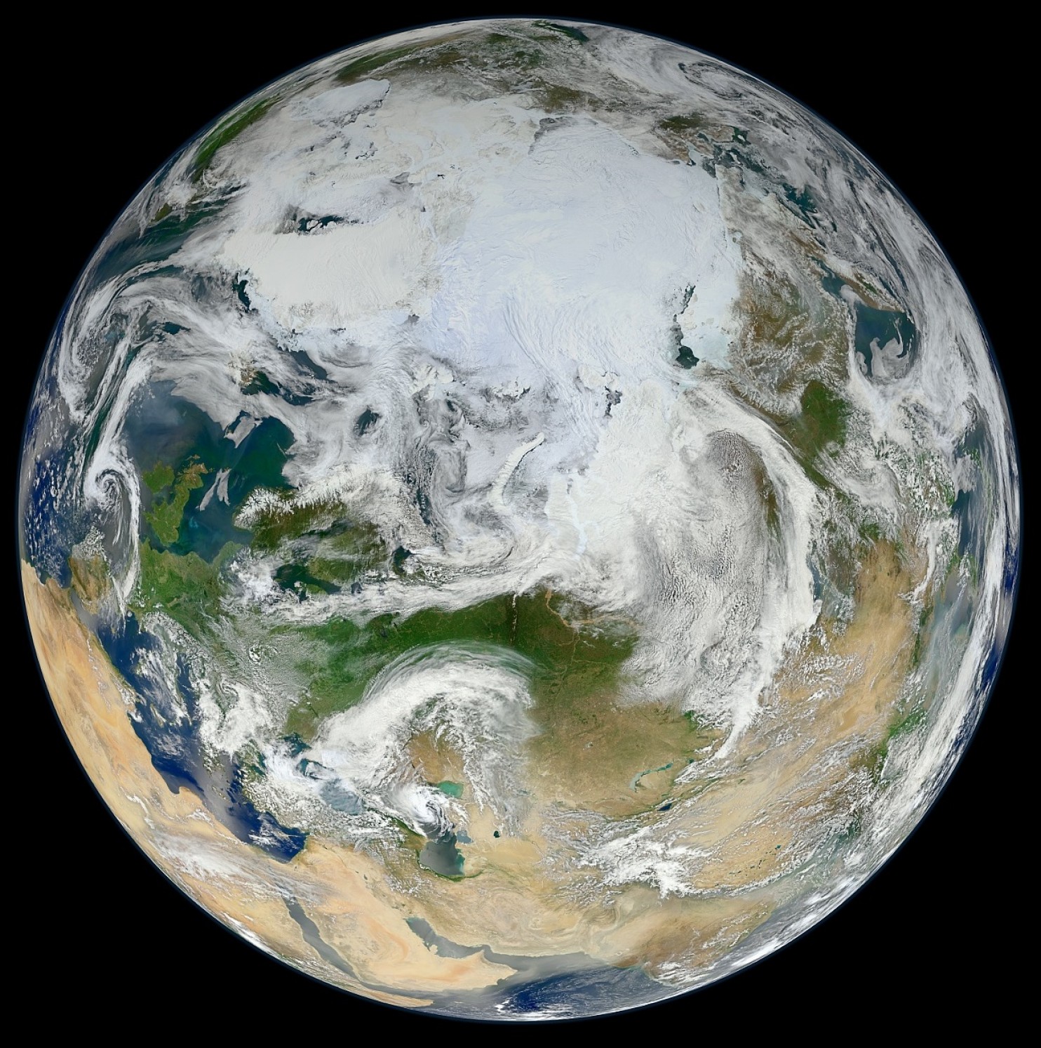
Large format -- http://www.jpss.noaa.gov/satellites.html -- VIIRS is a scanning radiometer that collects visible and infrared imagery and radiometric measurements of the land, atmosphere, cryosphere, and oceans. VIIRS data is used to measure cloud and aerosol properties, ocean color, sea and land surface temperature, ice motion and temperature, fires, and Earth's albedo. VIIRS extends and improves upon a series of measurements initiated by the NOAA Advanced Very High Resolution Radiometer (AVHRR) and the NASA Moderate Resolution Imaging Spectroradiometer (MODIS).


