GOES-16: Difference between revisions
Siterunner (talk | contribs) No edit summary |
Siterunner (talk | contribs) No edit summary |
||
| Line 1: | Line 1: | ||
GOES-R, now named GOES-16 -- https://www.nesdis.noaa.gov/GOES-16 | GOES-R, now named GOES-16 -- https://www.nesdis.noaa.gov/GOES-16 | ||
::''https://www.nesdis.noaa.gov/sites/default/files/asset/document/goes_16_first_images_press_release_jan_18_19.pdf'' | ::''https://www.nesdis.noaa.gov/sites/default/files/asset/document/goes_16_first_images_press_release_jan_18_19.pdf'' | ||
Latest revision as of 13:18, 9 March 2017
GOES-R, now named GOES-16 -- https://www.nesdis.noaa.gov/GOES-16
- GOES-16 goes "First Light": http://earthobservatory.nasa.gov/IOTD/view.php?id=89506&src=eoa-iotd
Launched in November 2016 with the promise to revolutionize weather forecasting in the U.S.
The most advanced satellite NOAA has ever put in orbit has sent back its first pictures. In a press release, NOAA said the images are the start of an age of “high-definition from the heavens.”
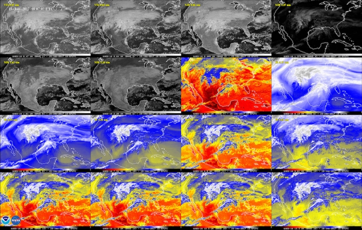
This 16-panel image shows the continental United States in the two visible, four near-infrared and 10 infrared channels on ABI. These channels help forecasters distinguish between differences in the atmosphere like clouds, water vapor, smoke, ice and volcanic ash. GOES-16 has three-times more spectral channels than earlier generations of GOES satellites.
NOAA’s satellites are the backbone of its life-saving weather forecasts. GOES-16 will build upon and extend the more than 40-year legacy of satellite observations from NOAA ...
