File:Dscovr epic moontransit.gif: Difference between revisions
Siterunner (talk | contribs) No edit summary |
Siterunner (talk | contribs) No edit summary |
||
| (4 intermediate revisions by the same user not shown) | |||
| Line 1: | Line 1: | ||
https://www.nasa.gov/feature/goddard/from-a-million-miles-away-nasa-camera-shows-moon-crossing-face-of-earth/ | |||
<big>'''Viewing Planet Earth, the 'Home Planet''''</big> | |||
July 2015 | |||
* https://www.nasa.gov/feature/goddard/from-a-million-miles-away-nasa-camera-shows-moon-crossing-face-of-earth/ | |||
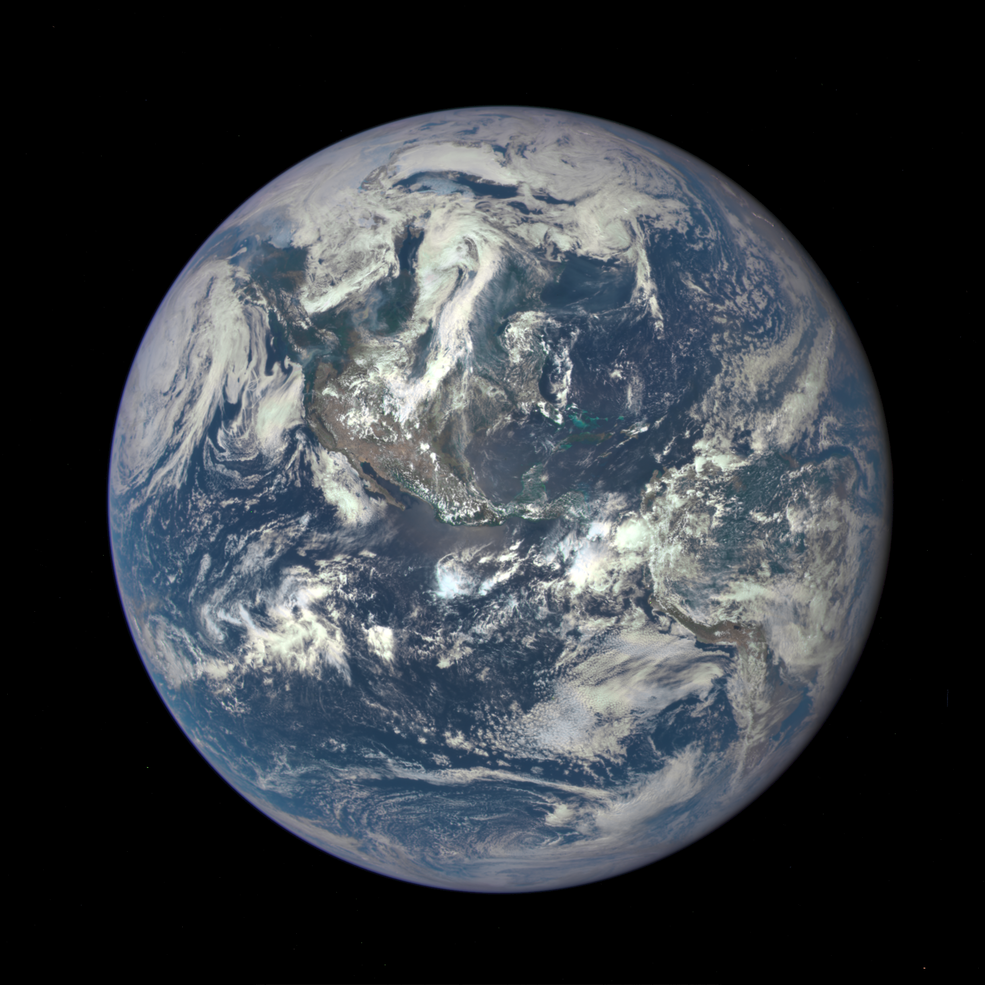
From one million miles away... the NASA Earth Polychromatic Imaging Camera (EPIC) camera aboard the Deep Space Climate Observatory (DSCOVR) satellite captures a unique view of the moon as it moves in front of the sunlit side of Earth in July 2015. This “dark side” of the moon is never visible from Earth... | From one million miles away... the NASA Earth Polychromatic Imaging Camera (EPIC) camera aboard the Deep Space Climate Observatory (DSCOVR) satellite captures a unique view of the moon as it moves in front of the sunlit side of Earth in July 2015. This “dark side” of the moon is never visible from Earth... | ||
* http://www.planetcitizen.org | |||
* http://www.space.com/30168-moon-crosses-earth-face-nasa-video.html | |||
[[File:DSCOVR-EPIC 187 1003705 americas dxm.png]] | |||
<small>* http://www.quora.com/How-was-the-recent-DSCOVR-photo-of-the-moon-transiting-the-earth-taken-and-there-not-be-a-solar-eclipse-from-our-perspective-on-earth</small> | |||
🌎 | |||
<big><big>'''Our Home Planet...'''</big></big> | |||
<big>'''DSCOVR: Watching Us from a Million Miles Way'''</big> | |||
GreenPolicy360 works alongside NASA's DSCOVR Mission | |||
In 2015 GreenPolicy360 assisted NASA managers in releasing the first tranche of photos from the newly launched DSCOVR:EPIC satellite mission. It was truly big picture time, daily full-earth, multi-band images taken from a Lagrange point 1 (L1) in orbit, a million miles from planet Earth. As [http://www.planetcitizens.org '''planet citizens'''] along for the ride, we were joyful ! | |||
In 2022, many of the same DSCOVR:EPIC NASA team from launch to operational green light are still at work on the Whole Earth mission. Here's to [https://www.greenpolicy360.net/w/Category:Earth_Science '''Earth Science'''] and [https://www.greenpolicy360.net/w/Earth_Science_Research_from_Space '''Earth Science Research from Space'''] | |||
* https://epic.gsfc.nasa.gov/ | |||
>The NOAA Deep Space Climate Observatory (DSCOVR) spacecraft was launched on February 11, 2015, and in June 2015 achieved its orbit at the first Lagrange point or L1, 1.5 million km from Earth towards the Sun. There are two NASA Earth observing instruments onboard: the Earth Polychromatic Imaging Camera (EPIC) and the National Institute of Standards and Technology Advanced Radiometer (NISTAR). The purpose of this paper is to describe various capabilities of the DSCOVR/EPIC instrument. EPIC views the entire sunlit Earth from sunrise to sunset at the backscattering direction (scattering angles between 168.5° and 175.5°) with 10 narrowband filters: 317, 325, 340, 388, 443, 552, 680, 688, 764 and 779 nm. We discuss a number of pre-processingsteps necessary for EPIC calibration including the geolocation algorithm and the radiometric calibration for each wavelength channel in terms of EPIC counts/second for conversion to reflectance units. The principal EPIC products are total ozone O3amount, scene reflectivity, erythemal irradiance, UV aerosol properties, sulfur dioxide SO2 for volcanic eruptions, surface spectral reflectance, vegetation properties, and cloud products including cloud height. Finally, we describe the observation of horizontally oriented ice crystals in clouds and the unexpected | |||
>NASA has contributed two Earth science instruments for NOAA's space weather observing satellite called the Deep Space Climate Observatory or DSCOVR, launched in January 2015. | |||
* https://www.nasa.gov/content/goddard/noaas-dscovr-to-provide-epic-views-of-earth/ | |||
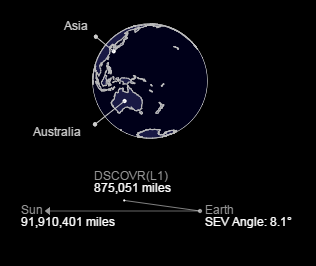
>One of the DSCOVR Earth-scanning instruments, called EPIC for Earth Polychromatic Imaging Camera, images the Earth in one picture, something that hasn't been done before from a satellite. EPIC also provides valuable atmospheric data. Currently, to get an entire Earth view, scientists have to piece together images from satellites in orbit. With the launch of the National Oceanic and Atmospheric Administration's (NOAA) DSCOVR and EPIC instrument, scientists will get pictures of the entire sunlit side of Earth. To get this unique view, EPIC orbits the first sun-Earth '''Lagrange point (L1), 1 million miles from Earth'''. At this location, four times further than the orbit of the Moon, the gravitational pull of the sun and Earth cancel out providing a stable orbit for DSCOVR. Most other Earth-observing satellites circle the planet within 22,300 miles. | |||
[http://www.planetcitizen.org <big>'''As 'Planet Citizens', Helping NASA Was a Blast!'''</big>] | |||
<big><big>'''Delivered Daily: "Blue Marble" Images from the DSCOVR Mission'''</big></big> | |||
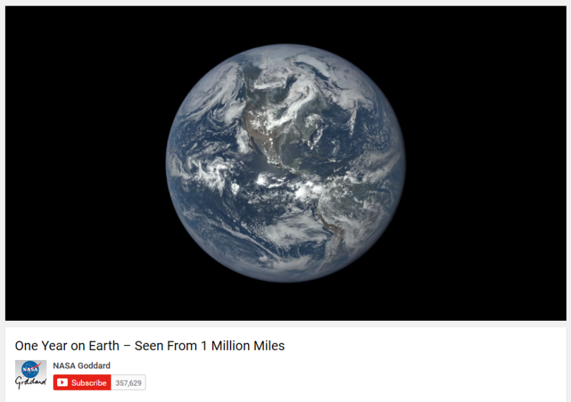
: [https://www.youtube.com/watch?v=CFrP6QfbC2g&feature=youtu.be '''Million-mile Views of Our Home Planet'''] | |||
[[File:DSCOVR-EPIC | : [[File:One year of Earth from DSCOVR.png|link=https://www.youtube.com/watch?v=CFrP6QfbC2g&feature=youtu.be]] | ||
::<big><big>'''DSCOVR GOES LIVE: "[[HelloEarth]]"'''</big></big> | |||
::<big>'''A New Era of Whole Earth Images'''</big> | |||
::[http://epic.gsfc.nasa.gov/ '''"A million mile view of the home planet - Delivered Daily'''] | |||
:::[[File:DSCOVR-EPIC ImagingofPlanetEarth.png|link=http://www.greenpolicy360.net/mw/images/DSCOVR_looks_back_at_earth_from_a_million_miles_away.jpg]] | |||
| |||
[[File:DSCOVR-EPIC ImagingofPlanetEarth 2.png|link=http://www.greenpolicy360.net/mw/images/Earth_from_DSCOVR.jpg]] | |||
| |||
[[Category:Earth360]] | [[Category:Earth360]] | ||
[[Category:EarthPOV]] | [[Category:EarthPOV]] | ||
[[Category:Earth Imaging]] | |||
[[Category:Earth Observations]] | [[Category:Earth Observations]] | ||
[[Category:Earth Science]] | [[Category:Earth Science]] | ||
[[Category:Environmental Protection]] | [[Category:Environmental Protection]] | ||
[[Category:Green Graphics]] | [[Category:Green Graphics]] | ||
[[Category:NASA]] | [[Category:NASA]] | ||
[[Category:Planet Citizen]] | [[Category:Planet Citizen]] | ||
[[Category:Planet Citizens]] | |||
[[Category:Planet Citizens, Planet Scientists]] | [[Category:Planet Citizens, Planet Scientists]] | ||
[[Category:Whole Earth]] | |||
Latest revision as of 13:40, 3 July 2024
Viewing Planet Earth, the 'Home Planet'
July 2015
From one million miles away... the NASA Earth Polychromatic Imaging Camera (EPIC) camera aboard the Deep Space Climate Observatory (DSCOVR) satellite captures a unique view of the moon as it moves in front of the sunlit side of Earth in July 2015. This “dark side” of the moon is never visible from Earth...
🌎
Our Home Planet...
DSCOVR: Watching Us from a Million Miles Way
GreenPolicy360 works alongside NASA's DSCOVR Mission
In 2015 GreenPolicy360 assisted NASA managers in releasing the first tranche of photos from the newly launched DSCOVR:EPIC satellite mission. It was truly big picture time, daily full-earth, multi-band images taken from a Lagrange point 1 (L1) in orbit, a million miles from planet Earth. As planet citizens along for the ride, we were joyful !
In 2022, many of the same DSCOVR:EPIC NASA team from launch to operational green light are still at work on the Whole Earth mission. Here's to Earth Science and Earth Science Research from Space
>The NOAA Deep Space Climate Observatory (DSCOVR) spacecraft was launched on February 11, 2015, and in June 2015 achieved its orbit at the first Lagrange point or L1, 1.5 million km from Earth towards the Sun. There are two NASA Earth observing instruments onboard: the Earth Polychromatic Imaging Camera (EPIC) and the National Institute of Standards and Technology Advanced Radiometer (NISTAR). The purpose of this paper is to describe various capabilities of the DSCOVR/EPIC instrument. EPIC views the entire sunlit Earth from sunrise to sunset at the backscattering direction (scattering angles between 168.5° and 175.5°) with 10 narrowband filters: 317, 325, 340, 388, 443, 552, 680, 688, 764 and 779 nm. We discuss a number of pre-processingsteps necessary for EPIC calibration including the geolocation algorithm and the radiometric calibration for each wavelength channel in terms of EPIC counts/second for conversion to reflectance units. The principal EPIC products are total ozone O3amount, scene reflectivity, erythemal irradiance, UV aerosol properties, sulfur dioxide SO2 for volcanic eruptions, surface spectral reflectance, vegetation properties, and cloud products including cloud height. Finally, we describe the observation of horizontally oriented ice crystals in clouds and the unexpected
>NASA has contributed two Earth science instruments for NOAA's space weather observing satellite called the Deep Space Climate Observatory or DSCOVR, launched in January 2015.
>One of the DSCOVR Earth-scanning instruments, called EPIC for Earth Polychromatic Imaging Camera, images the Earth in one picture, something that hasn't been done before from a satellite. EPIC also provides valuable atmospheric data. Currently, to get an entire Earth view, scientists have to piece together images from satellites in orbit. With the launch of the National Oceanic and Atmospheric Administration's (NOAA) DSCOVR and EPIC instrument, scientists will get pictures of the entire sunlit side of Earth. To get this unique view, EPIC orbits the first sun-Earth Lagrange point (L1), 1 million miles from Earth. At this location, four times further than the orbit of the Moon, the gravitational pull of the sun and Earth cancel out providing a stable orbit for DSCOVR. Most other Earth-observing satellites circle the planet within 22,300 miles.
As 'Planet Citizens', Helping NASA Was a Blast!
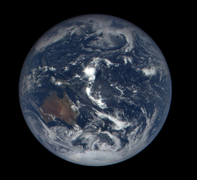
Delivered Daily: "Blue Marble" Images from the DSCOVR Mission
- DSCOVR GOES LIVE: "HelloEarth"
- A New Era of Whole Earth Images
File history
Click on a date/time to view the file as it appeared at that time.
| Date/Time | Thumbnail | Dimensions | User | Comment | |
|---|---|---|---|---|---|
| current | 19:02, 6 August 2015 |  | 985 × 554 (2.97 MB) | Siterunner (talk | contribs) | http://www.airspacemag.com/daily-planet/earth-turns-180956130/ |
You cannot overwrite this file.
File usage
The following 6 pages use this file:


